December 6 , 2025.
Hawaii , Kilauea :
HAWAIIAN VOLCANO OBSERVATORY DAILY UPDATE , U.S. Geological Survey
Friday, December 5, 2025, 12:13 PM HST (Friday, December 5, 2025, 22:13 UTC)
19°25’16 » N 155°17’13 » W,
Summit Elevation 4091 ft (1247 m)
Current Volcano Alert Level: WATCH
Current Aviation Color Code: ORANGE
Activity Summary:
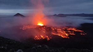
The rate of summit inflation increased yesterday and both vents had moderate-strong glow overnight with intermittent spattering from the north vent. Models indicate he onset of episode 38 fountains will occur between December 6 and 8, with Saturday and Sunday, December 6-7, most likely.
Summit Observations:
The south vent had moderate glow overnight while the north vent became increasingly active with stronger glow from the vent beginning about 11:40 HST followed by increasing spattering events after about 3:30 HST. Spattering indicates that magma is standing high in the column. Large flames continued to within the south vent and from the crack adjacent to the north vent, presumably due to burning of hydrogen gas. Persistent low to moderate tremor was punctuated by multiple periods of tremor bursts suggestive of gas pistoning. These periods increased in frequency overnight.
As of this morning, about 14.8 microradians of inflationary tilt have been recorded by UWD since the end of episode 37, with increased inflation recorded in the past day.
Rift Zone Observations:
Rates of seismicity and ground deformation remain very low in the East Rift Zone and Southwest Rift Zone. SO2 emissions from the East Rift Zone remain below the detection limit.
An aerial view of the volcanic vents in the southwest part of Halemaʻumaʻu crater, at the summit of Kīlaeua volcano.
Analysis:
Increased inflationary tilt overnight along with stronger glow, intermittent spatter, and strong gas pistoning indicates that episode 38 fountaining is likely to start soon. Small, precursory eruptions of degassed lava may begin erupting from the vents at anytime. Models indicate that episode 38 fountains are likely to begin between December 6 and 8, with December 6 and 7 most likely. The forecast may continue to change if there are more changes in the rate of summit inflation.
Source : HVO
Photos : USGS , USGS / H. Winslow .
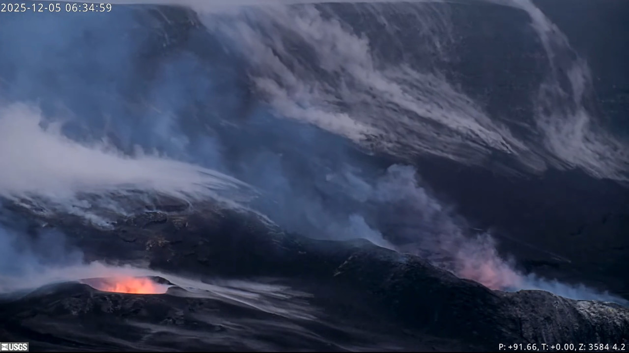
Alaska , Shishaldin :
Signs of volcanic unrest at Shishaldin continued this week. Vigorous steaming from the summit crater was observed in web-camera and satellite images yesterday, December 4. Views the rest of the week were blocked by clouds. Low-level seismicity is ongoing, with frequent small earthquakes occurring daily. Infrasound signals were also detected throughout the week.
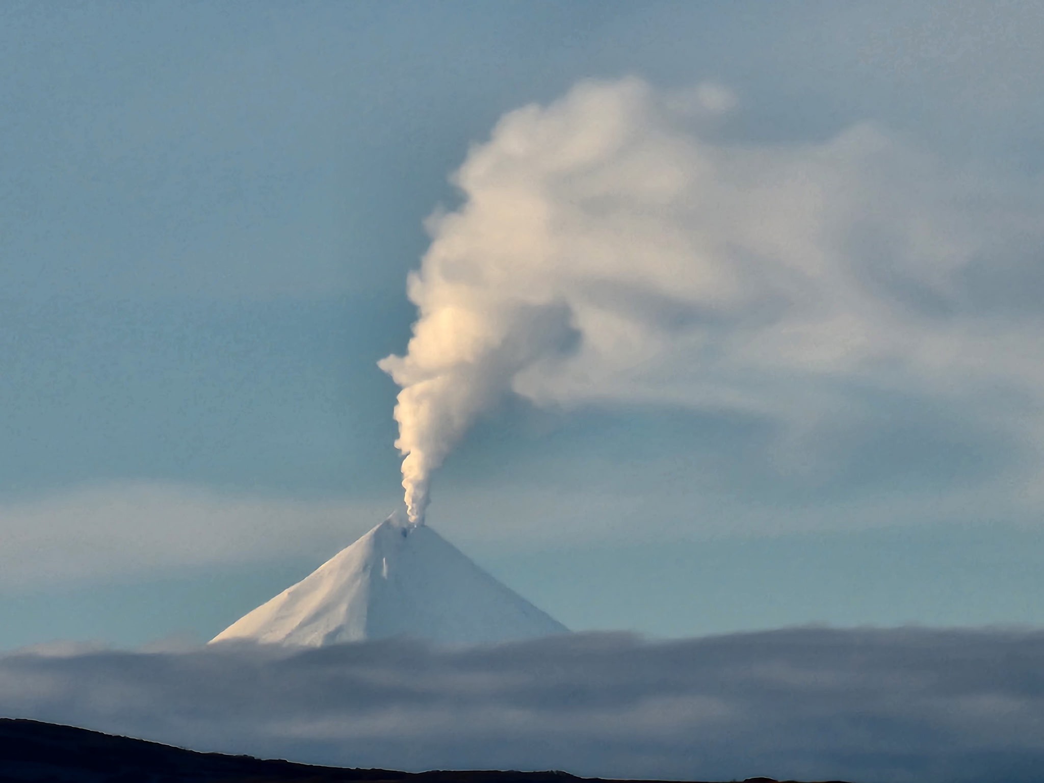
These are likely caused by gas bubbles bursting through magma deep within the volcanic vent. Satellite data show no evidence of elevated temperatures or other changes within the summit crater, indicating no lava at or near the surface.
Shishaldin Volcano is monitored by local seismic and infrasound sensors, web cameras, and a telemetered geodetic network. In addition to the local monitoring network, AVO uses nearby geophysical networks, regional infrasound and lighting data, and satellite images to monitor the volcano.
Source : AVO.
Photo : AVO
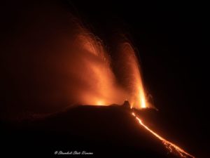
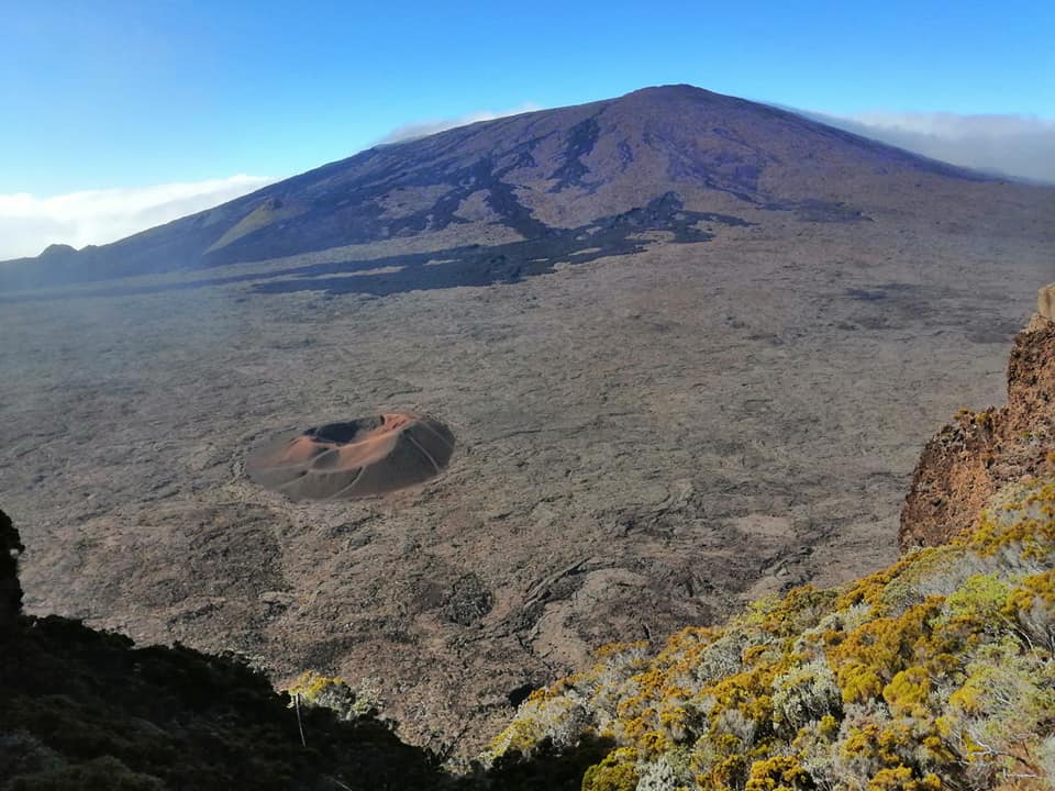
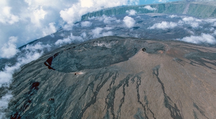
La Réunion , Piton de la Fournaise :
Press Release from the Paris Institute of Earth Physics, Piton de la Fournaise Volcanological Observatory
December 5, 2025 – 10:50 PM local time – 6:50 PM UTC
Seismic Crisis
Since 10:30 PM local time, a seismic crisis has been recorded by the instruments at the Piton de la Fournaise Volcanological Observatory. This indicates that the roof of the magma reservoir is rupturing and that magma is leaving the reservoir and propagating towards the surface.
An eruption is likely in the near future, within the next few minutes or hours.
Further information will follow regarding the area impacted by this magma propagation towards the surface.
Recommended alert level: Alert 1
Press Release from the Paris 7 Institute of Earth Physics, Piton de la Fournaise Volcanological Observatory
December 6, 2025 – 3:00 AM local time – 11:00 PM UTC
Seismic Crisis Ended
The seismic crisis that began on December 5, 2025, at 10:30 PM local time, has slowed considerably since the beginning of the day on December 6 and can now be considered over. However, seismicity remains high.
The following were recorded:
Between 10:00 PM and 11:00 PM (local time, or 6:00 PM and 7:00 PM UTC), 173 summit volcano-tectonic earthquakes,
Between 11:00 PM and midnight (local time, or 7:00 PM and 8:00 PM UTC), 88 summit volcano-tectonic earthquakes,
Between midnight and 1 a.m. (local time, i.e., 8 p.m. and 9 p.m. UTC), 33 summit volcano-tectonic earthquakes occurred.
Between 1 a.m. and 2 a.m. (local time, i.e., 9 p.m. and 10 p.m. UTC), 16 summit volcano-tectonic earthquakes occurred.
The localizable earthquakes associated with this seismic crisis were located on the northeast and southeast rims of the Dolomieu crater, at depths between 1.8 and 2.3 km below the surface.
This increase in seismicity was accompanied by rapid, low-magnitude deformations in the summit area of the volcano (less than 10 microradians) that lasted less than an hour.
These rapid deformations and the peak in seismicity observed between approximately 10:30 p.m. and 11:33 p.m. indicated a deep magma intrusion, specifically magma rising from the shallow reservoir (located about 2 km below the summit) towards the surface.
The decrease in seismicity and the cessation of rapid deformations mean that the magma’s progression has stopped at depth and has not reached the surface.
Seismicity remains high, indicating that the magma reservoir remains under pressure.
At this stage, no hypothesis is being ruled out (definitive cessation of the intrusion, resumption of the intrusion, or a new intrusion) regarding the future evolution of the situation, given this persistent seismicity. In the past, such intrusions have sometimes preceded the final magma injection leading to the eruption by a few days, as was observed recently in September 2022 and December 2020.
Source : direction de l’OVPF-IPG
Photos : Nath Duverlie , Clicanoo.
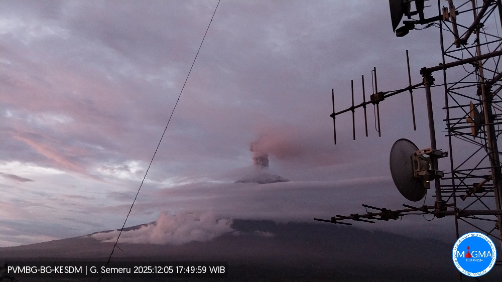
Indonesia , Semeru :
Mount Semeru erupted on Friday, December 5, 2025, at 5:49 PM (Jakarta local time). An ash column was observed approximately 1,000 meters above the summit (at an altitude of about 4,676 meters). This ash column, white to gray in color, was highly intense and drifted northeast. The eruption was recorded by a seismograph with a maximum amplitude of 22 mm and a duration of 138 seconds.
VOLCANO OBSERVATORY NOTICE FOR AVIATION – VONA
Issued : December 5 , 2025
Volcano : Semeru (263300)
Current Aviation Colour Code : ORANGE
Previous Aviation Colour Code : orange
Source : Semeru Volcano Observatory
Notice Number : 2025SMR3466
Volcano Location : S 08 deg 06 min 29 sec E 112 deg 55 min 12 sec
Area : East java, Indonesia
Summit Elevation : 11763 FT (3676 M)
Volcanic Activity Summary :
Eruption with volcanic ash cloud at 10h49 UTC (17h49 local).
Volcanic Cloud Height :
Best estimate of ash-cloud top is around 14963 FT (4676 M) above sea level or 3200 FT (1000 M) above summit. May be higher than what can be observed clearly. Source of height data: ground observer.
Other Volcanic Cloud Information :
Ash cloud moving to northeast. Volcanic ash is observed to be white to gray. The intensity of volcanic ash is observed to be thick.
Remarks :
Eruption recorded on seismogram with maximum amplitude 22 mm and maximum duration 138 second.
Source et photo : Magma Indonésie .
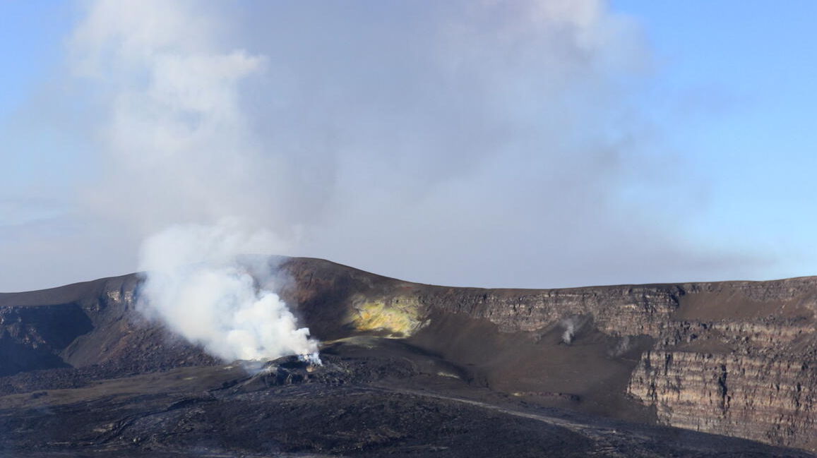
Colombia , Puracé – Chaîne volcanique de Los Coconucos :
Popayán, December 5, 2025, 9:10 AM
Regarding the monitoring of activity in the Los Coconucos volcanic chain, the Colombian Geological Survey (SGC), an agency under the Ministry of Mines and Energy, reports the following:
Since the publication of yesterday’s extraordinary bulletin and up to this publication, seismicity associated with fluid movements within the volcanic edifice has been recorded. This seismicity, of the tremor (TR) and long-period (LP) type, is primarily located beneath the Puracé volcano crater and is linked to the sustained emission of gases into the atmosphere.
Furthermore, continuous tremor has been recorded.
Some of these signals were accompanied by ash emissions, the dispersal of which depended on wind variations. Among those that occurred yesterday, the 10:11 a.m. ashfall was particularly noteworthy, reaching an altitude of approximately 900 meters above the volcano’s summit. In total, six ash emissions were recorded at the Puracé volcano crater, and alerts were issued to the Civil Aviation Authority.
Furthermore, favorable atmospheric conditions allowed for the satellite detection of thermal anomalies inside the Puracé volcano crater. These observations showed no significant changes compared to the previous day. These variations are possibly linked to the heat input from gases rising from the volcano’s interior to the surface.
Regarding geochemical parameters, satellite detection also recorded sulfur dioxide (SO₂) emissions, which dispersed southeastward within a 200 km radius of the volcano, following the direction of prevailing winds.
The amount of SO₂ emitted remains within the range of previously observed values.
As long as the orange alert level remains in effect, temporary fluctuations in volcanic activity are possible, meaning that it may sometimes decrease compared to previous days or weeks. However, this does not necessarily imply that the volcano has returned to a stable level of activity. A reasonable amount of time is needed to return to a more stable level (yellow alert) in order to assess all monitored parameters and determine trends that would indicate reliable stabilization.

Thermal imaging camera footage from Mina, located 2.2 km north of the Puracé volcano. A column of gas and ash was recorded at 4:14 PM on December 4, 2025, reaching a height of 900 m above the summit of the Puracé volcano.
Geological Survey of Colombia (SGC) recommends staying away from the volcano’s crater and surrounding areas, closely monitoring the situation through special bulletins and information published on our official channels, and following the instructions of local and regional authorities and the National Unit for Disaster Risk Management (UNGRD).
The volcanic activity level remains at orange alert: the volcano is exhibiting significant variations in monitored parameters.
Source et photo : SGC.