
November 28 , 2021.
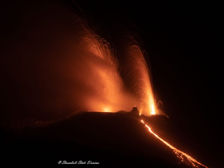
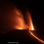
Italy , Stromboli :
November 27, 2021. 12:08 (11:08 UTC). Press release on STROMBOLI’s activity.
The National Institute of Geophysics and Volcanology, Osservatorio Etneo, announces that the lava overflow fed by the North Crater area continues to be active. The front remains confined to the middle part of the Sciara del Fuoco. From its end, the hot material continues to break away, rolling down the slope of the Sciara del Fuoco and occasionally reaching the coast. Ordinary Strombolian activity persists in both the North and Center-South crater areas, often with simultaneous explosions from multiple mouths.
In the period since the previous press release, the volcanic tremor has remained at average levels. Sometimes, in conjunction with slightly more energetic explosions, it reached medium to high values.
From the point of view of the deformation, no significant variation was detected in the signals of the GPS and tilt networks.
November 27, 2021. 18:46 (17:46 UTC).
The National Institute of Geophysics and Volcanology, Osservatorio Etneo, announces that the lava overflow fed by the area of the North crater is no longer active, however occasional phenomena of detachment of hot material from the front with the rolling of blocks persist. along the slope of the Sciara del Fuoco. Strombolian activity persists in the North and Center-South crater areas.
The volcanic tremor, in the period in question, remained at average values.
The GPS and tilt deformation signals do not show significant changes.
Further updates will be communicated shortly.
Source : INGV.
Photo : Sébastien Cannavá
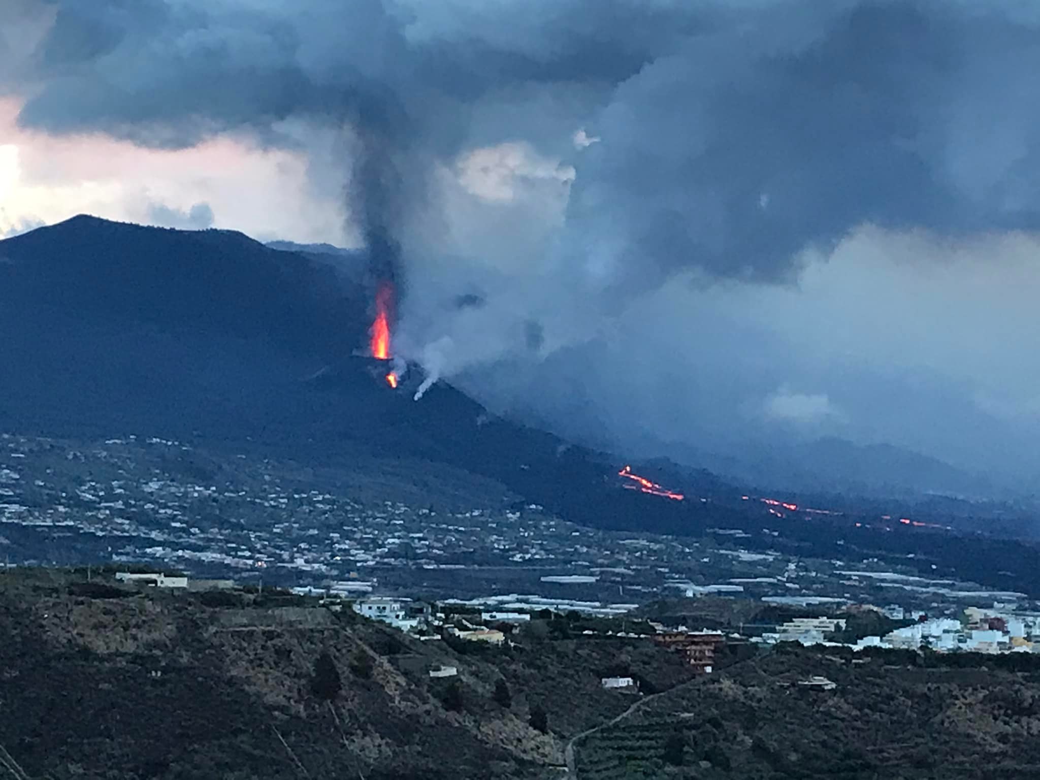
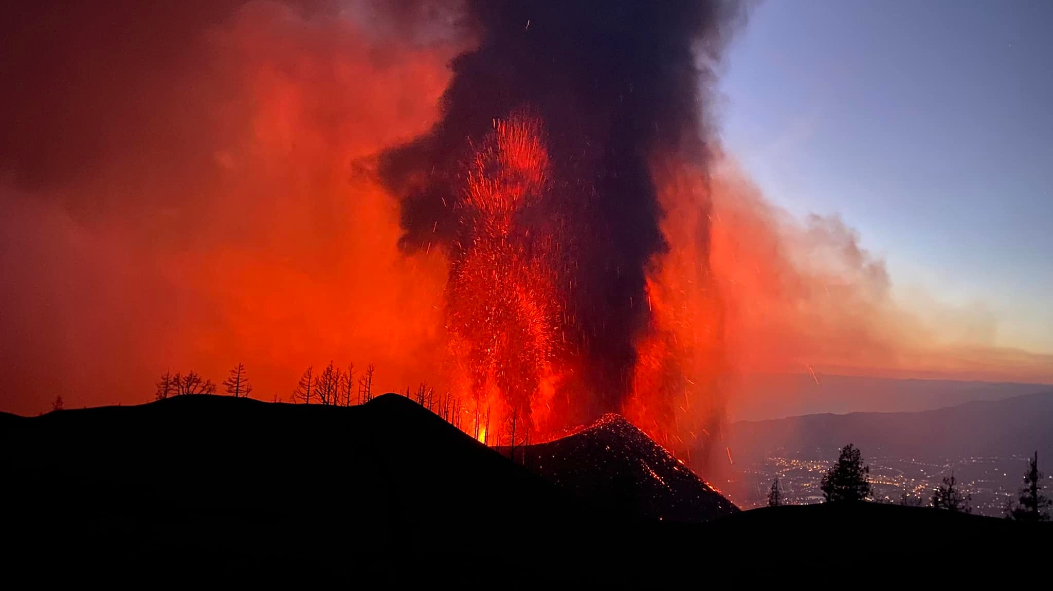
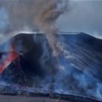
Spain / La Palma , Cumbre Vieja :
November 27, 2021 09:00 UTC. Eruptive activity continues on La Palma.
Since the last declaration, a total of 74 earthquakes have been located in the area affected by the volcanic reactivation on the island of La Palma, of which 2 were felt by the population.
Seismicity continues below the central area of Cumbre Vieja in the same areas of the previous days, 15 of these earthquakes are located at depths of 10 to 15 km and the rest at depths greater than 30 km.
The maximum recorded magnitude is 3.5 (mbLg) corresponding to yesterday’s earthquake at 19:56 UTC, with a depth of 36 km.
The amplitude of the volcanic tremor signal continues at lower average levels with fluctuations.
The island’s network of permanent GNSS stations shows an elevation of around 6 cm between November 24 and 26 at station LP03, which is closest to the eruptive centers.
In the rest of the stations, the slight deflation possibly linked to the deep seismicity has stabilized, except in LP01 which continues to record it.
In view of the image calibrated at 09:25 UTC, a column height of 1700 m is estimated, with a scatter cloud in the southwest direction.
The height of the cone is measured by obtaining a value of 1,127 m at sea level.
The widening of the flow towards the mountain of La Laguna threatens to close access to the observation point allowed in this area, which is also where most of the drones used to monitor the advance of the lava from the volcano. of Cumbre Vieja take off. On the other hand, the flow located further south, which crossed the cemetery of Las Manchas, has joined the old one and, in principle, it does not appear that it will cause more damage, the spokesperson said on Saturday. of the steering committee of the volcanic emergency plan for the Canary Islands (Pevolca), Miguel Ángel Morcuende. On the 69th day since the start of the eruption, there is still a supply of lava mainly in the central areas of the fronts of flows 7, 4, 5, 1 and 9, both on the surface and through the volcanic tubes. . The spokesperson of the scientific committee, María José Blanco, indicated in any case that the lava crosses areas already covered, although in recent hours of « small overflows » have been detected in the region of Las Norias, although the movement of molten rock is « very slow ». Blanco also said the two small eruptive cracks located south of the main cone yesterday are already inactive.
María José Blanco indicated that yesterday Friday it was not possible to measure sulfur dioxide in the plume due to the rain, although « most likely » it will remain at high values, between 1,000 and 29,000 tons per day. It was also not possible to measure diffuse CO2 emissions on Cumbre Vieja. As for the six-centimeter ground elevation at the station closest to the cone, she said this was a local episode, and pointed to the possibility that weather conditions could disrupt the data. The best news is the direction of the ash and smoke cloud expected for the next 48-72 hours, to the east and south-east, which will favor the operation of La Palma airport, as well as the low odds. of precipitation in this same time interval, in any case low and on the eastern side of the island.
Sources : IGN es , El Pais .
Photo : Sandra Jacob , Daniel Brazillier .
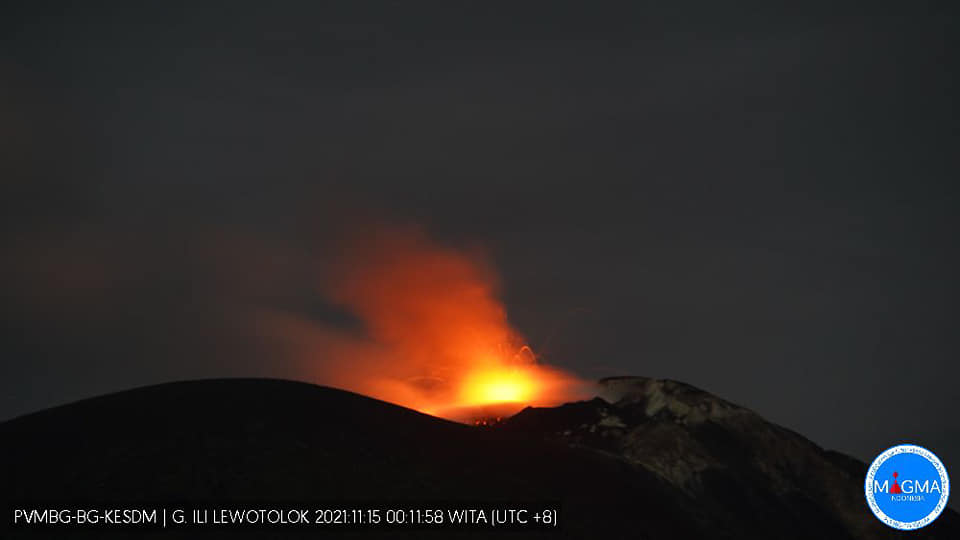
Indonesia , Ili Lewotolok :
Level of activity at SIAGA level.
High intensity white / gray smoke is recorded about 100-600 meters above the summit. An eruption was accompanied by a low rumbling, an incandescence was observed.
The seismicity associated with the activity of the magma showed:
– 25 eruption / explosion earthquakes
– 100 earthquakes of emissions
– 1 harmonic tremor
– 31 non-harmonic tremors
– 7 deep volcanic earthquakes
– 1 local tectonic earthquake
– Continuous tremor, amplitude 0.5 – 7 mm (mainly 1 mm)
Communities around Mount Ili Lewotolok as well as visitors / climbers / tourists are recommended not to engage in activities within a 3 km radius of the summit / crater of Mount Ili Lewotolok.
The community of Jontona Village should always be aware of the potential threat of weathered material avalanches which may be accompanied by hot clouds from the south-eastern part of G. Ili Lewotolok.
Source : PVMBG.
Photo : Magma Indonésie.
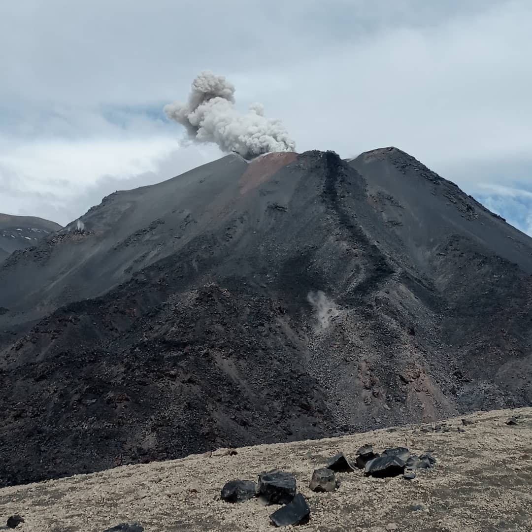
Chile , Nevados de Chillan :
Special Report on Volcanic Activity (REAV), Ñuble region, Nevados de Chillán volcanic complex, November 26, 2021, 02:20 a.m. local time (Continental Chile).
The National Service of Geology and Mines of Chile (Sernageomin) publishes the following PRELIMINARY information, obtained thanks to the monitoring equipment of the National Volcanic Monitoring Network (RNVV), processed and analyzed at the Volcanological Observatory of the Southern Andes ( Ovdas):
On Friday, November 26, 2021, at 02:04 local time (05:04 UTC), the monitoring stations installed near the Nevados de Chillán volcanic complex recorded an earthquake associated with fluid dynamics (long period LP type) in the volcanic system.
The characteristics of earthquakes after their analysis are as follows:
ORIGINAL TIME: 02:04 local time (05:04 UTC)
LATITUDE: 36.856 ° S
LONGITUDE: 71.372 ° W
DEPTH: 0.5 km
REDUCED DISPLACEMENT: 646 (cm2)
ACOUSTIC SIGNAL: 5.5 Pascals (Pa) reduced to 1 km.
OBSERVATIONS:
The characteristics of the surface activity associated with this event are as follows:
HEIGHT OF THE INCANDESCENCE: 180 m above the point of emission.
The volcanic technical alert remains at the Yellow level.
Sources and photo : Sernageomin.
Costa Rica , Turrialba / Poas / Rincon de la Vieja :
Turrialba volcano:
No eruption is reported.
Seismic activity is similar, compared to yesterday.
At the time of this report, the winds are blowing from the southwest.
Seismographs do not record seismic signals from eruptions or volcanic tremor, but low frequency and low amplitude volcanic earthquakes of the LP type continue to be frequently recorded.
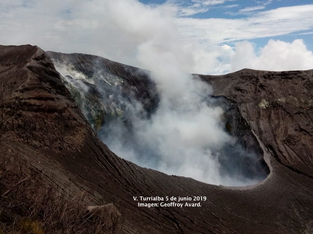
The fumaroles of the west crater maintain a moderate degassing mainly of water vapor and ashless volcanic gases. Gas measurements near the active crater by the MultiGAS monitoring system show stable CO2 / SO2 and H2S / SO2 ratios, between 18-20 and 0.2-0.30, respectively, with SO2 concentrations between 5 , 8 and 7.6 ppm. The deformation of the volcanic building remains stable with slight deflation. From the SO2 and aerosol analyzer data for the last 24 hours from the OVSICORI-UNA volcanic gas and aerosol monitoring station in Coronado, good air quality is inferred, at least in Coronado. SO2 has concentrations below the detection limit (less than 0.5 ppm) and PM10 concentrations well below the arithmetic mean for 24 hours (4.5 ug / m3).
Poas volcano:
No eruption is reported.
Seismic activity is similar, compared to yesterday.
At the time of this report, the winds are blowing from the southwest.
Seismographs do not record seismic signals corresponding to eruptions or volcanic tremors, but low frequency and amplitude LP-type earthquake signals continue to be recorded. Fumarole activity continues weakly through the subaerial fumaroles present in the walls and the terrace of the eastern sector of the active crater, although an increase in the number of fumaroles is noted, particularly in the upper part of the eastern terrace near from the edge of the crater. The orange fumarole can be heard degasing from the point of view of visitors and the smell of hydrogen sulfide, H2S, is perceived.
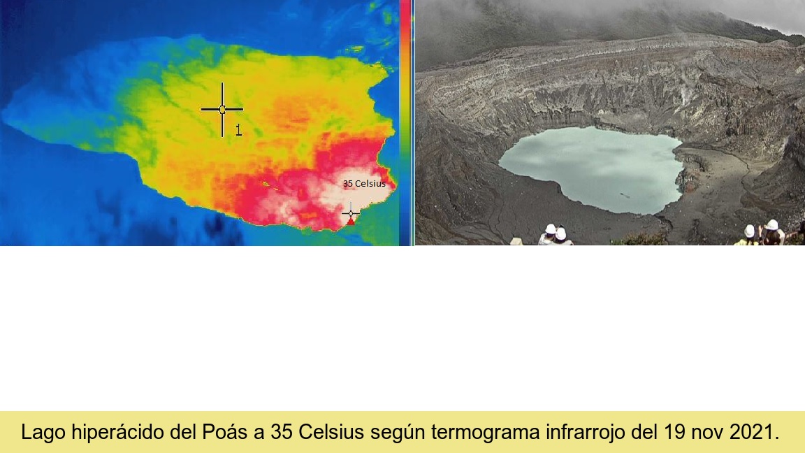
The MultiGAS gas monitoring system in the western sector of the active crater has measured SO2 concentrations between 0.6 and 1.4 ppm over the past 24 hours. The smell of H2S is detected at the visitors’ point of view, while the ExpoGAS gas traffic light detected a maximum of 0.5 ppm SO2 in the air around the point of view. The deformation of the volcanic building remains stable. The ultra-acidic lake has a milky green color and recorded an apparent temperature of 38 ° Celsius on November 24, 2021. Globules and bands of molten sulfur rich in metallic sulphides from the volcano’s shallow hydrothermal system float in abundance on the surface of the lake since the occurrence of the tsunami in the lake of November 3, 2021.
Rincón de la Vieja volcano:
No eruption is reported.
Seismic activity is similar, compared to yesterday.
At the time of this report, the winds are blowing from the southwest.

Seismographs do not record seismic signals from eruptions or volcanic tremors. Seismic activity in general remains at a low level compared to what has been recorded since 2019. There is no significant deformation of the volcanic building. High cloud cover conditions prevail these days in the Rincón region, so it is not possible to appreciate the crater through webcams.
Source : Ovsicori.
Photos : Archive Ovsicori / Geoffroy Avard , Ovsicori , Federico Chavarría-Kopper – Ovsicori

No comment yet, add your voice below!