October 11 , 2025.
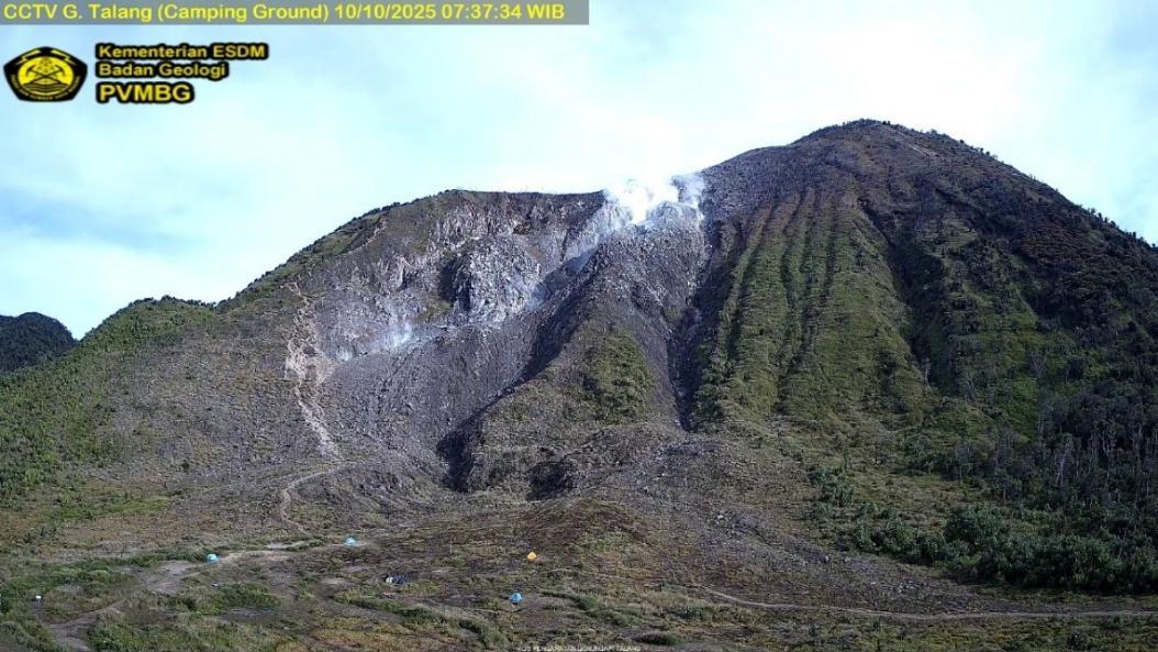
Indonesia , Talang :
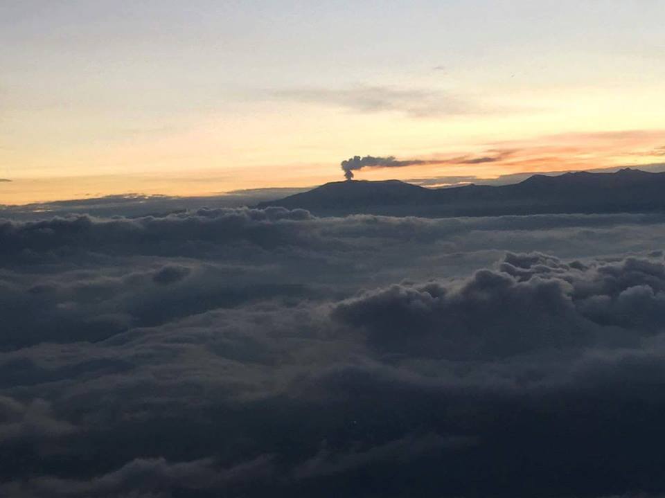
Type VT seismic swarm on Mount Talang, West Sumatra.
Mount Talang, located in Solok Regency, is one of the most active volcanoes in West Sumatra. This volcano is a volcanic complex composed of the Talang Jantan cone to the east and Talang Betina to the west, approximately 1 km apart. This volcanic complex develops in the central zone of the active Greater Sumatra Fault, namely the Sumani and Suliti segments. The northern part of the Sumani segment runs along the northern shore of Lake Singkarak, crosses the southwest shore of the lake, passes through the towns of Solok, Sumani, and Selayo, and terminates north of Lake Diatas, southeast of Mount Talang.
The activity of Mount Talang is strongly influenced by surrounding tectonic activity. For example, the eruption of April 12, 2005, created two new craters: the Main Crater and the South Crater. These two craters were believed to have been triggered by the Mentawai tectonic earthquake (magnitude 6.8) of April 10, 2005. To this day, these two craters remain the center of activity on Mount Talang, along with the Upper Gabuo and Lower Gabuo fissures.
The seismicity of Mount Talang is generally dominated by distant tectonic earthquakes. On October 9, 2025, 28 volcano-tectonic (VT) earthquakes were recorded, and 14 swarms, or series of VT earthquakes, were recorded between 23:01 and 23:04 WIB (Western Indonesian Time). Swarms occurred four times in 2025: on April 8, July 25, September 23, and October 9. The distribution of epicenters of VT earthquake swarms shows that the period of September 23 was more concentrated in the crater area than those of April 8 and July 25. Similarly, the depth of the swarm was shallower on September 23 than those of April 8 and July 25. The presence of VT earthquakes indicates the migration or movement of magma from a deep magma chamber to the surface. At the same time, the presence of VT swarms is an indicator of volcanic instability, sometimes followed by eruptions.
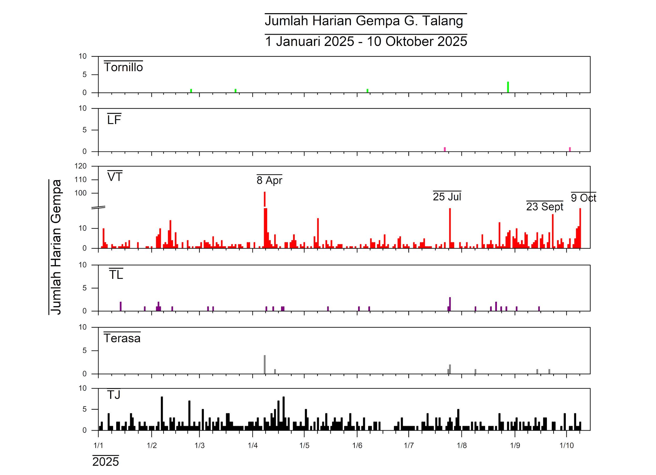
Seismic monitoring of Mount Talang on October 10, 2025, until 3:00 PM WIB (Western Indonesian Time), showed a decrease in the number of earthquakes. Visual observations of the crater from the Mount Talang observation post in Batu Bajanjang village revealed no changes. White smoke rose 10 to 50 meters above the summit. The activity level of Mount Talang is currently Level I (normal).
Source et photos : PVMBG.
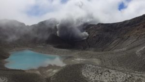
Chile , Lascar :
Seismology
Seismological activity during this period was characterized by:
12 VT-type earthquakes, associated with rock fracturing (volcano-tectonics). The most energetic earthquake, with a local magnitude (LM) of 2.1, occurred 0.3 km west-northwest of the volcanic edifice, at a depth of 1.0 km.
7 LP-type earthquakes, associated with fluid dynamics within the volcanic system (Long Period). The magnitude of the strongest earthquake, assessed by the reduced displacement (RD) parameter, was 4 cm².
Fluid Geochemistry
Ten atmospheric sulfur dioxide (SO₂) emission anomalies were reported near the volcano, according to data published by the Tropospheric Monitoring Instrument (TROPOMI) and the Sulfur Dioxide Group of the Ozone Monitoring Instrument (OMI).
Satellite Thermal Anomalies
During this period, 97 thermal alerts were recorded on the MIROVA platform in the area associated with the volcano, with a maximum radiative power (MRP) of 4.1 MW in MODIS on September 24 and 4.4 MW on September 23. Based on analytical processing of Sentinel 2-L2A satellite images, five images with false-color radiance anomalies were analyzed on September 9, 19, 24, 26, and 29. Using NHI TOOLS, a total hotspot area of 1,200 m² was estimated on September 24, which was considered low.
Geodesy
Geodetic activity during this period was characterized by:
– Low vertical GNSS deformation rates, with magnitude variations less than 0.3 cm/month and in the deflationary direction, a value considered low.
Horizontal deformation rates at GNSS monitoring stations were around 0.9 cm/month at one station, resulting in a shortening of the monitoring line (distance between GNSS stations) north and south of the volcano. This indicator does not reflect significant behavior due to its magnitude and direction.
Sentinel 1A (Single Look Complex-SLC) imaging radar (InSAR) interferometry revealed no signs of deformation near the volcano.
Therefore, no significant changes associated with the deformation of the volcanic system were observed.
Satellite Geomorphological Analysis
During this period, a high-resolution SkySat Collect image, taken on September 8, 2025, was processed. Its photointerpretation shows degassing associated with concentric scarps located within the active crater.
Activity has remained at levels considered low, suggesting the volcano’s stability.
The technical volcanic alert remains in effect:
GREEN TECHNICAL ALERT: Active volcano with stable behavior – No immediate risk
Source et photo : Sernageomin .
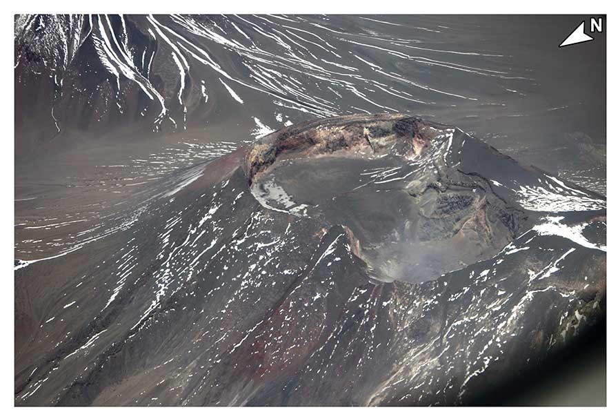
Colombia , Nevado del Ruiz :
Manizales, October 7, 2025, 5:30 p.m.
Regarding the monitoring of the activity of the Nevado del Ruiz volcano, the Colombian Geological Survey (SGC), an entity affiliated with the Ministry of Mines and Energy, reports that:
During the week of September 30 to October 6, 2025, the volcano continued to exhibit unstable behavior. Compared to the previous week, the main variations in the monitored parameters were:
– Seismicity related to fluid dynamics in volcanic conduits:
– Increase in the number of recorded earthquakes and the seismic energy released, particularly for short-duration signals. The energy levels of the seismic events were low to moderate at times. Thanks to the cameras (conventional or thermographic) used for monitoring the volcano and the reports from the officials of the Los Nevados National Natural Park (PNN), several pulsed ash emissions and some variations in the apparent temperature of the ejected materials have been confirmed.
Seismic activity associated with rock fracturing processes within the volcanic edifice increased in the number of recorded earthquakes and decreased in the released seismic energy. The events were low-energy (magnitudes less than 1) and were mainly located in the Arenas crater, less than 2 km deep from the volcano’s summit. To a lesser extent, scattered seismic activity occurred on the volcano’s various flanks, primarily on the northeast and southeast flanks, at distances of up to 7 km from the Arenas crater. Furthermore, on October 1 and 5, seismic activity was recorded related to the activity of the lava dome (protuberance or mound) located at the crater floor, characterized by low energy levels.
The volcano continues to emit water vapor and volcanic gases, primarily sulfur dioxide (SO₂), into the atmosphere. The estimated values of the SO₂ flux associated with degassing processes were similar to those obtained the previous week. This trend was also confirmed by satellite monitoring of this parameter.
The vertical height of the gas, water vapor, or ash column remained mostly below the 600 m measured above the volcano’s summit. On September 30, during the ash emission recorded at 6:58 a.m., the column reached a maximum vertical height of 1,000 m and a dispersion height of 1,600 m. Regarding the dispersion direction, the plume showed a preferential trend toward the northwest flank of the volcano, causing ashfall in the area known as Valle de las Tumbas, within the national park.
When monitoring thermal anomalies at the floor of the Arenas crater using satellite monitoring platforms, detection remained limited by the atmospheric conditions of high cloud cover in the volcanic area. However, some reports of low energy anomalies have been obtained.
Source : SGC.
Photo : Diana M Bustamante.
Costa Rica , Poas :
OVSICORI-UNA Weekly Volcano Monitoring Bulletin, October 9, 2025
Latitude: 10.20°N;
Longitude: 84.23°W;
Altitude: 2,687 m.
Current Activity Level: Alert
This week, the tremor amplitude increased compared to the previous week. This trend has been observed since September 9, the date of the flooding of Mouth A and the last eruption. Acoustic tremor remains stable, with moderate intensity. After peaking last week and then decreasing, the number of long-period events remains stable. No volcano-tectonic events were recorded this week.
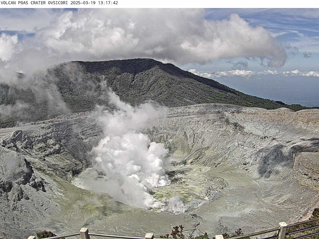
The geodetic network does not record any significant short-term deformation, but shows slight contraction and subsidence of the volcano over the past six months. MultiGAS stations measured an average SO₂/CO₂ ratio of 1.8 ± 0.6 this week, similar to last week’s (1.6 ± 0.7). The H₂S/SO₂ ratio has remained very low (< 0.1) in recent weeks.
The ExpoGAS station located at the visitor observation post measured a maximum of 9.2 ppm SO₂ this week, which represents a high concentration. DOAS stations measured an SO₂ flux of 177 ± 93 t/d, slightly lower than the previous week’s (205 ± 76 t/d). In addition, satellite measurements of atmospheric SO₂ remained detectable, with a decrease of between 30 and 80 tonnes, except on October 3, when 308 tonnes of SO₂ were measured.
This week, the lake level dropped again. Water temperatures above 76°C were measured, and fumaroles exceeded 190°C.
Source et photo : Ovsicori
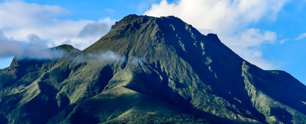
La Martinique , Mount Pelée :
Weekly Report, Paris Institute of Earth Physics, Martinique Volcanological and Seismological Observatory
Saint-Pierre, October 10, 2025 at 6:00 p.m. local time (GMT-4)
Volcanic activity remained significant this week, with 2,666 earthquakes of volcanic origin observed.
Between October 3, 2025 at 4:00 p.m. (UT) and October 10, 2025 at 4:00 p.m. (UT), the OVSM recorded:
• 2,588 shallow volcano-tectonic earthquakes. Among them, at least 237 had a magnitude (duration magnitude Md or local magnitude Mlv) greater than 0.5, 43 had a magnitude greater than 1, and 2 had a magnitude greater than 2. The largest had a magnitude Mlv = 2.49. The others were of lower energy. These earthquakes are located at depths between 0.9 and 4.7 km below the volcano’s summit, as was the case the previous week. A significant number of them originate from the well-known seismically active zones at Mount Pelée, located between 1.0 and 1.4 km below the volcano’s summit. The shallow volcano-tectonic seismicity is associated with microfracturing in the volcanic edifice, linked to the global reactivation of the volcano observed since 2019.
• 49 shallow hybrid earthquakes and 29 long-period earthquakes. Among them, at least 9 have a local magnitude (LMI) greater than 0.5 and 4 have a magnitude greater than 1. The largest has a magnitude LMI = 1.35. The others are of lower energy. These earthquakes are located in the same areas as the shallow volcano-tectonic earthquakes. The seismic signals from these types of earthquakes are enriched in (or contain only) low frequencies and are associated with the circulation of fluids (gas, hydrothermal fluids) within the volcanic edifice.
No earthquakes have been confirmed as being felt by the public. However, several volcanic earthquakes have a magnitude approaching that of earthquakes likely to be felt by hikers on Mount Pelée.
The previous week, the OVSM had recorded 2,585 earthquakes of volcanic origin. As of October 10, 2025, and over the past four weeks, the OVSM has observed a total of 8,169 volcanic earthquakes, an average of 2,042 to 2,043 earthquakes per week.
During phases of volcanic reactivation in volcanoes similar to Mount Pelée, seismic activity of varying intensity and frequency is commonly observed, which can evolve rapidly but also cease rapidly without major changes to the system.
The deformations of the edifice are very slight, and to date, there is no evidence of marked inflation of the summit zone or evidence of deformations associated with deeper sources. There is currently no evidence of fumarolic activity on Mount Pelée.
The probability of eruptive activity in the short term remains low. However, given all the observations collected since the end of 2018 and their nature, and based on recent observations from the OVSM-IPGP, we cannot rule out a change in the situation in the medium term (weeks, months).
The volcanic alert level, in accordance with the measures planned by the authorities, is currently YELLOW: vigilance.
Source : OVSM- IPGP.
Photo : ville-saintemarie