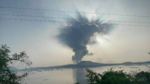
August 08 , 2025 .
Chile , Laguna del Maule :
Seismology
Seismological activity during this period was characterized by:
11,119 VT-type earthquakes, associated with rock fracturing (volcano-tectonics). The most energetic earthquake, with a local magnitude (LM) of 3.7, occurred 10.2 km west-southwest of the volcanic edifice, at a depth of 5.4 km from the center of the lagoon.
60 LP-type earthquakes, associated with fluid dynamics within the volcanic system (Long Period). The magnitude of the strongest earthquake, as measured by the reduced displacement (RD) parameter, was 10 cm².
2 TR-type earthquakes, associated with sustained fluid dynamics within the volcanic system (TRemor). The magnitude of the strongest earthquake, as measured by the reduced displacement (RD) parameter, was 3 cm².
Fluid Geochemistry
No atmospheric sulfur dioxide (SO2) emission anomalies were reported near the volcanic complex, according to data published by the Tropospheric Monitoring Instrument (TROPOMI) and the Sulfur Dioxide Group of the Ozone Monitoring Instrument (OMI).
Satellite Thermal Anomalies
During the period, no thermal anomalies were recorded in the area associated with the volcanic complex, according to analytical processing of Sentinel 2-L2A satellite images, combined with false-color bands.
Geodesy
Geodetic activity for the period was characterized by:
– GNSS vertical deformation rates, with maximum magnitude variations of 4.2 cm/month at the station closest to the center of the lagoon, demonstrating the increase in internal activity reflected at the surface from mid-May to the reference period;
– Horizontal variation rates at the GNSS monitoring stations, with variations of approximately 2.1 cm/month, a value considered high.
– A slight increase in the variation rate of the GNSS monitoring lines (distance between GNSS stations), reaching a maximum of 2.7 cm/month for the reference period, a value consistent with the increase in activity measured in the previous parameters.
Radar interferometry (InSAR) of Sentinel 1A (Single Look Complex-SLC) images reveals no signs of deformation due to poor coherence caused by the heavy snow cover in the area.
Significant changes associated with the deformation of the volcanic system are therefore observed, indicating an increase in the internal activity of the volcanic complex.
Satellite geomorphological analysis
No morphological variations associated with volcanic activity were identified from Planet Scope and Sentinel 2 L2A satellite images.
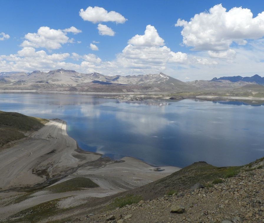
In recent weeks, a progressive increase in volcano-tectonic seismicity has been observed in the Laguna del Maule volcanic complex. Several seismic swarms have been recorded, mainly in the Troncoso-Nieblas (southwest) and eastern sectors of the lagoon.
New development: During the assessment period, the seismic source was identified as being located toward the center of the lagoon, coinciding with an increase in deformation rates measured by GNSS stations, reaching historically high levels. These data suggest a progression of internal activity toward new areas of the complex, with instrumental parameters considered above their reference threshold.
In light of the above, the technical volcanic alert has been modified to: YELLOW TECHNICAL ALERT: Changes in the behavior of volcanic activity.
Source et photo : Sernageomin
Hawaii , Kilauea :
HAWAIIAN VOLCANO OBSERVATORY DAILY UPDATE . U.S. Geological Survey
Thursday, August 7, 2025, 9:01 AM HST (Thursday, August 7, 2025, 19:01 UTC)
19°25’16 » N 155°17’13 » W,
Summit Elevation 4091 ft (1247 m)
Current Volcano Alert Level: WATCH
Current Aviation Color Code: ORANGE
Activity Summary:
Episode 30 of the ongoing Halemaʻumaʻu eruption ended abruptly at 12:55 p.m. HST on August 6 after 12 hours of continuous fountaining. Lava fountains reached up to 300 ft (90 m) during this episode. A new fissure vent that transected the south wall of Halemaʻumaʻu ceased erupting at 4:40 a.m. HST on the morning of August 6. Volcanic gas emissions have greatly decreased. Lava flows from this episode on the floor of Halemaʻumaʻu within the southern part of Kaluapele (Kīlauea caldera) may continue to exhibit slow movement or incandescence as they cool and solidify over the coming days.
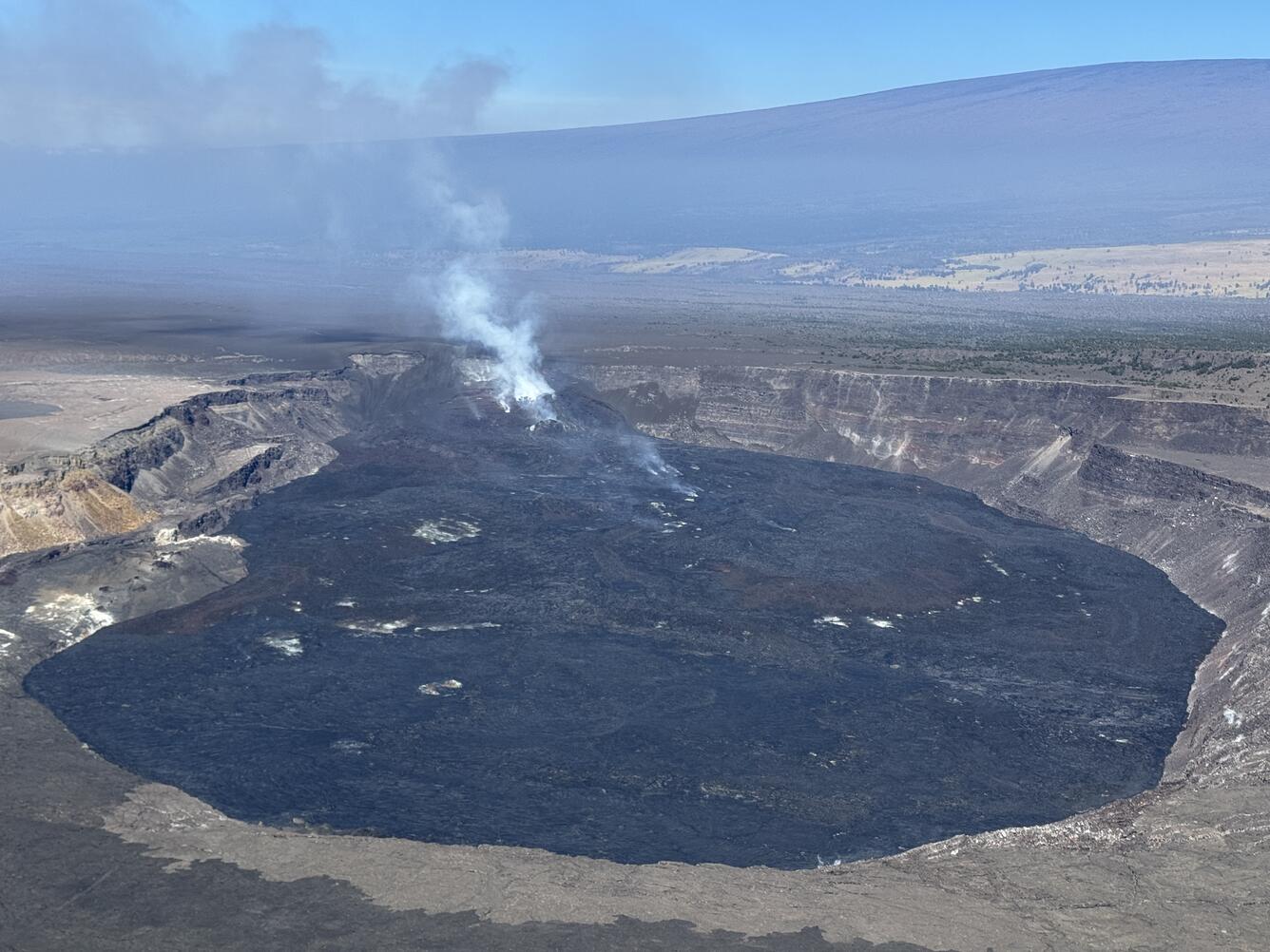
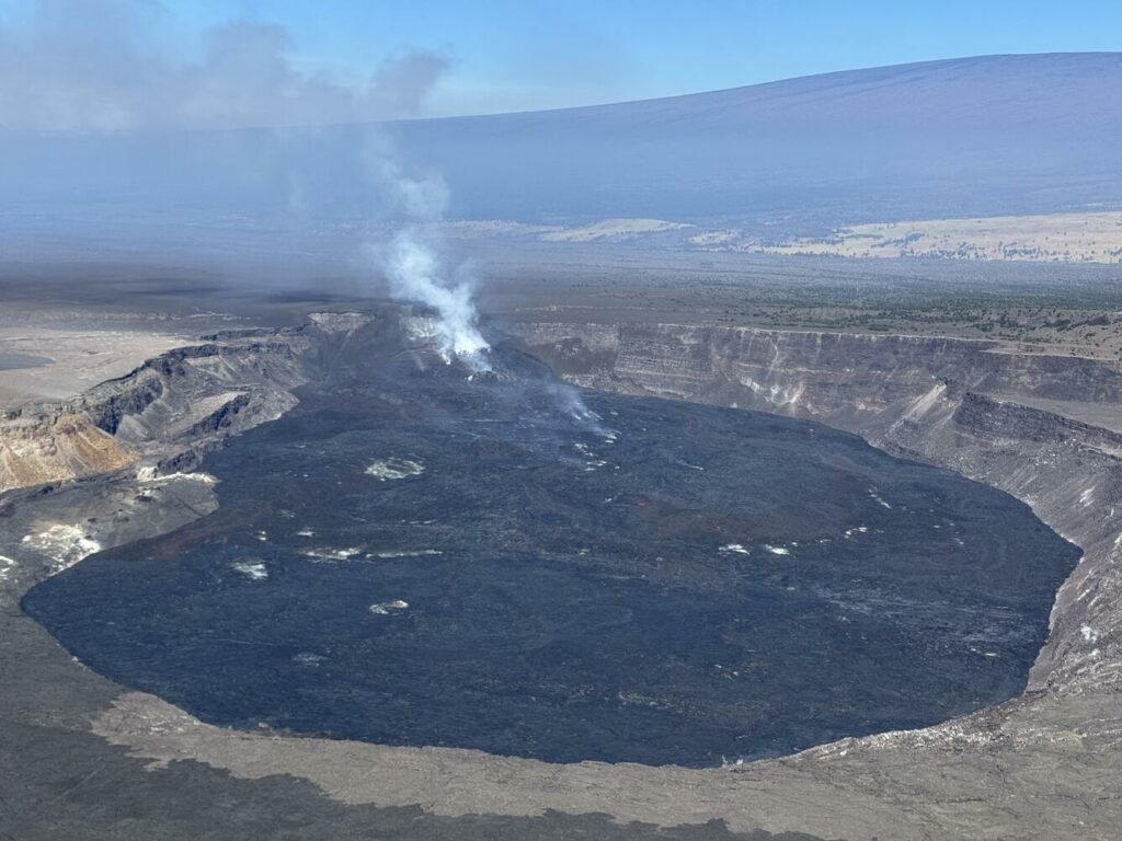
This closer view of Halema‘uma‘u crater at the summit of Kīlauea was captured during the Hawaiian Volcano Observatory’s helicopter overflight on August 5. The circular black zone consists of recent lava flows that have been filling the crater in recent months, and the outgassing plume from the eruptive vents is carried southwest by the trade winds.
Summit Observations:
The Uēkahuna tiltmeter (UWD) recorded about 22.5 microradians of deflationary tilt during this episode. The end of the eruption was coincident with a rapid change from deflation to inflation at the summit and a decrease in seismic tremor intensity. The Uēkahuna tiltmeter (UWD) has recorded just over 2 microradians of inflationary tilt since the episode ended. Incandescence from the recent lava flows and glow from the north vent were visible last night,
Elevated degassing continues from the vent. Average sulfur dioxide (SO2) emission rates during inter-episode pauses are typically 1,200 to 1,500 t/d, though emission rates vary on short time scales in association with gas pistoning.
Source : HVO
Photo : USGS / M. Patrick.
Indonesia , Dempo :
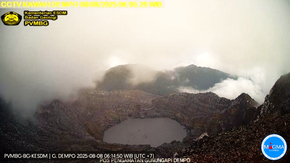
Mount Dempo erupted on Thursday, August 7, 2025, at 9:38 PM WIB. An ash column was observed about 1,200 m above the summit (about 4,373 m above sea level). The ash column was gray and of strong intensity, oriented toward the north. This eruption was recorded by a seismograph with a maximum amplitude of 30 mm and a duration of 239 seconds.
Seismic observations
One eruption earthquake with an amplitude of 30 mm and a duration of 239 seconds.
Three emission earthquakes with an amplitude of 18 to 21 mm and a duration of 31 to 146 seconds.
Three low-frequency earthquakes with an amplitude of 1 to 2 mm and a duration of 4 to 8 seconds.
Two deep volcanic earthquakes with an amplitude of 30 mm and a duration of 18 to 21 seconds.
Three local tectonic earthquakes with an amplitude of 25 to 30 mm and a duration of 18 to 30 seconds.
Continuous tremor with an amplitude of 0.5 to 1 mm, mainly 0.5 mm.
VOLCANO OBSERVATORY NOTICE FOR AVIATION – VONA
Issued : August 07 , 2025
Volcano : Dempo (261230)
Current Aviation Colour Code : ORANGE
Previous Aviation Colour Code : orange
Source : Dempo Volcano Observatory
Notice Number : 2025DEM003
Volcano Location : S 04 deg 01 min 48 sec E 103 deg 07 min 48 sec
Area : South Sumatra, Indonesia
Summit Elevation : 10154 FT (3173 M)
Volcanic Activity Summary :
Eruption with volcanic ash cloud at 14h38 UTC (21h38 local).
Volcanic Cloud Height :
Best estimate of ash-cloud top is around 13994 FT (4373 M) above sea level or 3840 FT (1200 M) above summit. May be higher than what can be observed clearly. Source of height data: ground observer.
Other Volcanic Cloud Information :
Ash cloud moving to north. Volcanic ash is observed to be gray. The intensity of volcanic ash is observed to be thick.
Remarks :
Eruption recorded on seismogram with maximum amplitude 30 mm and maximum duration 239 second. Tremor recorded on seismogram with maximum amplitude 0.5 mm.
Source et photo : Magma Indonésie .
Colombia , Puracé – Los Coconucos volcanic chain:
Popayán, August 5, 2025, 3:00 p.m.
Regarding the monitoring of the activity of the Puracé Volcano – Los Coconucos Volcanic Range, the Colombian Geological Survey (SGC), an entity affiliated with the Ministry of Mines and Energy, reports that:
During the week of July 29 to August 4, 2025, a decrease in seismic activity was observed compared to the previous week, both in terms of the number of events and the energy released. Earthquakes associated with rock fracturing were located mainly 2 km southeast of the Puracé Volcano crater, at a depth of 2 km, reaching a maximum magnitude of 1.6. The remaining seismic activity was concentrated in the distal areas northeast of the Puracé Volcano crater. Fluid-driven earthquakes were located beneath this same crater, at a depth of less than 1 km, characterized by low energy input.
Satellite and ground-based detection instruments recorded moderate levels of sulfur dioxide (SO2) emissions. Furthermore, the slow deformation process detected after the eruption of Curiquinga Volcano on January 20, 2025, persists.
Images captured by visible and infrared webcams continued to reveal degassing processes and thermal anomalies in the Puracé Volcano crater and in the fumarole field on the outer rim of the crater, respectively. Seismic activity was located south of the Puracé Volcano crater, and slow ground deformation was observed, indicating the persistence of an active volcanic system.
In conclusion, the variations observed in the Puracé Volcano and Los Coconucos volcanic chain indicate that the system remains active and that monitoring parameters remain above their reference values. At yellow alert status, phenomena such as sporadic ash emissions (minor eruptions of limited magnitude and effects, whose dispersion depends on wind direction), the presence of incandescent glow, small explosions in the crater, low-energy thermal anomalies, noise, felt earthquakes, odors, precipitation of elemental sulfur near the crater, in hot springs and fumaroles, as well as degassing outside the crater, may occur. Fissure formation and the formation of minor lahars, among other things, may also occur.
The alert status for volcanic activity remains yellow: an active volcano exhibiting changes in the baseline behavior of monitored parameters and other manifestations.
Source : SGC
Photo : Carlos Carillo.
Costa Rica , Rincon de la Vieja :
Latitude: 10.83°N;
Longitude: 85.34°W;
Altitude: 1,916 m;
Current Activity Level: Alert.
An eruption was recorded on July 25 at 7:24 PM. It generated no lahars or ash emissions.
The acoustic energy of this eruption is higher than those recorded over the previous two weeks.
The background tremor remains of very low amplitude.
Starting on July 26, shortly before the eruption, a sequence of banded tremors (rhythmic tremor pulses) began with very similar amplitudes, low energy, and high frequencies (3 to 6 Hz) that persisted until the date of this report. The occurrence of « tornillos » type seismic events and the downward trend in the dominant frequency continue. Geodetic observations do not show any significant deformation. This week, DOAS stations detected a slightly lower SO2 flux (172 ± 80 t/d) compared to the previous week (263 ± 146 t/d).
Source : Ovsicori
Photo : Raul Mora / RSN / UCR

