July 25 , 2025.
Iceland , Reykjanes Peninsula :
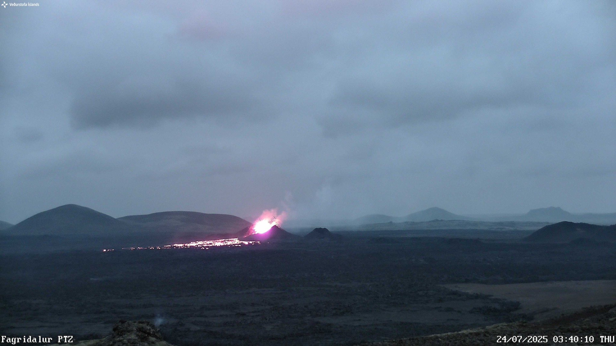
Eruption ongoing on the Sundhnúkur crater row . Updated 14:50, 24 July
Continued lava flow and decreasing gas emissions
Volcanic activity has decreased since yesterday morning. One crater is still erupting, and lava continues to flow eastward and south-eastward. Active lava flows spread about one kilometre from the crater and there is little overall expanse of the outer edges of the lava field, aside from limited flow to the south close to Fagradalsfjall.
According to the latest measurements by EFLA, taken on 23 July, the total volume of the new lava in the Sundhnúkur area is now estimated at 26.8 million cubic metres, covering about 3.3 square kilometres. New data show that the volume increased by 5.1 million cubic metres in five days, from 18 to 23 July, corresponding to an average flow rate of about 12 cubic metres per second.
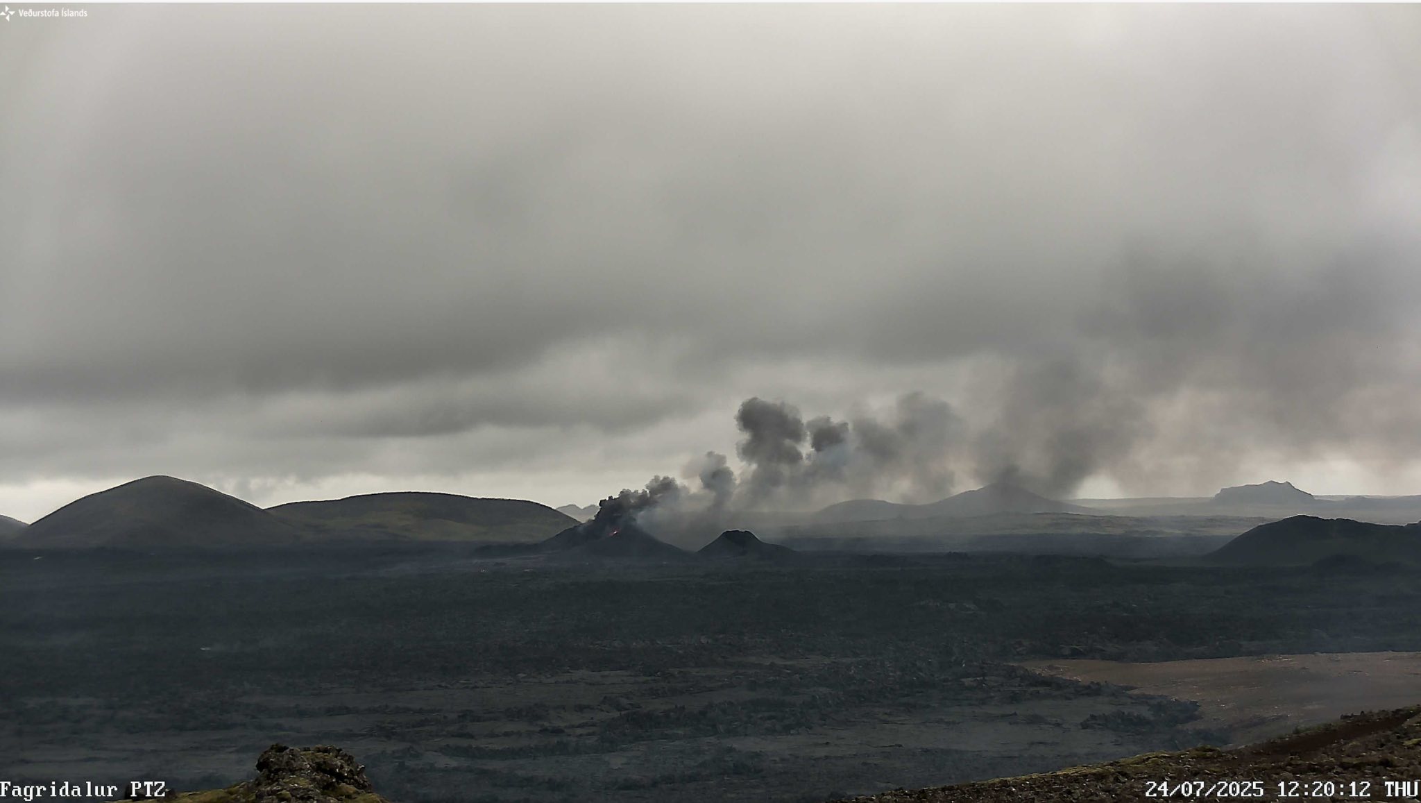
The photo was taken at 12:20 today. It shows activity in the main crater of the Sundhnúkur volcanic system.
Seismic tremor due to ongoing eruption decreased between 06:00 and 07:00 this morning, in line with decreased volcanic activity in the crater, and has remained relatively low since then. There are no measurable signs of ground deformation in the Svartsengi region, where magma accumulated at depth ahead of the latest eruption.

The photo was taken at 3:40 a.m. today. It shows activity in the main crater of the Sundhnúkur volcanic system.
Gas dispersion and air quality
Measurements of sulphur dioxide (SO₂) from the eruption site this morning show an emission rate between 25 and 44 kilograms per second, a significant decrease from the previous day. Today a south‑easterly wind has carried SO₂ pollution northwest over Njarðvík and Keflavík; it is expected to turn southerly later in the day, and the pollution could then drift over Vogar, the capital region, Akranes and Borgarnes.
Volcanic haze (SO₄) was reported widely this morning, including in Ísafjörður and Strandir. With increasing south‑easterly winds, the haze should diminish in many areas during the day, but calm weather conditions are forecast for Friday, and the haze may return then.
Source et photos : IMO
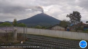
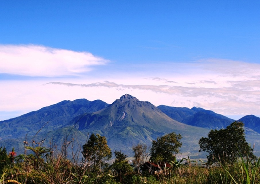
Indonesia , Bur Ni Telong :
SPECIAL REPORT ON THE EVOLUTION OF MOUNT BUR NI TELONG ACTIVITY, NANGGROE ACEH DARUSSALAM, JULY 23, 2025.
Bur Ni Telong is a stratovolcano rising to an altitude of 2,624 m, located at 96°49’16 » E and 4°46’10 » N.
Visual observations conducted from July 1 to 23, 2025, at 6:00 a.m. Western Indonesian Time (WIB), showed that the volcano was clearly visible until it was shrouded in mist. No smoke was observed from the crater. Seismic data collected from July 1 to 23, 2025, at 6:00 a.m. (Western Indonesia Time), revealed 46 deep volcanic earthquakes, 15 local tectonic earthquakes, and 33 distant tectonic earthquakes.
Visual observations indicate that no smoke activity has yet been observed from the Bur Ni Telong observation post, indicating no increase in temperature in the crater area or gas upwelling to the surface. This also indicates that crater activity remains relatively low. The recorded earthquake pattern indicates that magmatic activity is still dynamic but has not yet increased at the surface. Deep volcanic earthquakes have fluctuated since June 2025, requiring more intensive monitoring.
Considering the recorded condition of the crater and seismicity, the activity level of Mount Bur Ni Telong until July 23, 2025 at 06:00 WIB is still set at Level I (Normal) with recommendations to the public and visitors/climbers not to descend, approach and spend the night within a radius of 500 meters from the Bur Ni Telong crater and not to be near fumaroles and solfataras during cloudy or rainy weather as gas concentrations can be life-threatening.
Source : PVMBG
Photo : rafina2802 /wordpress.com
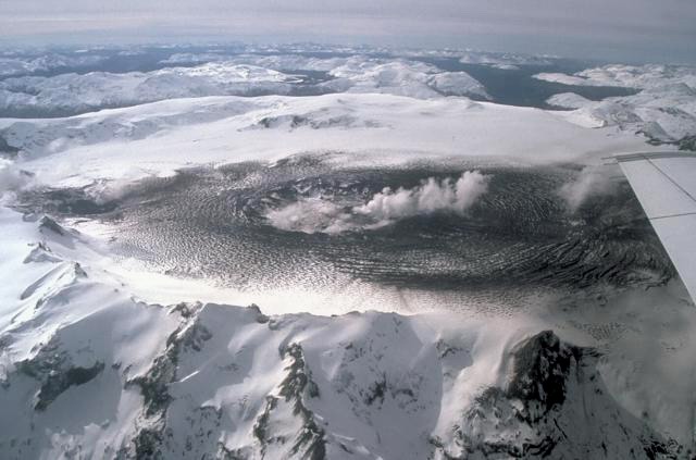
Chile , Hudson :
Special Report on Volcanic Activity (REAV), Aysen del General Carlos Ibanez del Campo Region, Hudson Volcano, July 24, 2025, 4:48 PM local time (Continental Chile)
The National Geology and Mining Service of Chile (Sernageomin) announces the following preliminary information, obtained using the monitoring equipment of the National Volcanic Monitoring Network (RNVV), processed and analyzed at the Southern Andean Volcano Observatory (OVDAS):
On Thursday, July 24, 2025, at 4:17 PM (20:17 UTC), monitoring stations installed near Hudson Volcano recorded an earthquake associated with both rock fracturing and fluid dynamics within the volcanic system (Hybrid Type).
The characteristics of the highest-energy earthquake after its analysis are as follows:
TIME OF ORIGIN: 4:17 PM local time (8:17 PM UTC)
LATITUDE: 45.880°S
LONGITUDE: 72.906°W
DEPTH: 3.3 km
LOCAL MAGNITUDE: 2.8
REDUCED DISPLACEMENT: 1,228 cm²
Observation:
At the time of this report, nine other volcano tectonic (VT) earthquakes have been recorded, but with lower magnitudes.
The technical volcanic alert remains at GREEN.
Source : Sernageomin
Photo : Norm Banks, 1991 (U.S. Geological Survey).
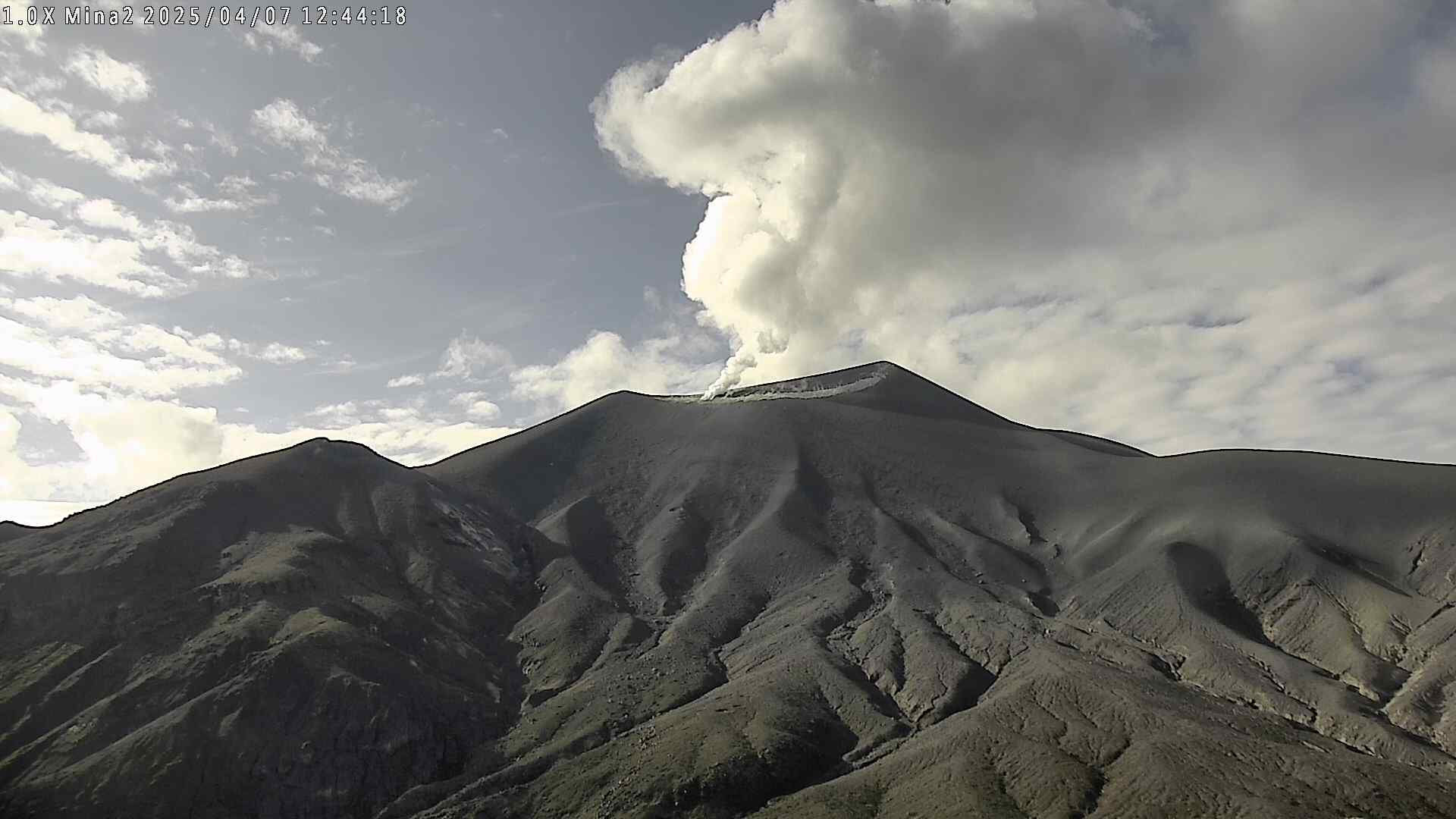
Colombia , Puracé – Los Coconucos volcanic chain :
Popayán, July 22, 2025, 3:00 p.m.
According to monitoring of the activity of the Puracé Volcano – Los Coconucos Volcanic Chain, the Colombian Geological Survey (SGC), an entity affiliated with the Ministry of Mines and Energy, reports that:
During the week of July 15-21, 2025, a decrease in seismic activity was observed compared to the previous week, both in terms of the number of events and the energy released. Earthquakes associated with rock fracturing were concentrated mainly in the area between the Puracé and Piocollo volcanoes, with depths of 1 to 3 km and a maximum magnitude of 0.5. The remaining seismic activity was located scattered over a distance of less than 3 km to the south and southwest of the Puracé volcano. Fluid-related earthquakes were located under this same crater, less than a kilometer deep, and were characterized by low energy input.
Satellite and ground-based detection instruments recorded moderate levels of sulfur dioxide (SO2) emissions. Furthermore, the slow deformation process identified after the eruption of Curiquinga Volcano on January 20, 2025, persists.
Visible spectrum webcam images continued to show degassing processes within the crater of Puracé Volcano and in the fumarole field on the outer rim of the crater.
In conclusion, the variations observed at Puracé Volcano (Los Coconucos volcanic chain) indicate that the system remains active and that monitoring parameters remain above their reference levels. In light of the above, the SGC recommends closely monitoring the evolution of volcanic activity through weekly and special bulletins, in addition to information published through official channels, and following the instructions of local and departmental authorities and the National Disaster Risk Management Unit (UNGRD).
The alert status for volcanic activity remains at yellow alert: active volcano showing changes in the basic behavior of monitored parameters and other manifestations.
Source et photo : SGC
Hawaii , Kilauea :
HAWAIIAN VOLCANO OBSERVATORY DAILY UPDATE / U.S. Geological Survey
Thursday, July 24, 2025, 9:06 AM HST (Thursday, July 24, 2025, 19:06 UTC)
19°25’16 » N 155°17’13 » W,
Summit Elevation 4091 ft (1247 m)
Current Volcano Alert Level: WATCH
Current Aviation Color Code: ORANGE
Activity Summary:
The ongoing Halemaʻumaʻu is currently paused. Episode 29 ended on July 20, 2025, after over 13 hours of sustained lava fountaining. Summit inflation resumed immediately and continues today. Degassing and low-level seismic tremor also persist. Current inflation data suggest that episode 30 may start July 31 or later.
No significant activity has been noted along Kīlauea’s East Rift Zone or Southwest Rift Zone.
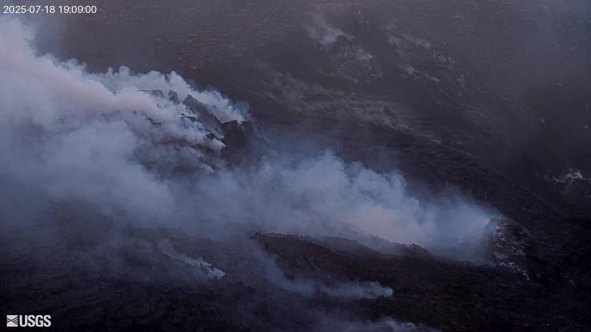
Summit Observations:
Incandescence in the crater last night was limited, with intermittent glow from north vent and more persistent glow from two areas higher up on the eruptive cone. Lava flows on the floor of Halemaʻumaʻu may continue to exhibit slow movement or sporadic incandescence as they cool and solidify over the coming days. Slow slumping of the eruptive cone is also possible.
At present, low-level tremor and elevated degassing persist. Both seismic and gas data streams indicate that gas pistoning is occurring; however, no lava or spatter is visible at the surface in association with the pistons at this time. Typical average sulfur dioxide (SO2) emission rates during inter-episode pauses are 1,200 to 1,500 t/d, though emission rates vary on short time scales in association with gas pistoning.
Fountaining associated with Episode 29 resulted in approximately 19 microradians of deflation. At the time of this update, UWD had re-inflated by about 7.5 microradians.
Source : HVO .
Photo : HVO ( archive)