July 14 , 2025 .
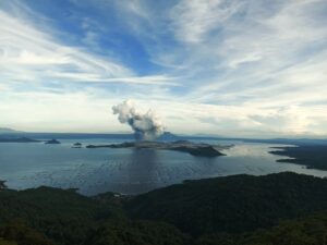
New Zealand , Ruapehu :
Earthquake swarm near Ruapehu – minor volcanic unrest continues. Volcanic Alert Level remains at 1.
Published: Mon Jul 14 2025 4:45 PM
Volcanic Alert Level remains at 1
Aviation Colour Code remains at Green
A swarm of small, relatively deep, earthquakes lasting two days occurred east of Ruapehu early last week. However, there have been no significant changes to the volcano observed following the earthquakes. Te Wai ā-moe (Ruapehu Crater Lake) temperature remains stable at about 12°C. We continue to record emissions of volcanic gas indicating heat and gas flow from depth is occurring. The Volcanic Alert Level remains at 1 and the Aviation Colour Code at Green.
We continue to record emissions of volcanic gas indicating heat and gas flow from depth is occurring.

Since our last update in May, the temperature of Te Wai ā-moe (Ruapehu Crater Lake) has declined from ~17 °C to ~12 ºC. Observations from a visit on 8 June confirmed the presence of sulphur slicks on the lake surface, usually related to hot fluids entering the lake floor melting sulphur. The lake was also observed overflowing, indicating that there continues to be inflow of hydrothermal fluids into the lake. Heat flux modelling indicates there is a continuous heat input of between 0 and 100 MW.
Sulphur dioxide emissions measured by our continuous gas emission detectors continue to show low-level, but continuous, gas emissions ranging from ~0 to 150 tonnes per day. The new multigas sensor system at the lake outlet has been recording continued gas fluxes of carbon dioxide (CO₂), and sulphur dioxide (SO₂).
Despite the swarm of nearby earthquakes, a lack of other observable changes at Ruapehu indicates that the volcano continues to exhibit typical background activity. When weather permits, we will be conducting further gas flights and sampling Crater Lake fluids to monitor any changes closely.
In summary our recent observations are consistent with minor volcanic unrest, therefore, the Volcanic Alert Level remains at 1 and the Aviation Colour Code remains Green.
Source : Geonet / Geoff Kilgour / Volcanologue de service .
Photo : Bradd Scott GNS Sciences
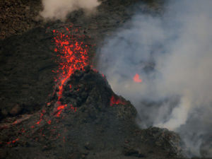
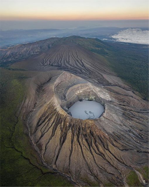
Chile , Hudson :
Seismology
Seismological activity during this period was characterized by:
175 VT-type earthquakes, associated with rock fracturing (volcano-tectonics). The most energetic earthquake, with a local magnitude (LM) of 1.8, was located 5.3 km south-southeast of the volcanic edifice, at a depth of 2.6 km from the caldera center.
18 LP-type earthquakes, associated with fluid dynamics within the volcanic system (long period). The magnitude of the largest earthquake, estimated using the reduced displacement (RD) parameter, was 10.3 cm².
Fluid Geochemistry
No anomalies in atmospheric sulfur dioxide (SO₂) emissions have been reported in the area near the volcano, according to data published by the Tropospheric Monitoring Instrument (TROPOMI) and the Sulfur Dioxide Monitoring Group of the Ozone Monitoring Instrument (OMI).
Geodesy
Geodetic activity during the period was characterized by:
– A low vertical deformation rate at the GNSS monitoring station, not exceeding 0.6 cm/month, which is considered a low magnitude.
– No InSAR data are available from satellite platforms due to low coherence caused by the heavy snow cover.
Therefore, there is no evidence of deformation of the volcanic system.
Satellite Thermal Anomalies
During the period under consideration, no thermal anomalies were recorded in the area associated with the volcano, according to analytical processing of Sentinel 2-L2A and Landsat 8-9 satellite images, using a combination of false-color bands.
Satellite Geomorphological Analysis
No morphological changes were identified in this volcanic system, based on Sentinel 2-L2A images using a combination of true-color bands.
Activity remained at levels considered low, suggesting the volcano’s stability.
The technical volcanic alert remains in effect:
GREEN TECHNICAL ALERT: Active volcano with stable behavior – No immediate risk
Source : Sernageomin .
Photo : Norm Banks .
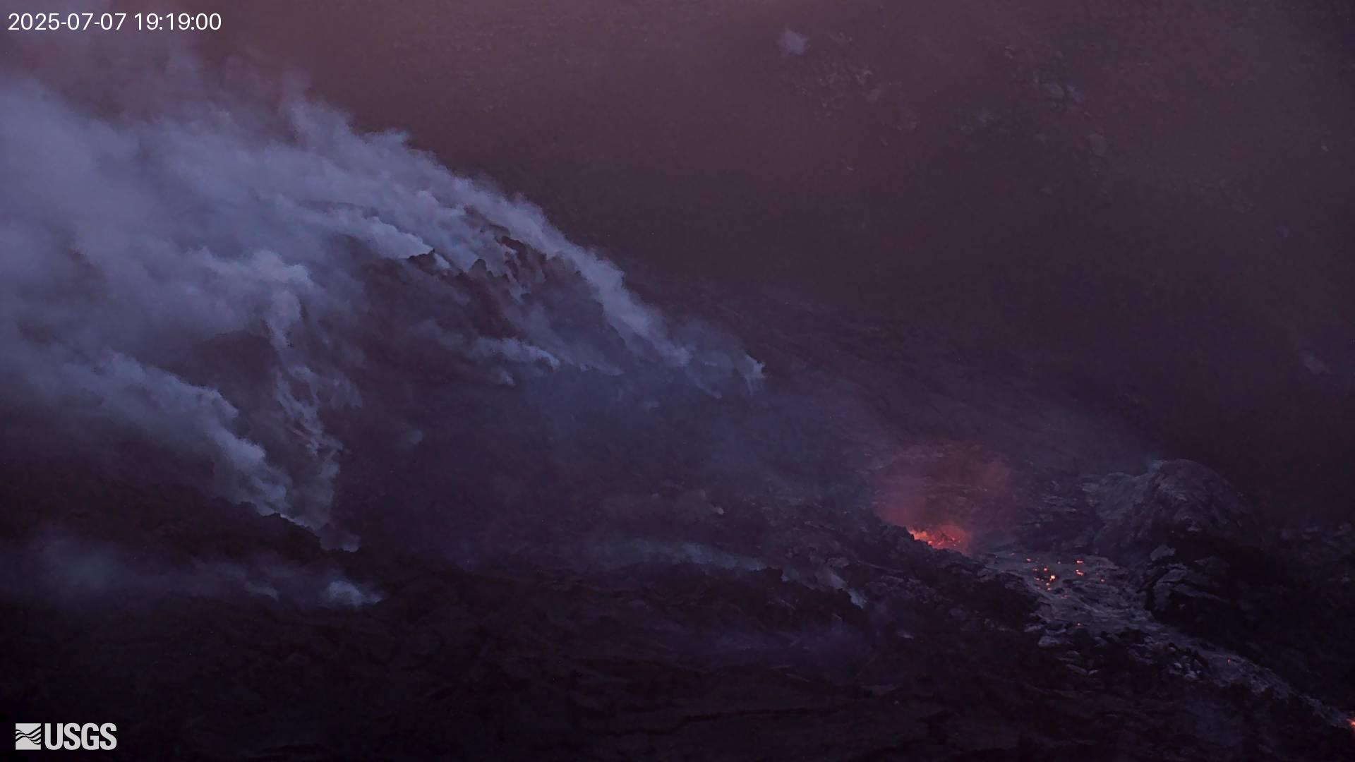
Hawaii , Kilauea :
Sunday, July 13, 2025, 9:06 AM HST (Sunday, July 13, 2025, 19:06 UTC)
19°25’16 » N 155°17’13 » W,
Summit Elevation 4091 ft (1247 m)
Current Volcano Alert Level: WATCH
Current Aviation Color Code: ORANGE
Activity Summary:
Episode 28 of the ongoing Halemaʻumaʻu eruption ended just before 1:30 p.m. HST on July 9, 2025. Summit inflation resumed immediately and continues today. Low-level degassing and seismic tremor also persist. Current inflation data indicate episode 29 is likely to start between July 16 and 19.
No significant activity has been noted along Kīlauea’s East Rift Zone or Southwest Rift Zone.
Current hazards include volcanic gas emissions, along with windblown volcanic glass (Pele’s hair) and tephra (ash and pumice) deposited during earlier eruptive episodes.
Summit Observations:
Incandescence in the crater last night was limited to the north vent and a few locations on the eruptive cone. Slow slumping of the eruptive cone continues this morning and was associated with spots of incandescence on the cone last night. Slumping may continue over the next hours to days.
At present, tremor and degassing persist at lower but still elevated levels. Typical sulfur dioxide (SO2) emission rates associated with pause periods are 1,200 to 1,500 t/d.
Fountaining associated with episode 28 resulted in 15 microradians of deflation. At the time of this update, UWD had re-inflated by just under 9 microradians.
Strands of volcanic glass known as Pele’s hair are present throughout the summit area of Hawaiʻi Volcanoes National Park and surrounding communities and can be remobilized by wind even after fountaining has ceased. Trade winds are forecast for today and would likely blow both volcanic gases and erupted particles (tephra, ash, and Pele’s hair) to the west and southwest of Kīlauea summit.
Source et photo : HVO.
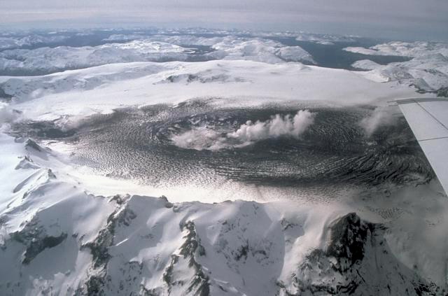
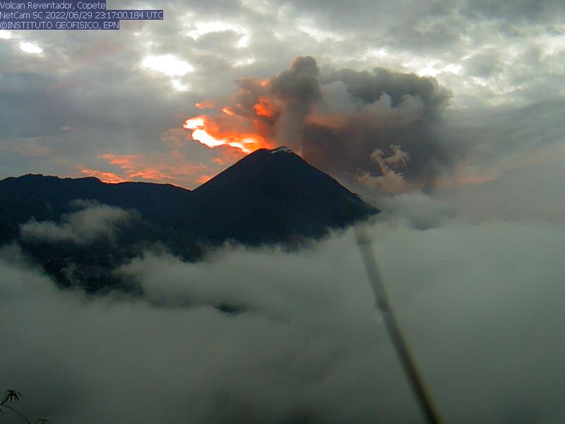
Ecuador , El Reventador :
DAILY STATUS REPORT OF REVENTADOR VOLCANO, Sunday, July 13, 2025.
Information Geophysical Institute – EPN.
Surface Activity Level: High, Surface Trend: No change
Internal Activity Level: Moderate, Internal Trend: No change
From July 12, 2025, 11:00 a.m. to July 13, 2025, 11:00 a.m.:
Seismicity:
Below is the count of seismic events recorded at the reference station.
Explosion (EXP) 65
Long Period (LP) 9
Emission Tremor (TREMI) 15
Harmonic Tremor (TRARM) 2
Rainfall/Lahars:
Precipitation was recorded in the area without generating mudflows or debris flows. **Heavy rainfall can remobilize accumulated material and generate debris-laden mudflows (lahars), which could cascade down the volcano’s flanks and drain into adjacent rivers.**
Emission/Ash Column:
Yesterday afternoon, due to weather conditions, surface activity could not be recorded by the surveillance camera and satellite system. Furthermore, the Washington VAAC has not issued any reports regarding volcanic activity.
Observation:
During the night, the camera system observed incandescent material falling back on the east-southeast and southeast flanks, up to 1,000 meters below the crater level. At the time of writing, the volcano was still completely cloudy.
Alert Level – SGR: Orange
Source : IGEPN
Photo : Archive IGEPN.
Costa Rica , Rincon de la Vieja :
Latitude: 10.83°N;
Longitude: 85.34°W;
Altitude: 1,916 m.
Current Activity Level: Alert.
Six small phreatic eruptions were recorded this week. None generated lahars or ash emissions. The acoustic energy of these eruptions remains low. The high-frequency (3-7 Hz) background tremor remains stable. Short-duration tremor pulses vary in amplitude, duration, and between events.
Eruptions generally occur when tremor decreases in amplitude or in the absence of short-term tremors. Since July 8, a decrease in tremor amplitude has been observed. Tornillo-type seismic events continue, in similar numbers to the previous week. Geodetic observations show no significant deformation. This week, the SO2 flux (158 ± 92 t/d) increased slightly compared to the previous week (200 ± 82 t/d). The last detection of low-level atmospheric SO2 (70 tonnes) using the TROPOMI sensor on the Sentinel-5P satellite was on June 2.
Source : Ovicori
Photo : Soy Tico