May 23 , 2025 .
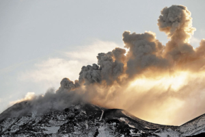
Hawaii , Kilauea :
Thursday, May 22, 2025, 9:17 AM HST (Thursday, May 22, 2025, 19:17 UTC)
19°25’16 » N 155°17’13 » W,
Summit Elevation 4091 ft (1247 m)
Current Volcano Alert Level: WATCH
Current Aviation Color Code: ORANGE
Activity Summary:
Episode 23 precursory activity began yesterday. Sustained fountaining is likely to start between today and Saturday.
Kīlauea’s current eruption in Halemaʻumaʻu crater within Kaluapele (the summit caldera) began on December 23, 2024. There have now been 22 episodes separated by pauses in activity. All eruptive activity remains within Hawaiʻi Volcanoes National Park. No significant activity has been noted along Kīlauea’s East Rift Zone or Southwest Rift Zone. Current hazards include volcanic gas emissions and windblown volcanic glass (Pele’s hair) and tephra that have impacted Hawaiʻi Volcanoes National Park and nearby communities.
Summit Observations:
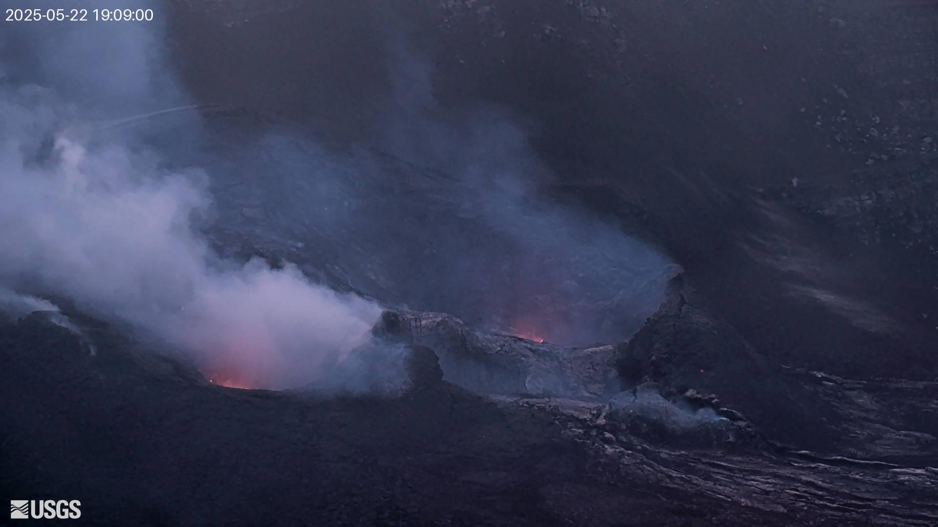
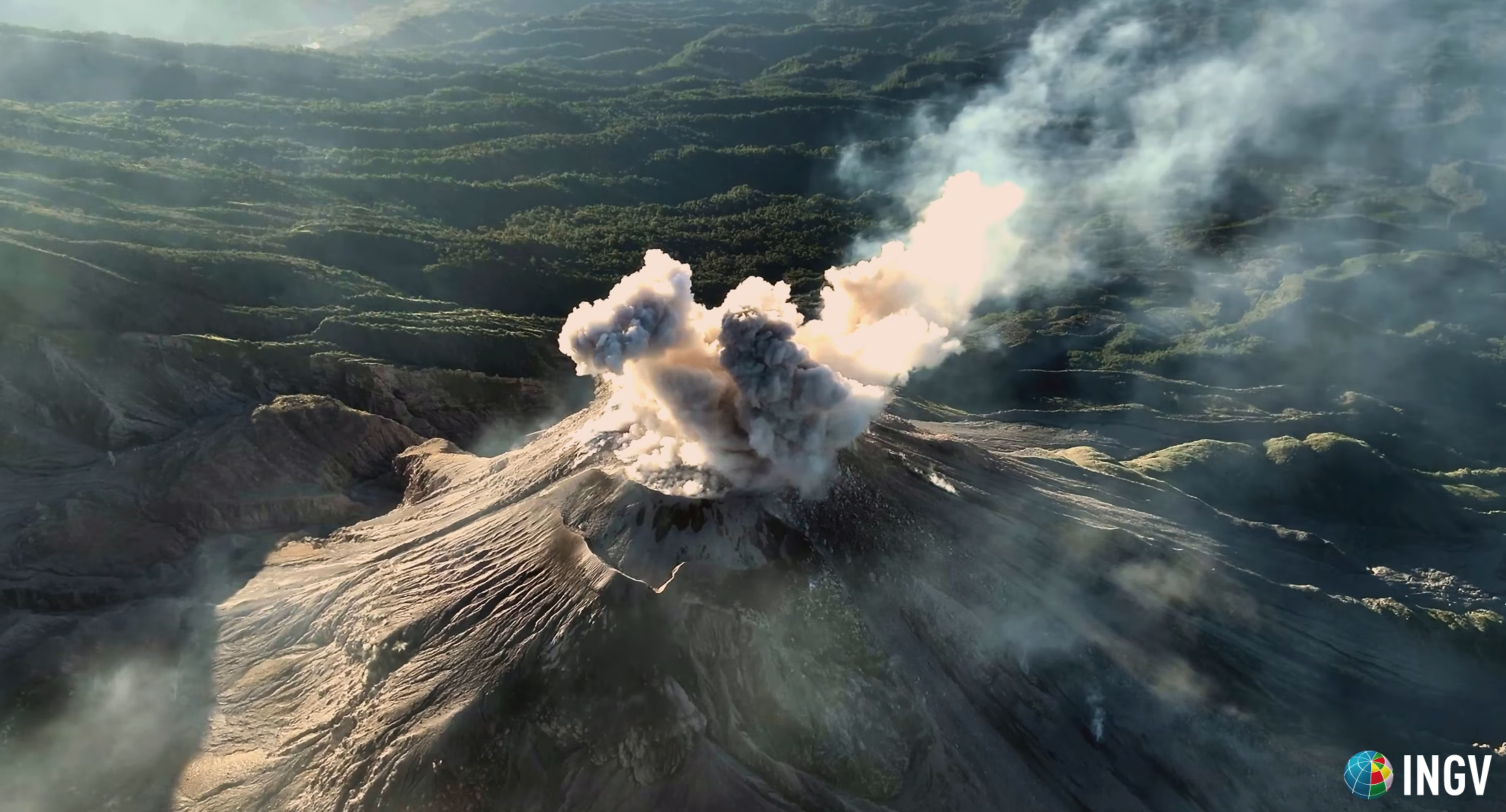
Strong glow remained visible overnight from both vents. Episode 23 precursory low-level activity began yesterday afternoon. Intermittent lava spattering is occurring in both vents. Small dome fountains were observed yesterday in the north vent. Large yellow flames have also been observed, especially from the north vent. This is similar to activity seen in the lead up to previous sustained fountaining episodes. Precursory activity is expected to increase further before the onset of sustained fountains.
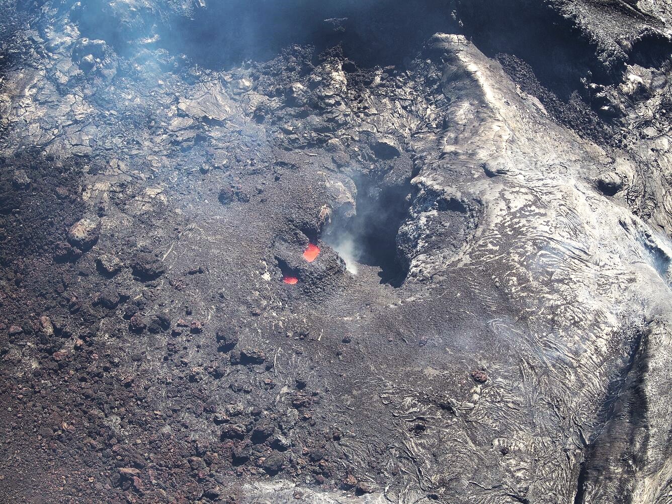
During UAS (uncrewed aircraft systems) overflights on May 21, the north vent within Halemaʻumaʻu at the summit of Kīlauea was occasionally spattering and consistently glowing with incandescence. This oblique aerial view from directly above the south vent shows the north vent structure, with a circular pit 5–10 meters (16–33 feet) wide that fed lava fountains during recent eruptive episodes, and an irregularly shaped spatter cone built within; geologists noted that this structure resembled a wasp nest, being nested within a pre-existing feature and having a bumpy surface texture with irregular openings.
The tiltmeter at Uēkahuna (UWD) has recorded approximately 9 microradians of inflationary tilt since the end of episode 22 on May 16. A deflationary excursion began yesterday around 6:00 p.m. Inflationary tilt resumed this morning around 7:30 a.m. after approximately 1 mircroradian of deflation. Low level tremor continues beneath Halemaʻumaʻu crater.
The average sulfur dioxide (SO2) emission rate is around 1,200 tonnes per day (t/d), similar to rates recorded during prior pauses.
Source : HVO
Photos : USGS , USGS / M. Zoeller.
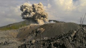
Indonesia , Dukono :
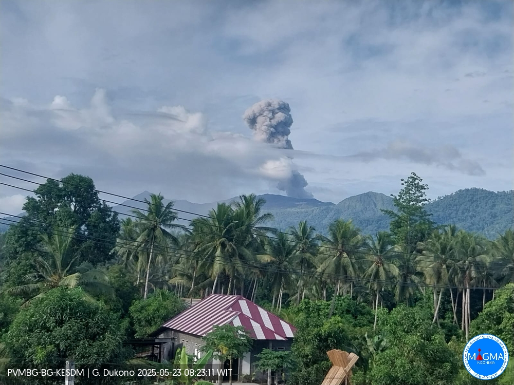
An eruption of Mount Dukono occurred on Friday, 23 May 2025 at 08:11 WIT with an observed ash column height of ± 1300 m above the peak (± 2387 m above sea level). The ash column was observed to be white to gray in color with a thick, eastward-oriented intensity. At the time of writing, the eruption was still ongoing.
Seismicity Observation:
227 eruption earthquakes with an amplitude of 6 to 34 mm and a duration of 31.56 to 184.43 seconds.
3 distant tectonic earthquakes with an amplitude of 15 to 20 mm and an earthquake duration of 70.79 to 99.87 seconds.
1 continuous tremor earthquake with an amplitude of 1-4 mm, dominant value 2 mm.
Recommendation
(1) People near Mount Dukono and visitors/tourists should not engage in activities, climb, or approach the Malupang Warirang Crater within a 4 km radius. (2) Since volcanic ash eruptions occur periodically and the distribution of ash follows the direction and speed of the wind, so the area where the ash lands is not constant, people around Mount Dukono are recommended to always carry masks/nose and mouth covers to use when needed to avoid the threat of volcanic ash to the respiratory system.
Source et photo : Magma Indonésie .
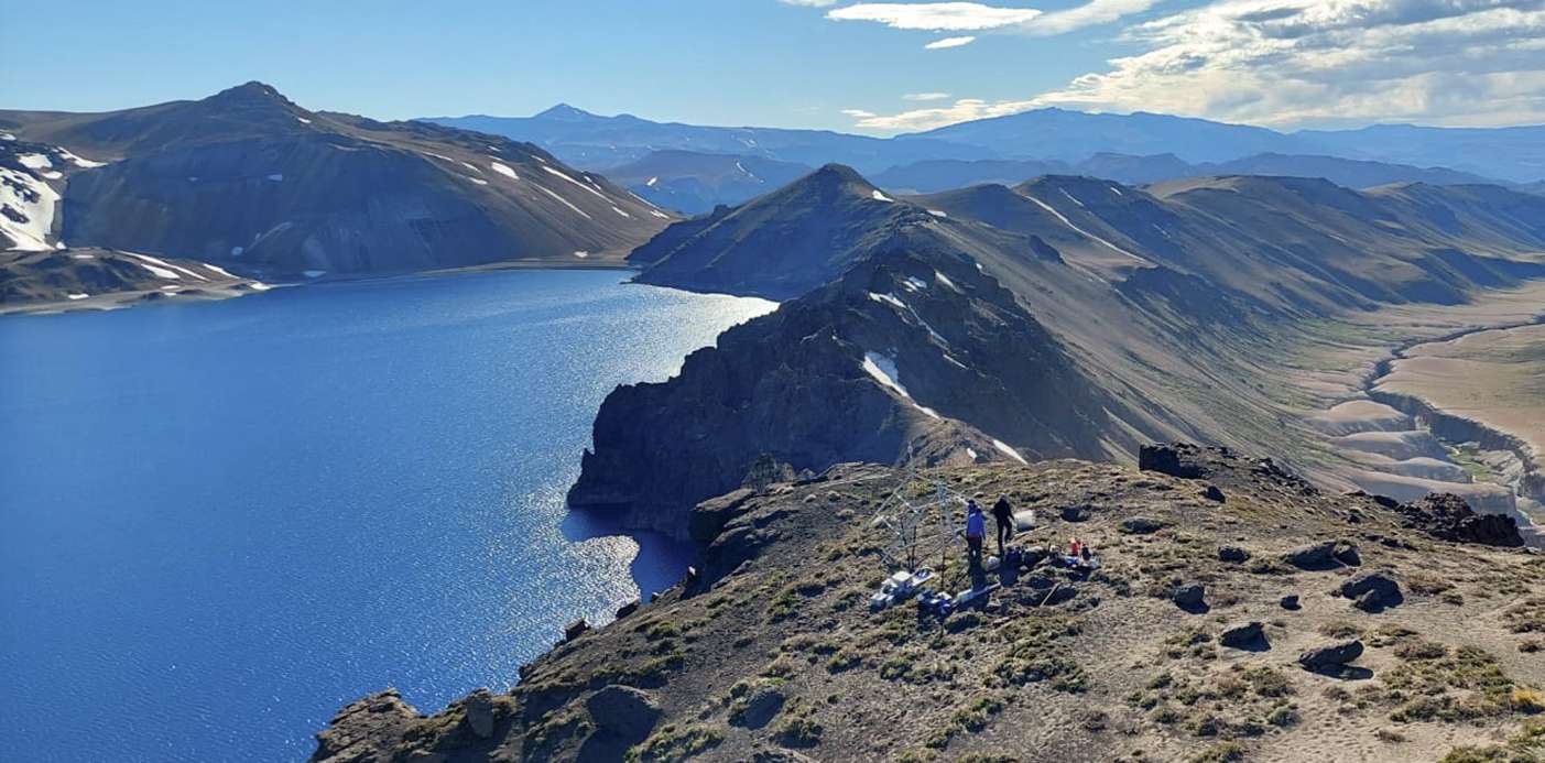
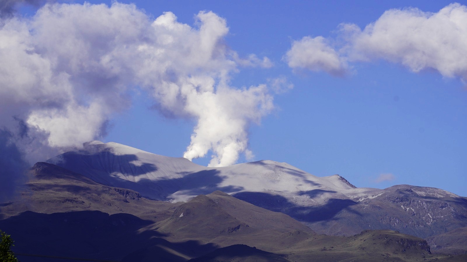
Chile , Laguna del Maule :
Special Report on Volcanic Activity (REAV), Maule Regions, Laguna del Maule Volcanic Complex, May 21, 2025, 1:30 a.m. local time (Continental Chile)
The National Geology and Mining Service of Chile (SERNAGEOMIN) announces the following preliminary information, obtained using the monitoring equipment of the National Volcanic Monitoring Network (RNVV), processed and analyzed at the Southern Andean Volcano Observatory (OVDAS):
On Tuesday, May 20, 2025, at 10:16 p.m. (2:16 UTC), monitoring stations installed near the Laguna del Maule volcanic complex recorded an increase in the occurrence of volcano-tectonic earthquakes (associated with rock fracturing within the volcanic system), reaching a total of 103 earthquakes in the last few hours, characterizing this episode. Seismic activity as a swarm of volcano-tectonic earthquakes.
The characteristics of the earthquake after analysis are as follows:
TIME OF ORIGIN: 00:10 local time (04:10 UTC)
LATITUDE: 36.050° S
LONGITUDE: 70.468° W
DEPTH: 6.7 km
LOCAL MAGNITUDE: 1.8 (ML)
Observation:
At the time of this report, seismic activity continues with low-energy events.
The technical volcanic alert remains at GREEN.
Source : Sernageomin
Photo : neuqueninforma.gob.ar
Colombia , Puracé – Los Coconucos Volcanic Range, :
Popayán, May 20, 2025, 2:00 p.m.
According to monitoring of the activity of the Puracé volcano – Los Coconucos volcanic chain, the Colombian Geological Survey (SGC), an entity affiliated with the Ministry of Mines and Energy, reports that:
During the week of May 13-19, seismic activity showed a slight decrease compared to the previous week, particularly in activity related to fluid movement in volcanic conduits.
Earthquakes associated with rock fracturing were mainly located between the Puracé and Piocollo volcanoes, with depths between 1 and 3 km, and reached a maximum magnitude of 1.8.
Fluid dynamic events were mainly concentrated beneath the crater of the Puracé volcano, at depths less than 500 m, and were characterized by their low energy input. Moderate values of sulfur dioxide (SO2) emissions were recorded by satellite and field instruments. In addition, the slow deformation process continued between the volcanic edifices of Puracé, Piocollo and Curiquinga.
In images captured by visible and infrared webcams, degassing processes continued to be observed in the lateral fumarole and within the crater of the Puracé volcano, characterized by gas columns reaching heights of up to 1.5 km above the summit of the volcanic chain.
On May 17 and 18, several minor secondary mudflows occurred, similar to those recorded since last February, caused by the action of rain on ash deposited on the slopes of the volcanic chain. Based on seismic recordings and reports from the area, it was observed that the basins affected by these processes correspond to the Cocuy River and the Río Blanco stream. In conclusion, continuous degassing from the lateral fumarole and crater of the Puracé volcano continued throughout the week, accompanied by moderate SO₂ emissions, with localized seismic activity beneath the structures of the Puracé and Piocollo volcanoes, slow ground deformation, and minor mudflows, indicating the persistence of an active volcanic system.
Based on the above, the SGC recommends closely monitoring the evolution of volcanic activity through weekly bulletins and other information published on official channels, as well as heeding the instructions of local and departmental authorities and the National Disaster Risk Management Unit (UNGRD).
The alert status for volcanic activity remains at yellow alert: active volcano with changes in the behavior of the baseline of monitored parameters and other manifestations.
Source : SGC.
Photo : Cric Colombia .org
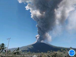
Guatemala , Santiaguito :
Weather conditions: Cloudy.
Wind: Northeast.
Precipitation: 4.2 mm.
Activity:
Activity is reported at the Caliente Dome of the Santa María-Santiaguito volcanic complex, characterized by white degassing at an altitude of 500 meters above the crater. Weak and moderate explosions are generated, sending columns of gas and ash to heights of 800 to 900 meters above the dome, which are carried by the wind toward the west and southwest. At night, incandescence was observed in the crater.
The Santiaguito Volcano Observatory (OVSAN) reports the collapse and descent of volcanic material toward the southern and southwest flanks of the dome. Activity remains high, so it is possible that, due to explosions or the effect of gravity, some of the accumulated material could collapse and generate pyroclastic flows over long distances toward the southwest, south, and southeast. The recommendations of Special Bulletin BESAN-002-2025 should be followed. Likewise, rains could cause lahars to descend into various ravines of the volcano.
Source : Insivumeh .
Photo : capture d’écran INGV Dr. Riccardo Civico