May 16 , 2025.
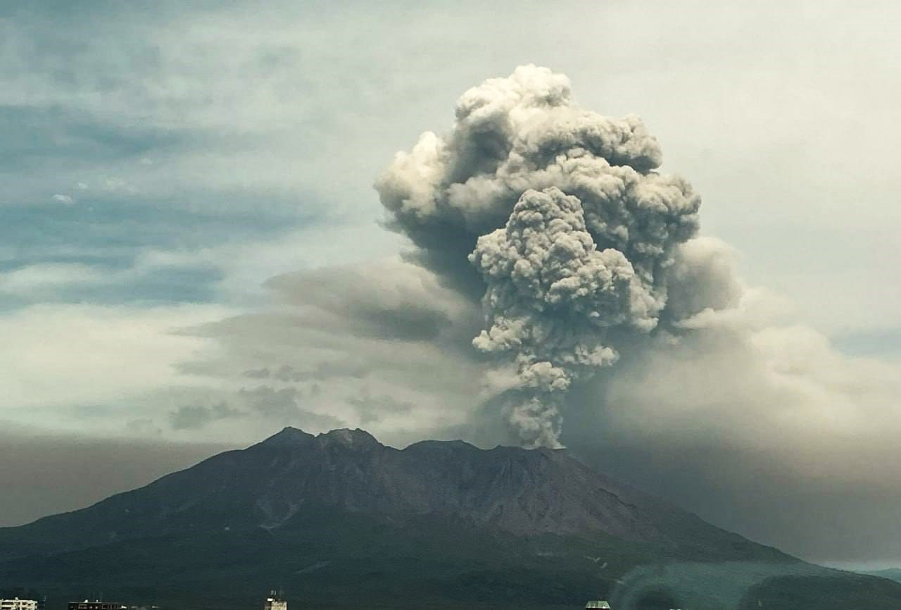
Japan , Sakurajima :
Sakurajima Volcano Eruption and Ash Risk in Kagoshima
Sakurajima Volcano, located in the southern region of Kyushu Island in Japan, erupted this Thursday, an event that caught the attention of many experts and local residents. According to the Japan Meteorological Agency, smoke emitted by the volcano rose more than 2,200 meters above the crater.
This impressive plume of smoke has raised concerns among local authorities about the potential consequences for the city of Kagoshima, which could be covered in a significant amount of ash if the eruption continues. The population has been advised to stay indoors due to the expected heavy ashfall, according to the Japanese agency.
The alert level for Sakurajima Volcano remains at three on a scale of five, with five being the highest alert level, reflecting the greatest danger. This eruption highlights the seismically active nature of Japan, a country with 111 active volcanoes.
The situation remains to be closely monitored by scientists.
Aira Caldera, in the northern half of Kagoshima Bay, contains the post-caldera Sakurajima volcano, one of the most active in Japan. The eruption of the voluminous Ito pyroclastic flow accompanied the formation of the 17 x 23 km caldera about 22,000 years ago. The smaller Wakamiko Caldera formed in the early Holocene in the northeast corner of the caldera, along with several post-caldera cones. Construction of Sakurajima began about 13,000 years ago on the southern shore, creating an island that was connected to the Osumi Peninsula during the major explosive and effusive eruption of 1914. Activity at the Kitadake summit cone ended about 4,850 years ago, after which eruptions continued from the Minamidake crater. Frequent eruptions since the 8th century have deposited ash on the city of Kagoshima, located across Kagoshima Bay, just 8 km from the summit. The largest recorded eruption occurred between 1471 and 1476.
Sources : Senego , GVP.
Photo : Alex Tor via FB
Indonesia , Dukono :
An eruption of Mount Dukono occurred on Thursday, May 15, 2025, at 5:56 PM WIT with an observed ash column height of ± 750 m above the peak (± 1837 m above sea level). The ash column was observed to be white to gray in color with a thick intensity, oriented toward the east. This eruption was recorded on a seismograph with a maximum amplitude of 30 mm and a duration of 98.33 seconds.

Seismicity Observation:
215 eruption earthquakes with an amplitude of 6 to 34 mm and a duration of 30.16 to 129.12 seconds.
4 distant tectonic earthquakes with an amplitude of 6 to 34 mm and an earthquake duration of 60.88 to 110.77 seconds.
1 continuous tremor earthquake with an amplitude of 1-4 mm, dominant value 2 mm.
Recommendation
(1) People around Mount Dukono and visitors/tourists should not engage in activities, climb, or approach the Malupang Warirang Crater within a 4 km radius. (2) Since volcanic ash eruptions occur periodically and the distribution of ash follows the direction and speed of the wind, so the area where the ash lands is not constant, people around Mount Dukono are recommended to always carry masks/nose and mouth covers to use when needed to avoid the threat of volcanic ash to the respiratory system.
Source et photo : Magma Indonésie .
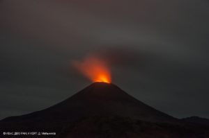
Hawaii , Kilauea :
Thursday, May 15, 2025, 9:09 AM HST (Thursday, May 15, 2025, 19:09 UTC)
19°25’16 » N 155°17’13 » W,
Summit Elevation 4091 ft (1247 m)
Current Volcano Alert Level: WATCH
Current Aviation Color Code: ORANGE
Activity Summary:
Episode 21 ended at 08:36 p.m. HST on Sunday, May 11, 2025, after 7 hours and 51 minutes of sustained fountaining from the north vent. The Halema’uma’u eruption is currently paused. Episode 22 is likely to begin in the next 2-3 days.
Both the north and south vents were incandescent last night but overnight glow from the episode 21 lava flows are greatly diminished.
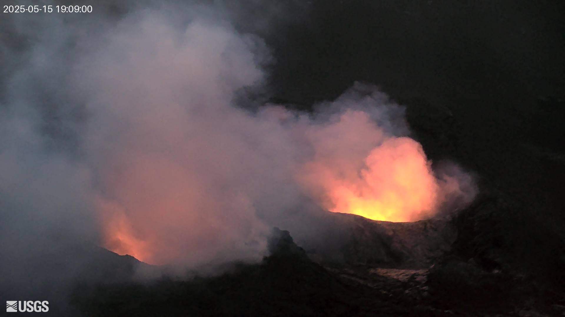
Summit Observations:
Orange glow was visible overnight from both vents, and intermittent spatter was observed from the north vent in the evening on May 14, indicating that magma remains close to the surface within the conduits.
The tiltmeter at Uēkahuna (UWD) recorded just under 8 microradians of deflation during episode 21 fountaining. Tilt changed from deflation to inflation at 8:36 p.m. HST when lava stopped erupting from the south vent; tremor also declined rapidly at this time. This morning, tilt at UWD has recorded approximately 5.6 microradians of inflationary tilt since the end of episode 21. Low level tremor continues along with a small number of shallow earthquakes.
Sulfur dioxide (SO2) emission rates are expected to be similar to rates recorded during prior pauses around 1,200 tonnes per day (t/d).
Source et photo : HVO
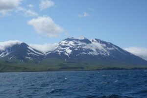
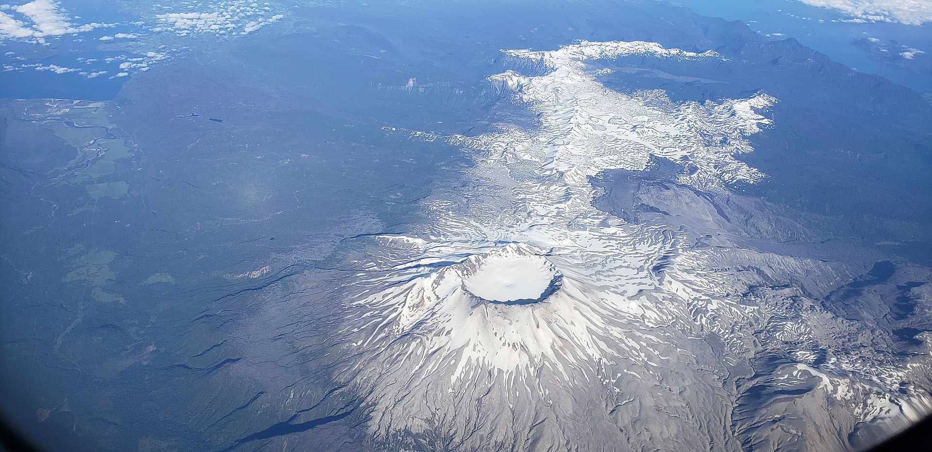
Chile , Puyehue / Cordon Caulle :
Seismology
The seismological activity for the period was characterized by the recording of:
52 VT-type seismic events, associated with rock fracturing (Volcano-Tectonic). The most energetic earthquake had a local magnitude (LM) value of 3.6, located 4.3 km to the south-southwest and with a depth of 7.3 km from the 2011 emission center.
5 LP-type seismic events, associated with fluid dynamics within the volcanic system (Long Period). The size of the largest earthquake, estimated using the reduced displacement (RD) parameter, was 1.7 cm².
Fluid Geochemistry
No anomalies in atmospheric sulfur dioxide (SO2) emissions have been reported in the area near the volcanic complex, according to data published by the Tropospheric Monitoring Instrument (TROPOMI) and the Sulfur Dioxide Group of the Ozone Monitoring Instrument (OMI).
Geodesy
The geodetic activity of the period was characterized by:
– Displacement rates (horizontal and vertical), similar to previous periods, showing that the inflationary process continues with a maximum rate of 0.98 cm/month vertically and 1.05 cm/month in a northeast direction.
– InSAR (radar interferometry) is consistent with what was obtained from the GNSS network, and a constant inflationary process is observed, with its maximum deformation in the laccolith sector (Editor’s note: a mass of volcanic rocks insinuated into a sedimentary series).
The above indicates that the deformation of the volcanic complex continues with the same directions and magnitudes recorded historically.
Satellite Thermal Anomalies
During this period, low-power thermal anomalies were recorded in the area where the laccoliths are located, northeast of the 2011 emission center. These laccoliths recorded a maximum volcanic radiative power (VRP) of 1.8 MW on March 15, according to data processed by the VIIRS sensor of the Mid-Infrared Volcanic Activity Observation Platform (MIROVA). Sentinel 2-L2A and Landsat 8-9 satellite images did not detect any significant radiance anomalies related to the volcanic complex.
Surveillance Cameras
Images provided by fixed cameras installed near the volcanic complex did not record any degassing plumes or variations associated with surface activity.
Satellite geomorphological analysis:
According to satellite images from Planet Scope Scene, Sentinel 2-L2A, and Pleiades, no morphological changes related to volcanic activity have been identified.
Volcanic activity in the complex remains unchanged. The most notable process, related to inflationary distortion, remains at a similar rate to that of the previous two weeks. Other monitoring parameters, particularly volcano-tectonic seismicity, show no significant changes. Therefore, the technical volcanic alert remains in effect for:
YELLOW TECHNICAL ALERT: Changes in the behavior of volcanic activity
Source : Sernageomin
Photo : Wikipédia
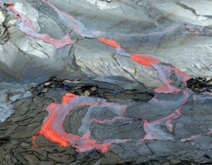
Colombia , Galeras :
San Juan de Pasto, May 13, 2025, 3:50 p.m.
Monitoring the activity of the Galeras Volcano, the Colombian Geological Survey (SGC), an entity affiliated with the Ministry of Mines and Energy, reports that:
During the week of May 6-12, 2025, the main variations in the monitored parameters compared to the previous week were:
● An increase in seismic occurrence and energy release was observed, and the predominance of low-magnitude seismicity related to rock fracture processes within the volcanic edifice continued.
● Earthquakes related to rock fracture were mainly located near the volcanic crater, at depths less than 2 km from the summit of the Galeras Volcano (4,200 m above sea level) and with a maximum magnitude of 0.3.
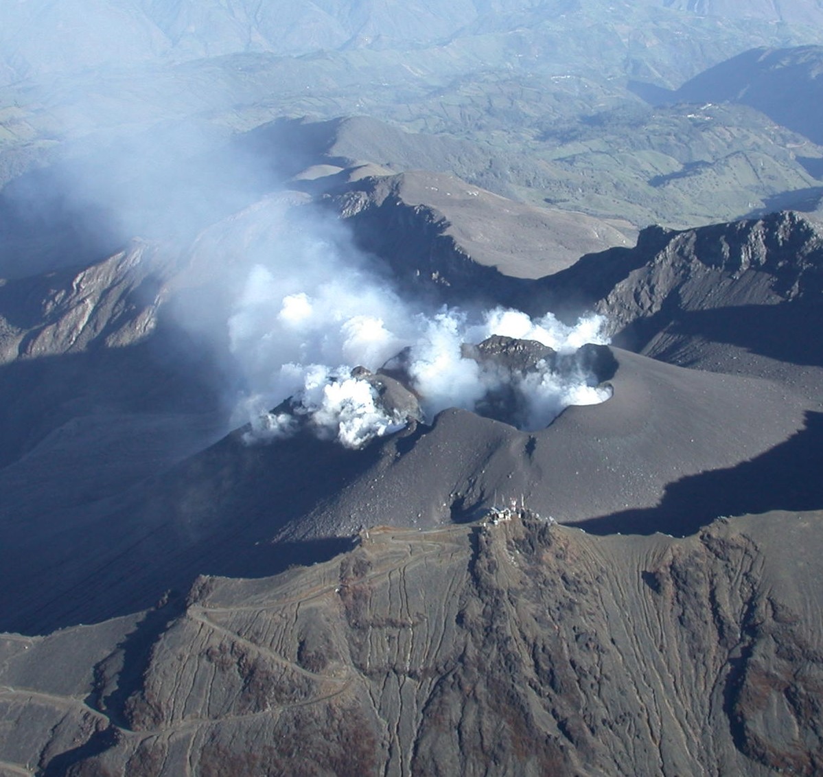
● Small gas emissions were observed, mainly from the fumarole fields of El Paisita, to the north; and Las Chavas, to the west of the active cone, with low white columns and variable dispersion determined by wind direction.
● Other volcanic monitoring parameters showed stability.
Based on the above, the SGC recommends closely monitoring developments through weekly bulletins and other information published through our official channels, as well as instructions from local and departmental authorities and the National Disaster Risk Management Unit (UNGRD).
Volcanic activity remains on Yellow alert: Active volcano with changes in the baseline behavior of monitored parameters and other manifestations.
Source et photo : SGC.