February 26 , 2025.
Hawaii , Kilauea :
19°25’16 » N 155°17’13 » W,
Summit Elevation 4091 ft (1247 m)
Current Volcano Alert Level: WATCH
Current Aviation Color Code: ORANGE
Activity Summary:
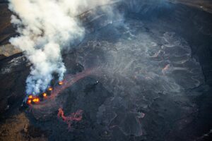
Episode 11 of the ongoing Halemaʻumaʻu eruption began at 6:26 p.m. HST on February 25, 2025 withiin Hawaiʻi Volcanoes National Park. The eruption began with low intensity spatter with lava erupting onto the caldera floor through a spillway in the north vent. The intensity and height of fountaining has continued to escalate since the eruption began reaching heights of over 200 feet (60 m) by 6:50 p.m. HST. Lava flows have covered 10-15% of the floor of Halemaʻumaʻu at this time..
Inflationary tilt reached just under 7 microradians since the end of the last episode.
Each episode of Halemaʻumaʻu lava fountaining since December 23, 2024, has continued for 13 hours to 8 days and episodes have been separated by pauses in eruptive activity lasting a less than 24 hours to 12 days.
No changes have been detected in the East Rift Zone or Southwest Rift Zone. HVO continues to closely monitor Kīlauea and will issue an eruption update tomorrow morning unless there are significant changes before then.
Kīlauea Volcano Alert Level/Aviation Color Code remain at WATCH/ORANGE. All current and recent activity is within Hawaiʻi Volcanoes National Park.
Hazards:
This episodic eruption is occurring within a closed area of Hawai’i Volcanoes National Park. High levels of volcanic gas—primarily water vapor (H2O), carbon dioxide (CO2), and sulfur dioxide (SO2)—are the primary hazard of concern, as this hazard can have far-reaching effects downwind. As SO2 is continuously released from the summit during an eruption, it will react in the atmosphere to create the visible haze known as vog (volcanic smog) downwind of Kīlauea.
Source : HVO
Italy / Sicily , Etna :
WEEKLY BULLETIN, from February 17, 2025 to February 23, 2025 . (issue date February 25, 2025 )
SUMMARY OF ACTIVITY STATUS
In light of monitoring data, it is highlighted:
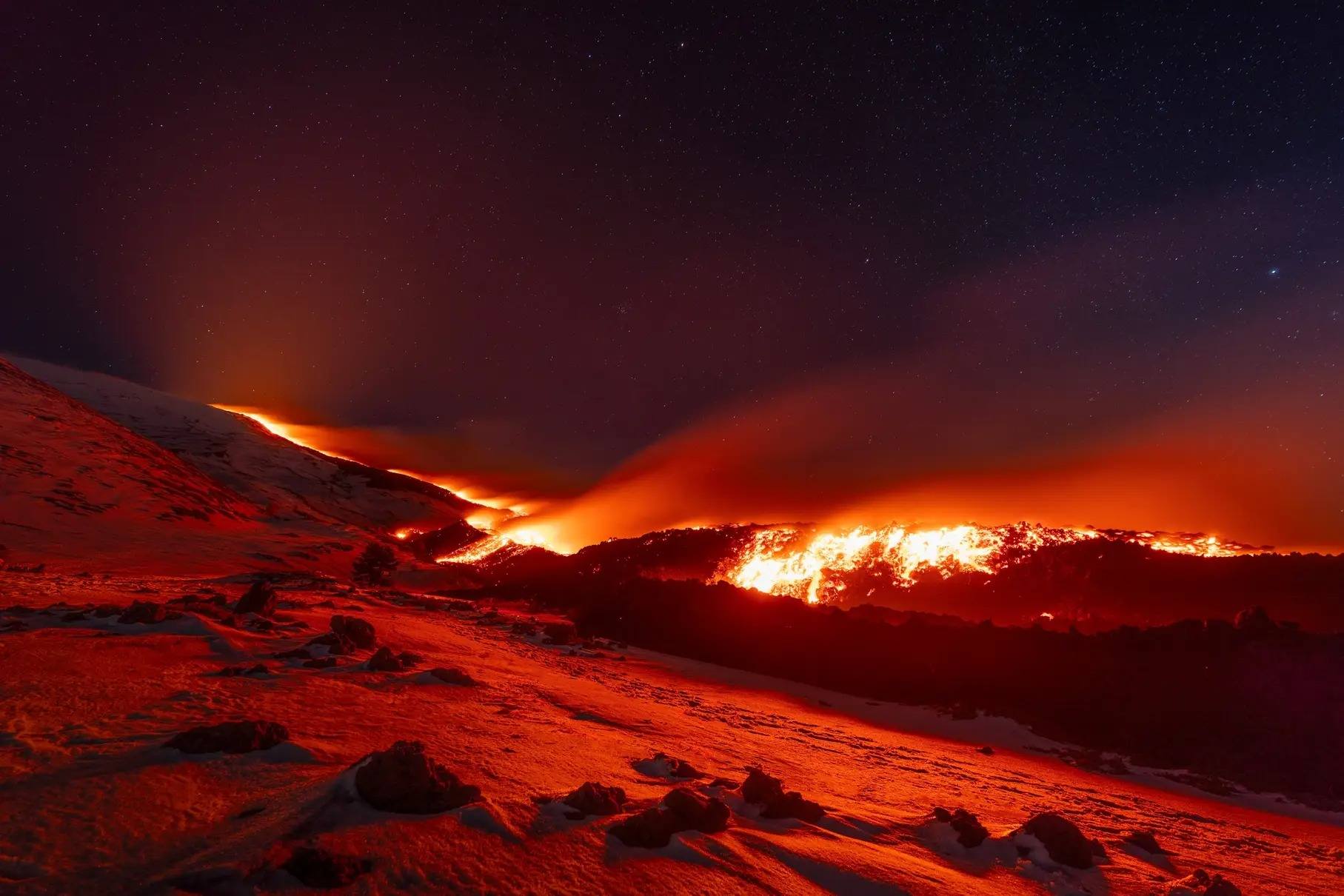
1) VOLCANOLOGICAL OBSERVATIONS: Effusive activity from an eruptive fissure at the base of the Bocca Nuova crater, Strombolian activity at the Southeast crater and degassing at the Bocca Nuova, Voragine and Northeast crater.
2) SEISMOLOGY: Occurrence of superficial fracturing earthquakes in the Southeast sector.
Decrease in the average amplitude of volcanic tremor on February 19 and slow increase from the 22nd.
3) INFRASOUND: Moderate infrasound activity with sources located in the Southeast Crater (SEC) area.
4) GROUND DEFORMATIONS: The GNSS network measured a slow slip event at the Lachea Island station on February 19, 2025. Since that date, dilatometric data have highlighted the transition from a decompression phase of the volcanic edifice to a compression phase.
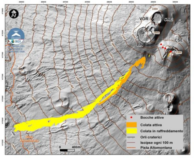
Map of the lava field, updated on 24 February, superimposed on the shaded relief of the terrain obtained by processing the images acquired by drone on 12 September 2024, for the BN, VOR and CNE craters, and on 31 July 2024 for the CSE. CSE = Southeast Crater, CNE = Northeast Crater VOR = Voragine BN = Bocca Nuova. Geoidal contour lines every 100 m.
5) GEOCHEMISTRY: SO2 flux at an average level
Soil CO2 flux (EtnaGas Network) on average values.
The partial pressure of dissolved CO2 in the aquifer (Ponteferro) shows values in seasonal variability.
Isotope ratio of peripheral sites: no updates. Latest data (31/01/2025) on average-high values.
6) SATELLITE OBSERVATIONS: The thermal activity observed by satellite in the summit area was generally high to very high, in correspondence with the ongoing eruptive activity.
VOLCANOLOGICAL OBSERVATIONS
During the week, the monitoring of the volcanic activity of Etna was carried out through the analysis of the images of the surveillance cameras of the INGV – Etneo Observatory (INGV-OE), field inspections carried out by INGV-OE staff using drones and satellite images. The observations of the surveillance cameras were intermittent due to adverse weather conditions; in situ observations were carried out on 19, 22 and 24 February.
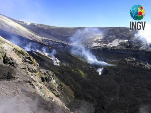
In general, during the observation period, Etna was characterized by Strombolian activity at the level of the South-East crater (CSE), by effusive activity at the base of the Bocca Nuova crater (BN) and by degassing of variable intensity coming from the BN, the North-East crater (CNE) and the Voragine (VOR).
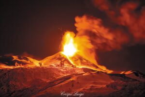
In particular, effusive activity continued, fuelled by the eruptive fissure that opened on 6 February at the base of the Bocca Nuova crater, at an altitude of about 3,070 metres above sea level. During the observation period, this activity varied in intensity and this was reflected in the development of the lava field, which was characterised by the emplacement of lava flows reaching altitudes of about 1,840 m above sea level until 19-20 February and lava flows remaining confined to altitudes between about 3,000 and 2,500 m above sea level thereafter. The main point of lava emission also varied in altitude over the days, from 3,070 m to about 2,980 m (February 22 and 23), corresponding to a change in slope at the exit of a probable lava tube that had formed from the partial filling of the main channel.
The longest lava flows, which reached a length of about 4.3 km, determined the maximum extension of the lava field, while the shortest ones determined its spatial expansion in the proximal sector.
The inspection carried out on February 24 allowed to note that the lava flow continued from the mouth of 2960 m, and then again from 3070 m, feeding several branched lava flows, some of which originated from ephemeral mouths that had formed at the exit of small lava tubes or in correspondence with the banks of flow channels and inflated lava fronts. In addition, INGV-OE field personnel observed another lava flow originating from the lower southern slope of the Bocca Nuova (yellow in Fig. 3.2), about 150 m upstream of the 3070 m a.s.l. emission point and, from 13:23 local time, also a lava overflow from the southern rim of the Southeast Crater (orange in Fig. 3.2). As of 24 February, the total area covered by the lava flows was about 0.7×10^6 m^2 and the total volume was about 3.5×10^6 m^3 (40% uncertainty).
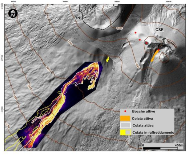
Orthomosaic of thermal images recorded by drone on 24 February, which highlights the structures of the lava field in the proximal and distal part of the emission point at 3070 m altitude.
During the observation period, Strombolian activity at the Southeast Crater continued with variable intensity, with the exception of 20, 21 and most of 22 February when no explosions were observed.
Activity resumed on the evening of 22 February with very sporadic and modest events from three explosive vents. This activity increased slightly from around 17:00 UTC during the day.
In the morning of 23 and 24 February, the presence of a fourth explosive vent was observed, which generated the lava overflow described above. Additionally, it was observed that one of the four vents had formed an elliptical crater with a major axis of approximately 100 m.
Source : INGV
Photos : INGV , Frederico Floresta .
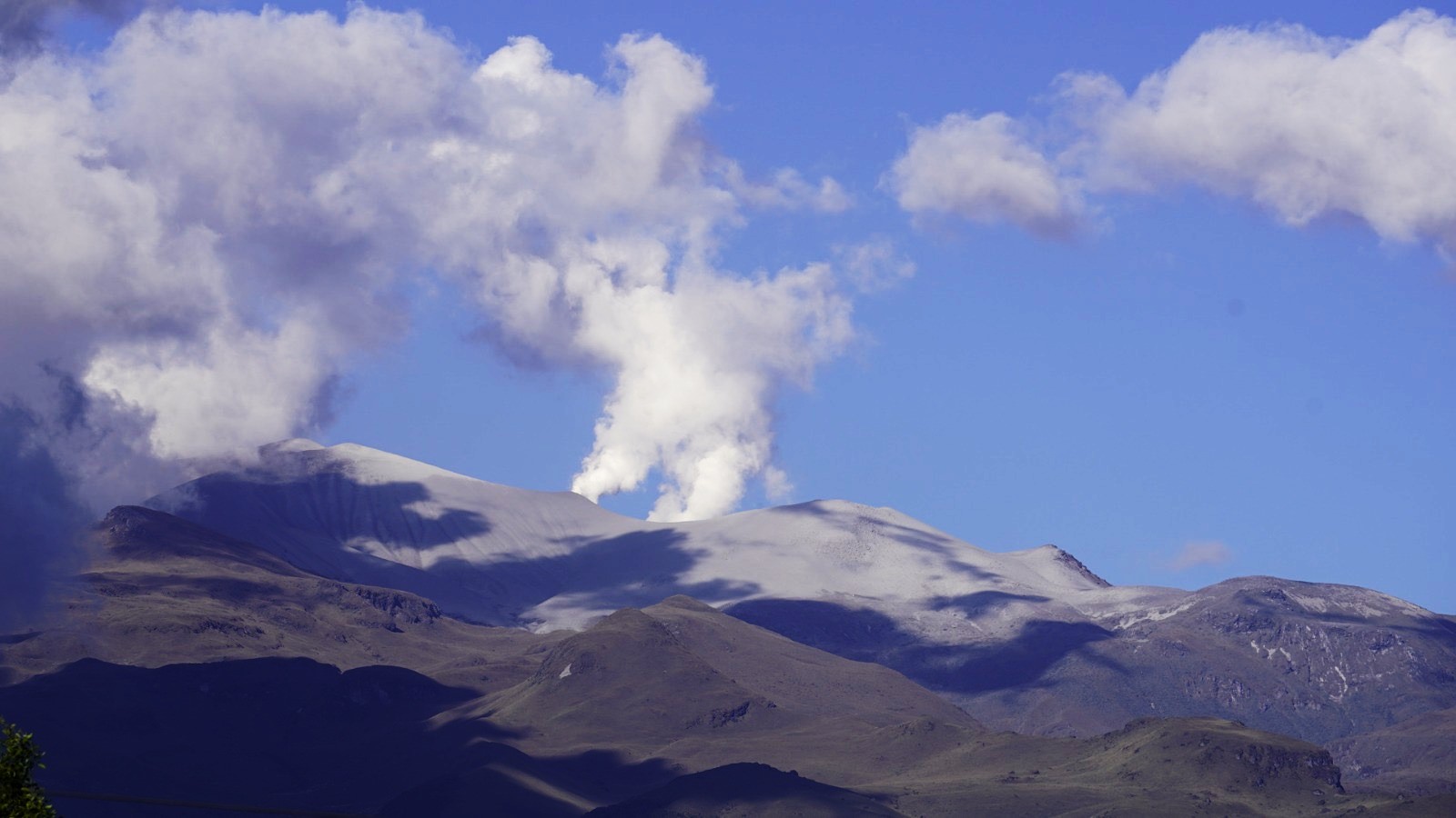
Chile , Lascar :
Special Report on Volcanic Activity (REAV), Antofagasta Region, February 24, 2025, 2:30 p.m. local time (Chilean continent)
The National Geology and Mining Service of Chile (Sernageomin) announces the following information, obtained through the monitoring equipment of the National Volcanic Monitoring Network (RNVV), processed and analyzed at the Southern Andean Volcanological Observatory (OVDAS).
Since February 19, 2025, the following changes have been observed in the monitoring parameters:
• Visualization of incandescence in the crater area, on February 19, 22 and 23, from the Alma surveillance camera.
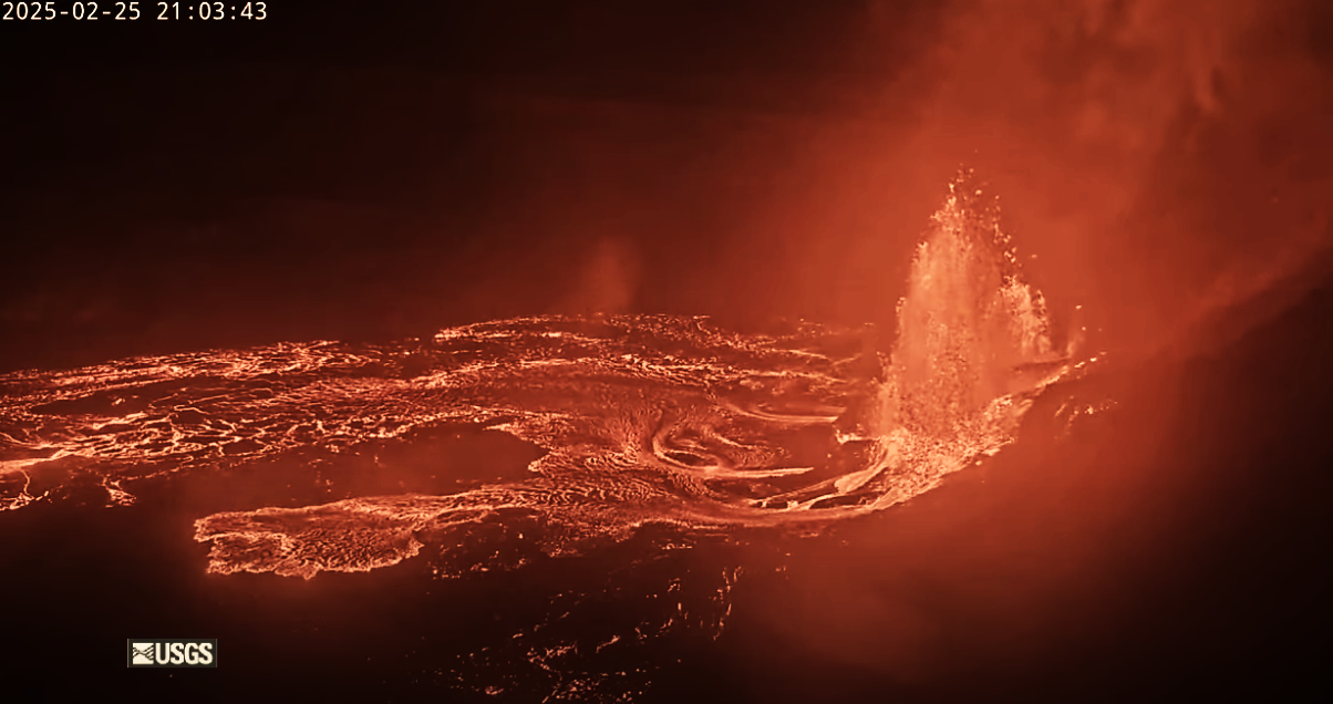
• Increase in anomalies of sulfur dioxide (SO2) emitted into the atmosphere. The Differential Optical Absorption Spectroscopy (DOAS) team, corresponding to the Emú station, located 6 km east-southeast (ESE) of the active crater, showed an increase in the flow rate on February 22, reaching an average daily value of 1,010 t/d. In addition, Tropomi satellite images (Sentinel-5P) show a gradual increase in emissions, reaching 1,191 tons on February 20, 2025.
![]()
• Increased temperature inside the active crater, inferred from satellite thermal anomaly reports. The VIIRS sensor detected a maximum of 5 MW on February 21, while MODIS detected 4 MW on February 23. In turn, SENTINEL 2-L2A satellite images, updated as of the date of publication of this report, continue to record radiance anomalies inside the active crater, with a higher intensity compared to the February 6 image.
• Decrease in the recording of Long Period (LP) volcanic seismicity since early February. In addition, an increase in seismic activity associated with surface activities such as landslides has been observed.
Taken together, the above features indicate an evolution towards a greater and more unstable activity of the surface system, which could eventually lead to the occurrence of minor explosions with an impact limited to the proximal area of the active crater. Considering the surface activity records during the last cycles, one could expect an emission of pyroclastic material with low energy columns. The possibility of generating major eruptive events cannot be excluded.
Based on the assessment of the activity recorded during the indicated period, the technical alert for this volcanic system remains at yellow technical alert.
Sernageomin continues the online monitoring and multiparametric monitoring of the Lascar volcano, and informs in a timely manner of any significant change in volcanic activity, via official communication channels.
Source : Sernageomin .
Photo : Sernageomin / Gabriel Orozco.
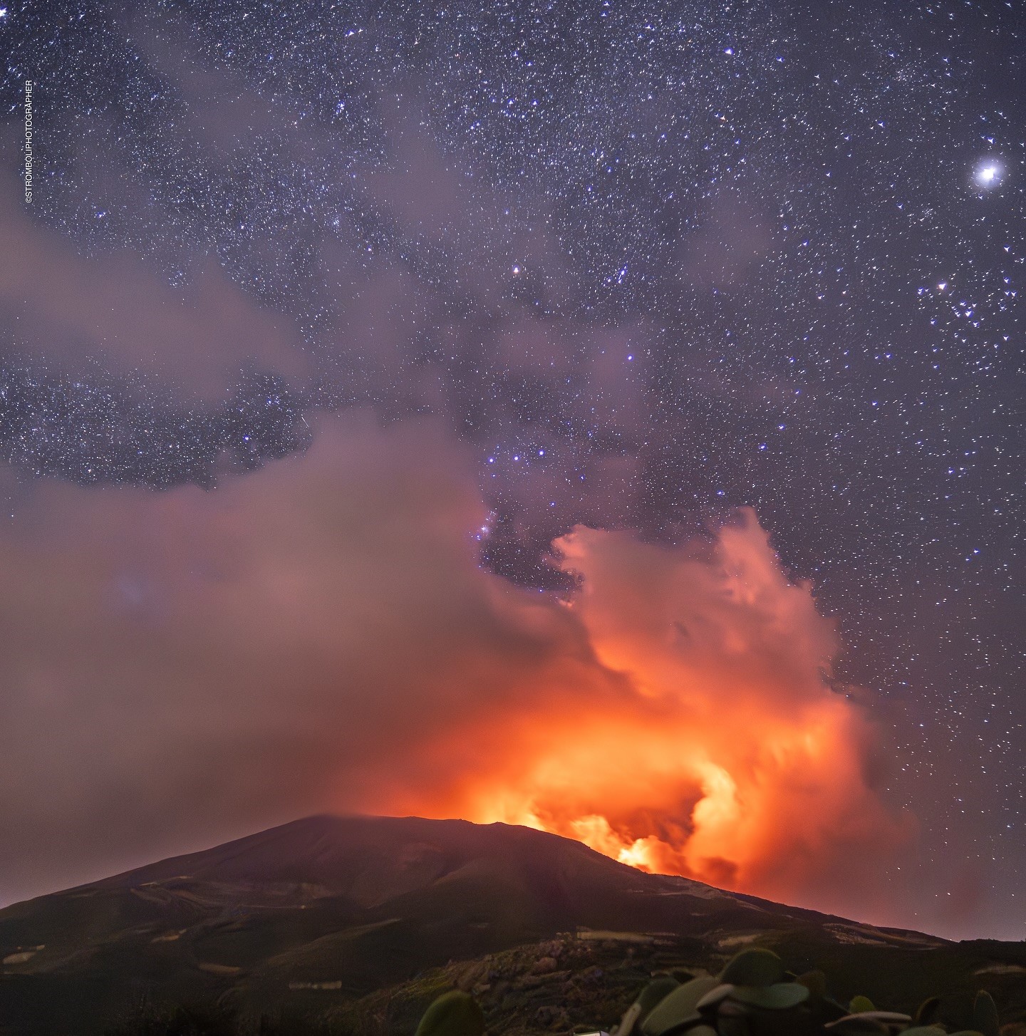
Italy , Stromboli :
WEEKLY BULLETIN, from February 17, 2025 to February 23, 2025 . (issue date February 25, 2025 )
SUMMARY OF ACTIVITY STATUS
In light of the monitoring data, it is highlighted:
1) VOLCANOLOGICAL OBSERVATIONS: During this period, ordinary eruptive activity was observed with splashes coming from the North crater area. The total hourly frequency was variable with average values (7-11 events/h). The intensity of the explosions was low and medium in the North and Center-South crater areas.
2) SEISMOLOGY: The monitored seismic parameters do not show significant variations.
3) GROUND DEFORMATIONS: The ground deformation monitoring networks did not show significant variations during the last week.
4) GEOCHEMISTRY: SO2 flux at medium level.
Soil CO2 flux from the Pizzo area (STR02): remains at very high values, decreasing.
CO2/SO2 ratio in the plume (StromboliPlume Network) at high values
Helium isotope ratio (R/Ra) dissolved in the thermal aquifer: last updated on 31 January 2025 at high values.
Soil CO2 flux in the San Bartolo area at medium values.
Soil CO2 flux in the Scari area at medium values.
5) SATELLITE OBSERVATIONS: The thermal activity observed by satellite in the summit area was generally low level.
VOLCANOLOGICAL OBSERVATIONS
During the observation period, the eruptive activity of Stromboli was characterized by the analysis of the images recorded by the INGV-OE surveillance cameras located at an altitude of 190 m (SCT-SCV) and at Punta dei Corvi (SPCT). The explosive activity was produced, mainly, by four eruptive vents located in the North crater area and by two vents located in the Centre-South area.
Observations of the explosive activity captured by surveillance cameras
In the North (N) crater area, four active vents were observed that produced explosive activity of low intensity (less than 80 m in height) and sometimes of medium intensity (less than 150 m in height). In addition, at the mouth of the N2 sector, a splashing activity was observed, continuous but of low intensity. The products emitted were mainly composed of coarse materials (bombs and lapilli). The average frequency of explosions varied between 7 and 9 events/h.
In the Centre-South (CS) area, explosive activity was produced by at least two vents, the explosions were of low and medium intensity and consisted mainly of coarse materials (lapilli and bombs). The average frequency of explosions varied between 1 and 4 events/h
Source : INGV.
Photo : Stromboli stati d’animo / Sebastiano Cannavo.
Colombia , Puracé – Los Coconucos volcanic chain :
Popayán, February 25, 2025, 3:30 p.m.
Following the monitoring of the activity of the Puracé volcano – Los Coconucos volcanic chain, the Colombian Geological Survey (SGC), an entity attached to the Ministry of Mines and Energy, reports that:
During the week of February 18 to 24, seismic activity associated with rock fracturing was located mainly under the Puracé volcano, at a depth of between 1 and 6 km and with a maximum recorded magnitude of 1.8. Events related to fluid dynamics were located at depths of less than 1 km, especially under the crater of the Puracé volcano.
Calculated values of sulfur dioxide (SO2) flux remain above their base levels, while the slow deformation process between the Puracé, Piocollo and Curiquinga volcanic buildings is ongoing.
Images captured by visible and infrared spectrum webcams showed degassing processes in the lateral fumarole and inside the crater of the Puracé volcano.
It is concluded that the volcanic system continues to show changes in the different monitoring parameters, with episodes of intense degassing accompanied by seismic activity under the Puracé volcano building, and slow changes in deformation and surface thermal anomalies.
In Yellow alert status, phenomena such as sporadic ash emissions (minor eruptions, of restricted magnitude and effects and whose dispersion depends on the wind direction), the presence of incandescence, small explosions in the crater, low-energy thermal anomalies, noise, felt earthquakes, odors, precipitation of elemental sulfur near the crater and in hot springs and fumaroles, as well as degassing in areas other than the crater, may occur. The formation of fissures and the appearance of minor mudflows, among others, are also observed.
Based on the above, the SGC recommends closely monitoring the evolution of volcanic activity through weekly bulletins and other information published on official channels, as well as following the instructions of local and departmental authorities and the National Disaster Risk Management Unit (UNGRD). The alert status for volcanic activity remains at yellow alert status: active volcano with changes in the behavior of the base level of monitored parameters and other manifestations.
Source : SGC
Photo : Cric-colombia .org