January 24 , 2025 .
Hawaii , Kilauea :
Thursday, January 23, 2025, 7:23 AM HST (Thursday, January 23, 2025, 17:23 UTC)
U.S. Geological Survey
19°25’16 » N 155°17’13 » W,
Summit Elevation 4091 ft (1247 m)
Current Volcano Alert Level: WATCH
Current Aviation Color Code: ORANGE
Activity Summary:
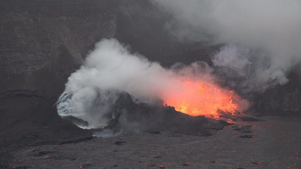
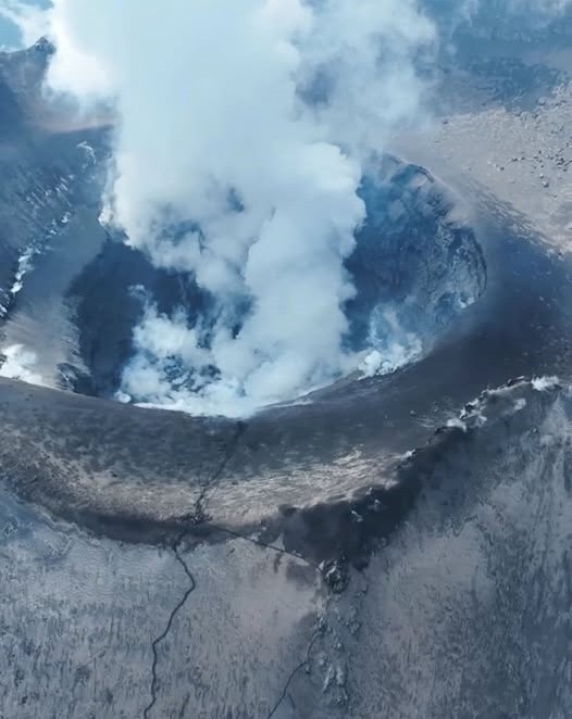
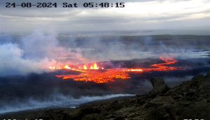
The summit eruption at Kīlauea volcano that began in Halemaʻumaʻu crater on December 23 ended its 5th episode at 4:30 AM HST January 23 after 26 hours of eruptive activity from the north vent. The 5th episode began at 2:30 p.m. HST January 22 and continued overnight with fountaining to 30-50 m height and Pele’s hair observed at the Steaming bluff car park. The 5th episode activity was accompanied by tremor on seismometers, deflation on near vent tiltmeters and gas discharge estimated at greater than 10000 tonnes per day. The fountain activity stopped suddenly at about 4:30 AM HST along with the end of lava effusion from the vent. Seismic tremor diminished at this time and returned to pre- fountaining levels. A strong glow from the north vent indicates that magma remains close to the surface of Halemaʻumaʻu within Kaluapele (the summit caldera). No unusual activity has been noted along Kīlauea’s East Rift Zone or Southwest Rift Zone.
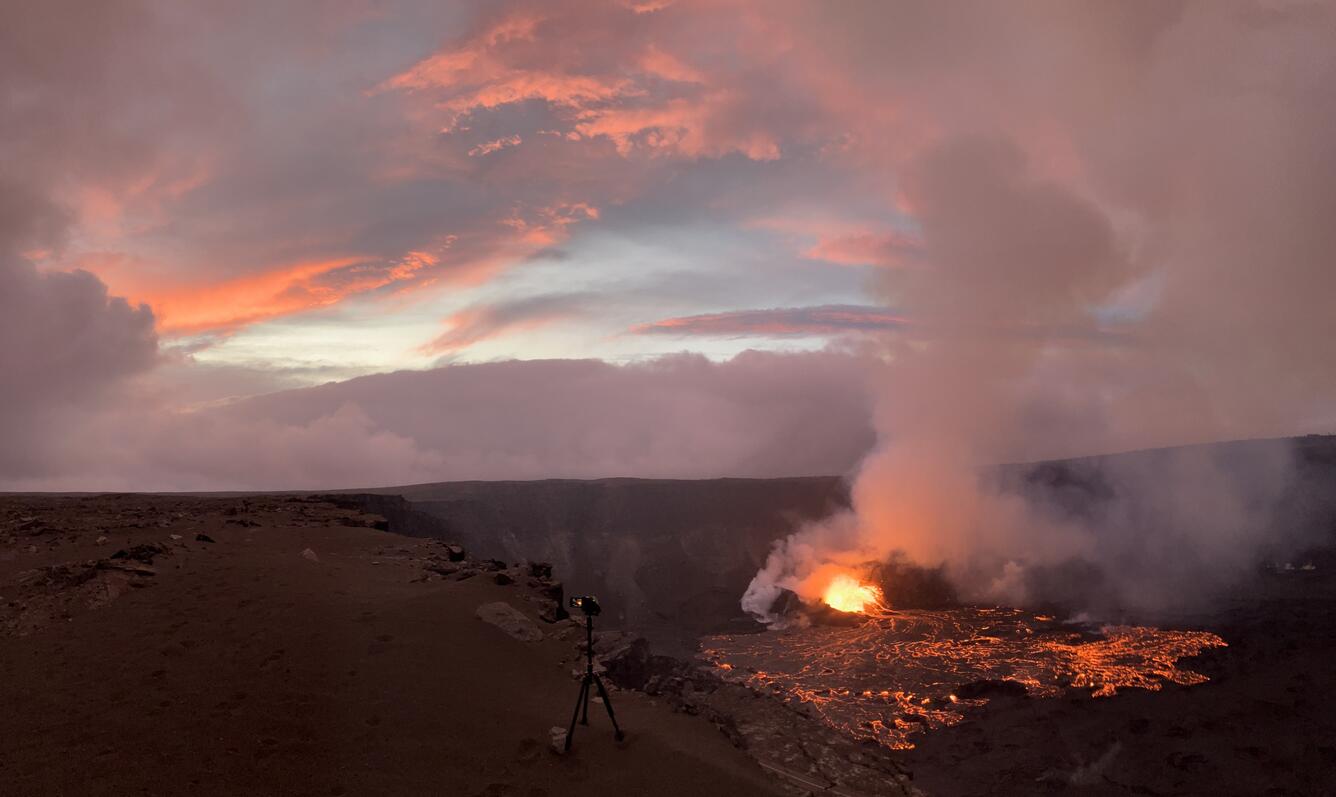
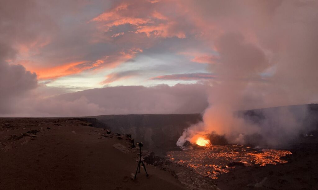
This panorama of Kīlauea summit eruption’s fifth episode was captured by USGS Hawaiian Volcano Observatory geologists around sunset on Wednesday, January 22. A tripod camcorder on the crater rim in the foreground was used to record high-resolution video of lava fountains at the northern eruptive vent within Halema‘uma‘u crater.
Summit Eruption Observations:
The Halemaʻumaʻu eruption that began its fifth episode on January 22nd at 2:29 HST which lasted until about 4:30 HST on the 23rd. Fountains fed a lava flow that spread over about one half of the floor of Halemaʻumaʻu crater. Since then, strong glow has continued. Pele’s hair was observed at the steaming bluff carpark overnight and may continue to be remobilized by winds within the National Park and in nearby communities over the next few days.
Summit Instrumental Observations:
Seismic tremor is currently present at low levels. Earthquake activity well below background (one earthquake detected overnight) has been detected in the summit region. Summit tiltmeters showed the onset of a new inflation cycle at about 4:30 HST consistent with the end of fountaining. Tilt increased about 0.2 microradians over the past 2 hours. The most recently measured sulfur dioxide (SO2) emission rate was approximately 10000 tonnes per day at the start of episode 5. Though significantly lower than rates measured during eruptive episodes 1, 2, and 3 (Kona winds precluded emission rate measurements during episode 4), this value still represents above-background SO2 emissions, and the resulting hazard will be affected by wind conditions
Source : HVO
Photo : USGS / M. Zoeller , USGS .
Indonesia , Semeru :
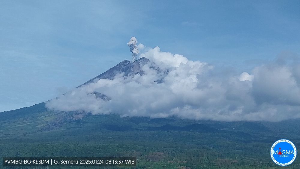
An eruption of Mount Semeru occurred on Friday, January 24, 2025, at 08:13 WIB with an observed ash column height of ± 900 m above the peak (± 4576 m above sea level). The ash column was observed to be white to gray in color with a thick intensity, oriented towards the southwest. This eruption was recorded on a seismograph with a maximum amplitude of 22 mm and a duration of 134 seconds.
The volcano continues its eruptive cycle, with explosions at 13:15, 06:35, 23:11 etc.
VOLCANO OBSERVATORY NOTICE FOR AVIATION – VONA
Issued : January 24 , 2025
Volcano : Semeru (263300)
Current Aviation Colour Code : ORANGE
Previous Aviation Colour Code : orange
Source : Semeru Volcano Observatory
Notice Number : 2025SMR420
Volcano Location : S 08 deg 06 min 29 sec E 112 deg 55 min 12 sec
Area : East java, Indonesia
Summit Elevation : 11763 FT (3676 M)
Volcanic Activity Summary :
Eruption with volcanic ash cloud at 01h13 UTC (08h13 local).
Volcanic Cloud Height :
Best estimate of ash-cloud top is around 14643 FT (4576 M) above sea level or 2880 FT (900 M) above summit. May be higher than what can be observed clearly. Source of height data: ground observer.
Other Volcanic Cloud Information :
Ash cloud moving to southwest. Volcanic ash is observed to be white to gray. The intensity of volcanic ash is observed to be thick.
Remarks :
Eruption recorded on seismogram with maximum amplitude 22 mm and maximum duration 134 second
Source et photo : Magma Indonésie.
Japan , Sakurajima :
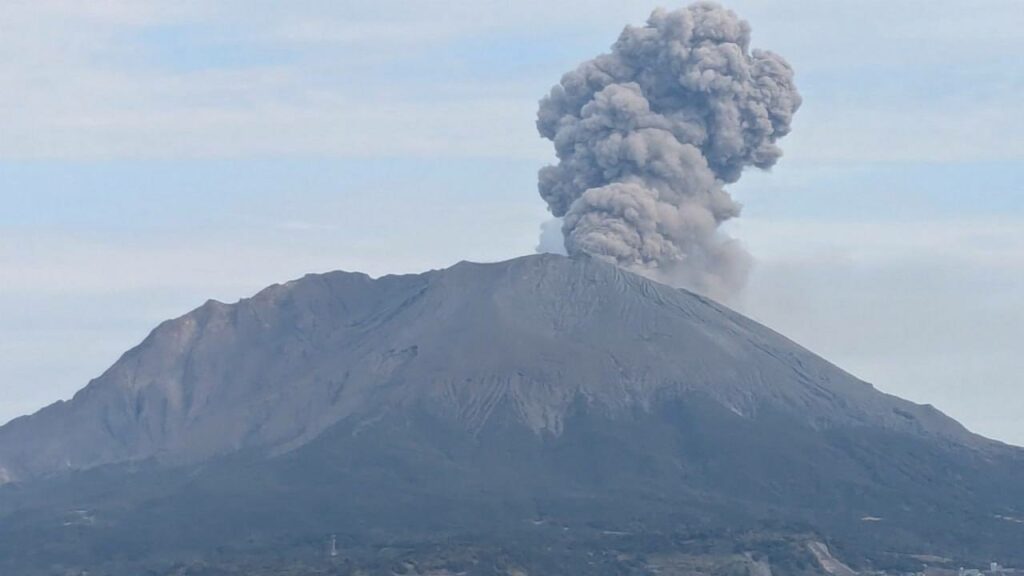
The Japan Meteorological Agency (JMA) reported ongoing eruptive activity at Minamidake Crater (Aira Caldera’s Sakurajima volcano) during 13-20 January. Nightly crater incandescence was visible in webcam images. On 14 January sulfur dioxide emissions were high, averaging 2,300 tons per day. Explosions at 02h23 and 04h40 on 15 January, at 06h26 on 17 January, at 08h37, 90h90, 14h27, and 15h26 on 19 January, and at 08h42 on 20 January produced ash plumes that rose 300-2,000 m above the crater rim and drifted SE and E. Most of the explosions ejected large blocks 500-1,300 m from the crater rim. The Alert Level remained at 3 (on a 5-level scale), and the public was warned to stay 1 km away from both craters.
The Aira caldera in the northern half of Kagoshima Bay contains the post-caldera Sakurajima volcano, one of Japan’s most active. Eruption of the voluminous Ito pyroclastic flow accompanied formation of the 17 x 23 km caldera about 22,000 years ago. The smaller Wakamiko caldera was formed during the early Holocene in the NE corner of the caldera, along with several post-caldera cones. The construction of Sakurajima began about 13,000 years ago on the southern rim and built an island that was joined to the Osumi Peninsula during the major explosive and effusive eruption of 1914. Activity at the Kitadake summit cone ended about 4,850 years ago, after which eruptions took place at Minamidake. Frequent eruptions since the 8th century have deposited ash on the city of Kagoshima, located across Kagoshima Bay only 8 km from the summit. The largest recorded eruption took place during 1471-76.
Sources : Japan Meteorological Agency (JMA), GVP.
Photo : via Alex Terry / FB
Colombia , Galeras :
San Juan de Pasto, January 21, 2025, 4:20 p.m.
Following the monitoring of the activity of the Galeras volcano, the Colombian Geological Survey (SGC), an entity attached to the Ministry of Mines and Energy, reports that:
During the week of January 14 to 20, 2025, the activity of the volcano remained stable. Compared to the previous week, the main variations in the monitored parameters were:
• An increase in both the frequency of events and the seismic energy released was observed. The predominance of seismic activity related to rock fracture processes within the volcano continued.
• The earthquakes related to fracturing were mainly located near the volcanic crater, at very superficial levels with depths less than 2 km from the summit (4,200 m above sea level). Other earthquakes were located scattered throughout the volcanic area, at maximum distances of 13.3 km and at depths of up to 11 km from the summit. The maximum magnitude of this type of event was 1.4.
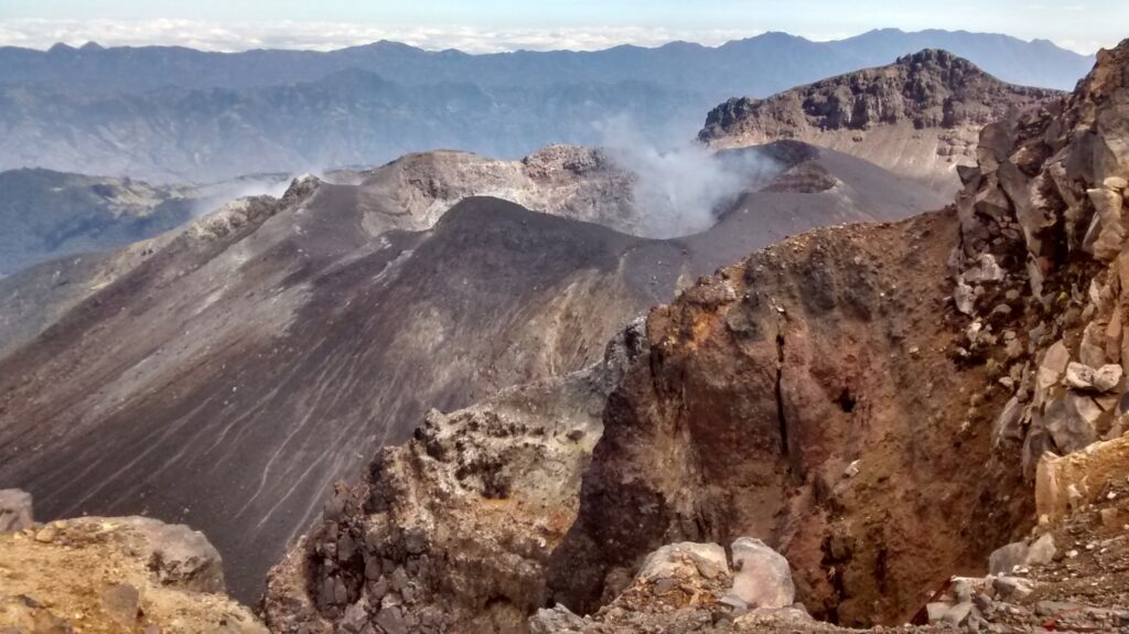
• Small gas emissions were observed, mainly from the fumarole fields of Las Chavas, to the West, and El Paisita, to the North of the active cone, with white columns, of low height and variable dispersion due to the action of the winds.
• The other parameters of the volcanic monitoring showed stability.
Based on the above, the SGC recommends closely monitoring the evolution through the weekly bulletins and other information published through our official channels, as well as the instructions of the local and departmental authorities and the National Unit for Disaster Risk Management (UNGRD).
The volcanic activity remains in yellow alert status: active volcano with changes in the behavior of the base level of the monitored parameters and other manifestations.
Source et photo : SGC
Mexico , Popocatepetl :
January 23, 11:00 (January 23, 17:00 GMT) . Activity in the last 24 hours:
43 exhalations were detected, accompanied by water vapor, volcanic gases and small amounts of ash; In addition, 176 minutes of very low amplitude tremor segments were recorded, including 51 minutes of high frequency tremor and 125 minutes of harmonic tremor.
During the morning and at the time of this report, a continuous emission of water vapor and volcanic gases is observed, with dispersion towards the Northeast (NE).
The Popocatépetl volcanic alert traffic light is at yellow phase 2.
The scenarios anticipated for this phase are:
A few minor to medium-sized explosions
Appearance of a tremor of varying amplitude
Light to moderate ash rains in the surrounding towns and in some more distant towns
Ejection of incandescent fragments within a 12-kilometer exclusion radius
Lahars are likely to occur in the ravines, due to the accumulation of ash on the slopes and their interaction with the rains expected in the coming weeks.
Possibility of pyroclastic flows not reaching the populations
Source : Cenapred
Photo: Liam Sebastian HP

