January 14 , 2025.
Kamchatka , Sheveluch :
VOLCANO OBSERVATORY NOTICE FOR AVIATION (VONA)
Issued: January 14 , 2025
Volcano: Sheveluch (CAVW #300270)
Current aviation colour code: ORANGE
Previous aviation colour code: orange
Source: KVERT
Notice Number: 2025-03
Volcano Location: N 56 deg 38 min E 161 deg 18 min
Area: Kamchatka, Russia
Summit Elevation: 3283 m (10768.24 ft), the dome elevation ~2500 m (8200 ft)
Volcanic Activity Summary:
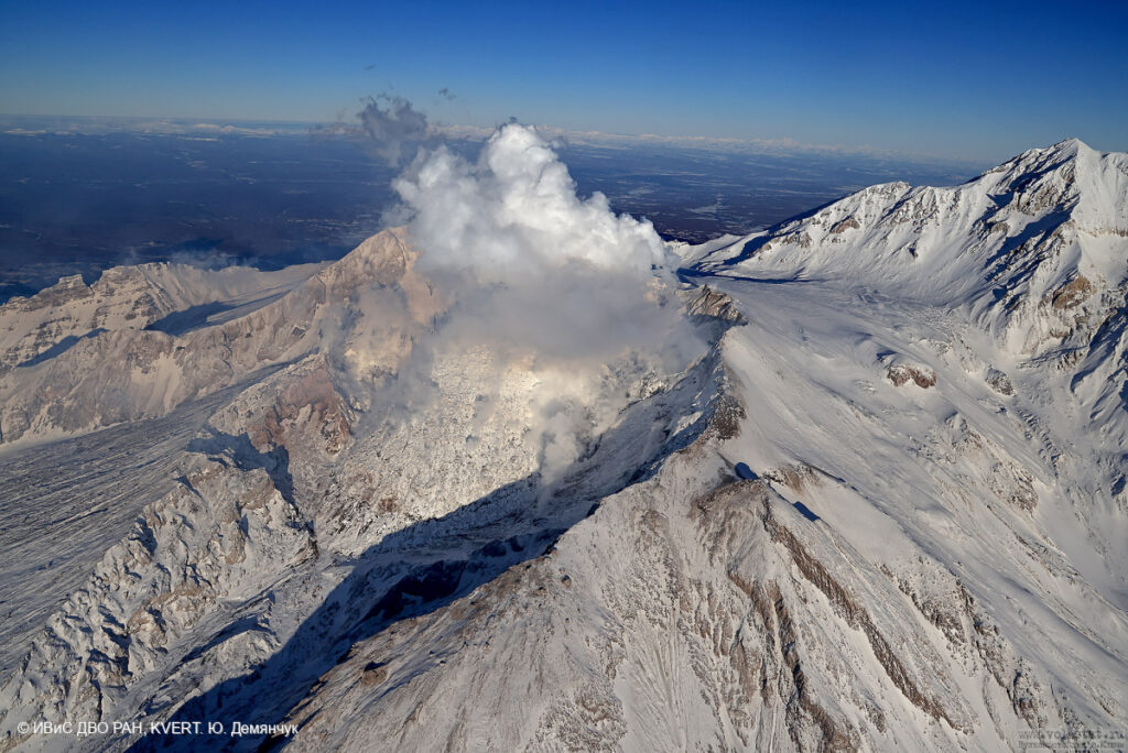
Video and satellite data by KVERT shows a strong wind lifts ash from the southern slopes of Sheveluch volcano, and a plume of resuspended ash is extending about 40 km to the east-south-east of the volcano.
An extrusive-effusive eruption of the Sheveluch volcano continues. The danger of ash explosions up to 10 km (32,800 ft) a.s.l. remains. Ongoing activity could affect international and low-flying aircraft.
Volcanic cloud height:
2000-2500 m (6560-8200 ft) AMSL Time and method of ash plume/cloud height determination: 20250114/0200Z – Himawari-9 14m15
Other volcanic cloud information:
Distance of ash plume/cloud of the volcano: 40 km (25 mi)
Direction of drift of ash plume/cloud of the volcano: ESE / azimuth 102 deg
Time and method of ash plume/cloud determination: 20250114/0200Z – Himawari-9 14m15
Source : Kvert
Photo : Yu. Demyanchuk. IVS FEB RAS, KVERT ( 01 / 2024 )
Indonesia , Ibu :
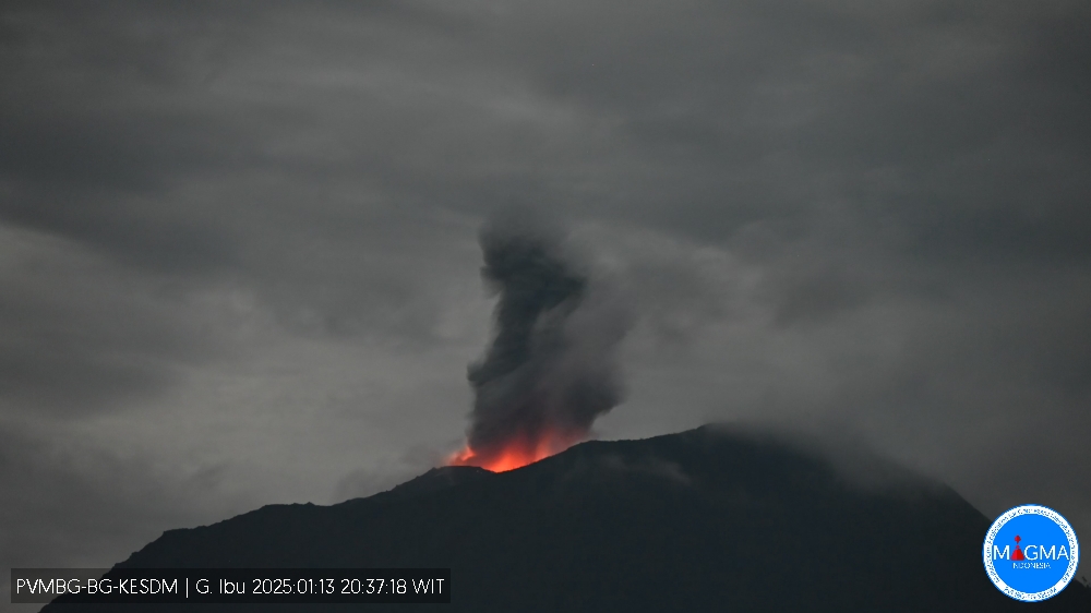
An eruption of Mount Ibu occurred on Monday, 13 January 2025, at 20:30 WIT with an observed ash column height of ±500 m above the peak (±1825 m above sea level). The ash column was observed to be grey in colour with a thick intensity, oriented towards the southwest. This eruption was recorded on a seismograph with a maximum amplitude of 25 mm and a duration of 55 seconds.
VOLCANO OBSERVATORY NOTICE FOR AVIATION – VONA
Issued : January 13 , 2025
Volcano : Ibu (268030)
Current Aviation Colour Code : ORANGE
Previous Aviation Colour Code : orange
Source : Ibu Volcano Observatory
Notice Number : 2025IBU057
Volcano Location : N 01 deg 29 min 17 sec E 127 deg 37 min 48 sec
Area : North Maluku, Indonesia
Summit Elevation : 4240 FT (1325 M)
Volcanic Activity Summary :
Eruption with volcanic ash cloud at 11h30 UTC (20h30 local).
Volcanic Cloud Height :
Best estimate of ash-cloud top is around 5840 FT (1825 M) above sea level or 1600 FT (500 M) above summit. May be higher than what can be observed clearly. Source of height data: ground observer.
Other Volcanic Cloud Information :
Ash cloud moving to southwest. Volcanic ash is observed to be white. The intensity of volcanic ash is observed to be thick.
Remarks :
Eruption recorded on seismogram with maximum amplitude 28 mm and maximum duration 55 second.
Source et photo : Magma Indonésie
Chile , Hudson :
Seismology
The seismological activity of the period was characterized by the recording of:
1058 VT-type seismic events, associated with rock fracturing (Volcano-Tectonic). The most energetic earthquake had a local magnitude (ML) value equal to 2.3, located 6.8 km south-southeast of the volcanic building, at a depth of 5.4 km from the center of the caldera.
85 LP-type seismic events, associated with fluid dynamics within the volcanic system (Long Period). The size of the largest earthquake estimated from the reduced displacement parameter (DR) was equal to 106 cm2.
2 HB-type seismic events, associated with both rock fracturing and fluid dynamics within the volcanic system (hybrid). The most energetic earthquake had a reduced displacement (DR) value of 987 cm2 and a local magnitude (ML) value of 2.8, located 1.6 km east-southeast of the volcanic building, at a depth of 7.5 km from the crater.
Fluid geochemistry
No anomalies in sulfur dioxide (SO2) emissions into the atmosphere have been reported in the area near the volcano, according to data published by the Tropospheric Monitoring Instrument (TROPOMI) and the Ozone Monitoring Instrument (OMI) Sulfur Dioxide Group.
Thermal anomalies by satellites
During this period, no thermal alerts were recorded in the area associated with the volcano, according to the analytical processing of Sentinel 2-L2A satellite images, in combination with false-color bands.
Geodesy
According to the data provided by two GNSS stations that measure the deformation of the volcano, small displacements can be observed, maintaining a general trend of inflation at a very low rate (less than 2 cm per year). For this month, the station located southeast of the caldera shows a displacement towards the southeast at a rate of 0.2 cm/month. The vertical displacement rates do not exceed 0.1 cm/month.
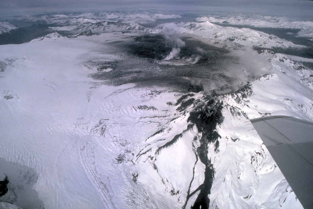
The activity has remained at levels considered low, suggesting the stability of the volcano.
The technical volcanic alert remains in effect in:
GREEN TECHNICAL ALERT: Active volcano with stable behavior – No immediate risk
Source : Sernageomin
Photo : Norm Banks, 1991 (U.S. Geological Survey).
Peru , Sabancaya :
Analysis period: from January 06, 2025 to January 12, 2025, Arequipa, January 13, 2025
Alert level: ORANGE
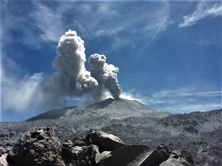
The Geophysical Institute of Peru (IGP) reports that the eruptive activity of the Sabancaya volcano continues. During this period, an average of 4 explosions per day have been recorded, with columns of ash and gas up to 1500 m above sea level above the summit of the volcano. Therefore, the volcanic alert level remains at ORANGE
The IGP has recorded and analyzed the occurrence of 151 earthquakes of volcanic origin, associated with the circulation of magmatic fluids inside the Sabancaya volcano, as well as earthquakes related to rock fracturing. An average of 4 explosions per day have been recorded.
Columns of ash and gas have been observed up to 1500 m above sea level above the summit of the volcano. The predominant direction of these emissions has been towards the West, North and Northwest sectors of the volcano over a distance of less than 10 KM.
A slight inflation process continues to be recorded in the North sector (around the Hualca Hualca volcano).
Satellite recordings have identified the presence of 2 thermal anomalies, with a maximum value of 2 MW, associated with the presence of a lava body on the surface of the volcano’s crater.
Moderate emissions (1060 tons/day) of sulfur dioxide (SO2) have been observed
RECOMMENDATIONS
• Maintain the orange volcanic alert level.
• Do not approach within a radius of less than 12 km of the crater.
Source : Cenvul
Photo : Ingemmet
Costa Rica , Rincón de la Vieja / Poas :
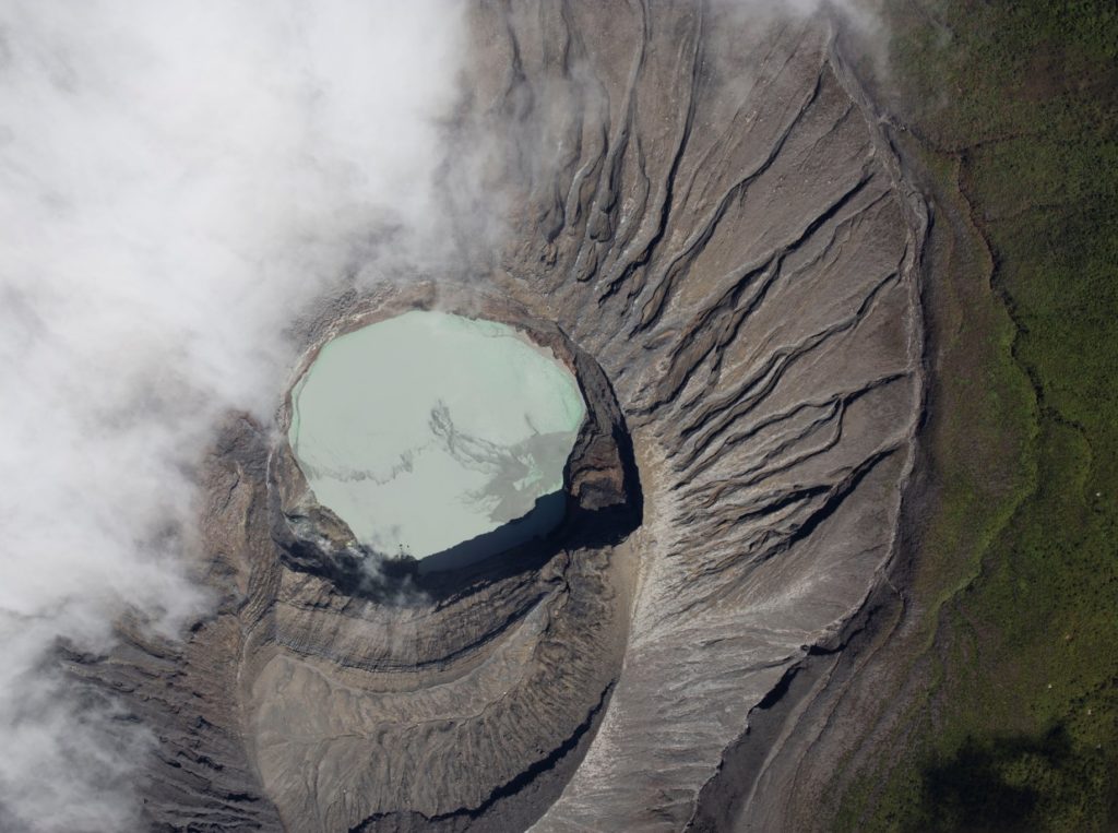
Rincón de la Vieja Volcano
Latitude: 10.83°N; Longitude: 85.34°W;
Altitude: 1916 m
Current Activity Level: Warning
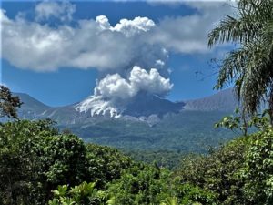
Eruptive activity remained low at the beginning of the year with the occurrence of two low-energy exhalations rich in water vapor, aerosols and volcanic gases. The background tremor has decreased in energy compared to last week. The occurrence of long-period « tornillo » signals and sporadic proximal volcano-tectonic earthquakes continues. The dominant frequency of « tornillos » has shown a slight decreasing trend in recent weeks. Geodetic observations continue to observe an extension and uplift of the volcano base as well as a southward movement of the summit.
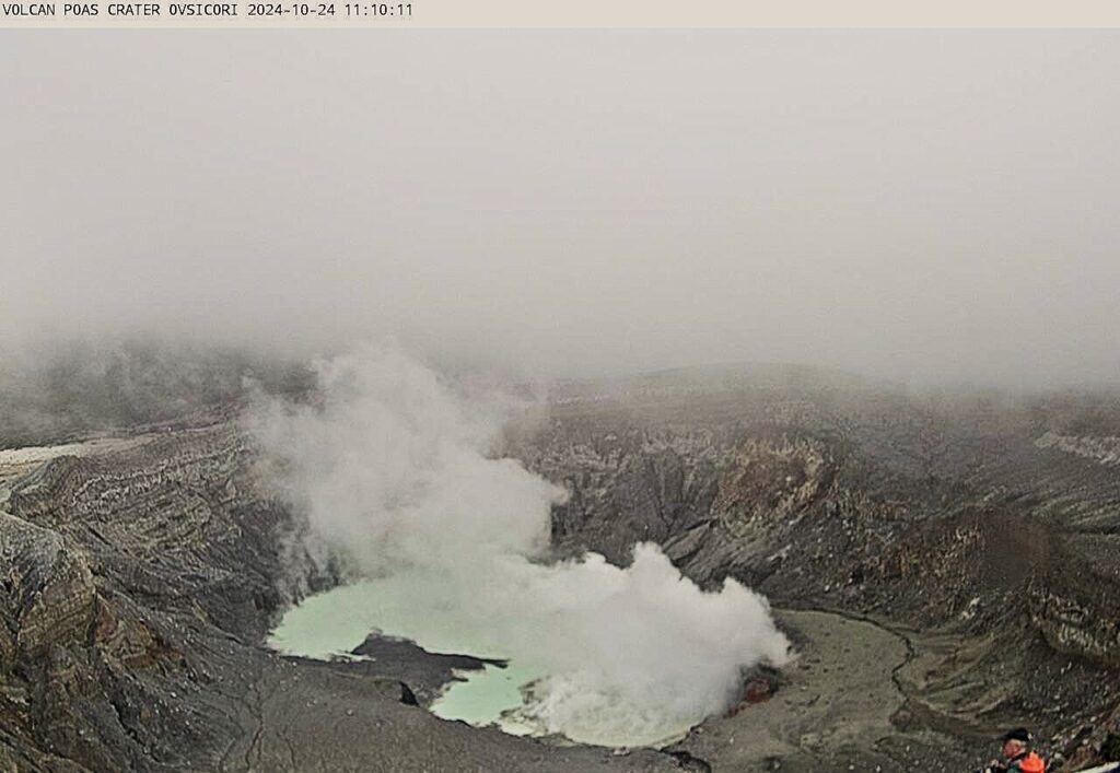
Poas Volcano
Latitude: 10.20°N; Longitude: 84.23°W;
Altitude: 2687 m
Current Activity Level: Warning
Rapid changes in seismic patterns were observed on Saturday, January 4: an increase in shallow, high-frequency (HF) proximal volcano-tectonic (pVT) events, as well as an increase in the intensity of long-period (LP) events. During the following day, a very intense seismic-acoustic tremor was observed, associated with the strong degassing and bubbling observed at the southwest end of the crater lake. A second episode of lesser intensity tremor occurred on the 7th. However, it was not associated with any observable surface activity. Since the 6th, no further pVT events have been recorded, however HF events continue. The number of LP events continues at normal levels. A slight uplift of the crater is detected.
Source : Ovsicori
Photos : Ovsicori , RSN .

