January 12 , 2025 .
Indonesia , Ibu :
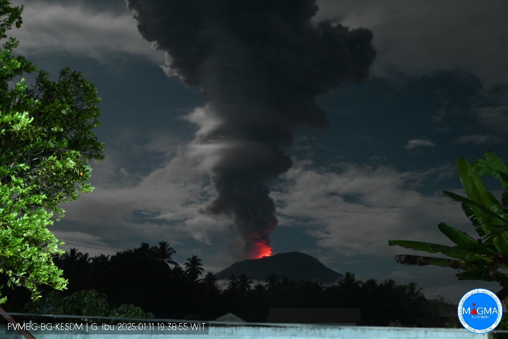
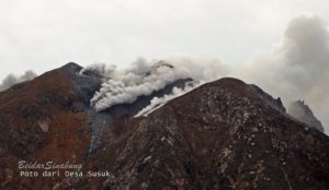
An eruption of Mount Ibu occurred on Saturday, 11 January 2025, at 19:35 WIT with an observed ash column height of ± 4000 m above the peak (± 5325 m above sea level). The ash column was observed to be grey in colour with a thick intensity, oriented towards the West. This eruption was recorded on a seismograph with a maximum amplitude of 28 mm and a duration of 185 seconds.
VOLCANO OBSERVATORY NOTICE FOR AVIATION – VONA
Issued : January 11 , 2025
Volcano : Ibu (268030)
Current Aviation Colour Code : RED
Previous Aviation Colour Code : orange
Source : Ibu Volcano Observatory
Notice Number : 2025IBU045
Volcano Location : N 01 deg 29 min 17 sec E 127 deg 37 min 48 sec
Area : North Maluku, Indonesia
Summit Elevation : 4240 FT (1325 M)
Volcanic Activity Summary :
Eruption with volcanic ash cloud at 10h35 UTC (19h35 local).
Volcanic Cloud Height :
Best estimate of ash-cloud top is around 17040 FT (5325 M) above sea level or 12800 FT (4000 M) above summit. May be higher than what can be observed clearly. Source of height data: ground observer.
Other Volcanic Cloud Information :
Ash cloud moving to west. Volcanic ash is observed to be gray. The intensity of volcanic ash is observed to be thick.
Remarks :
Eruption recorded on seismogram with maximum amplitude 28 mm and maximum duration 185 second.
Source et photo : Magma Indonésie
Philippines , Kanlaon :
KANLAON VOLCANO ADVISORY , 11 January 2025 , 02:00 PM
Notice of increased ground deformation at Kanlaon Volcano.
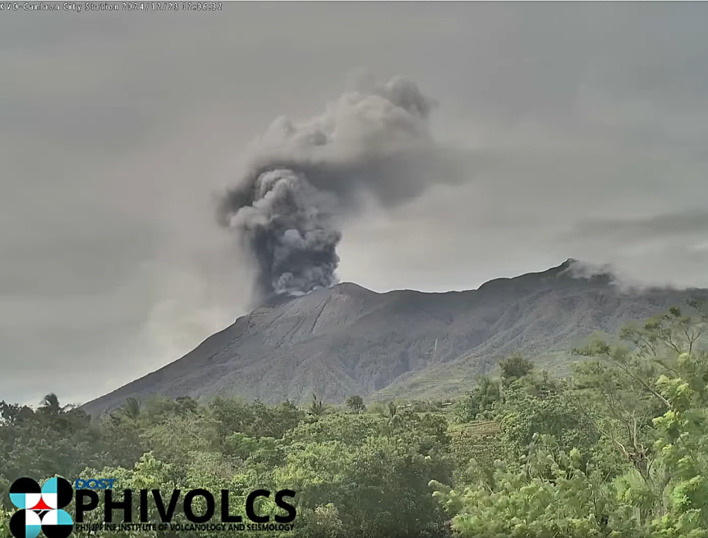
Ground deformation monitoring by the Kanlaon Volcano Network (KVN) has been recording a pronounced inflation or swelling of the middle to upper portion of the eastern edifice since yesterday evening. Electronic tilt recorded by the Upper Pantao Observation station (VKUP) at 1,056 m elevation on the eastern flank of the volcano showed an abrupt and sharp increase in inflationary tilt since 7:20 PM yesterday, 10 January 2025, indicating a sudden pressurization within the upper portions of the edifice. Electronic Distance Meter (EDM) measurements by Kanlaon Volcano Observatory have been tracking inflation of southeastern flank since the last week of December 2024 and deflation of the western flank since the first week of 2025. These ground deformation parameters are largely similar to those recorded prior to the 9 December 2024 eruption, which was also preceded by a drop in SO2 emission. Campaign SO2 measurements yesterday, 10 January 2025, averaged 5,763 tonnes/day, close to average emissions since the 3 June 2024 eruption, but a significant drop to 2,029 tonnes/day was recorded on the previous day, 9 January 2025. The overall parameters may indicate that the shallow magma conduit of the volcano is undergoing pressurization that may lead to an eruption broadly similar to the 9 December 2024 event.
The public is reminded that Alert Level 3 (magmatic unrest) is raised over Kanlaon Volcano. There is presently an increased chance for sudden explosive eruptions to occur and endanger communities at risk with life-threatening volcanic hazards. Communities within a six-kilometer radius of the summit crater must remain evacuated due to the danger of pyroclastic density currents or PDCs, ballistic projectiles and ashfall, lava flows, rockfalls and other related hazards. Local government units and DRRM councils must also vigilantly monitor weather conditions in case heavy rainfall occurs and generates lahars and sediment-laden streamflows in channels draining the southern flanks of the volcano. Specifically, barangays of La Castellana and Canlaon City that have been impacted by PDCs, as well as barangays downstream of these especially those that have experienced lahars and muddy streamflows in June 2024, could be affected by channel-confined lahars of in case of heavy rains. Civil aviation authorities must also advise pilots to avoid flying close to the volcano’s summit as ash from any sudden eruption can be hazardous to aircraft. Lastly, local government units and DRRM councils are advised to prepare communities within the DOST-PHIVOLCS Pyroclastic Density Currents Hazard Map for potential evacuation in case unrest further escalates and hazardous worst-case explosive eruption becomes imminent.
DOST-PHIVOLCS maintains close monitoring of Kanlaon Volcano and any new development will be communicated to all concerned stakeholders.
Source et photo : Phivolcs
Chile , Villarica :
Special Report on Volcanic Activity (REAV), Auracania and Los Rios Regions, Villarica Volcano, January 11, 2025, 16:40 local time (Continental Chile)
The National Geology and Mining Service of Chile (Sernageomin) announces the following PRELIMINARY information, obtained through the monitoring equipment of the National Volcanic Monitoring Network (RNVV), processed and analyzed at the Southern Andean Volcano Observatory (Ovdas):
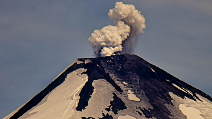
On Saturday, January 11, 2025, at 16:05 (19:05 UTC), the monitoring stations installed near the Villarica Volcano recorded an emission of particulate material associated with an earthquake related to fluid dynamics within the volcanic system (long-period type).
The characteristics of the earthquake after its analysis are as follows:
TIME OF ORIGIN: 16:05 local time (19:05 UTC)
REDUCED DISPLACEMENT: 4.2 (cm*cm)
ACOUSTIC SIGNAL: 2.1 Pascals (Pa) reduced to 1 km
The characteristics of the surface activity associated with the event are as follows:
MAXIMUM HEIGHT OF THE COLUMN: 200 meters above the emission point
DIRECTION OF DISPERSION: South (S)
Observation:
Before the reported event, a pulse of lower energy was recorded. Following the emission, no change in the dynamics of the volcano was observed.
The volcanic technical alert is maintained at GREEN level.
Source et photo : Sernageomin
Colombia , Nevado del Ruiz :
Manizales, January 7, 2025, 4:30 p.m.
Following the monitoring of the activity of the Nevado del Ruiz volcano, the Colombian Geological Survey (SGC), an entity attached to the Ministry of Mines and Energy, reports that:
During the week of December 31, 2024 to January 6, 2025, the volcano continued to show unstable behavior. Compared to the previous week, the main variations in the monitored parameters were:
– The seismic activity associated with the rock fracturing processes inside the volcanic edifice decreased in the number of earthquakes recorded and the seismic energy released compared to the previous week. The earthquakes were located mainly in the Arenas crater and in the northeast, east, southeast, southwest and northwest sectors of the volcano, at distances of up to 11 km from the crater, with a predominance of distances less than 5 km. The depths of the events varied between less than 1 km and 7 km from the summit of the volcano. The highest magnitude of the week was 1.2, corresponding to the earthquake recorded on January 2 at 3:51 p.m., located 3 km southwest of the Arenas crater, at a depth of 4 km.
– Seismicity related to fluid dynamics inside volcanic conduits associated with pulsatile ash emissions has decreased in the number of earthquakes and the seismic energy released. While seismic activity related to the continuous emission of gas and ash has increased, especially since yesterday, January 6. The energy levels of both types of signals were variable with values between low and moderate. Thanks to conventional and thermal cameras installed to monitor the volcano, some of the recorded ash emissions were confirmed.
In addition, it was possible to identify several changes in the relative temperature of the emitted material, associated with this phenomenon. The pulsatile ash emission of January 3 at 00:03 is remarkable for its energy level, the height of its column and the temperature change recorded.
– The emission of water vapor and gas, mainly sulfur dioxide (SO₂), into the atmosphere from the Arenas crater has continued. SO₂ degassing rates were variable and increased compared to the previous week.
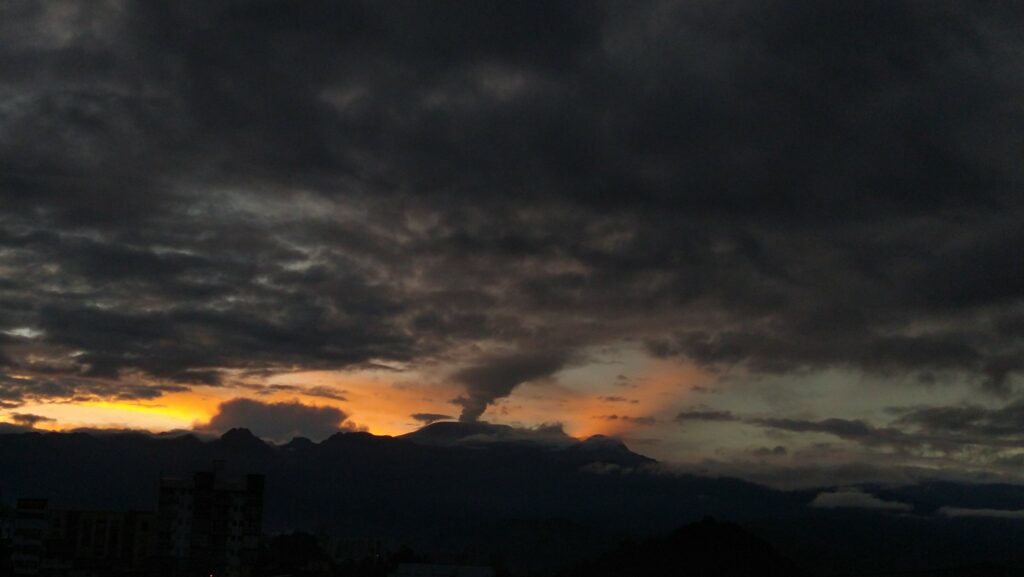
– The height of the gas column reached values between 2000 and 2100 m (measured on the volcanic summit) in vertical and dispersion. These values were estimated during the ash emissions of January 3 at 00:03 and January 1 at 08:14, respectively. Regarding the direction of dispersion of the gas column, it was directed preferentially towards the west side (from the northwest to the west-southwest of the volcano), generating ash falls in the municipalities of Manizales and Villamaría.
– When monitoring thermal anomalies at the bottom of the Arenas crater, using satellite monitoring platforms, several reports of low-energy thermal anomalies were obtained. The atmospheric conditions of high cloudiness prevailing in the region did not favor their detection.
Source : SGC
Photo : Julian Fernando Aranzazu Henao
Ecuador , Sangay :
DAILY STATE REPORT OF SANGAY VOLCANO, Saturday, January 11, 2025.
Information Geophysical Institute – EPN.
Surface Activity Level: Moderate, Surface Trend: No Change
Internal Activity Level: Moderate, Internal Trend: No Change
Seismicity: From January 10, 2025, 11:00 a.m. to January 11, 2025, 11:00 a.m.:
Seismicity:
Below is the count of seismic events recorded at the reference station
Explosion (EXP): 117
Rainfall/Lahars:
The presence of rain in the area of the volcano or in the surroundings, which could generate mud and debris flows, has not been recorded by the surveillance cameras. **In the event of heavy rain, it could remobilize the accumulated materials, generating mud and debris flows that would descend the sides of the volcano and flow into the adjacent rivers.
Emission/Ash Column:
In the last 24 hours, the surveillance camera system has observed the emission of gas and ash at a height of 700 meters above the crater level in a southwest direction. In addition to this, the VAAC agency in Washington has issued 2 reports of emissions with heights between 800 and 1200 meters above the crater level in the northwest and southwest directions.
Gas:
The MOUNTS satellite system detected 73.5 tons of sulfur dioxide (SO2), recorded on 10/01/2025 at 18:19TL.
Other monitoring parameters:
The FIRMS satellite system recorded 3 thermal anomalies, the MIROVA-VIIRS satellite system recorded 2 thermal anomalies, and the MIROVA-MODIS satellite system recorded 3 thermal anomalies.
Observation:
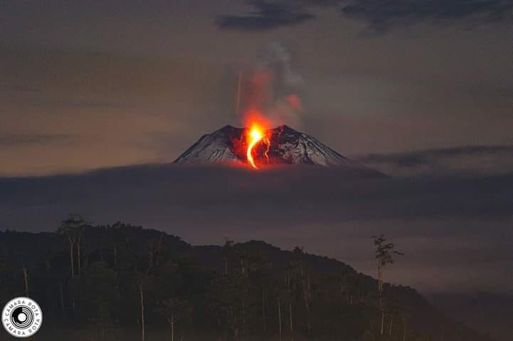
Since yesterday evening, episodes of incandescence at the crater have been observed thanks to the surveillance camera system. On the other hand, the volcano remained cloudy most of the time.
Alert level: yellow
Source : IGEPN
Photo : Cámara Rota ( 12/06/2024 ).

