January 11 , 2025.
Indonesia , Dukono :
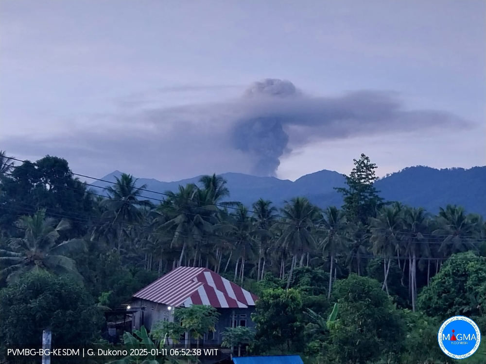
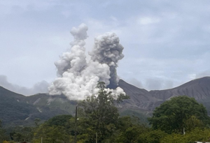
An eruption of Mount Dukono occurred on Saturday, 11 January 2025 at 06:26 WIT with an observed ash column height of ±1200 m above the peak (±2287 m above sea level). The ash column was observed to be white to grey in colour with a thick intensity, oriented towards the northwest. At the time of writing, the eruption was still ongoing.
Seismicity Observation
276 eruption/explosion earthquakes with an amplitude of 6 to 34 mm and a duration of 31.66 to 206.4 seconds.
1 local tectonic earthquake with an amplitude of 34 mm, and an earthquake duration of 75.39 seconds.
7 distant tectonic earthquakes with an amplitude of 10 to 34 mm, and an earthquake duration of 61.1 to 92.98 seconds.
1 continuous tremor earthquake with an amplitude of 1-5 mm, dominant value 2 mm.
Recommendation
(1) People in the vicinity of Mount Dukono and visitors/tourists should not engage in activities, climb or approach the Malupang Warirang Crater within a radius of 4 km.
(2) Since volcanic eruptions with ash occur periodically and the distribution of ash follows the direction and speed of the wind, so the area where the ash lands is not constant, people around Mount Dukono are advised to always carry masks/nose masks and mouth covers to use when needed. to avoid the threat of volcanic ash to the respiratory system.
Source et photo : Magma Indonésie .
Hawaii , Kilauea :
Friday, January 10, 2025, 11:30 AM HST (Friday, January 10, 2025, 21:30 UTC)
19°25’16 » N 155°17’13 » W,
Summit Elevation 4091 ft (1247 m)
Current Volcano Alert Level: WATCH
Current Aviation Color Code: ORANGE
SUMMARY
The eruption that began within Halemaʻumaʻu at the summit of Kīlauea volcano on December 23, 2024, remains paused. Monitoring data show that Kīlauea summit is slowly inflating, indicating that new magma is accumulating below the surface of the summit region. An overflight this morning, Friday, January 10, confirmed that lava is visible within both vents. This statement reviews recent observations and summarizes what could be expected next at Kīlauea.
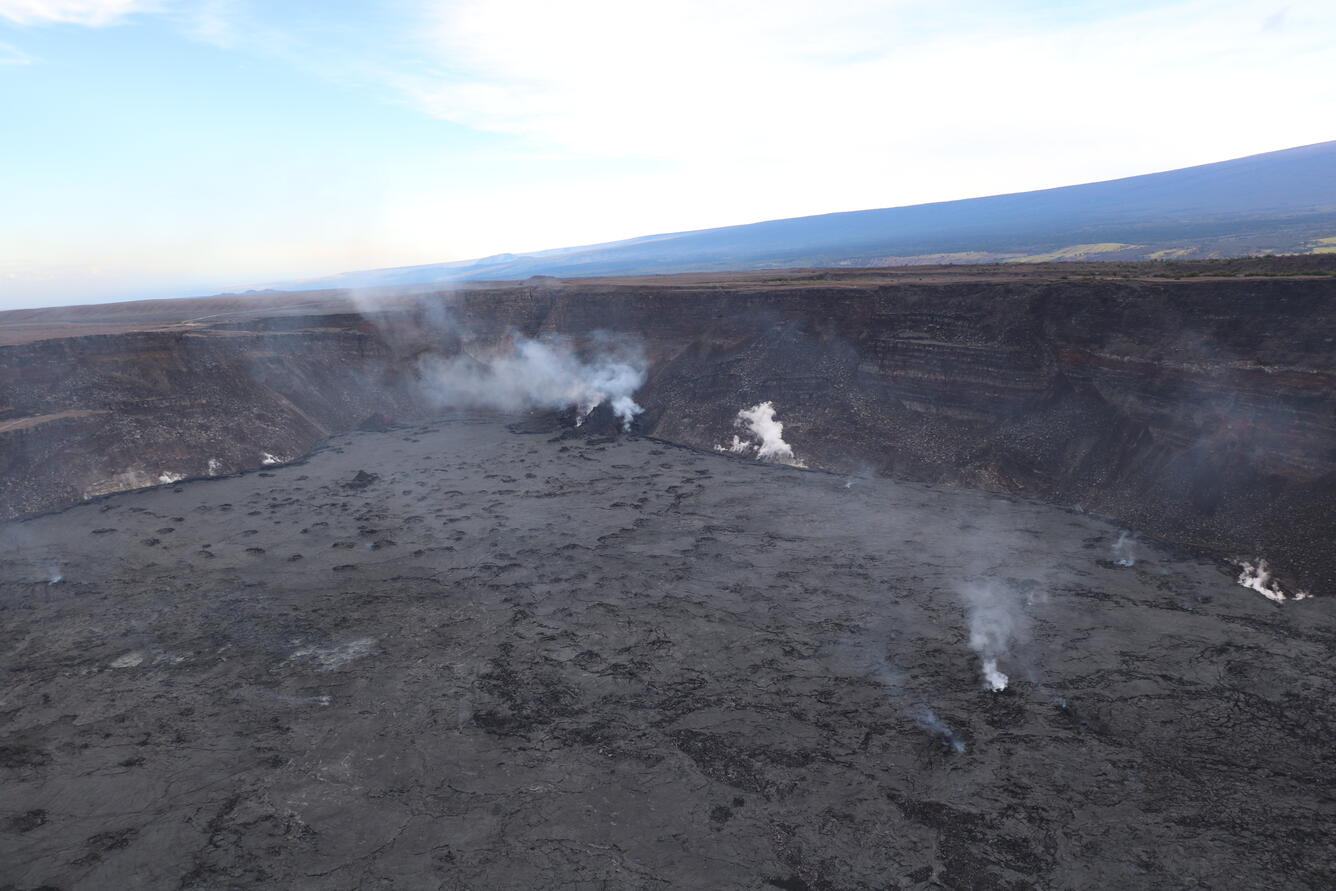
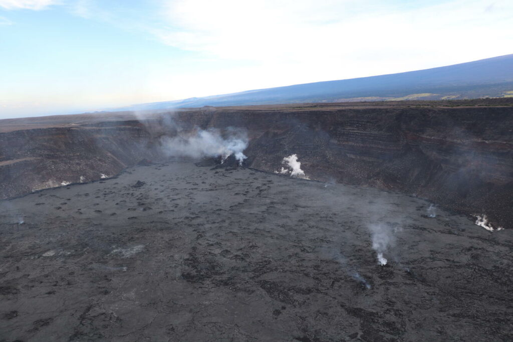
This aerial view shows the two eruptive cones from the December 2024 to January 2025 paused eruption at Kīlauea’s summit. The eruption paused on Jan 3, 2025, but geologists observed active lava within the vents during the monitoring overflight. This photo is looking southwest with the southwest flank of Mauna Loa in the background.
EPISODIC ERUPTIONS
The recent eruption of Kīlauea within Halemaʻumaʻu brought back an eruptive style not seen for many years. The eruption included 3 episodes of lava fountaining separated by pauses in eruptive activity. The third pause is ongoing, and USGS Hawaiian Volcano Observatory (HVO) scientists are reviewing patterns of past eruptions and current monitoring data to forecast what could happen next at Kīlauea.
Episodes are marked by the onset of lava fountains and rapid deflation of the source magma chamber. Pauses between fountain episodes are usually accompanied by reinflation of the summit. A new episode begins when the system builds up enough pressure to force magma to the surface again. Fountaining is driven by rapid volume expansion of gas in fresh lava but is commonly preceded by periods of eruption of sluggish degassed flows. Dense degassed material is pushed out of the vent like a cork from a champagne bottle, allowing gas-rich magma to rise rapidly and fountain.
WHAT IS LIKELY TO HAPPEN NEXT
It is not possible to forecast an exact outcome of this activity but we are in a window where it is likely another fountaining episode may occur.
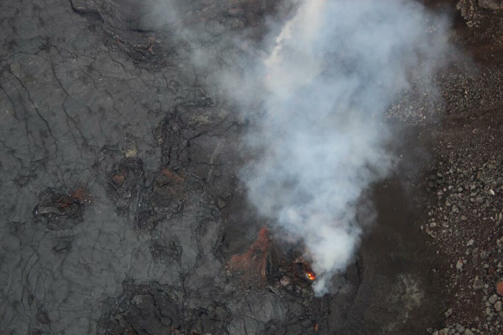
Telephoto view of eruptive cones from the December 2024 to January 2025 eruption in Kīlauea’s summit. This photo was taken looking down onto the caldera floor during a USGS Hawaiian Volcano Observatory monitoring overflight the morning of January 10, 2025. The north cone that was active during the recent eruption is in the center of the image, and lava glowing from within the vent is visible. The south vent is out of the frame, but a small lava flow is coming out of that vent and visible in the top left portion of the photo.
Sufficient pressure could push magma up to the surface to start another eruptive episode at Kīlauea summit. Following episode 3, Kīlauea has inflated and the 6 microradian level was reached about 4:30 p.m. HST Wednesday, January 8 afternoon (5 days after episode 3 paused on Friday, January 3 at 8:40 p.m. HST). That amount of inflation had been the minimum amount of pressure required previously for this eruption to restart. However, the large deflation that accompanied the prolonged fountaining of episode 3 suggests the system might need more inflation as recorded on tiltmeters to reach the pressure necessary for eruptive activity to resume.
HVO scientists on a monitoring overflight of Kīlaeua summit the morning of January 10 observed active lava within both vents that erupted recently in Halemʻamaʻu. The longer the vent sits without eruption on the surface, the more time molten material within the vent has to cool and it could reach a point that the eruption can’t restart. Assuming the vent remains open, indicated by continued glow and degassing, and inflation rate remains constant, it seems likely that a new episode could begin sometime between January 8 and January 13, when ground tilt at the Uēkahuna tiltmeter is expected to reach 12 microradians, about double prior post-fountain tilt increases.
Defining windows of time where there is a higher probability or likelihood of an eruption restart differs from more precise forecasts of eruptive activity that require a more specific time for an event to occur. While we know that magma is near the surface, we do not know the exact amount of degassed magma in the vent that is temporarily capping the fresh, gas-rich magma below. The rate of re-pressurization continues to vary as reflected by the changing rate of tilt recorded at Kīlauea’s summit making it difficult to know when enough pressure has accumulated to start forcing degassed magma out of the vent and starting a new episode.
Source : HVO
Photos : USGS / H. Winslow.
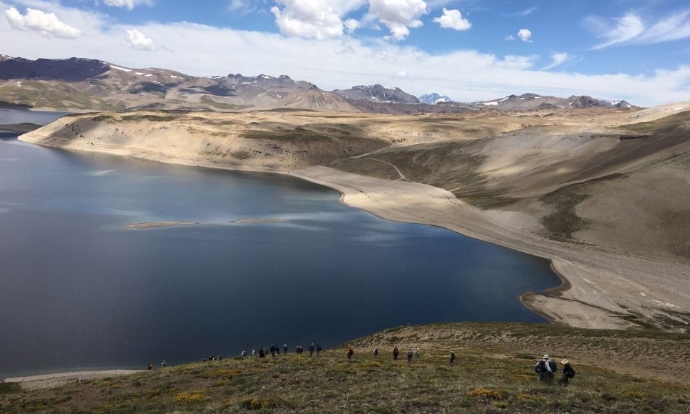
Chile , Laguna del Maule :
Seismology
The seismological activity of the period was characterized by the recording of:
4943 VT type seismic events, associated with rock fracturing (Volcano-Tectonic). The most energetic earthquake had a local magnitude (ML) value equal to 2.4, located 3.4 km to the East-Southeast of the volcanic building, at a depth of 7.7 km from the center of the lagoon.
3 LP type seismic events, associated with fluid dynamics within the volcanic system (Long Period). The size of the largest earthquake estimated from the reduced displacement parameter (DR) was equal to 17 cm2.
1 TR type seismic event, associated with sustained fluid dynamics within the volcanic system (TRemor). The size of the earthquake estimated from the reduced displacement parameter (DR) was equal to 1 cm2.
Fluid Geochemistry
No anomalies have been reported in sulfur dioxide (SO2) emissions into the atmosphere in the area near the volcanic complex, according to data published by the Tropospheric Monitoring Instrument (TROPOMI) and the sulfur dioxide group of the Ozone Monitoring Instrument (OMI).
Satellite thermal anomalies
During the period, no thermal alerts were recorded in the area associated with the volcanic complex, according to the analytical processing of Sentinel 2-L2A satellite images, in combination with false-color bands.
Geodesy
Based on the geodetic data obtained during the period, it is observed that the general inflationary trend of the system continues; however, in the last period, the distance between some GNSS stations has shortened, due to changes in horizontal trends or reduced displacement rates. The relative vertical displacements have amplitudes of less than 1.4 cm/month.
Surveillance cameras
The images provided by the fixed camera, installed near the volcanic complex, did not record degassing columns or variations related to surface activity.
The activity remained at levels considered low, suggesting stability in the volcanic complex. The technical volcanic alert remains in effect for:
GREEN TECHNICAL ALERT: Active volcano with stable behavior – No immediate risk
Observation:
The affected area is considered to be within a 2 km radius around the passive CO2 degassing zone.
Source : Sernageomin
Photo : Auteur inconnu
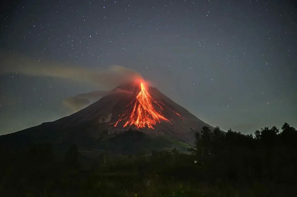
Indonesia , Merapi :
Mount Merapi Activity Report from January 3 to 9, 2025 . Published on January 10, 2025
OBSERVATION RESULT
Visual
The weather around Mount Merapi is generally sunny in the morning and night, while during the day and evening it is hazy. White smoke, thin to thick, low to moderate pressure and 25 m high was observed from Mount Merapi Jrakah Observation Post on January 9, 2025 at 17:45 WIB. This week, lava avalanches were observed 84 times in the southwest (upstream of Kali Bebeng) up to a maximum of 2,000 m, 29 times upstream of Kali Krasak up to a maximum of 2,000 m and 9 times in the west (upstream of Kali Sat/Putih) up to a maximum of 1,500 m. m. The morphology of the southwest dome was observed to have changed due to lava flow activity. For the central dome, no significant morphological changes were observed. The highest hot spot of the southwest dome was measured at 245.3 oC, higher than the previous measurement. Meanwhile, in the central dome, the measured hot spot was 228.6 oC, higher than the previous measurement. Based on an analysis of aerial photos, the volume of the South-West dome was measured at 3,505,900 m3. The central dome, meanwhile, measures 2,360,700 m3.
Seismicity:
This week, the seismicity of Mount Merapi recorded:
27 shallow volcanic earthquakes (VTB),
497 multiphase earthquakes (MP),
2 low-frequency earthquakes (LF),
1,050 avalanche earthquakes (RF),
12 tectonic earthquakes (TT).
The intensity of earthquakes this week is still quite high.
Deformation
The deformation of Mount Merapi monitored using EDM this week shows an average shortening rate of the thrust distance of 0.2 cm/day, relatively the same as last week.
Rain and Lahars
This week, it rained at Mount Merapi observation post with a rainfall intensity of 49 mm/hour for 32 minutes at Babadan post on 4 January 2025. There were no reports of additional flow or lava in the rivers that originate from Mount Merapi.
Conclusion
Based on the results of visual and instrumental observations, it is concluded that: The volcanic activity of Mount Merapi is still quite high in the form of effusive eruptive activity. The status of the activity is defined as « SIAGA ».
Source : BPPTKG
Photo : Abdllah Evan via Alicja Szojer FB
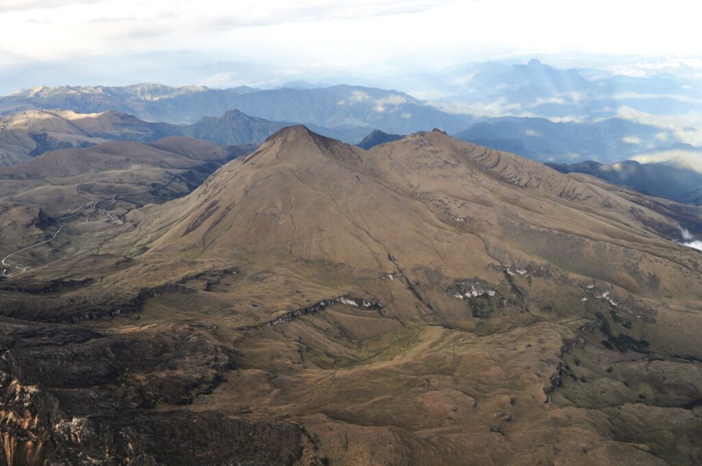
Colombia , Chiles / Cerro Negro :
San Juan de Pasto, January 7, 2025, 4:30 p.m.
Following the monitoring of the activity of the Chiles and Cerro Negro volcanoes, the Colombian Geological Survey (SGC), an entity attached to the Ministry of Mines and Energy, reports that:
During the week of December 31, 2024 to January 6, 2025, volcanic activity showed stable behavior. Compared to the previous week, the main variations in the monitored parameters were:
● The seismic occurrence in the evaluated period maintained the levels of seismic activity and the released energy recorded a decrease.
● The seismicity related to rock fracturing within the volcanic structure is predominant compared to the rest of the seismicity. However, the seismicity associated with fluid dynamics showed an increase compared to the previous week.
● Most of the seismic activity was located in the area of the Chiles volcano collapse, located north of the volcano summit (4700 m above sea level), with locations recorded at distances of up to 1.8 km and magnitudes between 0.65 and 1.3. The remaining seismicity was located south of the Chiles volcano summit, with depths of up to 6 km and maximum distances of 4 km from the volcano summit.
● Instruments that record crustal deformation and remote satellite sensors continue to show changes related to an inflationary process in the volcanic area.
Based on the above, the SGC recommends closely monitoring the evolution through weekly bulletins and other information published through our official channels, as well as instructions from local and departmental authorities and the National Disaster Risk Management Unit (UNGRD).
Volcanic activity remains in yellow alert status: active volcano with changes in the behavior of the base level of monitored parameters and other manifestations.
Source et photo : SGC .

