December 23 , 2024 .
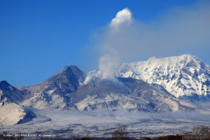
New Zealand , White Island :
Reduced steam and gas plumes at Whakaari. Volcanic Alert Level remains at Level 2 and Aviation Colour Code is lowered to Yellow.
Published: Mon Dec 23 2024 5:00 PM
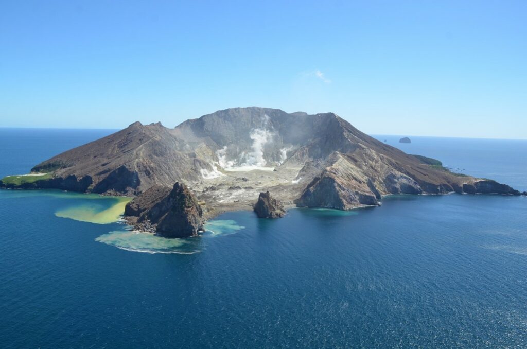
Whakaari / White Island is continuing to emit steam and gas plumes. No further passive emission of volcanic ash has been observed. The Volcanic Alert Level remains at 2 and the Aviation Colour Code is lowered to Yellow.
Since our last routine gas measurement flight on December 14, the emissions from the volcano have reduced to typical steam and gas plume emissions. We have not observed any volcanic ash, and the NZ Met service have detected no further volcanic ash in satellite data. These observations have been used to re-assess the Aviation Colour Code, which is now lowered to Yellow.
A weak steam plume is currently being emitted from Whakaari, as seen on our webcams at Whakatāne and Te Kaha as well as on satellite imagery. When the weather allows, a larger plume can sometimes be seen from the Bay of Plenty coast above the island. Similarly, activity can change at short notice and occasionally produce stronger steam plumes.
Without sensors on the island, we continue to rely on remote cameras and satellite imagery to monitor Whakaari. We will continue to monitor the island over the Christmas-New Year period.
Recent activity is consistent with moderate-heightened unrest and the Volcanic Alert Level therefore remains at Level 2. The lack of volcanic ash being emitted from the volcano means that the Aviation Colour Code is lowered to Yellow. These levels acknowledge the current level of activity but also reflect the degree of uncertainty about the level of unrest due to the current lack of consistent, usable real-time monitoring data. The level of volcanic activity could escalate back to levels seen earlier in the year and the volcano can erupt with little or no warning.
Source : Geonet / Geoff Kilgour / Duty Volcanologist
Photo : Brad Scott, GNS Science.
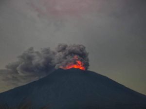
Indonesia , Plateau de Dieng :
INCREASED ACTIVITY OF SILERI CRATER IN G. DIENG COMPLEX, DECEMBER 18, 2024 .
The summit of the Dieng volcanic complex (2,565 m above sea level) is located at 7o 12′ S latitude and 109o 54′ E longitude and is administratively included in Banjarnegara Regency, Wonosobo Regency, and Batang Regency, Central Java Province.
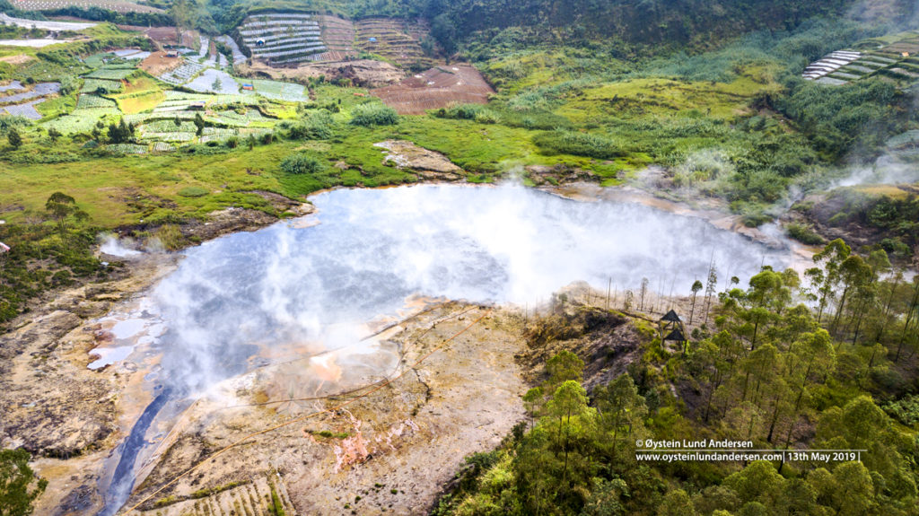
Phreatic eruptions occur quite frequently on the Dieng Plateau, including the Sileri Crater. In the past five years, a phreatic eruption of the Sileri Crater occurred on April 29, 2021, with mud ejected within a radius of less than 500 meters. Then an increase in seismicity occurred on January 13, 2023.
On December 18, 2024, the activity of the Sileri crater increased, where at 15:12:32 WIB, a phreatic eruption occurred from the eastern part of the crater. This eruption was recorded on a digital seismograph with a seismic duration of about 200 seconds and a maximum amplitude of 42.7 mm. The eruption took the form of a mudflow with a distribution to the northeast up to ±100 meters, to the west ±25 meters and to the south ±10 meters. Similar to the character of a phreatic eruption, this eruption was not preceded by signs of significant increase in volcanic activity either visually or instrumentally (seismicity and/or geochemistry) before the eruption because the pressure source was very shallow.
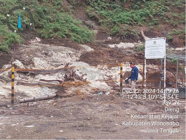
After the phreatic eruption of Sileri Crater, a team from the Center for Volcanology and Geological Disaster Mitigation (PVMBG), conducted an examination and inspection of Sileri Crater on December 22, 2024, with the result that the area affected by the eruption was still within the recommended area and the monitoring parameters (visual, temperature, gas and seismicity) are in normal conditions. On the same day, the results of inspections of other craters such as Sikendang-Telagawarna Crater, Sikidang Crater and Candradimuka which are tourist destinations also showed that the activity had not increased, however, the concentration of some volcanic gases in some of these craters was still relatively high in the area near or around the gas outlet vent.
The activity level of Mount Dieng was increased from Level I (normal) to Level II (WASPADA) on December 19, 2024 at 18:00 WIB, which is intended as an anticipatory or vigilance effort for the Sileri Crater. For other craters in the Mount Dieng complex, according to the results of the PVMBG team’s examination and inspection, the Geological Agency is still in a state of no improvement.
At the Mount Dieng Activity Level II (WASPADA), as a form of alert, the Geological Agency’s Volcanology and Disaster Mitigation Center recommends:
The public and visitors/tourists are not allowed to enter the 500-meter radius area around the center of Sileri Crater and are not allowed to spend the night around the crater.
The public and visitors/tourists should not enter the Timbang Crater and should also be careful when excavating the surrounding land as it is potentially threatened by CO2 gas.
Source : PVMBG
Photos : Sileri , Dieng-Plateau, Øystein Lund Andersen ( 2021) , PVMBG
Chile , Puyehue- Cordon Caulle :
Seismology
The seismological activity of the period was characterized by the recording of:
185 VT type seismic events, associated with rock fracturing (Volcano-Tectonic). The most energetic earthquake had a Local Magnitude (ML) value equal to 1.9, located 1.9 km to the East-Northeast, at a depth of 3.7 km in reference to the 2011 crater.
22 LP type seismic events, associated with fluid dynamics within the volcanic system (Long Period type). The size of the largest earthquake evaluated from the Reduced Displacement (DR) parameter was equal to 12 cm2.
Fluid Geochemistry
No anomalies were reported in sulfur dioxide (SO2) emissions into the atmosphere in the area near the volcanic complex, according to data published by the Tropopheric Monitoring Instrument (TROPOMI) and the Ozone Monitoring Instrument (OMI) Sulphur Dioxide Group.
Thermal anomalies by satellites
Over the period, no thermal alerts were recorded in the area associated with the volcanic complex according to data processed by the MIROVA site for the MODIS sensor. According to the analytical processing of Sentinel 2-L2A satellite images, in combination with false-color bands, no abnormal radiance is observed in the Volcanic Complex. Regarding the processing of Landsat 8-9 images, the results obtained do not represent variations attributable to changes in basal volcanic processes.
Geodesy
Based on the data obtained through the GNSS network, it is observed that the uplift process continues with magnitudes greater than those of the previous period, similar to the annual average of this year. The maximum rate of rise recorded is 1.7 cm/month.
Considering the analysis of radar images and using the InSAR technique, an increase in coherence is observed in the area, and suggests that the shape of the main source of deformation does not present significant variations.
Surveillance cameras
The images provided by the fixed camera, installed near the complex, did not record degassing columns or variations related to surface activity.
Satellite geomorphological analysis
From the processing of SkySat Collect and Planet Scope satellite images, no morphological changes attributable to volcanic activity are identified.
Aspects related to deformation and seismic activity show a volcanic system that continues above its base level of activity. For this period, the deformation data allowed us to calculate magnitudes slightly higher than those observed a few weeks ago. Similarly, volcanic seismicity of magnitude less than 2 continues to be recorded.
These characteristics contribute to maintaining the technical alert in:
YELLOW TECHNICAL ALERT: Changes in the behavior of volcanic activity
Source : Sernageomin
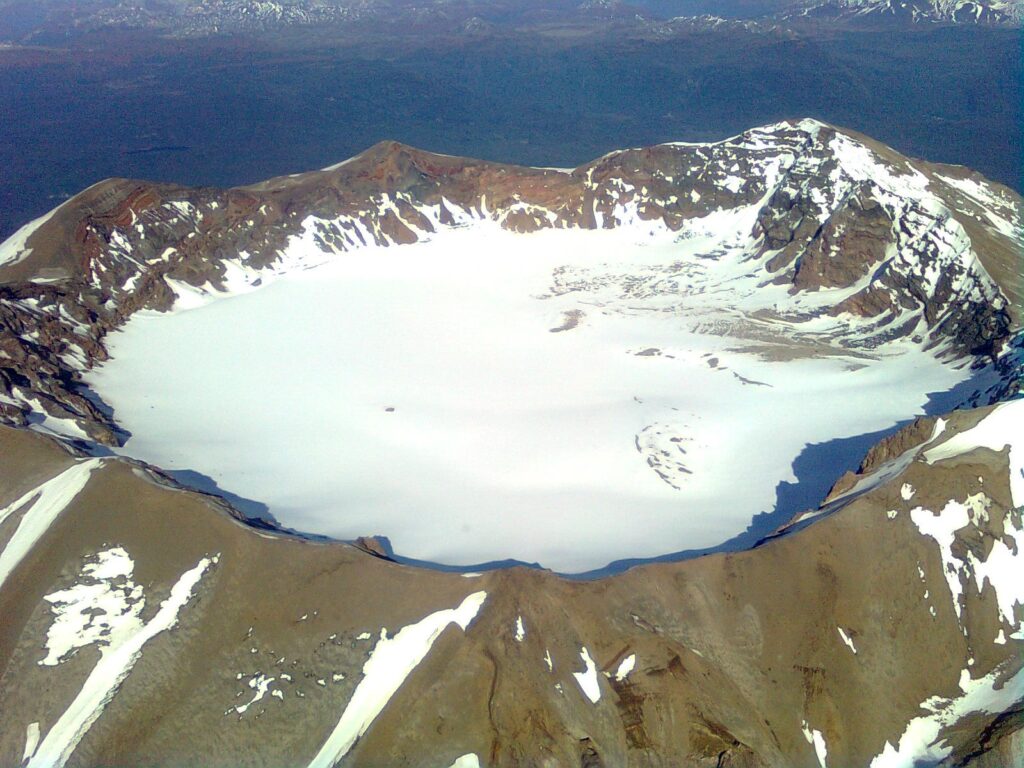
Photo : Sergio Osses
Philippines , Kanlaon :
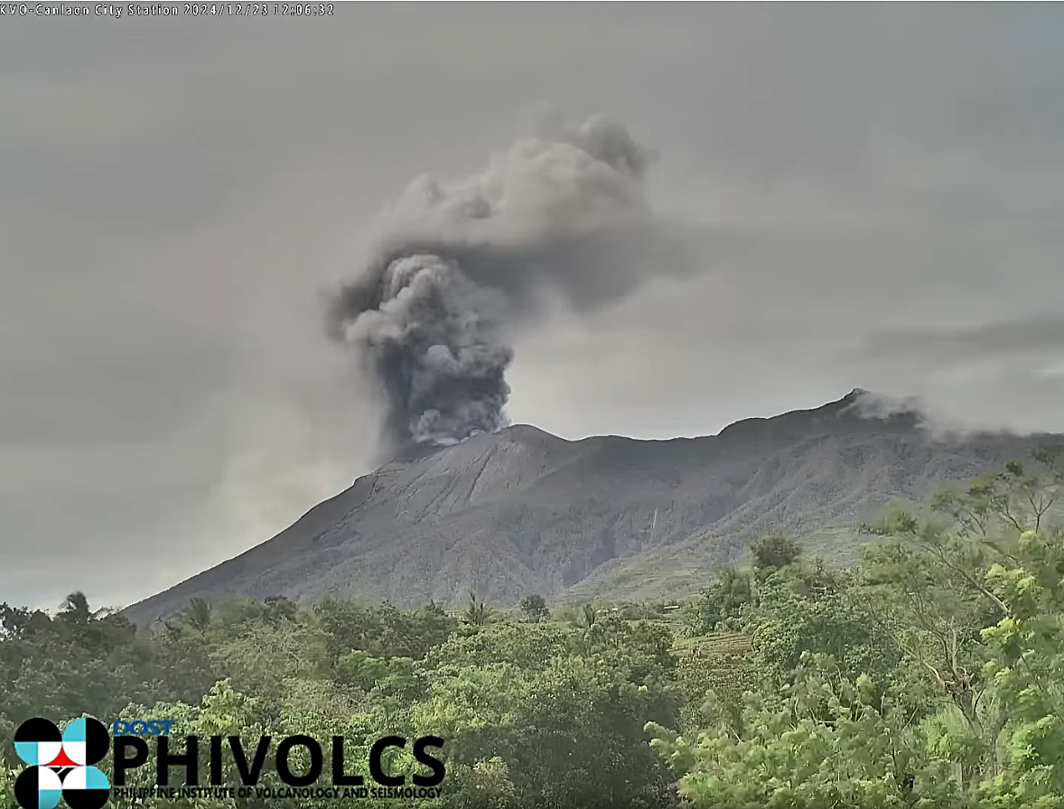
KANLAON VOLCANO ADVISORY , 23 December 2024, 12:30 PM
Notice of increased volcanic ash emission at Kanlaon Volcano.
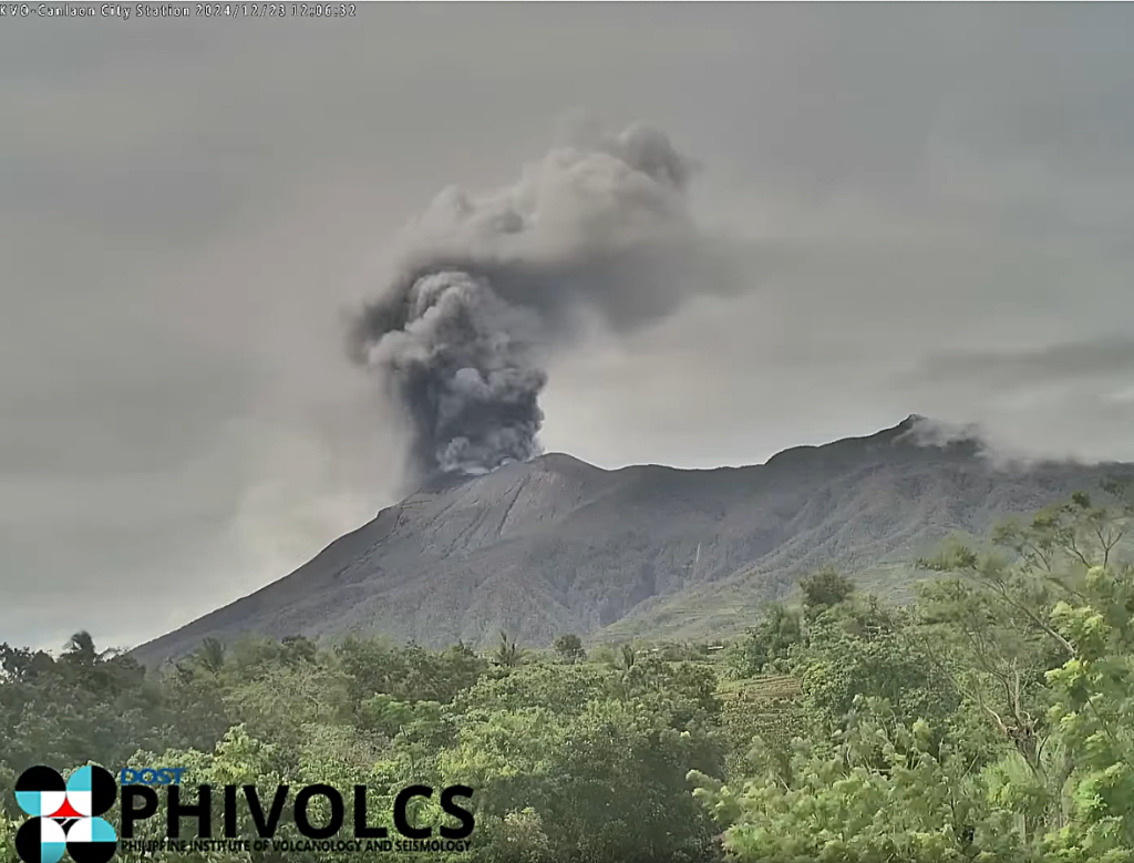
Since 11:45 am, dark ash has been issuing from the summit of Kanlaon Volcano accompanied by weak low frequency volcanic earthquake. This has produced a dark plume roughly 1.2 kilometers tall that is drifting to the northwest. Ash emission has been ongoing and ashfall is expected to fall over communities of Negros Occidental northwest to west of the volcano. All other parameters of the volcano remains elevated but are generally unchanged.
The public is reminded that Alert Level 3 (magmatic unrest) is raised over Kanlaon Volcano. This means that there are increased chances for sudden and even stronger explosive eruptions to occur and endanger communities at risk with life-threatening volcanic hazards. Communities within a six-kilometer radius of the summit crater must remain evacuated due to the danger of pyroclastic density currents or PDCs, ballistic projectiles and ashfall, lava flows, rockfalls and other related hazards.
Local government units and DRRM councils must also vigilantly monitor weather conditions in case heavy rainfall occurs and generates lahars and sediment-laden streamflows in channels draining the southern flanks of the volcano. Specifically, barangays of La Castellana and Canlaon City that have been impacted by PDCs, as well as barangays downstream of these especially those that have experienced lahars and muddy streamflows in June 2024, could be affected by channel-confined lahars of in case of heavy rains. Civil aviation authorities must also advise pilots to avoid flying close to the volcano’s summit as ash from any sudden eruption can be hazardous to aircraft. Lastly, local government units and DRRM councils are advised to prepare communities within the DOST-PHIVOLCS Pyroclastic Density Currents Hazard Map for potential evacuation in case unrest further escalates and hazardous worst-case explosive eruption becomes imminent.
DOST-PHIVOLCS maintains close monitoring of Kanlaon Volcano and any new development will be communicated to all concerned stakeholders.
Source : DOST-PHIVOLCS
Photo : capture ecran phivolcs
Indonesia , Ibu :
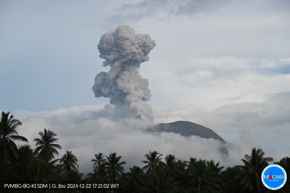
Mount Ibu erupted on Sunday, 22 December 2024 at 17:11 WIT with the height of the ash column observed at ±1,200 m above the summit (±2,525 m above sea level). The ash column was observed to be white to grey in colour, with moderate to thick intensity, oriented towards the North-East and East. This eruption was recorded on a seismograph with a maximum amplitude of 28 mm and a duration of 79 seconds.
VOLCANO OBSERVATORY NOTICE FOR AVIATION – VONA
Issued : December 22 , 2024
Volcano : Ibu (268030)
Current Aviation Colour Code : ORANGE
Previous Aviation Colour Code : orange
Source : Ibu Volcano Observatory
Notice Number : 2024IBU1303
Volcano Location : N 01 deg 29 min 17 sec E 127 deg 37 min 48 sec
Area : North Maluku, Indonesia
Volcanic Activity Summary :
Eruption with volcanic ash cloud at 08h11 UTC (17h11 local).
Volcanic Cloud Height :
Best estimate of ash-cloud top is around 8080 FT (2525 M) above sea level or 3840 FT (1200 M) above summit. May be higher than what can be observed clearly. Source of height data: ground observer.
Other Volcanic Cloud Information :
Ash cloud moving to northeast. Volcanic ash is observed to be gray. The intensity of volcanic ash is observed to be thick.
Remarks :
Eruption recorded on seismogram with maximum amplitude 28 mm and maximum duration 79 second.
Source et photo : Magma Indonésie .

