November 26 , 2024.
Iceland , Reykjanes Peninsula :
The Eruption Maintains Significant Power . Updated 25 November at 15:45 UTC
Activity has not decreased as quickly as it did in previous eruptions.
The rate of the flowing lava is comparable to the strongest eruptions at Fagradalsfjall.
The advancing lava flow may be exerting stress on the protective barriers at Svartsengi.
The hazard assessment remains unchanged.
Since yesterday in the early evening, volcanic tremor and visible activity from the eruption have further diminished, but the activity stabilized again after midnight. Nevertheless, the eruption remains quite powerful, and the activity has not decreased as quickly as it had in previous eruptions in the Sundhnúkur crater row. For comparison, the current lava flow is estimated to be on par with the most vigorous eruptions at Fagradalsfjall.
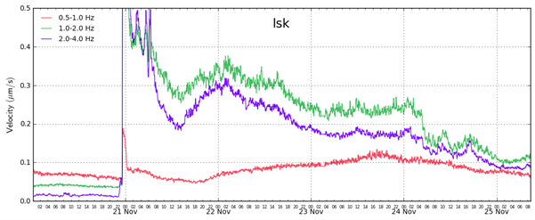
RSAM graph showing the average amplitude of volcanic tremor (green and blue lines) since the eruption began on November 20. A sharp decline in tremor occurred on the morning of November 24, with a further decrease that evening. Comparing the tremor graph of this eruption to those of previous eruptions shows that activity in this eruption has not decreased as rapidly as it did during previous eruptions at the Sundhnúkur crater row.
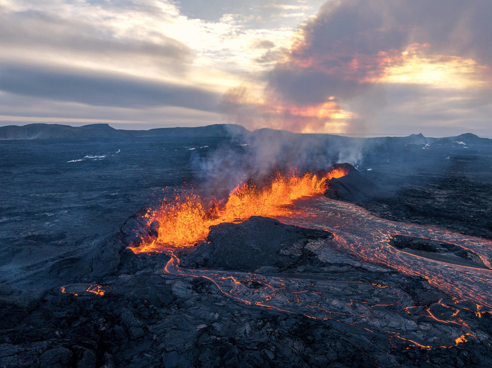
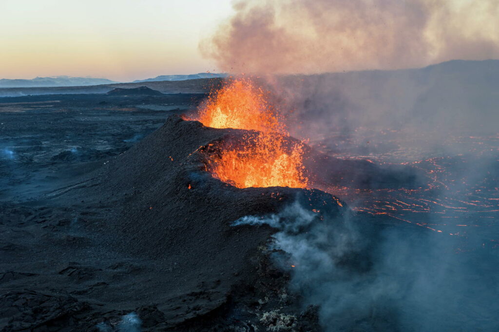
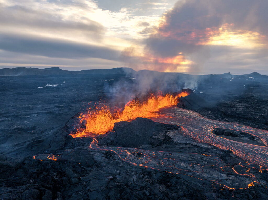
The northernmost vent is the most active, with the main lava flow now extending eastward from it. Overnight, sporadic splashes of lava were observed above the rim of the southernmost vent, but no activity has been observed there today. Similarly, the middle vent, which was the most active during the first days of the eruption, experienced a significant decrease in activity yesterday, and no activity is visible today on live webcams.
The lava flow that has been travelling westward has slowed and cooled on the surface. However, lava may still continue to flow beneath this solidified crust toward the protective barriers near Svartsengi and the Blue Lagoon, though its advance has significantly slowed.
Experts from the Icelandic Institute of Natural History measured the lava field’s spread on Saturday, about three days into the eruption. According to these measurements, the total volume of lava had reached about 43 million cubic meters, covering approximately 8.5 square kilometers. This is roughly 65% of the volume from the last eruption, which lasted 14 days.
Land continues to subside in Svartsengi, though at a slower rate compared to what was observed at the start of the eruption. It is still too early to determine whether magma accumulation will persist under Svartsengi. The flow of lava from eruptive vents needs to decrease further before any conclusions can be made about continued magma accumulation.
Important to Continue Monitoring Gas Pollution
Today, wind directions are shifting and becoming variable, meaning volcanic pollution could spread to the surrounding areas in the southwestern part of the country.
Source : IMO.
Photos : mbl . is/Hörður , mbl . is/Hörður Kristleifsson
Indonesia , Ibu :
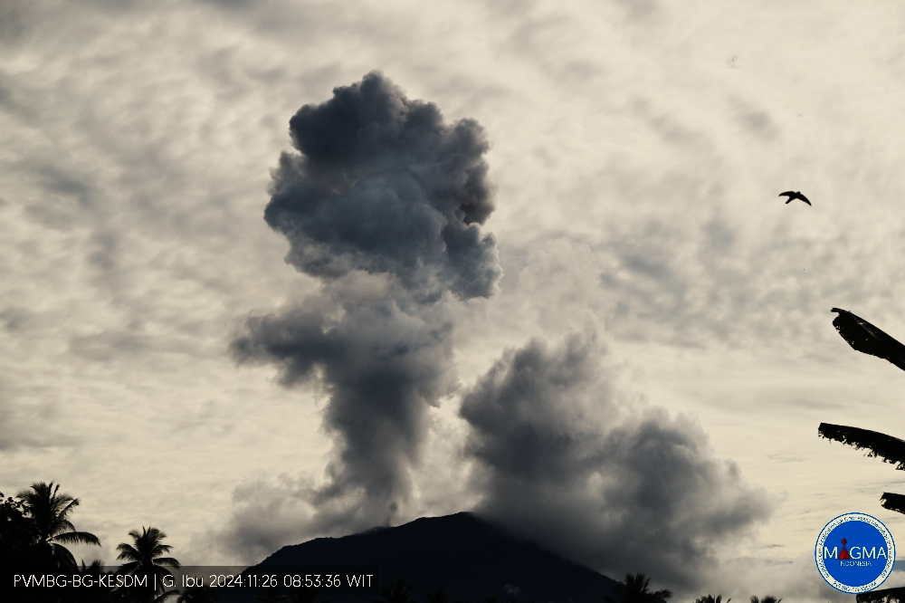
Mount Ibu exhibited an eruption on Tuesday 26 November 2024 at 08:49 WIT with the height of the ash column observed at ±2000 m above the summit (±3325 m above sea level). The ash column was observed to be grey with a thick intensity, oriented towards the West. This eruption was recorded on a seismograph with a maximum amplitude of 28 mm and a duration of 108 seconds.
VOLCANO OBSERVATORY NOTICE FOR AVIATION – VONA
Issued : November 26 , 2024
Volcano : Ibu (268030)
Current Aviation Colour Code : ORANGE
Previous Aviation Colour Code : orange
Source : Ibu Volcano Observatory
Notice Number : 2024IBU1178
Volcano Location : N 01 deg 29 min 17 sec E 127 deg 37 min 48 sec
Area : North Maluku, Indonesia
Summit Elevation : 4240 FT (1325 M)
Volcanic Activity Summary :
Eruption with volcanic ash cloud at 23h49 UTC (08h49 local).
Volcanic Cloud Height :
Best estimate of ash-cloud top is around 10640 FT (3325 M) above sea level or 6400 FT (2000 M) above summit. May be higher than what can be observed clearly. Source of height data: ground observer.
Other Volcanic Cloud Information :
Ash cloud moving to west. Volcanic ash is observed to be gray. The intensity of volcanic ash is observed to be thick.
Remarks :
Eruption recorded on seismogram with maximum amplitude 28 mm and maximum duration 108 second.
Source et photo : Magma Indonésie .
Philippines , Taal :
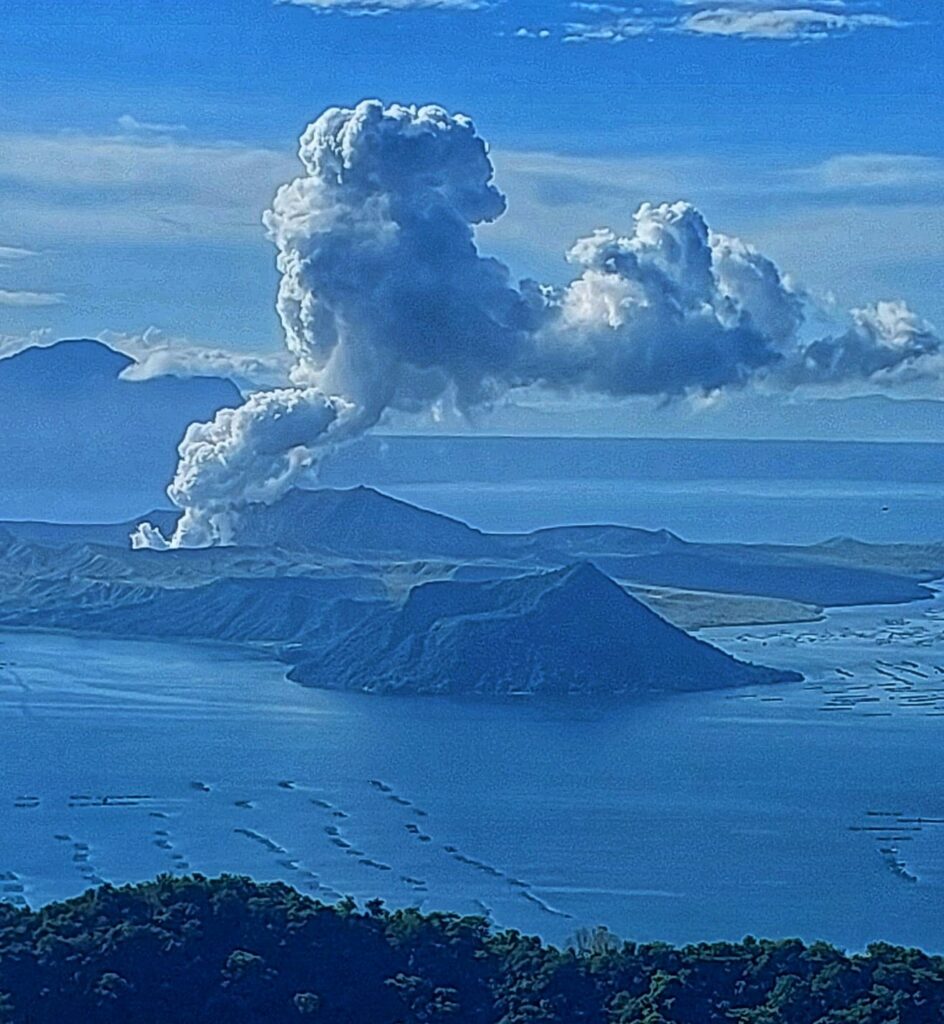
Taal Volcano in Batangas has shown an increase in sulfur dioxide emissions, the Philippine Institute of Volcanology and Seismology (Phivolcs) reported Tuesday.
In its 24-hour observation, Phivolcs said the volcano emitted 7,580 tons of sulfur dioxide on Monday, up from the 3,997 tons released the previous day.
The volcano also emitted plumes as high as 600 meters that drifted westward.
The seismicity recorded 7 volcanic earthquakes including 1 volcanic tremor (lasting 13 minutes).
There is a long-term deflation of the Taal Caldera and a short-term inflation of the general northern and southeastern flanks of Taal Volcano Island.
RECOMMENDATION:
Entry into Taal Volcano Island (Permanent Danger Zone or PDZ), particularly the main crater and Daang Kastila fissures, and occupation and navigation on Taal Lake is prohibited, as well as piloting any aircraft in the vicinity of the volcano
Sources : Inquirer.net , Phivolcs .
Photo : Auteur inconnu
Peru , Sabancaya :
Analysis period: from November 18, 2024 to November 24, 2024, Arequipa, November 25, 2024
Alert level: ORANGE
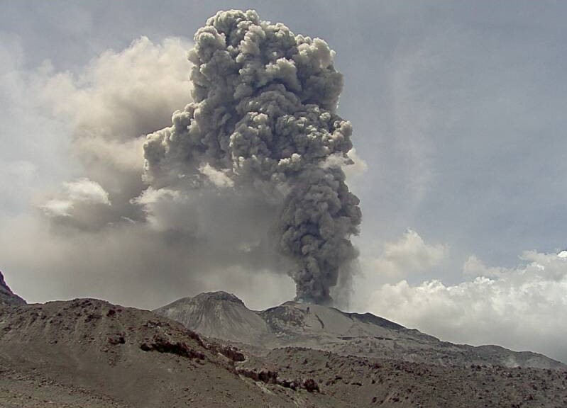
The Geophysical Institute of Peru (IGP) reports that the eruptive activity of the Sabancaya volcano continues. During this period, an average of 7 explosions per day have been recorded, with columns of ash and gas up to 1000 m above sea level above the summit of the volcano. Therefore, the volcanic alert level remains at ORANGE
The IGP has recorded and analyzed the occurrence of 203 earthquakes of volcanic origin, associated with the circulation of magmatic fluids inside the Sabancaya volcano, as well as earthquakes related to rock fracturing. An average of 7 explosions per day have been recorded.
Columns of ash and gas have been observed up to 1000 m above sea level above the summit of the volcano. The predominant direction of these emissions has been towards the western sector of the volcano over a distance of less than 10 KM.
A slight inflation process continues to be recorded in the northern sector (around the Hualca Hualca volcano).
Satellite recordings have identified the presence of a thermal anomaly, with a maximum value of 1 MW, associated with the presence of a lava body on the surface of the volcano’s crater.
Moderate emissions (340 tons/day) of sulfur dioxide (SO2) have been observed
RECOMMENDATIONS
• Maintain the orange volcanic alert level.
• Do not approach within a radius of less than 12 km of the crater.
Source : Cenvul
Photo : Ingemmet (2017).
Mexico , Popocatepetl :
November 25, 11:00 (November 25, 17:00 GMT),
Activity in the last 24 hours
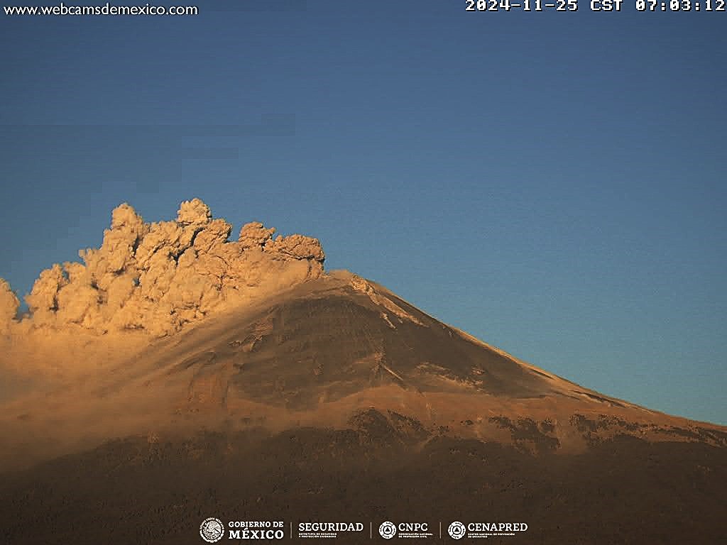
42 exhalations were detected, accompanied by water vapor, volcanic gases and small amounts of ash. In addition, 258 minutes of low amplitude tremor were recorded (180 minutes of high frequency tremor and 78 minutes of harmonic tremor).
During the morning and at the time of this report, a continuous emission of water vapor, volcanic gases and ash was observed, with dispersion towards the Southwest.
The Popocatépetl volcanic alert fire is in yellow phase 2.
The scenarios anticipated for this phase are:
A few small to moderate explosions
Occurrence of tremors of varying amplitude
Light to moderate ash rains in the surrounding towns and in some more distant towns
Ejection of incandescent fragments within the 12-kilometer exclusion radius
The occurrence of lahars can be expected to descend into the ravines, due to the accumulation of ash on the slopes and their interaction with the rains expected in the coming weeks.
Possibility of pyroclastic flows not reaching the populations.
Source et photo: Cenapred.

