November 23 , 2024.
Iceland : Reykjanes Peninsula :
Three Vents are Active Along the Eruptive Fissure
Land subsidence continues at Svartsengi
Updated 22. November at 15:30 UTC
Eruptive activity in three vents has been relatively steady since yesterday
The progression of the lava flow slows significantly near Svartsengi
Land subsidence is occurring at Svartsengi
The hazard assessment has been updated, and it is valid until 25 November if conditions remain unchanged
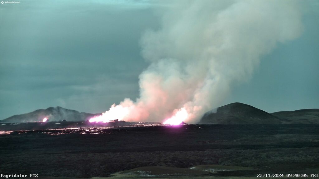
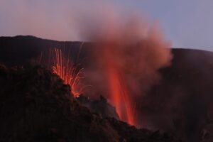
A photograph captured at 9:40 this morning via the Icelandic Meteorological Office’s webcam in Fagradalsfjall. The camera faces southwest, showing three active areas along the eruptive fissure. Stóra-Skógfell can be seen on the right side of the image, while Þorbjörn appears in the background on the left.
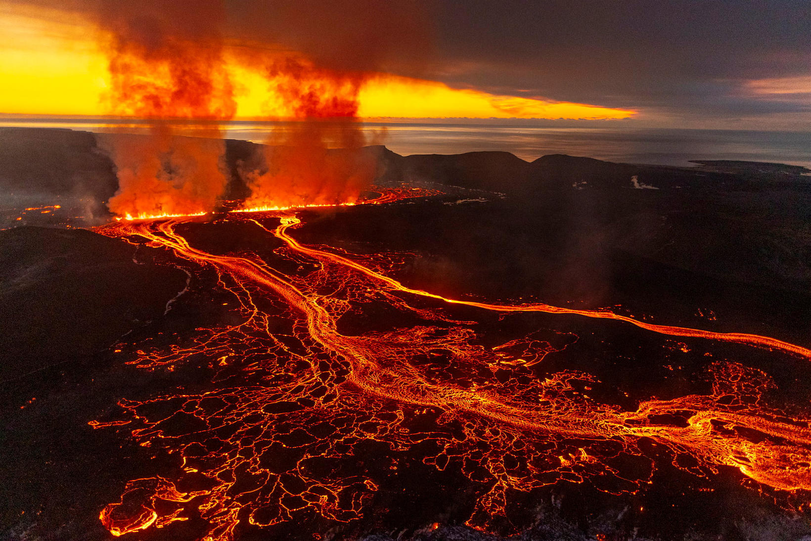
Since yesterday, three areas along the eruptive fissure between Stóra-Skógfell and Sýlingarfell have been active. Activity in these areas remained fairly stable overnight, with the central vent showing the highest activity levels. Minor changes have been observed in volcanic tremor, consistent with stable activity in the eruption.
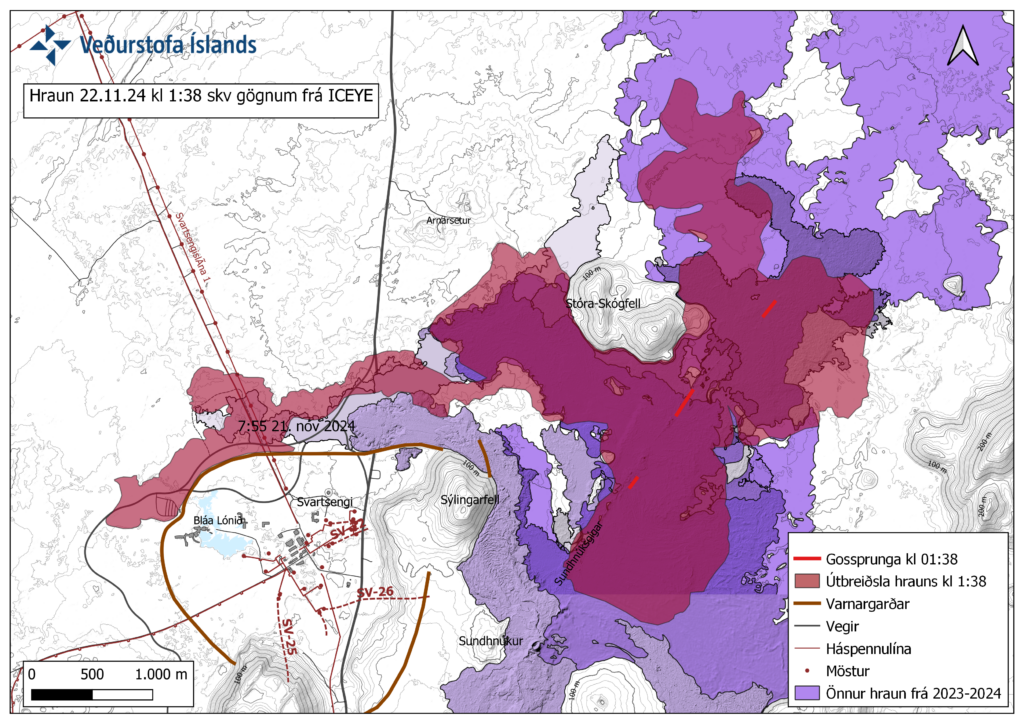
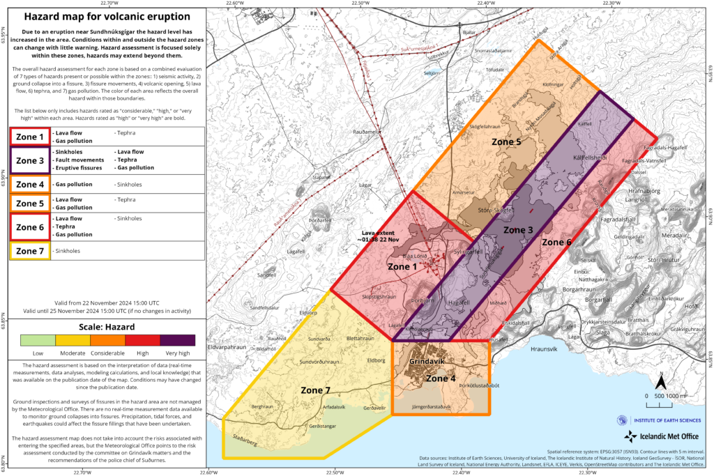
Map showing the extent of the lava flow as of 1:38 AM, based on satellite imagery from Iceye.
The lava is flowing primarily westward, originating from the central vent. Lava from the southern and northern parts of the fissure flows predominantly eastward but poses no threat to infrastructure. Near the protective barriers at Svartsengi, the lava’s advance has slowed significantly. The lava tongue has encountered obstacles in the terrain at that location, spreading northward from the barriers and thickening. Compared to the initial phase of the eruption, the lava flow from the eruptive fissure has decreased considerably. However, a significant lava flow persists from the active craters, especially toward the west.
Land subsidence continues at Svartsengi
Land continues to subside at Svartsengi, consistent with significant magma outflow to the eruption. Approximately 10 million cubic meters of magma erupted during the first few hours, representing about half of the volume that had accumulated in the magma chamber since the last eruption. The pattern of subsidence at Svartsengi is similar to what was observed during the initial phases of the last two eruptions. Land subsidence is expected to continue as long as the injection of magma from the reservoir towards the eruptive fissure remains high.
Hazard Assessment Updated
The hazard assessment has been updated and, barring any changes, is valid until 3:00 PM on 25 November. The main update is that the overall risk in Zone 4 (Grindavík) is now assessed to be considerable (orange).
According to measurements and visual inspections conducted yesterday by geological survey teams from ÍSOR, EFLA, and Verkís, there were no clear signs of new fractures or movements on existing fractures in Grindavík. As a result, fissure-related ground collapse has been downgraded as a hazard to the level it was before the present eruption began.
The possibility of lava flow and ashfall in Zone 4 (Grindavík) is assessed to be lower since no lava is moving toward the town. However, because of prevailing wind conditions in the coming days, gas pollution levels could be high in Grindavík. There are no changes to the overall hazard levels in other areas.
Gas Dispersion Forecast: Today, a northeasterly wind is expected, and tomorrow gas pollution will move southwest toward Grindavík and Svartsengi.
Source : IMO
Photos : IMO , mbl.is/Árni Sæberg.
Indonesia , Ibu :
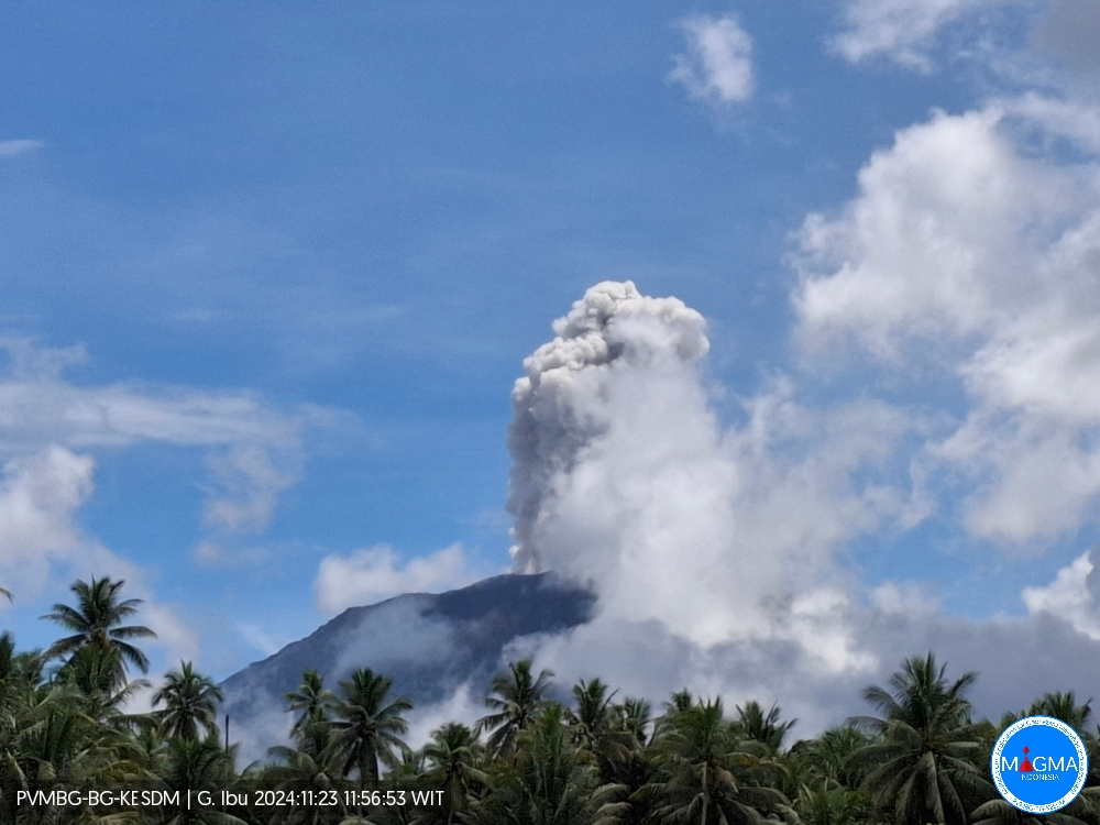
An eruption of Mount Ibu occurred on Saturday, 23 November 2024 at 11:55 WIT with the height of the ash column observed at ± 800 m above the summit (± 2,125 m above sea level). The ash column was observed to be white to grey in colour with a thick intensity, oriented towards the South-West. This eruption was recorded on a seismograph with a maximum amplitude of 28 mm and a duration of 65 seconds.
VOLCANO OBSERVATORY NOTICE FOR AVIATION – VONA
Issued : November 23 , 2024
Volcano : Ibu (268030)
Current Aviation Colour Code : ORANGE
Previous Aviation Colour Code : orange
Source : Ibu Volcano Observatory
Notice Number : 2024IBU1151
Volcano Location : N 01 deg 29 min 17 sec E 127 deg 37 min 48 sec
Area : North Maluku, Indonesia
Summit Elevation : 4240 FT (1325 M)
Volcanic Activity Summary :
Eruption with volcanic ash cloud at 02h55 UTC (11h55 local).
Volcanic Cloud Height :
Best estimate of ash-cloud top is around 6800 FT (2125 M) above sea level or 2560 FT (800 M) above summit. May be higher than what can be observed clearly. Source of height data: ground observer.
Other Volcanic Cloud Information :
Ash cloud moving to southwest. Volcanic ash is observed to be white to gray. The intensity of volcanic ash is observed to be thick.
Remarks :
Eruption recorded on seismogram with maximum amplitude 28 mm and maximum duration 65 second.
Source et photo : Magma Indonésie .
Chile , Copahue :
Seismology
The seismological activity of the period was characterized by the recording of:
8 seismic events of type VT, associated with the fracturing of rocks (Volcano-Tectonic). The most energetic earthquake had a Local Magnitude (ML) value equal to 0.6, located 6.5 km to the North-Northeast of the volcanic edifice, at a depth of 4.4 km from the crater.
3 seismic events of type LP, associated with the dynamics of fluids inside the volcanic system (Long Period). The size of the largest earthquake evaluated from the Reduced Displacement (DR) parameter was equal to 1 cm2.
Fluid Geochemistry
The sulfur dioxide (SO2) emissions data obtained by the Differential Optical Absorption Spectroscopy (DOAS) equipment, corresponding to the Mellizas station, installed 6 km east-northeast of the active crater, presented an average value of 517 ± 90 t/d, with a maximum value of 1,240 t/d on November 4. An increase in the number of measurements associated with the current dynamics of continuous degassing is observed, indicating a greater availability of gas.
No anomalies have been reported in sulfur dioxide (SO2) emissions into the atmosphere in the area near the volcano, according to data published by the Tropospheric Monitoring Instrument (TROPOMI) and the Sulfur Dioxide Group of the Ozone Monitoring Instrument (OMI).
Thermal anomalies by satellites
During the period, no thermal alerts were recorded in the area associated with the volcano, according to the analytical processing of Sentinel 2-L2A satellite images, in combination with false color bands.
Geodesy
According to the data obtained using the radar interferometry technique (InSar), no changes associated with deformation are observed in the volcanic system.
Surveillance cameras
The images provided by the fixed cameras, installed near the volcano, recorded degassing columns whose maximum height was observed on November 6, at 860 m above the crater level. During the fortnight, no presence of pyroclasts was observed in the gas columns, nor new deposits of autumn materials, nor any nocturnal incandescence recorded.
Satellite geomorphological analysis
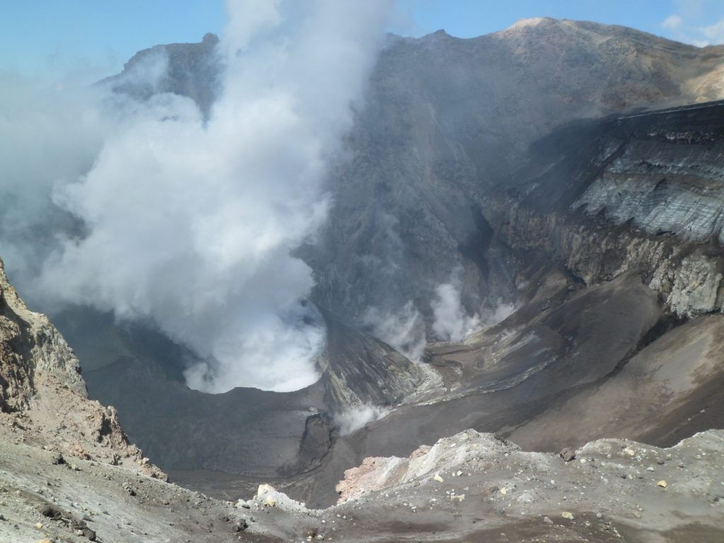
Based on the photo-interpretation of the Planet Scope and Skysat Collect satellite images, the appearance of a body of water inside the active crater since the last days of October stands out. No new pyroclastic fall deposits are observed attributable to the occurrence of explosions during the fortnight.
Volcanic activity has shown a decrease in both the recurrence and energy of the recorded seismic signals, as well as its surface activity, dominated by whitish degassing columns, with low output power and without pyroclastic content. In turn, at the bottom of the crater, a partial restitution of the crater lake is detected through satellite images, a key aspect of the ongoing assessment. However, due to a greater presence of sulfur dioxide and although other monitoring parameters show a decreasing trend, it is presumed that the volcanic system has not yet returned to the equilibrium observed in previous months.
Therefore, the technical alert is maintained at:
YELLOW TECHNICAL ALERT: Changes in the behavior of volcanic activity
Observation:
Given the behavior of this volcanic system observed in recent years, sudden, small-scale explosions without precursors affecting the immediate surroundings of the active crater cannot be ruled out. However, in the context of its base level, this type of event has not been frequent, which is why it is considered to have a low probability of occurrence. The hazards associated with this minor activity consist of the ejection of ballistic pyroclasts, the emission of ash and volcanic gases.
Source : Sernageomin
Photo : Dario G. Lazo ( 2020 )
La Martinique , Mount Pelée :
Weekly report, Institut de physique du globe de Paris / Observatoire volcanologique et seismologique de Martinique
Activity of Mount Pelée
Saint-Pierre, November 22, 2024 at 4:00 p.m. local time (GMT-4)
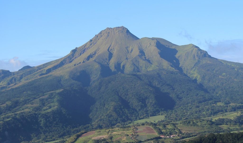
Volcanic activity is increasing this week with 62 earthquakes of volcanic origin observed.
Between November 15, 2024 at 4:00 p.m. (UT) and November 22, 2024 at 4:00 p.m. (UT), the OVSM recorded 62 low-energy volcano-tectonic earthquakes. These earthquakes were clearly identified as originating from one of the well-known seismically active zones at Mount Pelée, located between 1.0 and 1.4 km deep below the summit of the volcano. The superficial volcano-tectonic seismicity is associated with micro-fracturing in the volcanic edifice linked to the global reactivation of the volcano observed since the end of 2018.
No earthquake was felt by the population.
The previous week, the OVSM had recorded 13 earthquakes of volcanic origin. As of November 22, 2024 and during the last 4 weeks, the OVSM has therefore observed a total of 99 volcanic earthquakes, an average of 24 to 25 earthquakes per week.
During the volcanic reactivation phases of volcanoes similar to Mount Pelée, it is usual to observe seismic activity that varies in intensity and frequency.
For more details on observations and interpretations of volcanic activity over the longer term, refer to the OVSM monthly bulletins.
The alert level is currently YELLOW: vigilance.
Source : Direction de l’OVSM-IPGP.
Photo : OVSM IPGP.
Costa Rica , Rincón de la Vieja / Poas :
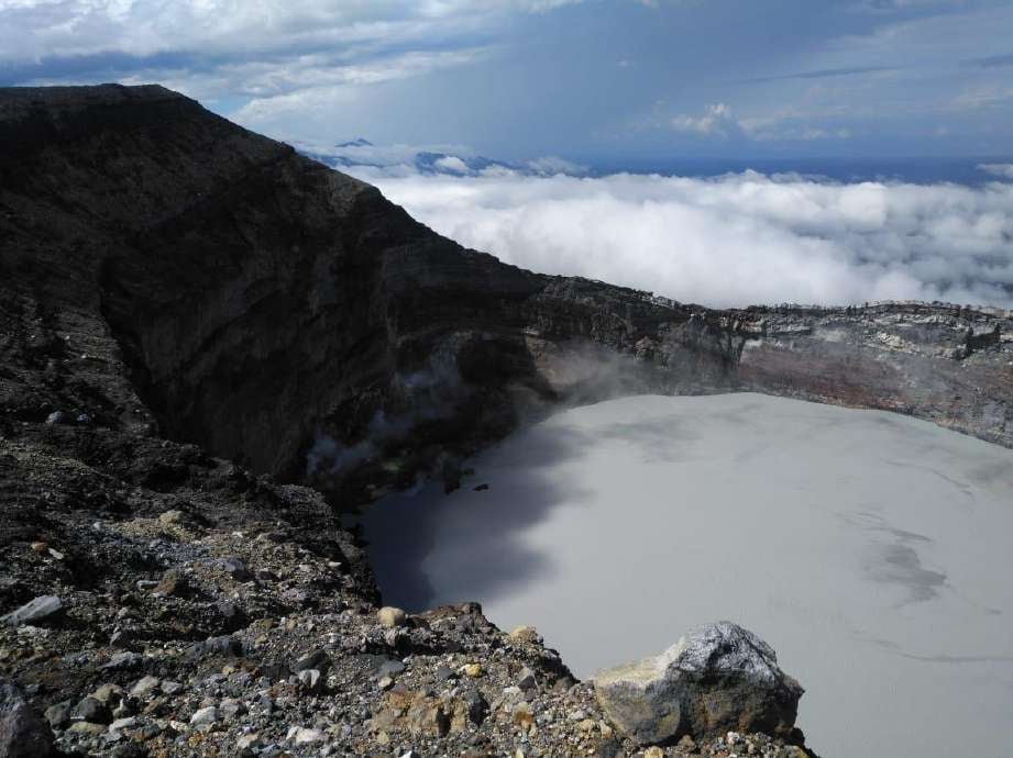
Rincón de la Vieja Volcano
Latitude: 10.83
Longitude:-85.324
Altitude: 1,916 meters
Observed activity:
A continuous tremor persists with a dominant frequency of 2 Hz. Geodetic measurements indicate that the deformation of the volcanic edifice is not significant. Currently, the Rincón de la Vieja volcano emits 265 tons of SO2 per day into the atmosphere.
Environmental conditions:
Cloudy weather at the summit, with southwest wind (3 m/s).
Activity level: Warning (2)
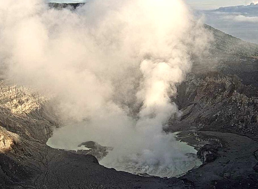
Poas Volcano
Latitude: 10.2
Longitude: -84,233
Altitude: 2,687 meters
Observed activity:
The level of Laguna Caliente continues to rise. The volcanic tremor is continuous, of low amplitude and with a frequency range of 2 to 7 Hz. The CO2/SO2, H2S/SO2 gas ratios and the SO2 concentration are stable: 0.82; 0.10 and 14.06 ppm; respectively. This morning at the visitor viewpoint, around 9:15, a maximum concentration of 2.5 ppm of SO2 was recorded. Geodetic measurements show that the deformation of the volcanic edifice is not significant.
Environmental conditions:
Clear weather at the summit, with southwest wind (2 m/s).
Activity level: Warning (2)
Source : Ovsicori.
Photos : Waldo Taylor / ICE , Ovsicori .

