November 14 , 2024.
Indonesia , Lokon-Empung :
The Pusat Vulkanologi dan Mitigasi Bencana Geologi (PVMBG) reported increased seismic activity at Lokon-Empung since 31 October. During 6-12 November daily gas-and-steam emissions rose 10-20 m above the summit and drifted multiple directions. Between 32 and 154 shallow volcanic earthquakes were recorded each day. Due to the increased activity, PVMBG raised the Alert Level from 2 to 3 (on a scale of 1-4) at 22h00 on 10 November, and the public was warned to stay 3 km away from the crater.
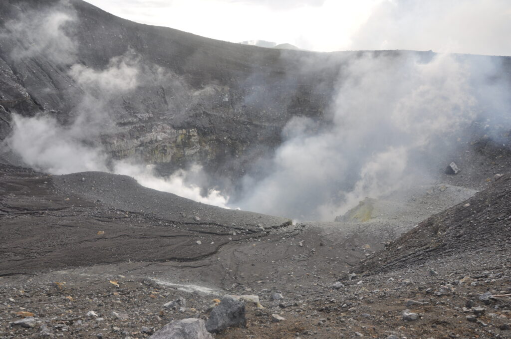
The Lokong-Empung volcanic complex, rising above the plain of Tondano in North Sulawesi, includes four peaks and an active crater. Lokon, the highest peak, has a flat craterless top. The morphologically younger Empung cone 2 km NE has a 400-m-wide, 150-m-deep crater that erupted last in the 18th century. A ridge extending 3 km WNW from Lokon includes the Tatawiran and Tetempangan peaks. All eruptions since 1829 have originated from Tompaluan, a 150 x 250 m crater in the saddle between Lokon and Empung. These eruptions have primarily produced small-to-moderate ash plumes that sometimes damaged croplands and houses, but lava-dome growth and pyroclastic flows have also occurred.
Seismicity observation:
32 shallow volcanic earthquakes with an amplitude of 3 to 7 mm and an earthquake duration of 3 to 4 seconds.
1 emission earthquake with an amplitude of 22 mm, and an earthquake duration of 13 seconds.
1 distant tectonic earthquake with an amplitude of 12 mm, and the earthquake lasted 125 seconds.
Recommendation
(1) The public and tourists should not approach and carry out activities within a 3 km radius of the Tompaluan Crater (activity center).
(2) In the event of an eruption and ashfall, people are advised to stay indoors and, when outside the house, use nose, mouth (mask) and eye protection (goggles).
(3) Soyez conscient du potentiel de lahars dans les rivières qui prennent leur source au sommet du mont Lokon, en particulier pendant la saison des pluies.
Sources : PVMBG , GVP.
Photo : G Vitton ( 2019).
Indonesia , Lewotobi Laki-laki :
The Pusat Vulkanologi dan Mitigasi Bencana Geologi (PVMBG) reported that eruptive activity at Lewotobi Laki-laki remained at a high-level during 5-12 November, producing tall ash plumes, explosions, pyroclastic flows, and a lava flow, which all significantly affected residents, infrastructure, and transportation. The Badan Nasional Penanggulangan Bencana (BNPB) reported that as of 5 November there were 2,472 people spread across three evacuation shelters. A total of nine people had died (six from one family according to a news article) from the eruptive events that occurred during 3-4 November, 63 were injured, and five people remained in the hospital, one was critically injured. Information about damage to homes and infrastructure was incomplete because the exclusion zone and ongoing eruption prevented evaluations.
During 06h00-12h00 on 9 November the hazard exclusion zone was expanded to 9 km on the SW, W, and NW flanks of Laki-laki. Additional evacuation centers opened in SDK Eputobi (16 km NNE) in the Titehena District. Community members were assisting in food preparation, health workers offered care and psychological support to families, teachers were providing lessons to students, and surrounding communities helped with sanitation needs. By 20h00 on 9 November a total of 11,445 residents had evacuated. The Komodo Labuan Bajo Airport (317 km W) was closed during 9-10 November and at least 30 flights were cancelled. Ships were sent to transport people to areas with open airports.
According to a news report an eruption occurred early in the morning on 10 November; a photo showed streams on incandescent material covering the upper flanks. A webcam image captured at 18h14 showed a possible lava flow on the upper W or NW flank. BNPB reported that on 10 November two evacuation posts, in Hikong and Kringa (12-15 km from the summit), that were being affected by ashfall were moved to East Flores. Ash plumes rose 1-6 km above the summit and drifted SW, W, NW, and N.
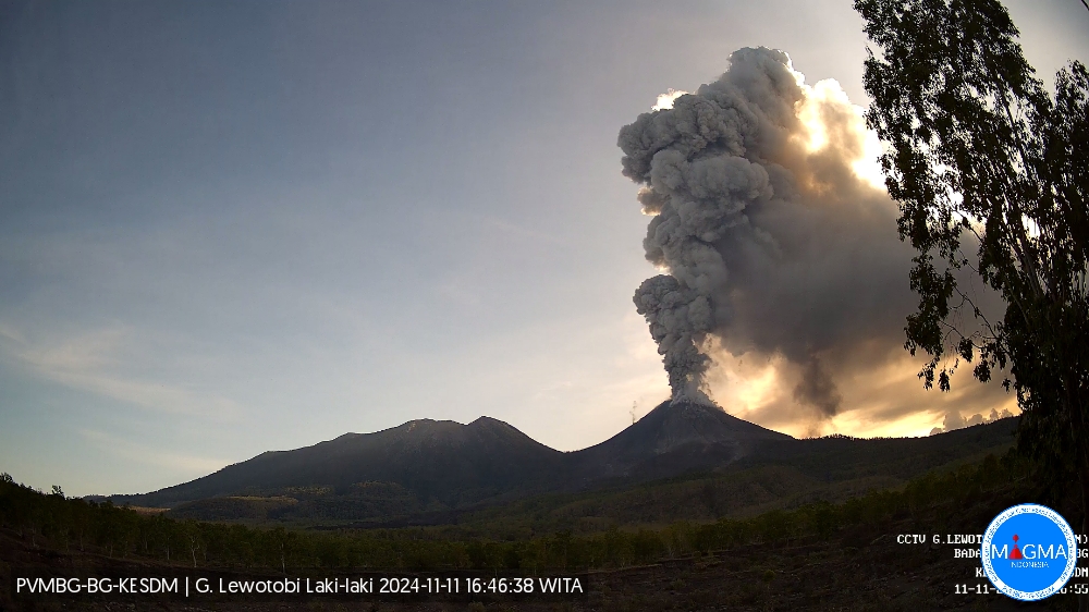
On 11 November airports that remained closed because of ashfall included the Komodo International Airport, the Francis Airport Xaverius Seda (60 km W), the H. Hasan Aroeboesman Airport (126 km WSW), the Soa Airport (190 km W), and Frans Xavier Seda Airport (252 km W). Ash plumes continued to be produced, rising 0.5-2.5 km above the summit and drifting SW, W, and NW. A webcam image at 20h06 showed incandescent material being ejected above the summit, and advancement of the lava flow on the NW flank.
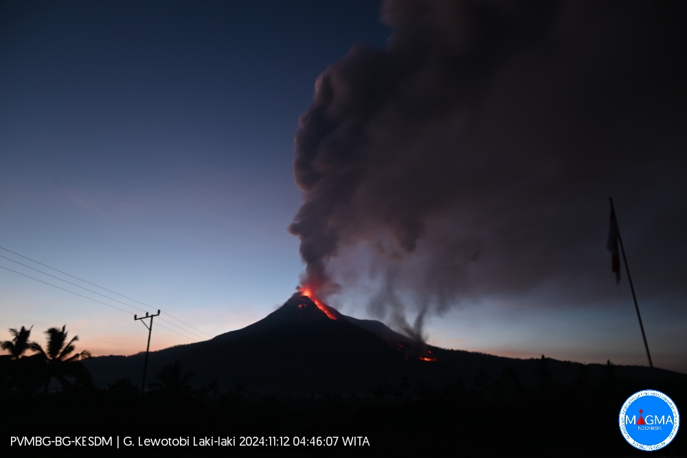
Ash plumes on 12 November rose as high as 9 km above the summit and drifted SW, W, and NW. Webcam images from 04h06 and 05h27 showed the advancing lava flow and a dark plume rising from possibly the end of the flow. A news report noted on 12 November that preliminary estimates suggested that around 2,700 housing units needed to be built for evacuees to be relocated. The H. Hasan Aroeboesman Airport, Gewayantana Airport (38 km NE), Frans Xavier Seda Airport, and Soa Airport in Bajawa among others remained closed. According to a news report about 84 flights in and out of Bali’s Gusti Ngurah Rai international airport (835 km W) were affected during the previous few days and on 13 November 90 international and domestic flights were cancelled. BNPB reported that by 13 November a total of 13,116 people were in evacuation shelters across eight locations.
Sources : PVMBG , GVP.
Japan , Sakurajima :
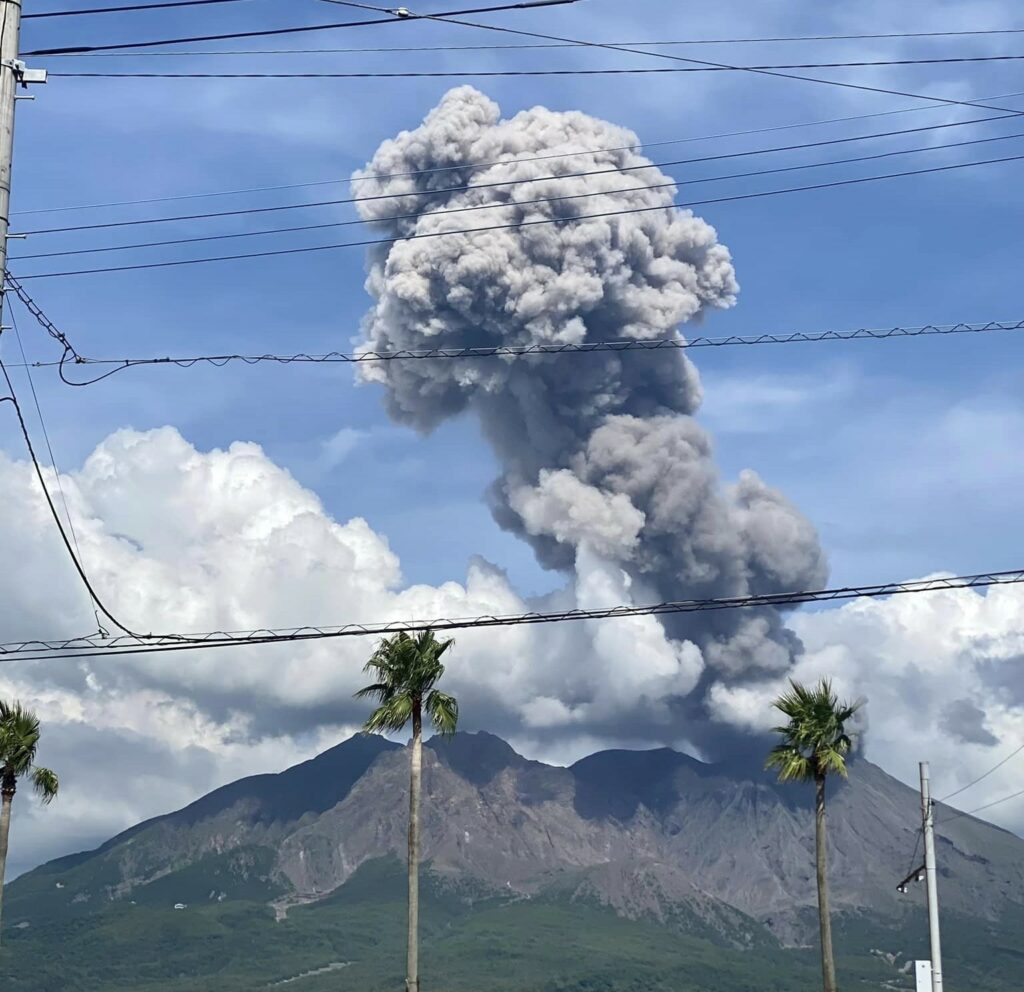
The Japan Meteorological Agency (JMA) reported ongoing eruptive activity at Minamidake Crater (Aira Caldera’s Sakurajima volcano) during 4-11 November. Nightly crater incandescence was visible in webcam images and very small eruptive events were periodically recorded. On 7 November sulfur dioxide emissions were very high, averaging 4,700 tons per day. The Alert Level remained at 3 (on a 5-level scale), and the public was warned to stay 1 km away from both craters.
The Aira caldera in the northern half of Kagoshima Bay contains the post-caldera Sakurajima volcano, one of Japan’s most active. Eruption of the voluminous Ito pyroclastic flow accompanied formation of the 17 x 23 km caldera about 22,000 years ago. The smaller Wakamiko caldera was formed during the early Holocene in the NE corner of the caldera, along with several post-caldera cones. The construction of Sakurajima began about 13,000 years ago on the southern rim and built an island that was joined to the Osumi Peninsula during the major explosive and effusive eruption of 1914. Activity at the Kitadake summit cone ended about 4,850 years ago, after which eruptions took place at Minamidake. Frequent eruptions since the 8th century have deposited ash on the city of Kagoshima, located across Kagoshima Bay only 8 km from the summit. The largest recorded eruption took place during 1471-76.
Sources : Japan Meteorological Agency (JMA), GVP.
Photo : Kumiko Nagai ( 08/2024)
Chile , Lascar :
Seismology
The seismological activity of the period was characterized by the recording of:
71 VT-type seismic events, associated with rock fracturing (Volcano-Tectonic).
119 LP-type seismic events, associated with fluid dynamics within the volcanic system (Long Period). The size of the largest earthquake evaluated from the Reduced Displacement (DR) parameter was equal to 13 cm2.
2 TR-type seismic events, associated with the dynamics maintained over time of fluids within the volcanic system (TRemor). The size of the largest earthquake evaluated from the Reduced Displacement (DR) parameter was equal to 1 cm2.
Fluid Geochemistry
The sulfur dioxide (SO2) emissions data obtained by the Differential Optical Absorption Spectroscopy (DOAS) equipment, corresponding to the Emú station, located 6 km in an East-Southeast direction from the active crater, presented an average value of 377 ± 77 t/d, with a daily maximum of 615 t/d on October 24.
No anomalies were reported in sulfur dioxide (SO2) emissions into the atmosphere in the area near the volcano, according to data published by the Tropopheric Monitoring Instrument (TROPOMI) and the Ozone Monitoring Instrument (OMI) Sulphur Dioxide Group.
Thermal anomalies by satellites
During the period, no thermal alerts were recorded in the area associated with the volcano, according to the analytical processing of Sentinel 2-L2A satellite images, in combination with false-color bands.
Geodesy
The data provided by the geodetic monitoring network, composed of 3 GNSS stations, do not indicate significant variations in the volcanic edifice. Low displacement rates are observed, with magnitudes lower than 0.6 cm/month, with no sustained trend over time.
Surveillance cameras
The images provided by the fixed camera, installed near the volcano, recorded regular degassing columns, with a maximum height of 560 meters on October 17.
The activity remained at levels considered low, suggesting stability of the volcano.
The volcanic technical alert is maintained at:
GREEN TECHNICAL ALERT: Active volcano with stable behavior – There is no immediate risk.
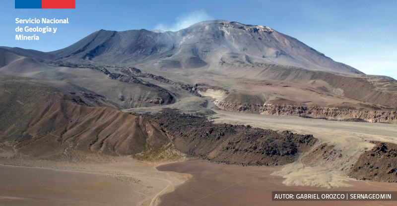
Source : Sernageomin
Photo : Sernageomin / Gabriel Orozco.
Italy , Stromboli :
Statement on the activity of Stromboli, 13 November 2024, 10:32 (09:32 UTC) .
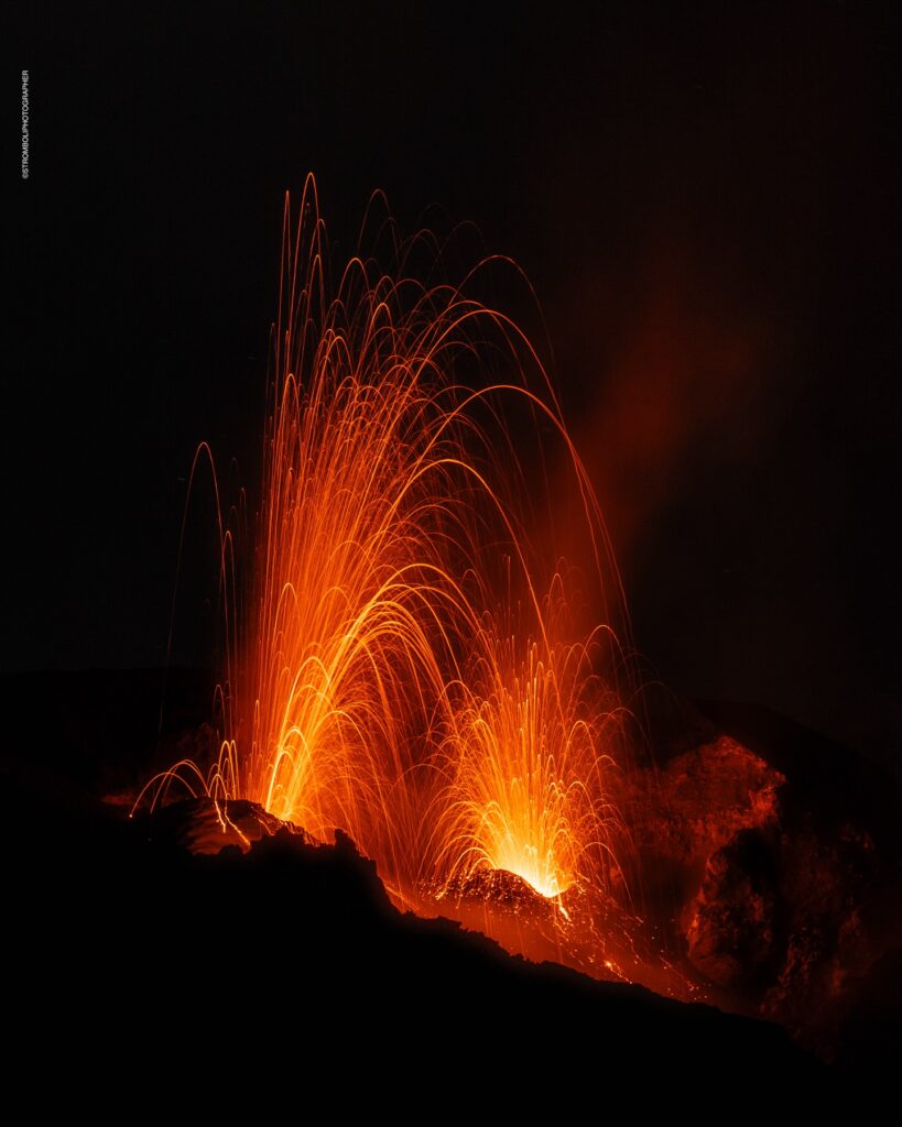
The National Institute of Geophysics and Volcanology, Osservatorio Etneo, reports that thanks to the analysis of the images from the surveillance cameras, it has been observed that the activity of projections from the area of the North crater, reported in the statement of 8 November at 07:44 UTC , continues, with variable frequency and intensity . The modest overflow of lava, described in the same statement, has ceased. Incandescent materials produced by explosive activity occasionally roll along the Sciara del Fuoco.
From a seismic point of view, in recent days, the average amplitude of volcanic tremor has almost always remained in the high range, reporting very high values for short periods; in the last hours, the amplitude oscillates between high and very high values. No significant changes have been reported in the frequency of occurrence and amplitude of explosion earthquakes.
Ground deformation monitoring networks do not show significant variations.
Further updates will be communicated shortly.
Source : INGV.
Photo : Stromboli stati d’animo / Sebastiano Cannavo

