November 05 , 2024.
Indonesia , Lewotobi Laki-Laki :
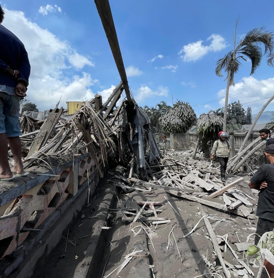
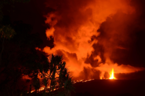
At least six people have died after the volcano erupted repeatedly in the east of the country.
“According to our coordination with local authorities, six deaths have been confirmed,” Abdul Muhari, a spokesman for Indonesia’s disaster mitigation agency, said in an interview with Kompas television.
Avi Mangota Hallan, head of emergency response and logistics for East Flores district, told German news agency DPA that rescue teams were still searching for potential victims trapped under collapsed houses.
The crater erupted just before midnight and again at 1:27 a.m. (17:27 UTC Sunday) and 2:48 a.m. local time.
The volcano has been spewing ash up to 2,000 meters (6,500 feet) into the air every day since Thursday.
Firman Yosef, head of the volcano monitoring station, said several houses had been burned, including a convent of Catholic nuns.
Hallan said the government had declared a state of emergency in the affected areas until December 31.
Indonesia’s volcanology agency raised the alert level to its highest rating.
It asked residents and tourists not to carry out activities within a seven-kilometer (4.3-mile) radius of the crater.
« There has been a significant increase in volcanic activity on Mount Lewotobi Laki-Laki, » the press release said.
He warned that there was a risk of lahar flooding caused by rain and asked residents to wear masks to avoid the effects of volcanic ash.
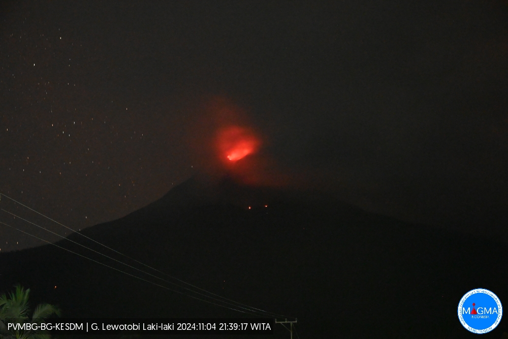
An eruption of Lewotobi Laki-Laki occurred on Monday, November 4, 2024, at 21:38 WITA with the height of the ash column observed at ± 300 m above the summit (± 1884 m above sea level). The ash column was observed to be gray in color with a thick intensity towards the southwest. This eruption was recorded on a seismograph with a maximum amplitude of 14.8 mm and a duration of 105 seconds.
Seismicity observation:
1 emission earthquake with an amplitude of 7.4 mm, and an earthquake duration of 37 seconds.
7 harmonic tremors with an amplitude of 7.4 to 10.5 mm and an earthquake duration of 14 to 130 seconds.
2 shallow volcanic earthquakes with an amplitude of 10.5 to 14.8 mm and an earthquake duration of 8 to 14 seconds.
1 distant tectonic earthquake with an amplitude of 47.3 mm, and an earthquake duration of 41 seconds.
Recommendation
1. Residents around Lewotobi Laki-Laki and visitors/tourists do not carry out any activities within a radius of 7 km around the eruption center of Lewotobi Laki-Laki.
2. The public should remain calm and follow the instructions of the Regional Government and not believe in rumors whose origin is unclear.
Source : DW . com , Magma Indonésie .
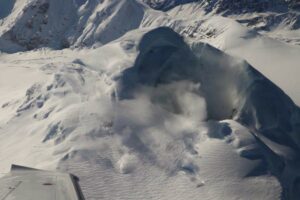
Photos : Magma Indonésie , Andi volcanist .
Iceland , Reykjanes Peninsula:
A short seismic sequence over the Sundhnúks crater series
No signs of deformation or pressure changes were observed on GPS meters, fiber optics or in HS-Orku boreholes, which could be indicative of magma flow.
Updated November 4, 15:20
The location of the earthquakes in areas similar to where the latest magma flows began
The seismic activity may indicate that a small amount of magma was moving
No earthquakes have been reported since last night and magma accumulation continues
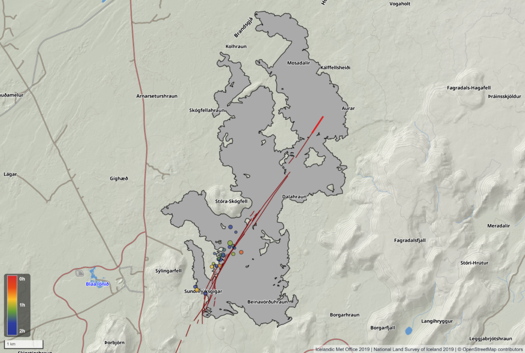
Between 2 and 3 am, there was a series of small earthquakes between Sýlingarfell and Stóra-Scógfell. More than twenty earthquakes of magnitudes close to and below M1.0 were measured at a depth of 3 to 6 km. The location of the earthquakes is very similar to earthquakes observed at the beginning of magma flows in the Sundhnúks crater series over the past year. The earthquakes were short-lived and no earthquakes have been recorded since 4 p.m.
The map shows the location of earthquakes between 2 and 4 p.m. The dark red lines are fissures on the Sundhnúks crater series from December 2023 to August 2024. The red line is the part of the fissure that was active the longest during the last eruption. The gray coverage shows the extent of lava formed during the last eruption from August 22 to September 5. The location of the eruption fissure and lava bed is based on data from the imaging team at the National Institute of Natural Sciences and Landmæling Iceland.
There was no sign of deformation of the GPS meters or fiber optic cables, nor of pressure changes in the HS-Orku boreholes at Svartsengi. When magma flowed from Svartsengi to the Sundhnúks crater series, these measuring devices showed clear signs of this.
One possible explanation for tonight’s seismic activity is that magma movements stopped before magma flow began. No signs of change in the magma accumulation beneath Svartsengi appeared on the Met Office meters after the earthquake.
According to the National Weather Service’s response plans, Civil Defence was informed of the earthquake and informed that experts were assessing whether magma flow had started. As there were no further signs of magma flow, it was decided to take no further action tonight.
Source et photo : vedur . is
Mexico , Popocatepetl :
November 4, 11:00 (November 4, 17:00 GMT) , Activity in the last 24 hours
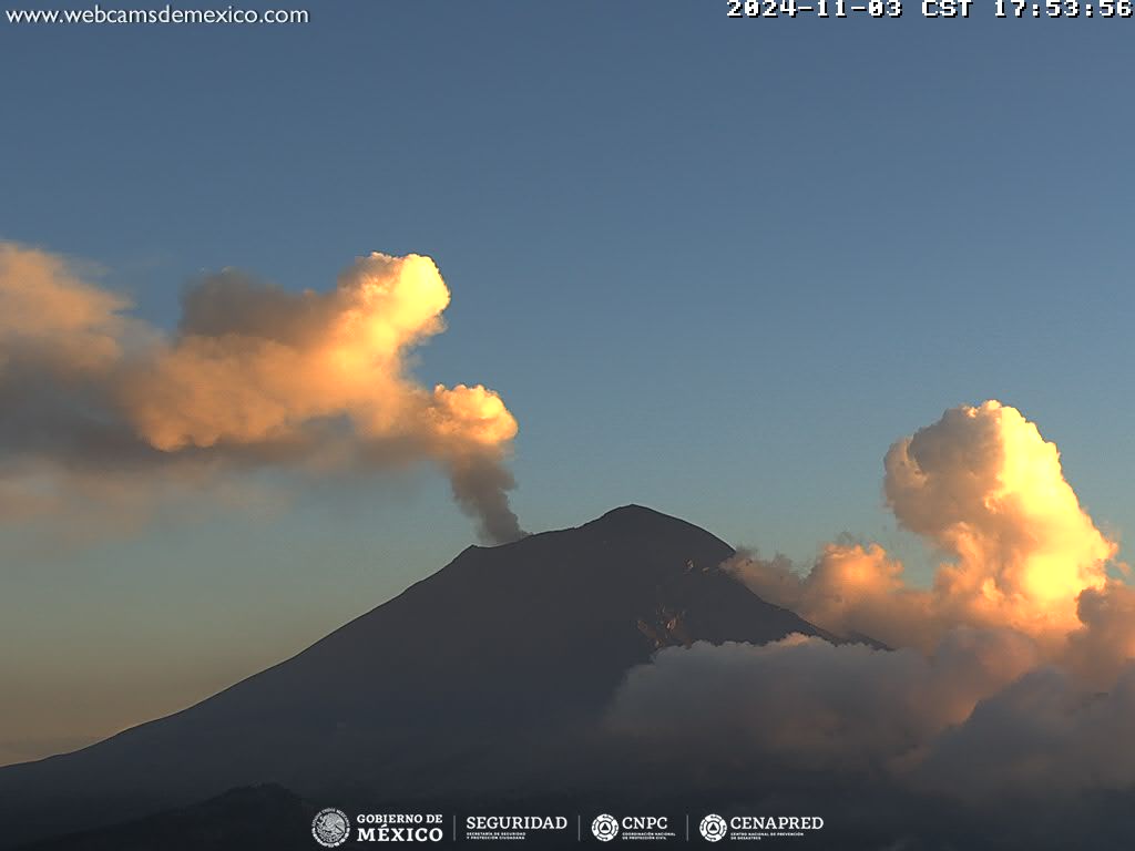
35 exhalations were detected, accompanied by water vapor, volcanic gases and ash . In addition, 1,072 minutes of high-frequency, low-to-medium amplitude tremors were recorded, as well as a smaller explosion .
At the time of this report, water vapor and volcanic gas emissions scattered to the northeast were observed .
The Popocatépetl volcanic fire alert is at yellow phase 2.
The scenarios anticipated for this phase are:
A few small to moderate explosions
Occurrence of tremors of varying amplitude
Light to moderate ash rains in the surrounding towns and in some more distant towns
Ejection of incandescent fragments within the 12-kilometer exclusion radius
The occurrence of lahars can be expected to descend into the ravines, due to the accumulation of ash on the slopes and their interaction with the rains expected in the coming weeks.
Possibility of pyroclastic flows not reaching the populations
Source et photo : Cenapred .
Indonesia , Dukono :
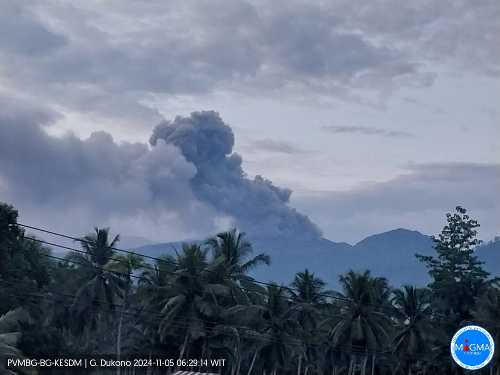
An eruption of Mount Dukono occurred on Tuesday, 5 November 2024 at 06:27 WIT with the height of the ash column observed at ±800 m above the summit (±1887 m above sea level). The ash column was observed to be white to grey in colour with a thick intensity, oriented towards the East. At the time of writing this report, the eruption was still ongoing.
Seismicity Observation:
248 eruption/explosion earthquakes with an amplitude of 6 to 27 mm and a seismic duration of 32.4 to 58.83 seconds.
6 deep tectonic earthquakes with an amplitude of 4-20 mm, and earthquake duration 58.9-78.44 seconds.
1 Continuous Tremor with an amplitude of 2 to 5 mm, dominant value of 3 mm.
Recommendation
(1) People around Mt. Dukono and visitors/tourists are advised not to do any activities, climb or approach the Malupang Warirang Crater within a radius of 3 km.
(2) Since eruptions with volcanic ash occur periodically and the distribution of ash follows the direction and speed of the wind, so the landing area of the ash is not fixed, people around Mount Dukono are advised to always carry masks/nose and mouth covers to use when needed to avoid the threat of volcanic ash on the respiratory system.
Source et photo : Magma Indonésie.
Costa Rica , Rincon de la Vieja / Poas :
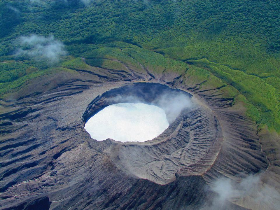
Rincón de la Vieja Volcano
Latitude: 10.83°N;
Longitude: 85.34°W;
Altitude: 1916 m
Current activity level: Warning.
This week, 7 exhalations and a small eruption were recorded. The eruption was recorded on October 30 at 08:46. The energy of these events is low and generates volcanic gas, water vapor, and aerosol emanations. None of the exhalations generated lahars or ash emissions. The background seismic and volcanic tremor remained at low and stable amplitudes until October 30. After this week’s eruption, the background seismic shaking increased in amplitude and continues to the day of this report. Sometimes, a variation in the dominant frequency of the tremor is observed after exhalations or eruptions. The appearance of long-period signals and « tornillo » type signals continues. The dominant frequency of « tornillos » shows a slight increase during this week. In recent weeks, there has been a slight contraction and subsidence of the base of the volcanic edifice and a slight uplift of the summit station. The MultiGas station recorded weekly averages of 1.6 ± 0.5 for CO2/SO2 and 0.11 ± 0.03 for H2S/SO2, values typical of magmatic gases. During the past week, the average SO2 flow rate was 641 ± 210 t/d, higher than the previous week (437 ± 210 t/d). No atmospheric SO2 detections have been made by the Sentinel-5P satellite since October 19.
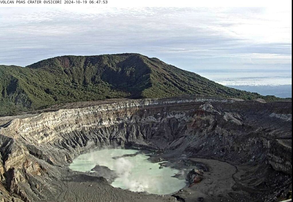
Poas Volcano
Latitude: 10.20°N;
Longitude: 84.23°W;
Altitude: 2687 m
Current activity level: Warning
Seismic tremor remains moderate to low amplitude and very stable. Frequent low-frequency, low-amplitude LP-type seismic events are recorded. Sporadic short tremors are recorded.
Geodetic observations do not detect significant deformation. The MultiGas station recorded weekly averages of 0.7 ± 0.2 for SO2/CO2 and 0.1 ± 0.3 for H2S/SO2. SO2 concentrations up to 4.9 ppm were recorded at the visitor viewpoint this week. Over the past week, the average SO2 flow rate was 160 ± 90 t/d, higher than the previous week (112 ± 61 t/d). No SO2 plumes have been detected in the atmosphere by the Sentinel-5P satellite since 17 October. The lake level has risen again this week with a significant rise of at least 0.6 m.
Source : Ovsicori .
Photos : Raul Mora / RSN / UCR ( 2020) , Ovsicori , 19/10/2024.

