October 22 , 2024.
New Zealand , White Island :
End of eruption at Whakaari/White Island, steam and gas emissions remain variable. Volcanic Alert Level lowered to Level 2 and Aviation Colour Code changed to Yellow.
Published: Tue Oct 22 2024 11:00 AM
Based on observations from a monitoring flight on 18 October 2024, recent images from GeoNet’s cameras, and satellite imagery, we can confirm that the recent minor eruptive activity Whakaari/White Island has now stopped, with no further ash emission from the volcano.
Based on observations from a monitoring flight on 18 October 2024, recent images from GeoNet’s cameras, and satellite imagery, we can confirm that the recent minor eruptive activity Whakaari/White Island has now stopped, with no further ash emission from the volcano.
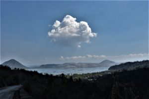
Observations from our flight have shown that the level of activity from the active vent area has decreased (Fig. 1), with no evidence of eruptive activity or ash emissions from the last couple of weeks. Additionally, Metservice has not detected any volcanic ash via satellite imagery since late September. As is fairly typical, Whakaari is now back to emitting a steam and gas plume, which sometimes reaches up to 1 km above the island when winds are calm. When the weather is clear, this plume can be seen from the Bay of Plenty coast and on the GeoNet cameras at Whakatāne and Te Kaha.
Figure 1. Image of the gas and steam plume at Whakaari/White Island on 18 October 2024 (B. Scott).
The Volcanic Alert Level is now lowered to Level 2 (Moderate-heightened unrest) and the Aviation Colour Code to Yellow. These levels acknowledge the current level of activity, but also reflect the degree of uncertainty about the level of unrest due to the current lack of consistent, usable real-time monitoring data. The level of volcanic activity could escalate back to levels seen over the last 5-7 weeks, although the likelihood of this is low.
Summary of the recent eruptive activity
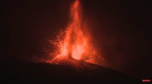
The recent eruptive episode at Whakaari/White Island started with a steam-driven eruption on 24 May 2024, creating a plume up to about 2.5 km above sea level and a thin, narrow ash deposit on the north flank. The crater lake level also noticeably dropped. Further steam-driven events occurred over the ensuing days. In the following weeks, the steam plume above Whakaari was unsteady and pulsatory. Simultaneously, emitted magmatic gas fluxes were elevated whilst the crater lake level continued to fall, largely disappearing in early July. Satellite data and aerial imagery captured from 8-12 July showed a new vent had been created, with vigorous steam and minor ash emissions; ballistic impacts up to 250 m from the vent; and a more widespread, but thin, local ashfall deposit. On 9 August, activity switched to a new vent which emitted a continuous low-altitude ash plume. This plume extended tens of kilometres downwind, occasionally reaching over the mainland whilst local ashfall also occurred near the island. This activity continued with varying rate until late-September/early-October at which time ash emissions gradually decreased and then stopped.
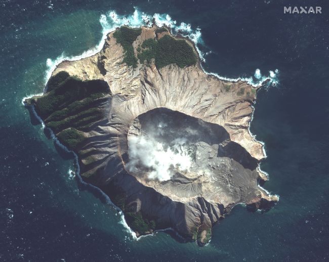
A satellite image of White Island taken on May 12, 2019 (Image credit: Satellite image ©2019 Maxar Technologies)
The observations suggest that at the start of the episode magma ascended beneath the volcano, evaporating the lake and driving the initial steam-driven eruptions from May until July. As the magma rose to the surface, it released significant quantities of magmatic gas. This released gas also entrained fragments of magma, producing the continuous ash plume that was first observed in August. As the amount of gas being released by the magma dropped, ash emission and eruptive activity eventually ended in September/October.
GNS Science’s Volcano Monitoring Group and National Geohazards Monitoring Centre will continue to closely monitor Whakaari/White Island for any changes in activity.
Source : Geonet / Paul Jarvis / Duty Volcanologist .
Photos : Brad Scott , Maxar Technologies.
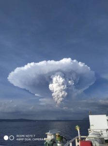
Philippines , Mayon :
LAHAR ADVISORY FOR MAYON VOLCANO UNDER TROPICAL STORM “KRISTINE” . 22 October 2024 , 11:45 AM
Based on the Tropical Cyclone Bulletin #6 issued at 11:00 AM today by the Philippine Atmospheric Geophysical and Astronomical Services Administration (PAGASA), tropical storm “KRISTINE” is expected to maintain its strength and bring heavy to intense rains over Bicol Region and Eastern Visayas today until tomorrow evening (23 October). These rains could generate volcanic sediment flows or lahars, muddy streamflows or muddy run-off in rivers and drainage areas of Mayon Volcano.
DOST-PHIVOLCS thus strongly recommends increased vigilance and readiness of communities in pre- determined zones of lahar and related hazards on this volcano. Prolonged and heavy rainfall may generate non-eruption lahars along river/stream channels draining the Mayon edifice. Potential lahars and sediment-laden streamflows may occur along the Miisi, Binaan, Anoling, Quirangay, Maninila, Masarawag, Muladbucad, Nasisi, Mabinit, Matanag, Bonga, Buyuan, Basud, and Bulawan Channels in Albay Province. Mayon lahars can threaten communities along the middle and lower slopes and downstream of these channels with inundation, burial and wash out.
DOST-PHIVOLCS strongly advises the communities and local government units of the above identified areas of risk to continually monitor the tropical storm conditions and take pre-emptive response measures for their safety from “KRISTINE.”
Source : DOST-PHIVOLCS
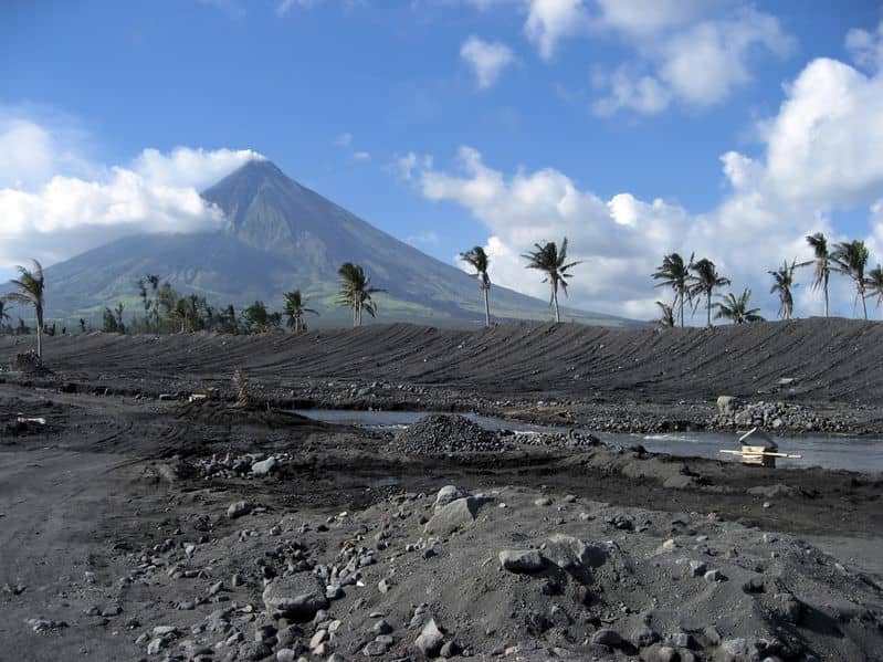
Photo : Archive 2018 , (auteur inconnu)
Colombia , Galeras :
San Juan de Pasto, October 15, 2024, 4:30 p.m.
From the monitoring of the activity of the Galeras volcano, the Colombian Geological Survey (SGC), an entity attached to the Ministry of Mines and Energy, reports that:
During the week of October 8 to 14, 2024, the activity of the volcano maintained a stable behavior. Compared to the previous week, the main variations in the monitored parameters were:
● Seismic activity presented similar levels both in terms of occurrence and energy released.
● Seismicity associated with the fracture of rocks within the volcanic system maintained its predominance, both in number of earthquakes and in energy levels.
● Fracture earthquakes were located mainly near the active cone, at distances between 0.3 and 2 km, with depths between 1 and 3 km from the summit of Galeras (4,200 m) and magnitudes less than 1.3.

● Columns of low-level white gas emissions were observed, both from the main crater and from the fumarole fields of Las Chavas, to the West; and El Paisita, to the North of the active cone, with variable dispersion due to wind action.
● The other volcanic monitoring parameters showed stability.
Based on the above, the SGC recommends closely monitoring the evolution through the weekly bulletins and other information published through our official channels, as well as the instructions of local and departmental authorities and the National Disaster Risk Management Unit (UNGRD).
Volcanic activity remains in yellow alert status: active volcano with changes in the behavior of the base level of the monitored parameters and other manifestations.
Source et photo : SGC
Iceland , Geysir geothermal area :
Increased activity in several hot springs in the Geysir Geothermal Area have been noticed since last Saturday, October 19. None of the instruments used in the real-time monitoring of natural hazards by the Met Office (seismometers, GPS or satellite images) have revealed the reasons for these changes.
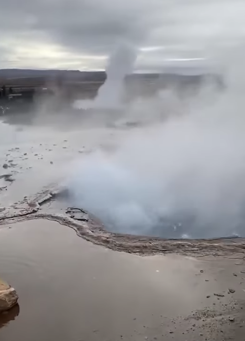
Representatives of the Icelandic Environmental Agency, including Park Rangers, have been to observe the area and confirm the activity is more intense than it has been. The hotspring named Strokkur is drawing particular attention as it has been having steam explosions that are higher (up to 30 meters), more powerful and more frequent than usual. Mud and small stones have been thrown up during these powerful steam explosions. The hotspring named Geysir (for which the area is named) hasn´t shown any changes.
Just now, specialists from the Environmental Agency, the Met Office and the Civil Defense met to go over the situation. The situation will continue to be watched and attempts will be made to understand the underlying reasons for the increased activity. Geothermal areas are highly dynamic and there are always hazards present when visiting areas with boiling water and steam. The Met Office recommends that visitors to the area pay attention to possible dangers ,keep a safe distance from the hot springs and hot waters and follow instructions from rangers in the area.
Source : Veðurstofa Íslands
Photo : Dagur Jónsson ( capture d’écran)
Costa Rica , Rincon de la Vieja / Poas :
Rincón de la Vieja Volcano
Latitude: 10.83°N;
Longitude: 85.34°W;
Altitude: 1916 m
Current Activity Level: Warning
This week, 5 expirations were recorded. This activity is rich in water vapor, aerosols and volcanic gases. None of these generated lahars or ash descent. The background tremor remains weak and stable. Sometimes, a variation in the dominant frequency of the tremor, of the slip type, is observed. Sporadic volcano-tectonic earthquakes of low magnitude are recorded both near the summit and at a distance, associated with rock breakage. The appearance of long-period signals and « tornillos » type signals continues. The dominant trend for « tornillos » has started to decline in the last two weeks.
When there is visibility, the degassing of the crater is quite regular and constant. In recent weeks, a slight contraction and subsidence of the base of the volcanic edifice as well as a slight elevation of the station at the summit have been detected. The MultiGas station recorded this week a CO2/SO2 ratio of 0.7 and H2S/SO2 of 0.2. The SO2 emission was 267 ± 174 t/d. No detectable accumulation of SO2 in the atmosphere was observed this week by the Sentinel-5P satellite, it was possible to directly observe the level of the lake in the crater, which is at a level similar to that of early June 2024. Several fumaroles are submerged but at the edge of the lake.
Poas Volcano
Latitude: 10.20°N;
Longitude: 84.23°W;
Altitude: 2687 m
Current activity level: Warning
Moderate amplitude seismic tremor remains very stable. Almost no acoustic tremor is recorded. Low-frequency, low-amplitude LP-type seismic events are recorded. This week, LP events occurred in greater numbers than last week and had slightly larger amplitudes. The number of brief tremors continues to decrease. Geodetic observations do not detect any significant deformation.
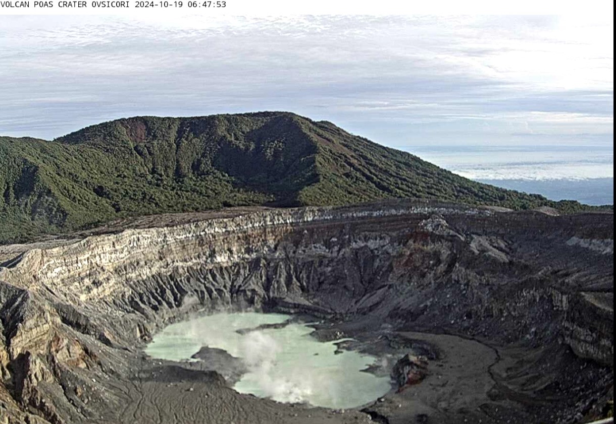
The MultiGas station recorded weekly averages of SO2/CO2 of 0.7 ± 0.1 and H2S/SO2 of 0.07 ± 0.03 this week, and the ExpoGAS station recorded a maximum of 1.7 ppm SO2.
. The NOVAC station measured 58 ± 53 t/d of SO2
. SO2 was detected in the atmosphere by the Sentinel-5P satellite on October 17 with a low value (11 tons). The lake level continues to rise, during the week it increased by about 0.4 m.
Source : Ovsicori.
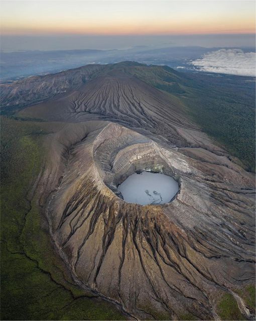
Photos : Soy Tico ( 04/2022) , Ovsicori , 19/10/2024