August 12 , 2024 .
Back again… End of vacation. I rekindle the fire under the Cauldron of Vulcan…
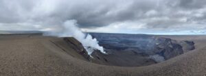
New Zealand , White Island :
Shallow magma likely at Whakaari/White Island. Volcanic Alert Level remains at Level 3 and Aviation Colour Code remains at Orange.
Published: Mon Aug 12 2024 2:40 PM
Volcanic Alert Level remains at 3
Aviation Colour Code remains at Orange
An increase in sulfur dioxide emissions in combination with the minor volcanic eruptions observed over the weekend suggest there is magma in the shallow system at Whakaari. The Volcanic Alert Level remains at Level 3 (minor eruption) and the Aviation Colour Code remains at Orange.
Clouds above Whakaari are making it difficult to confirm whether the minor eruption on Sunday (11th August) has finished. If activity is continuing, there is a low probability of any ash affecting the mainland.
On 11/08/2024, TROPOMI – a satellite capable of measuring daily sulfur dioxide (SO2) emissions – clearly detected SO2 emissions from Whakaari. This is the first time SO2 has been detected by the satellite since the recent activity that began in May 2024. TROPOMI is less sensitive than our regular gas flights and hence this suggests SO2 emissions from Whakaari have increased. We will be conducting a gas observation flight when conditions allow to confirm this.
The minor eruptions with ash emissions observed over the weekend and the increase in SO2 emissions indicate that magma (molten rock) has ascended to shallow levels beneath Whakaari. Shallow magma could cause high temperature gas venting, which will likely cause regular eruptive activity to continue. We are currently observing intermittent minor volcanic eruptions, with eruption hazards largely restricted to the island, and importantly, there is no current indication that activity will increase in magnitude.
We will continue to closely monitor volcanic activity at Whakaari with remote cameras and satellite imagery, and we plan to conduct gas and observation flights when weather conditions are suitable. Without an on-island monitoring network, changes in activity could occur at short notice and changes in Volcanic Alert Level may be delayed depending on monitoring conditions. We will provide updates when information becomes available.
GNS Science’s National Geohazards Monitoring Centre and Volcano Monitoring Group, through the GeoNet programme, will continue to closely monitor Whakaari/White Island for further changes in unrest.
Source : Geonet / Ery Hughes (she/her , Duty Volcanologist)
Photo : Extreme Pursuit via Berard Duyck sur FB
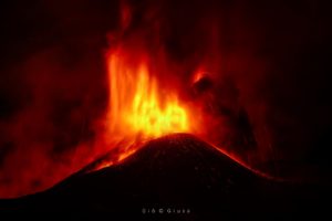
Iceland , Reykjanes Peninsula:
Number of earthquakes in the Sundhúkur crater row continues to Increase
Likelihood of Magma Intrusion and an eruption increase
Updated 9 August at 12:30 UTC
The number of earthquakes in the Sundhnúkur crater row continues to increase. Almost 300 earthquakes have been recorded since Monday, August 5
Around 300 earthquakes recorded since August 5. All of them are small earthquakes
Uplift and magma accumulation under Svartsengi remain like the last few days
The number of recorded earthquakes in the Sundhnúkur crater row continues to increase. All of these are small earthquakes, with magnitudes below M2.0, and most of them below M1.0. This week, since Monday, August 5, nearly 300 earthquakes have been recorded in the area. The number of earthquakes has been increasing in recent weeks.
Deformation data and model calculations show that uplift and magma accumulation under Svartsengi remain similar to the last few days. These data indicate that magma pressure continues to increase, and this is a similar trend to the weeks leading up to previous magma intrusions and eruptions.
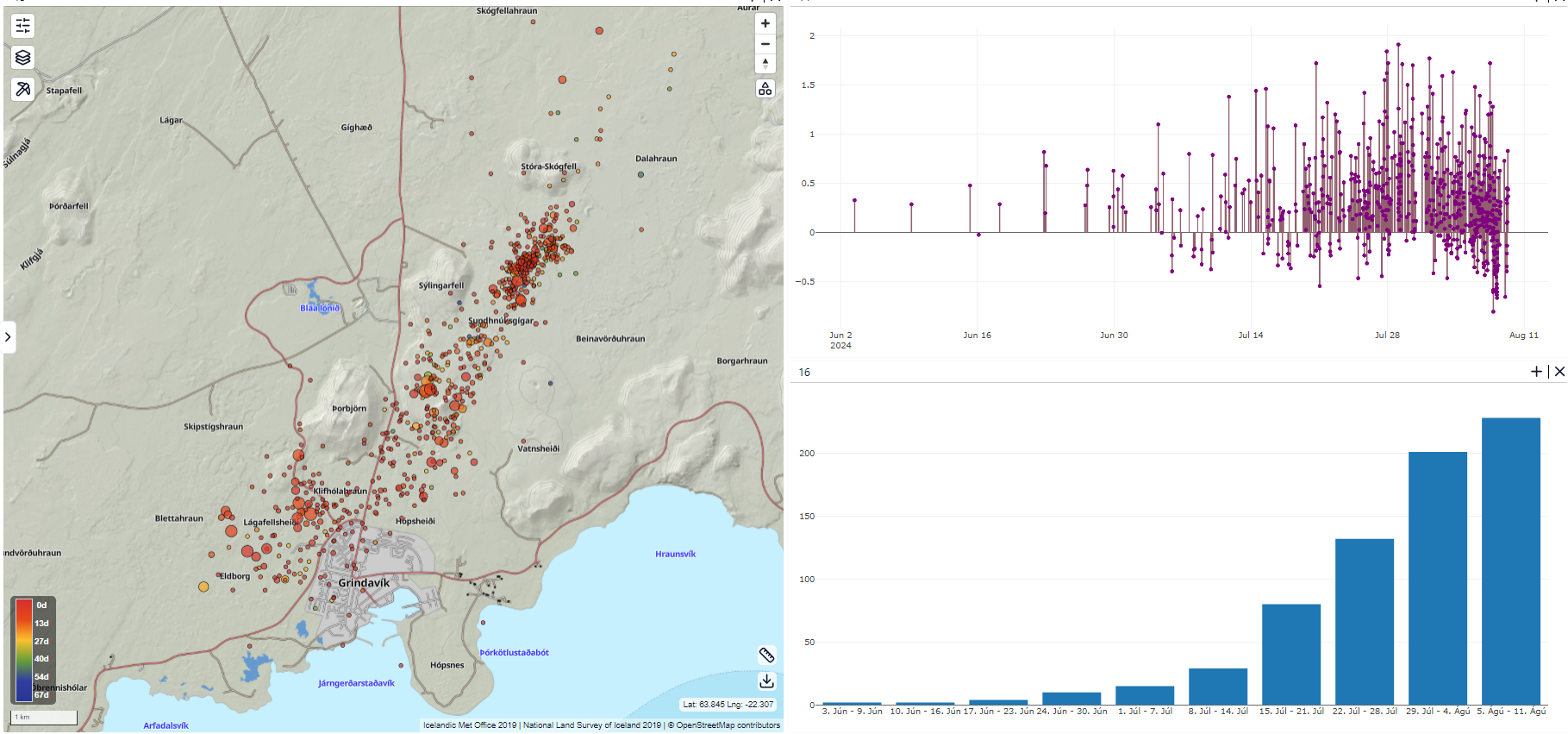
Overview of earthquake activity around the Sundhnúkur crater row based on reviewed earthquakes from June 3 to August 9. On the left, the location of the earthquakes is shown on a map; in the upper right, there is a graph showing the magnitude of the earthquakes; and in the lower right, there is a bar chart showing the number of earthquakes per week. The bar chart shows increasing seismic activity in recent weeks compared to the low activity during the last eruption from May 29 to June 22.
The IMO’s hazard assessment remains unchanged from before. The updated hazard assessment is valid until August 13, if no changes occur. The scenarios presented in the last news update also remain unchanged.
Source : IMO
Photos : Défense civile , IMO
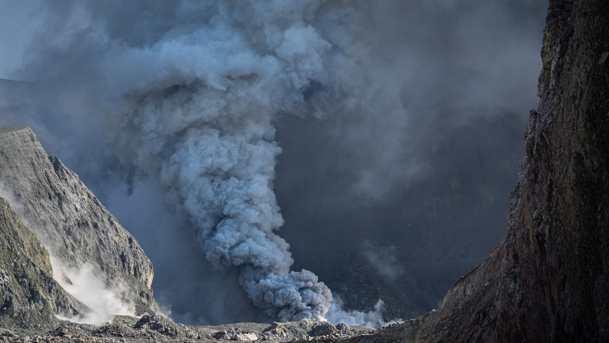
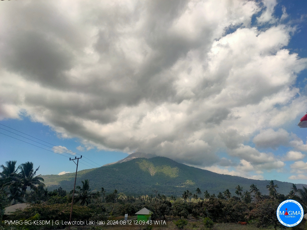
Indonesia , Lewotobi Laki Laki :
An eruption of Mount Lewotobi Laki-laki occurred on Monday, August 12, 2024, at 12:07 WITA. No visual rash was observed. This eruption was recorded on a seismograph with a maximum amplitude of 22 mm and a duration of 215 seconds.
VOLCANO OBSERVATORY NOTICE FOR AVIATION – VONA
Issued : August 12 , 2024
Volcano : Lewotobi Laki-laki (264180)
Current Aviation Colour Code : ORANGE
Previous Aviation Colour Code : orange
Source : Lewotobi Laki-laki Volcano Observatory
Notice Number : 2024LWK344
Volcano Location : S 08 deg 32 min 20 sec E 122 deg 46 min 06 sec
Area : East Nusa Tenggara, Indonesia
Summit Elevation : 5069 FT (1584 M)
Volcanic Activity Summary :
Eruption at 0407 UTC (1207 local).
Volcanic Cloud Height :
Ash-cloud is not observed.
Other Volcanic Cloud Information :
Ash-cloud is not observed.
Remarks :
Eruption recorded on seismogram with maximum amplitude 22 mm and maximum duration 215 second.
Source et photo : Magma Indonésie .
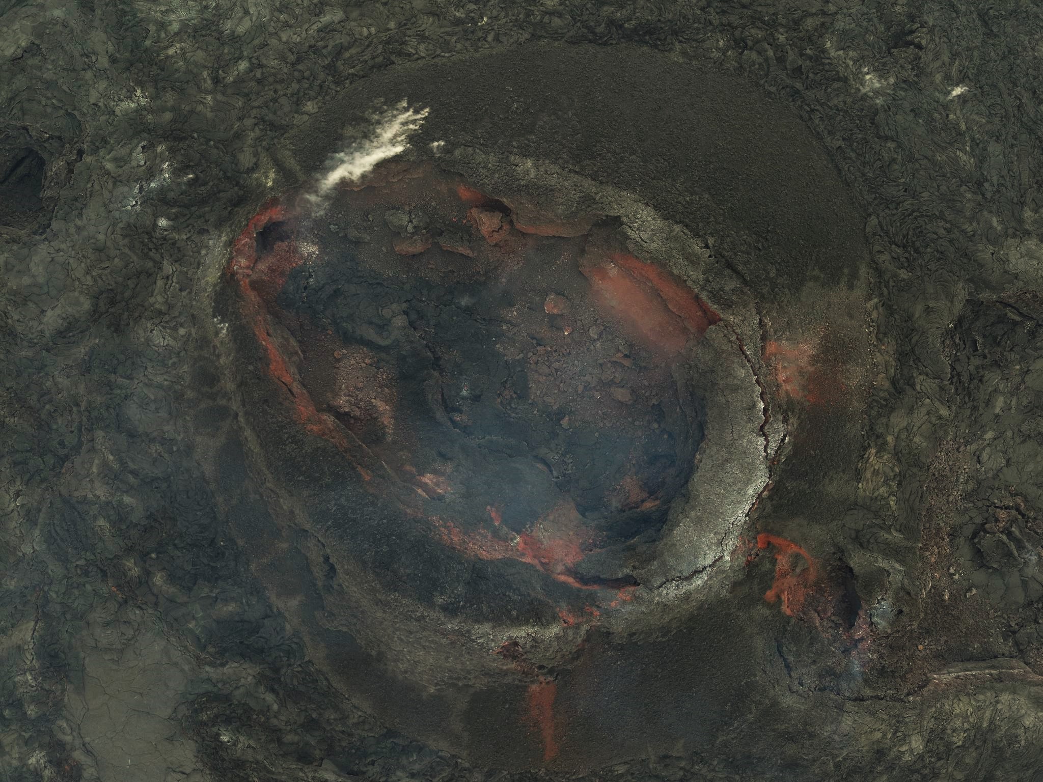
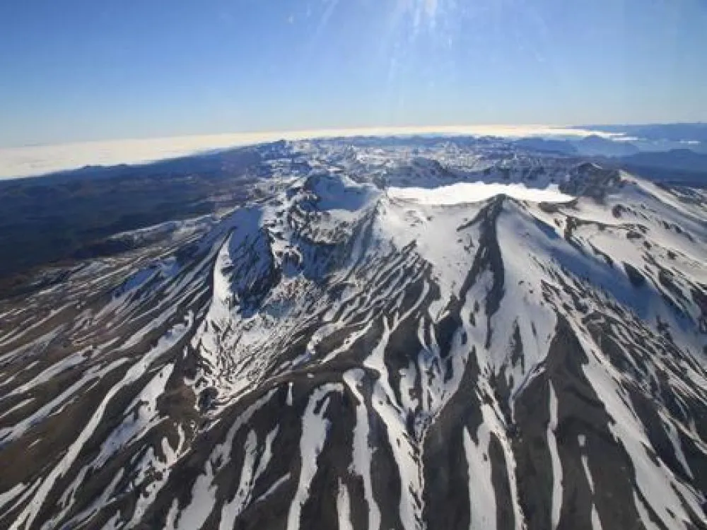
Chile , Puyehue-Cordon Caulle :
Special Report on Volcanic Activity (REAV), Los Lagos region, Puyehue-Cordon Caulle volcanic complex, August 8, 2024, 00:00 local time (mainland Chile).
The National Service of Geology and Mines of Chile (Sernageomin) publishes the following PRELIMINARY information, obtained using the monitoring equipment of the National Volcanic Monitoring Network (RNVV), processed and analyzed at the Southern Andean Volcanological Observatory ( Ovdas):
On Wednesday, August 7, at 11:46 p.m. local time (03:46 UTC), monitoring stations installed near the Puyehue-Cordon Caulle volcanic complex recorded an earthquake associated with the fracturing of rocks (volcano-tectonic type).
The characteristics of earthquakes after their analysis are as follows:
ORIGINAL TIME: 11:46 p.m. local time (03:46 UTC)
LATITUDE: 40.561°S
LONGITUDE: 72.177° West
DEPTH: 5.8 km
LOCAL MAGNITUDE: 3.7 (ML)
OBSERVATIONS:
The technical volcanic alert remains at level Green.
Source et photo : Sernageomin