July 26 , 2024.
United – States , Yellowstone :
Wednesday, July 24, 2024, 3:43 PM MDT (Wednesday, July 24, 2024, 21:43 UTC)
44°25’48 » N 110°40’12 » W,
Summit Elevation 9203 ft (2805 m)
Current Volcano Alert Level: NORMAL
Current Aviation Color Code: GREEN
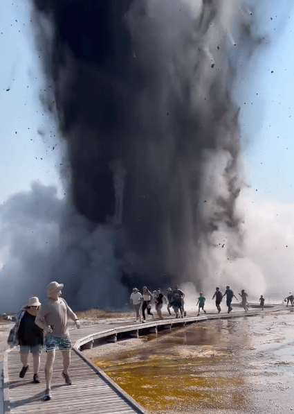
Update on the hydrothermal explosion that occurred just before 10 AM on Tuesday, July 23, in Biscuit Basin, Yellowstone National Park.
National Park Service (NPS) field crews have completed a preliminary assessment of the conditions following the hydrothermal explosion at Black Diamond Pool.
What happened?
The July 23, 2024, hydrothermal explosion at Biscuit Basin resulted from water suddenly transitioning to steam in the shallow hydrothermal system beneath Black Diamond Pool and was not caused by volcanic activity. Seismicity, ground deformation, and gas and thermal emissions remain at their normal background levels, and there were no detectable precursors to this event.
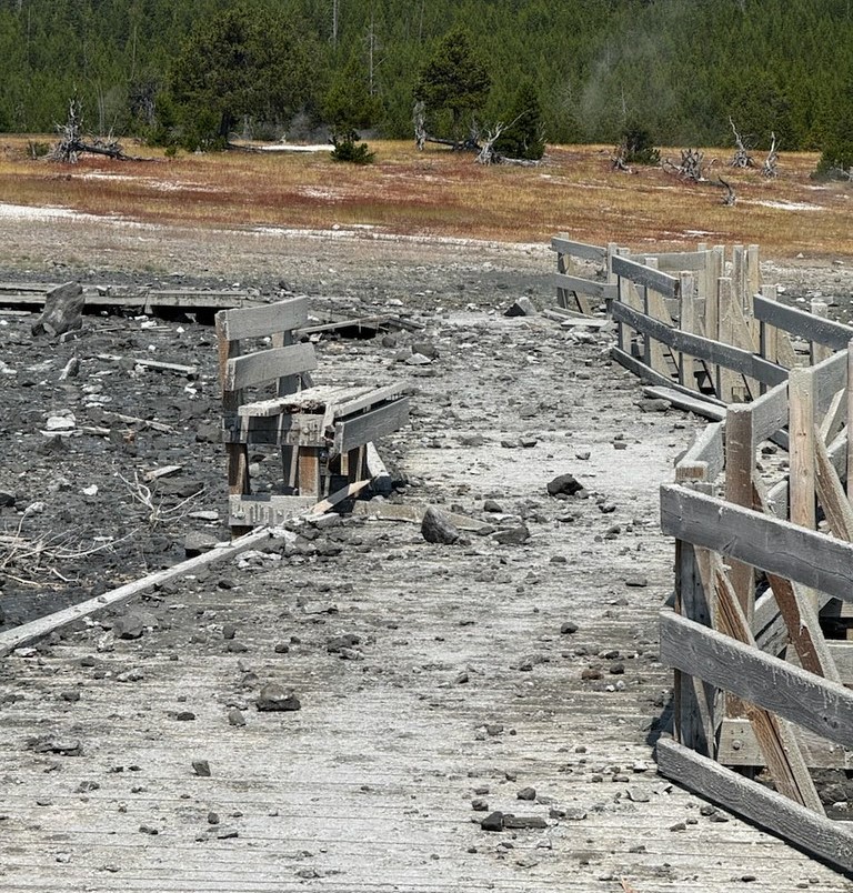
The explosion, which sent steam and debris to a height of hundreds of feet above the ground, destroyed a nearby boardwalk and ejected grapefruit-sized rocks tens to hundreds of feet from the source. Some blocks closest to the explosion site are about 3 feet (1 meter) wide and weigh hundreds of pounds. The explosion was largely directed to the northeast toward the Firehole River, and the largest blocks of debris fell in that direction. The dark color of the explosion was a result of mud and debris mixed with steam and boiling water. Although visitors were present at the time of the event, no injuries were reported.
Black Diamond Pool and Black Opal Pool were affected by Tuesday’s explosion, and while they remain distinct features, the shape of Black Diamond has changed somewhat. Both pools are murky due to debris, and the unstable ground around their edges occasionally slides into the water. Just after the eruption, Black Diamond Pool exhibited minor roiling and water spouting. The water level in the pool rose over the course of the day, and by Tuesday afternoon the roiling transitioned to occasional bursts of hot water that reached about 8 feet (2.4 meters) in height.
What is happening now?
By Wednesday morning, July 24, the levels of Black Diamond Pool and Black Opal Pool had risen enough that both were overflowing and sending murky water into the Firehole River. No water bursts from Black Diamond Pool were witnessed Wednesday morning.
What are ongoing hazards?
Given the recent changes to the hydrothermal plumbing system, small explosions of boiling water from this area in Biscuit Basin continue to be possible over the coming days to months. USGS and NPS geologists will be monitoring conditions, mapping the debris field, and sampling water to assess any changes in the shallow hydrothermal system over the next several days.
Hydrothermal explosions typically occur in the park one to a few times per year, but often in the back country where they may not be immediately detected.
Similar, although smaller, hydrothermal explosions took place in 1989 at Porkchop Geyser in Norris Geyser Basin, and on April 15, 2024, from the Porcelain Terrace Area of Norris Geyser Basin. A small hydrothermal explosion occurred from Wall Pool, in Biscuit Basin, in 2009. Significant hydrothermal explosions, probably similar in size to that of July 23, 2024, occurred in the 1880s at Excelsior Geyser, in Midway Geyser Basin.
Source : YVO
Photos : USGS , Capture d’écran FB
Italy / Sicily , Etna :
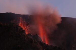
Press release on the activity of Etna, July 25, 2024, 2:40 p.m. (12:40 p.m. UTC).
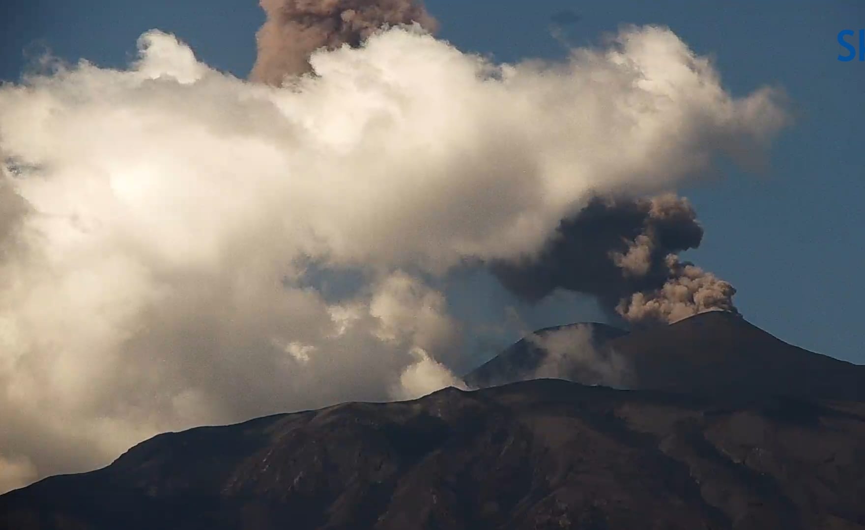
The National Institute of Geophysics and Volcanology, Osservatorio Etneo, communicates that, from images from the video surveillance network, Strombolian activity is observed at the level of the Voragine crater. Observations are severely limited due to cloud cover over the summit area. The predicted dispersion model of the possible volcanic cloud indicates a direction towards the South-East.
A sequence of seismic and infrasound events, associated with explosive activity, was recorded from approximately 11:44 to 12:00 UTC. The most energetic events were recorded at 11:54 UTC. A sudden increase in the average tremor amplitude accompanied this phenomenon, reaching high values and subsequently, at the end of the phenomenon, a tendency of the parameters to return to their previous values (mean-low) was observed.
The centroid of the tremor sources is located in an area between the Voragine crater and the Southeast crater, at an altitude of approximately 2,800 m above sea level.
The infrasound events are located in the Voragine crater.
The signals from the GNSS and inclinometer deformation monitoring networks do not show significant variations. Exclusively on the ECP inclinometer, during the most energetic events, a slight residual variation of approximately 0.1 microradian is observed.
Further updates will be communicated shortly.
Source : INGV.
Photo : Vincenzo Nicoletti ( Via B Duyck)
New Zealand , White Island :
VOLCANIC ACTIVITY BULLETIN , Fri Jul 26 2024 9:30 AM;
Volcanic Alert Level remains at 2
Aviation Colour Code remains at Yellow
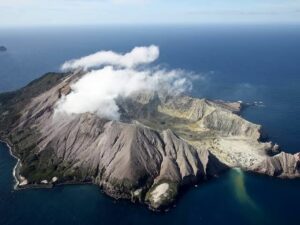
Webcam imagery this morning shows a short-lived vigorous steam and gas plume above Whakaari/White Island. The plume appears to have contained a minor amount of ash at low level. The Volcanic Alert Level remains at Level 2 (moderate to heightened unrest) and the Aviation Colour Code remains Yellow.
Between 06:30 and 7:30 am this morning a vigorous steam and gas plume was observed rising from the island to about 1000 m. The plume appears to have carried a minor amount of ash as observed from our Whakatane webcam. Ash fall was local to the island and immediately to the west. The Metservice indicates no ash was detected beyond the island and there is no ashfall threat to the mainland.
Whakaari is in a period of elevated unrest and with the drying up of the vent area such short lived steam and ash emissions may become more frequent.
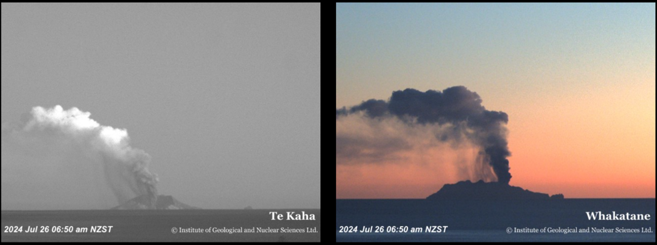
Figure 1. Ash emission views from Te Kaha and Whakatane. Ash is seen falling from the downwind part of the plume to the left (west) of the main plume.
Although the Volcanic Alert Level remains at Level 2, short lived increases in degassing or eruptions can still occur with little or no warning as shown by this morning’s ash emission. The Volcanic Alert Level reflects the current level of volcanic unrest or activity and is not a forecast of future activity. While Volcanic Alert Level 2 is mostly associated with volcanic unrest hazards (including discharge of steam and hot volcanic gases, earthquakes, landslides, and hydrothermal activity), the potential for eruption hazards remains.
As we have no sensors on the island, we continue to rely on remote cameras and satellite imagery, complemented with gas and observation flights to assess the volcanic activity.
Further gas and observation flights will be conducted by GNS Science volcanologists to maintain a close eye on activity levels. GNS Science’s National Geohazards Monitoring Centre and Volcano Monitoring Group, through the GeoNet programme, will continue to closely monitor Whakaari/White Island for further changes in unrest.
Source : Geonet / Craig Miller/ Duty Volcanologist
Photo : Webcam Geonet
Colombia , Nevado del Ruiz :
From monitoring the activity of the Nevado del Ruiz volcano, the Colombian Geological Service (SGC), an entity attached to the Ministry of Mines and Energy, reports that:
In the week of July 16 to 22, 2024, the volcano continued with unstable behavior. Compared to the previous week, the main variations in the parameters monitored were:
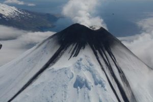
– Seismic activity associated with the fracturing of rocks inside the volcanic edifice has decreased in the number of earthquakes recorded and in the seismic energy released. The earthquakes were of low energy level (magnitudes less than 1) and were located mainly in the Arenas crater and in the northeast, south-southwest and southeast sectors of the volcano, at lower distances 5 km from the crater. The depths of the events varied between less than 1 and 4 km from the volcano summit. Seismic activity related to the activity of the lava dome (protrusion or mound) located at the bottom of the crater was of low energy levels and was recorded occasionally.

– Seismicity linked to the activity of fluids inside volcanic conduits has decreased in the number of earthquakes recorded and in the seismic energy released. The seismic signals showed varying energy levels with values ranging from low to moderate. Thanks to the cameras used to monitor the volcano, it was possible to confirm several emissions of ash and changes in the temperature of the emitted material, both of which are associated with some of these seismic events.
– On the volcano, the emission of water vapor and gas into the atmosphere from the Arenas crater continues. Sulfur dioxide (SO₂) outgassing rates were variable and showed levels similar to those observed the previous week. The gas column reached a maximum height of 1000 m above the volcanic summit on the morning of July 16. The direction of dispersion of the gas column maintained a preferential trend towards the northwest of the volcano.
– When monitoring thermal anomalies at the bottom of Arenas Crater, from satellite monitoring platforms, their detection continued to be limited by the high cloud conditions that persist in the area. Two low energy anomalies were detected this week.
Source : SGC
Photo : SGC ( archive avril 2023 ).
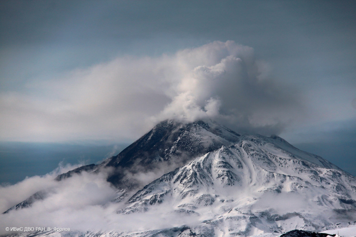
Kamchatka , Bezymianny :
55.97 N, 160.6 E;
Elevation 2882 m (9453 ft)
Aviation Colour Code is ORANGE
The effusive eruption of the volcano continues. Ongoing activity could affect low-flying aircraft.
Since July 22, collapses of hot avalanches were observed from the dome. According to KVERT satellite data, the explosive eruption of the volcano began at 15:10 UTC on 24 July, with ash being carried up to 12 km a.s.l. and pyroclastic flow deposits being formed. The ash plume extended for 2,500 km to the southeast of the volcano, but part of the ash cloud, 362 km long and 60 to 125 km wide, continues to remain over Kamchatka to this time. After the explosive eruption, an effusive eruption of the volcano began (viscous lava is extruding onto the dome slopes), which accompanied by hot avalanches and powerful gas-steam activity; a bright thermal anomaly over the volcano is noting on satellite images.
Source : Kvert
Photo : V. Frolov. IVS FEB RAS (7/4/2024)