May 12 , 2024.
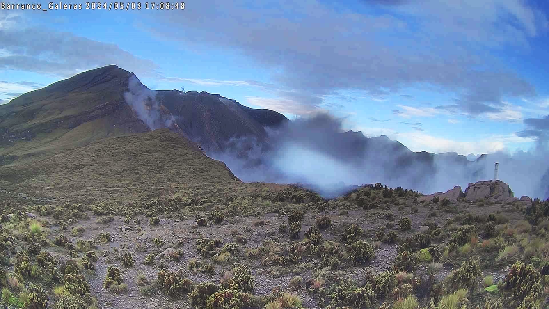
Colombia , Galeras :
San Juan de Pasto, May 7, 2024, 5:20 p.m. Weekly activity bulletin: Galeras Volcano
Regarding the monitoring of the activity of the GALERAS VOLCANO, the COLOMBIAN GEOLOGICAL SERVICE (SGC), an entity attached to the MINISTRY OF MINES AND ENERGY, reports that:
For the week between April 30 and May 6, 2024, and at low levels, seismicity showed similar behavior to that recorded the immediately preceding week.
The predominance of earthquakes related to rock fracture in the volcanic zone continues and, to a lesser extent, there has been a record of seismicity related to the movement of fluids within the volcano.
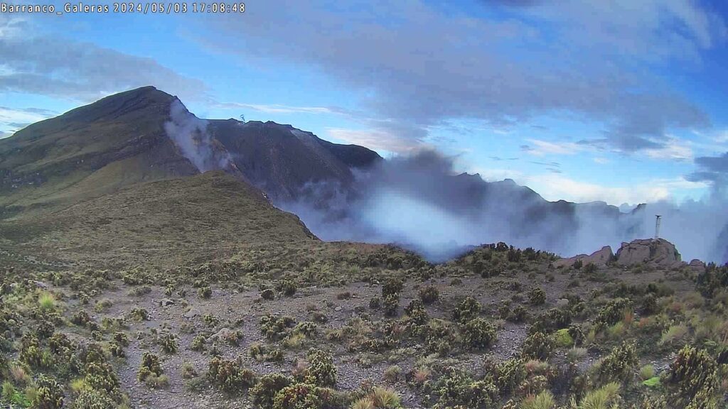
The earthquakes associated with the fracture of the rock were located in a scattered manner, at distances between 0.1 and 16 km, at depths between 1.0 and 16 km from its summit (4,200 m altitude) and a maximum magnitude of 0.4.
No earthquakes were reported as felt.
Gas emissions were observed from the fumarole fields of Las Chavas, to the West, and El Paisita, to the North of the active cone, with white gas columns, of low height and variable dispersion due to the action of the winds.
Other volcanic monitoring areas showed stability in their recordings.
Volcanic activity remains in a YELLOW ALERT state: Active volcano with changes in the behavior of the base level of monitored parameters and other manifestations.
Source et photo : SGC
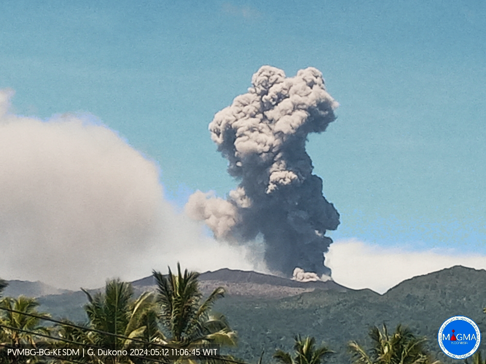
Indonesia , Dukono :
An eruption of Mount Dukono occurred on Sunday, May 12, 2024 at 11:04 a.m. WIT with the height of the ash column observed at ±1,200 m above the summit (±2,287 m above the level of the sea). The ash column was observed to be white to gray in color with moderate to thick intensity, oriented towards the East. This eruption was recorded on a seismograph with a maximum amplitude of 5 mm and a duration of 46.26 seconds.
Observation of seismicity:
14 eruption earthquakes with an amplitude of 4 to 34 mm and an earthquake duration of 29.68 to 74.35 seconds.
6 deep tectonic earthquakes with an amplitude of 4 to 34 mm, and an earthquake duration of 61.85 to 117.2 seconds.
1 Continuous tremor with an amplitude of 0.5 to 2 mm, dominant value of 1 mm.
RECOMMENDATION
People around Mount Dukono and visitors/tourists are advised not to do activities, climb or approach the Malupang Warirang Crater within a 3 km radius.
Source et photo : Magma Indonésie
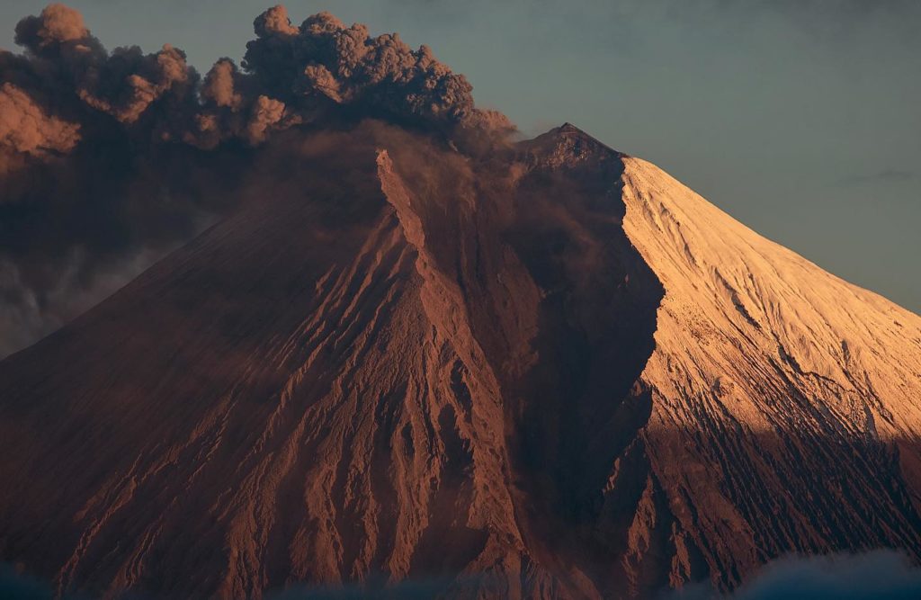
Ecuador , Sangay :
DAILY REPORT ON THE STATE OF THE SANGAY VOLCANO, Saturday May 11, 2024.
Information Geophysical Institute – EPN.
Surface activity level: High, Surface trend: No change
Internal activity level: High, Internal trend: No change
Seismicity: From May 10, 2024, 11:00 a.m. to May 11, 2024, 11:00 a.m.:
Due to problems at the seismic stations, it was not possible to carry out the seismic count.
Precipitation/Lahars:
Rains were recorded in the volcano area without generating mudslides or debris. **In the event of heavy rains, these could remobilize the accumulated materials, generating mud and debris flows which would descend the sides of the volcano and flow into adjacent rivers.
Emissions/ash column:
During the last 24 hours, thanks to the surveillance camera system, a gas emission with a low ash load was recorded, at a height of 400 meters above the level of the crater in the southwest direction. For its part, the Washington VAAC has not published reports for this volcano.
Other monitoring parameters:
The MIROVA-SENTINEL satellite system recorded 1 thermal anomaly in the last 24 hours.
Observation:
Over the past 24 hours, the volcano has remained mostly cloudy. Currently, the volcano is still covered in clouds.
Alert level: yellow
Source : IGEPN
Photo : #Eqphos_fotografía
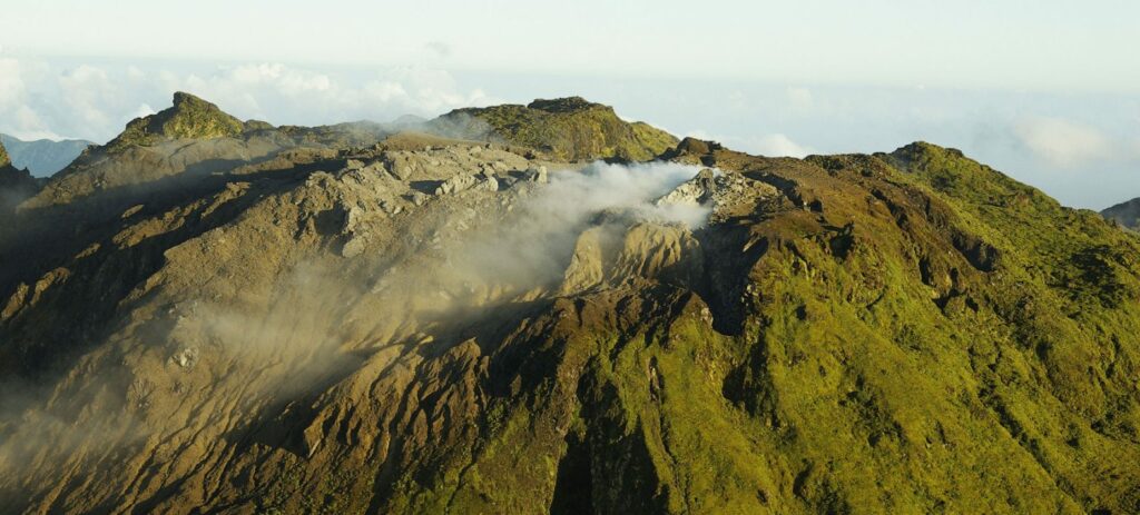
La Guadeloupe , La Soufrière :
Monthly bulletin, Paris Institute of Globe Physics.
Volcanological and seismological observatory of Guadeloupe, April 2024
Soufriere Volcano
• Seismicity: 405 volcano-tectonic earthquakes (VT), including 2 swarms of 98 and 192 earthquakes were detected in the volcano sector. All earthquakes have a negative magnitude and are located less than 1 km deep under the Soufrière dome. The energy released (1.0 MJ) is down slightly compared to the previous month (1.8 MJ)
• Deformation: the opening of the dome tends to slow down (GNSS data).
• Gas :
– after significant fluctuations in 2023, the temperature (95.7°C) and pH (2.9) of the Napoléon Nord fumarole returned to normal values
– the composition of the Soufrière gas plume does not show any major change
• Thermal springs: spring temperatures and compositions are within the ranges measured in previous years. However, there is an increase in the HCO3 content
– (91 ppm) in the Carbet Echelle source, which confirms a trend that began in 2022.
Based on the observations summarized in this bulletin, and in accordance with the provisions planned by the authorities, the volcanic alert level (table in the appendix) remains:
Vigilance: Yellow
Regional telluric activity
• Low activity: 156 earthquakes of magnitude ≤ 3.2 were recorded on regional fault networks
• A weak earthquake (Md= 2.5 ± 0.3) was felt by the population on Tuesday April 9 at 03:29 (local time).
The epicenter was located 9 km northwest of Sainte-Rose, at a depth of 13 km.
Source et photo: IPGP
Costa Rica , Poas / Rincon de la Vieja :
Date: May 11, 2024, updated at: 2:07:00 p.m.
Poas Volcano
Latitude: 10.2
Longitude: -84,233
Altitude: 2,687 meters
Activity observed:
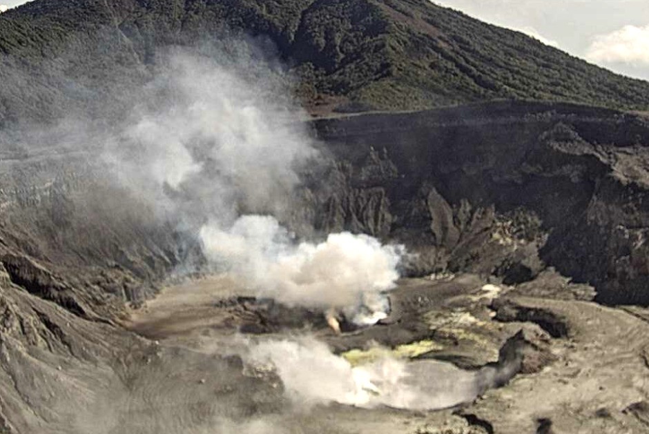
-During the night, a glowing light continues to be observed in the fumaroles at the bottom of the crater due to the ignition and combustion of molten sulfur.
-Vigorous plume of gas, water vapor and aerosols with a small quantity of ash and dispersed by mainly West-South-West winds.
-The volcanic tremor is weak.
-The acoustic tremor is low.
-Many low-frequency (LP) seismic events associated with the transport of fluids from the interior of the volcano to the environment are recorded.
-Gas measurements by the MultiGas near real-time detection system on the western edge of the crater remain stable compared to recent weeks: The CO2/SO2 ratio remains between 0.3 and 0.99 and the H2S/SO2 ratio remains stable between 0.3 and 0.6. . The maximum SO2 concentration is 9.8 parts per million.
-The concentration of SO2 at the visitor’s point of view detected by the ExpoGAS gas monitor reached a maximum of 3 parts per million today, May 11, around noon.
-SO2 sulfur gas, probably originating from the Poás volcano and transported by winds to the southern region of the volcano (IMN), was detected in the ambient air of Vásquez de Coronado between May 5 and 7 (3.1 parts per billion) and today May 11 (2 parts per billion).
-The SENTINEL satellite detected on May 9, 2024 a mass of 159 tons of SO2 coming from the Poás volcano.
-In recent days we have not received any reports of the smell of sulfur or falling ash from residents near Poás Volcano.
Environmental conditions:
-The predominant wind direction at the summit of Poás is towards the South at the time of sending this report (IMN). The summit of Poás remains partially clear.
Activity Level: Warning (2)
Rincón de la Vieja Volcano
Latitude: 10.83
Longitude: -85,324 Height: 1,916 meters
Activity observed:
-The volcanic seismic tremor continues with an intense signal with a predominant frequency band between 1 and 4 Hz over the last 24 hours.
-No eruptions or ashfall have been recorded in the last 24 hours.
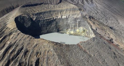
-A vigorous fumarolic degassing rich in water vapor, gas and aerosols is permanently maintained in the main Rincón crater. The fumarole plume is dispersed by the prevailing winds towards the northeast.
-The SENTINEL satellite detected a mass of SO2 of 37 tonnes heading south on May 3, 2024.
Environmental conditions:
The winds at the top of Rincón are directed towards the Northeast. The summit remains cloudy.
Activity Level: Caution (3)
Source : Ovsicori
Photos : Ovsicori , Chris Allen de Sunquest Helitours

