March 24 , 2024.
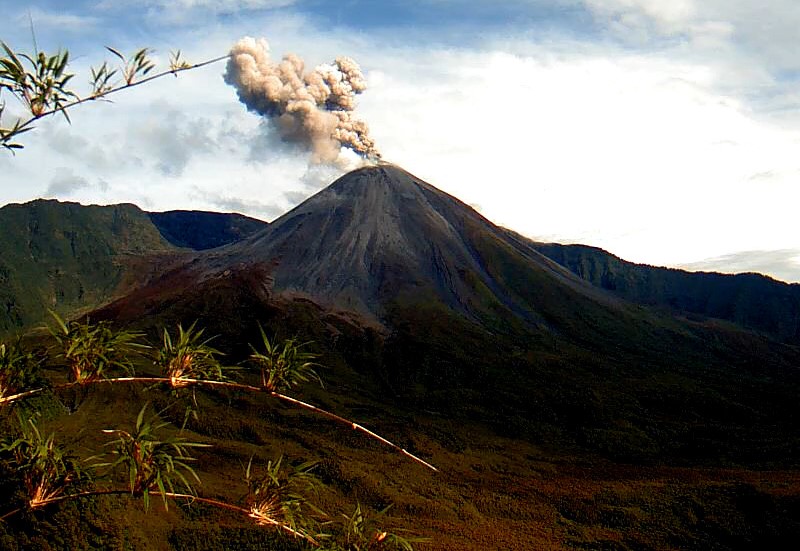
Colombia , Cerro Machin :
Manizales, March 23, 2024 4:05 a.m.
Concerning the monitoring of the activity of the CERRO MACHÍN VOLCANO, the COLOMBIAN GEOLOGICAL SERVICE, an entity attached to the MINISTRY OF MINES AND ENERGY, reports that:
From 02:25 today, March 23, 2024, an increase in seismic activity associated with the fracturing of rocks inside the volcano was recorded, in the main dome sector. At the time of publication of this bulletin, more than 150 earthquakes have been recorded, including two with magnitudes of 4.2 and 4.0, which were reported to be felt by residents in areas of volcanic influence. These two earthquakes correspond to those of maximum magnitudes recorded so far, they occurred at 2:25 a.m. and 2:30 a.m. and were located in the West and South sectors of the main dome, at depths of 3 km and 4 km, respectively.
It is worth mentioning that since December 2022, no seismic increase with a magnitude greater than 4.0 has been recorded.
It is important to keep in mind that the increases in activity associated with the fracturing of rocks inside the volcano and the earthquakes felt are considered within the framework of the yellow alert state in which is located currently the volcano.
It is recommended that the community continue to be alert to any changes that may occur in the volcano’s activity.
Source et photo : SGC
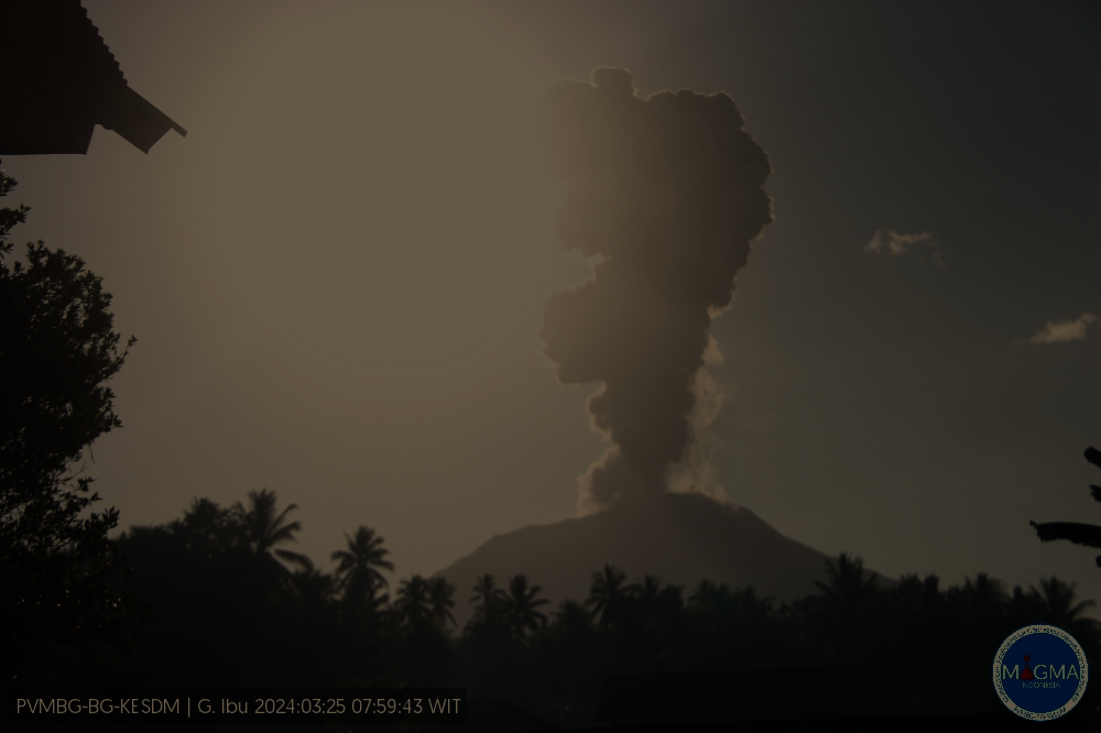
Indonesia , Ibu :
An eruption of Mount Ibu occurred on Monday 25 March 2024 at 07:47 WIT with the height of the ash column observed at ±1,500 m above the summit (±2,825 m above sea level) . The ash column was observed to be gray with thick intensity, oriented towards the West. This eruption was recorded on a seismograph with a maximum amplitude of 28 mm and a duration of 132 seconds.
Observation of seismicity:
7 eruption/explosion earthquakes with an amplitude of 15 to 28 mm and earthquake duration of 26 to 46 seconds.
29 emission earthquakes with an amplitude of 2 to 14 mm and earthquake duration of 15 to 50 seconds.
118 shallow volcanic earthquakes with an amplitude of 2 to 14 mm and a seismic duration of 4 to 14 seconds.
3 deep volcanic earthquakes with an amplitude of 2 to 8 mm, and an earthquake duration of 4 to 7 seconds.
7 distant tectonic earthquakes with an amplitude of 2 to 28 mm, the duration of the earthquake was 33 to 122 seconds.
RECOMMENDATION
1. Communities around Mount Ibu and visitors/tourists should not practice activities within a radius of 2.0 km and a sectoral extension of 3.5 km towards the crater opening in the northern part of the active crater from Mount Ibu.
2. In the event of ash falling, people who carry out activities outside the house are advised to protect their nose, mouth (mask) and eyes (glasses).
Source et photo : Magma Indonésie .
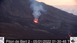
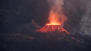
Ecuador , Reventador :
DAILY REPORT ON THE STATE OF THE REVENTADOR VOLCANO, Sunday March 24, 2024.
Information Geophysical Institute – EPN.
Surface activity level: Moderate, Surface trend: No changes
Internal activity level: Moderate, Internal trend: No changes
Seismicity: From March 23, 2024, 11:00 a.m. to March 24, 2024, 11:00 a.m.:
The following table shows the number of seismic events from the reference station in the last 24 hours.
Explosion (EXP) 37
Long Period (LP) 4
Transmitting Tremor (TREMI) 2
Tremor harmonic (TRARM): 5
Precipitation/Lahars:
No rain was recorded in the volcano area. **Heavy rains could remobilize accumulated material and generate mud and debris flows that travel down the volcano’s flanks and flow into rivers downstream.
Emissions/ash column:
Over the last 24 hours, due to poor weather conditions, no gas or ash emissions have been observed. For its part, the Washington VAAC has not published emissions reports for this volcano.
Other monitoring parameters:
The FIRMS satellite system recorded 2 thermal anomalies in the last 24 hours.
Observation:
Despite the cloudiness in the volcano area, at the start of the day, an episode of incandescence was observed in the volcano’s crater. At the time of closing this report, the volcano remained completely cloudy.
Alert level: Orange.
Source : IGEPN.
Photo : IGEPN
Costa Rica , Poas :
Latitude: 10.20°N;
Longitude: 84.23°W;
Altitude: 2687 m
Current activity level: Warning
Possible manifestations: Small eruptions, bubble or geyser, significant gas emission, increase in temperature (incandescence), seismic swarms or volcanic tremor, slight inflation-extension of the volcanic edifice.
Since March 8, no eruption has been recorded by the sensors operated by OVSICORI.
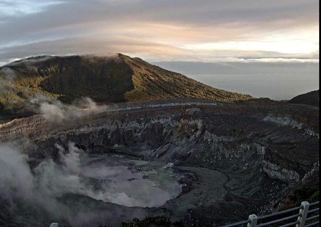
The volcanic tremor is maintained with low frequencies and amplitude fluctuations. Frequent low frequency and very low amplitude volcanic earthquakes are recorded. The GPS network does not show significant deformation in the active sector of the crater. The SO2 gas concentration at Visitor Viewpoint recorded values below 6 ppm. In contrast, the MultiGAS gas monitoring system located on the western edge of the active crater detected stable ratios and concentrations of SO2/CO2 (1.97 ± 0.43), H2S/SO2
(0.17 ± 0.06) and SO2 (6.45 ± 4.61 ppm). No presence of SO2 was detected in the atmosphere by satellites this week. The NOVAC station recorded a slight decrease in SO2 flow during the previous week (136 ± 73 t/d), compared to the previous week (256 ± 100 t/d). The lake level dropped by ~2.9 m in 14 days without this being very noticeable because the surface of the lagoons hardly changed. This is because these 2 pools of water are now confined in more vertical walls. From a distance, a maximum temperature of 64°C was measured.
Source : Ovsicori.
Photo : Archive Ovsicori
Alaska , Shishaldin :
Low-level unrest continues at Shishaldin Volcano. Small explosions within the conduit have been producing minor but detectable infrasound signals over the past day. Clouds obscured views of the volcano in webcam imagery. Clear satellite views of the volcano summit over the past day showed nothing noteworthy
No significant eruptive activity has been observed since November 2023.
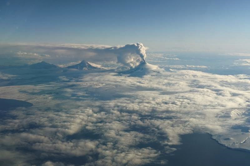
Local seismic and infrasound sensors, web cameras, and a geodetic network are used to monitor Shishaldin Volcano. In addition to the local monitoring network, AVO uses nearby geophysical networks, regional infrasound and lighting data, and satellite images to detect eruptions.
Source : AVO
Photo : Matt Brekke.