March 16 , 2024.
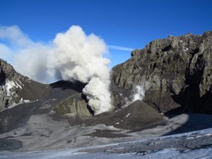
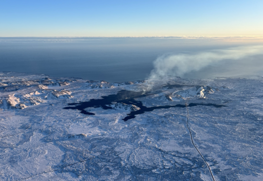
Iceland , Reykjanes Peninsula :
Continued increased likelihood of an eruption.
Indications that more magma needs to accumulate under Svartsengi than before to trigger a new magma intrusion and possibly an eruption.
Updated 15. March at 14:30 UTC
Likely sequence of events in the next few days:
The amount of magma under Svartsengi continues to increase, which could end with a new magma intrusion and possibly an eruption.
An eruption could start with very little warning, possibly within 30 minutes.
It is most likely that an eruption would occur in the area between Stóra-Skógfell and Hagafell.
Main changes in activity:
There are indications that more magma needs to accumulate under Svartsengi than before, to trigger a new dike intrusion and possibly an eruption.
There is now higher uncertainty than before about the timing of the next dike intrusion and possible eruption.
Note:
When the weather worsens, the sensitivity of the Icelandic Meteorological Office’s monitoring system decreases. Today and this evening,there is strong wind and precipitation in Reykjanes Peninsula. Therefore, it can be assumed that both the sensitivity of the earthquake and the real-time GPS monitoring of the Meteorological Office will be impaired. The weather will also affect tremor detection and visual monitoring with webcams. The weather will rapidly improve by midnight today 15 March.
Higher uncertainty than before about the timing of the next dike intrusion and possible eruption.
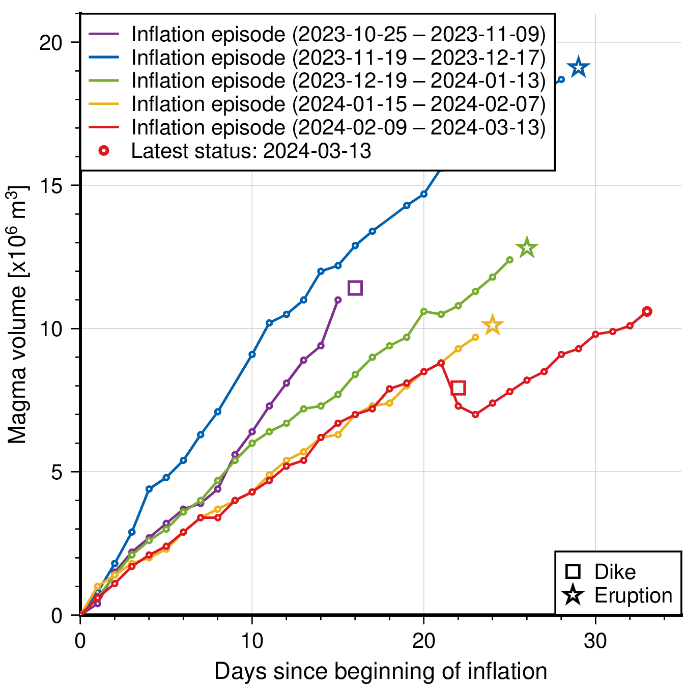
GNSS displacements and recent interferograms show continued inflation of the Svartsengi magma reservoir – at a similar rate to that observed prior to the diking event on 2 March 2024. Geodetic modelling using these datasets confirms the inflation source is also at a similar location and depth as that observed during previous inflation episodes.
The models inditate a recharge volume of approx. 4 million cubic meters to the Svartsengi reservoir since 3 March.
For the diking events that occurred between 14 January to 2 March, the failure limit calculated to trigger these dike intrusions and/or eruptions was consistently estimated at around 10 million cubic meters. This enabled longer-term forecasts to be made based on the volume loss from the magma reservoir during the diking events and then estimating the time window when this amount would be fully recharged, hence triggering the next event.
However, on 2 March it is estimated that a much smaller volume was lost from the magma reservoir during this event (approx. 1.3 million m3) which triggered a small dike intrusion that did not result in an eruption.
A larger volume, compared to the amount lost from the Svartsengi reservoir on the 2 March, has now been recharged, yet a new dike intrusion/eruption has not yet occurred. This indicates a possible change in the magma plumbing system and greater uncertainty in the new failure limit that now needs to be reached, and thus the timing, of the next dike intrusion and/or eruption.
When this new limit is reached, the most likely scenario is another dike intrusion within the existing diking area – between Stóra-Skogfell to Grindavík – which may or may not culminate in an eruption.
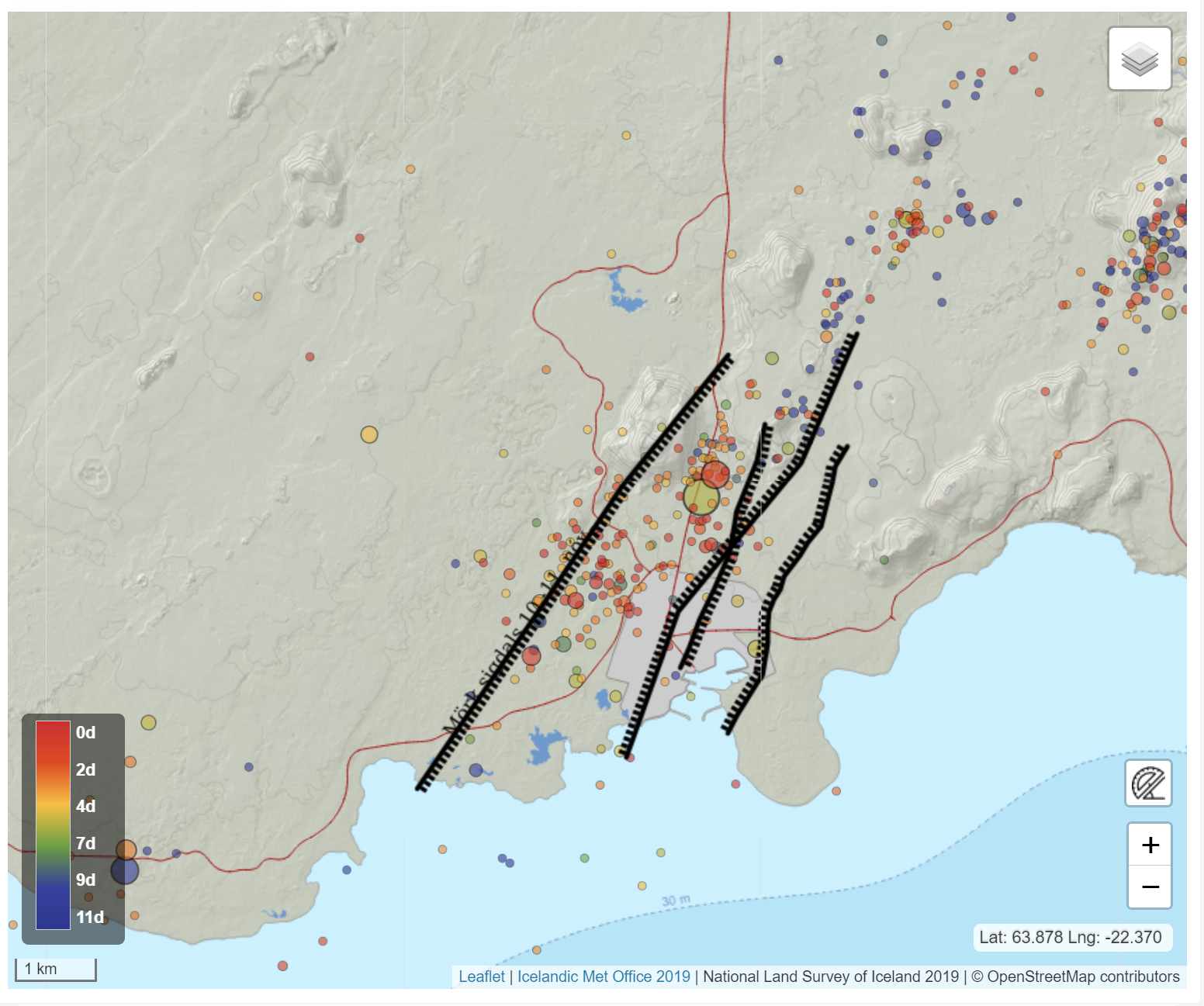
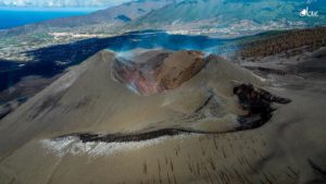
The map shows seismicity detected from 3 March to 14 March. Black lines outline Grabens that formed in diking events on 10 November 2023 and 14 January 2024.
Seismicity NW of Grindavík not a sign of dike intrusion there
We cannot rule out the possibility of an eruption occurring within an adjacent area or volcanic system e.g. west of Mt Þorbjörn or in Eldvörp, however, prior to this occurring a new dike will first need to be intruded in the corresponding area.
There is currently no evidence of a dike intrusion within these areas. Such an intrusion in a new area, is expected to be characterised by a strong earthquake sequence, and large amounts of ground deformation detected on both the GNSS network and on interferograms – none of these monitoring datasets currently show any evidence of this.
There has been an increase in seismicity (all earthquakes < M1.5) to the north west of Grindavík. It is likely that the continued inflation of the Svartsengi magma reservoir is now triggering small movements on pre-existing faults in this area that were activated during the 10 November 2023 diking event.
Source : IMO
Photos : IMO , Birgir Vilhelm Óskarsson/Institut islandais d’histoire naturelle, IMO.
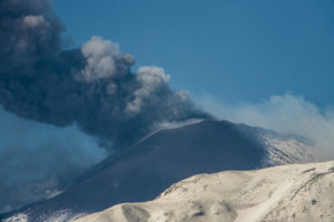
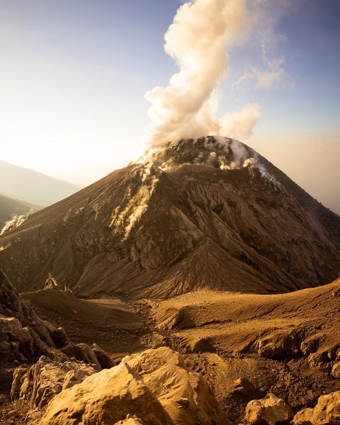
Indonesia , Marapi :
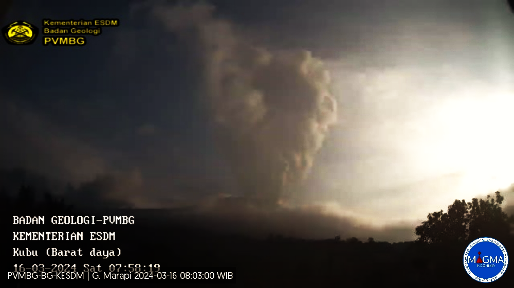
An eruption of Mount Marapi occurred on Saturday, March 16, 2024 at 07:50 WIB with the height of the ash column observed at ± 800 m above the summit (± 3691 m above sea level). The ash column was observed to be white to gray in color with moderate to thick intensity, oriented towards the East. This eruption was recorded on a seismograph with a maximum amplitude of 30.4 mm and a duration of 65 seconds.
VOLCANO OBSERVATORY NOTICE FOR AVIATION – VONA
Issued : March 16 , 2024
Volcano : Marapi (261140)
Current Aviation Colour Code : ORANGE
Previous Aviation Colour Code : orange
Source : Marapi Volcano Observatory
Notice Number : 2024MAR027
Volcano Location : S 0 deg 22 min 52 sec E 100 deg 28 min 23 sec
Area : West Sumatra, Indonesia
Summit Elevation : 9251 FT (2891 M)
Volcanic Activity Summary :
Eruption with volcanic ash cloud at 00h50 UTC (07h50 local).
Volcanic Cloud Height :
Best estimate of ash-cloud top is around 11811 FT (3691 M) above sea level or 2560 FT (800 M) above summit. May be higher than what can be observed clearly. Source of height data: ground observer.
Other Volcanic Cloud Information :
Ash cloud moving to east. Volcanic ash is observed to be white to gray. The intensity of volcanic ash is observed from medium to thick.
Remarks :
Eruption recorded on seismogram with maximum amplitude 30.4 mm and maximum duration 65 second. Tremor recorded on seismogram with maximum amplitude 2.5 mm.
Source et photo : Magma Indonésie.
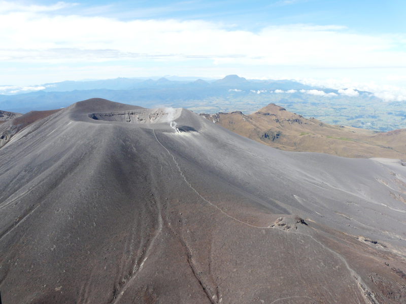
Colombia , Puracé – Los Coconucos Volcanic Range :
Weekly bulletin of the activity of the Puracé volcano – Los Coconucos volcanic chain
From the monitoring of the activity of the PURACE VOLCANO – LOS COCONUCOS VOLCANIC CHAIN, the MINISTRY OF MINES AND ENERGY, through the COLOMBIAN GEOLOGICAL SERVICE (SGC), reports that:
In the week of March 5 to 11, 2024, seismic activity presented levels similar to those of previous weeks, both in seismic energy released and in the number of events.
The fracture earthquakes recorded were mainly located under the building of the Puracé volcano, with depths less than 6 km and magnitudes less than 1.2 ML; while the earthquakes associated with the fluids were located in two areas: one under the crater of the volcano, at depths less than 500 m, and another to the South-East of it, at depths between 1.5 and 6.0 km.
During the period evaluated, deformations continued to be recorded between the Puracé and Curiquinga volcanoes. Likewise, the concentration of carbon dioxide (CO2) continued to oscillate and remains above reference values in this volcano. The increase in sulfur dioxide (SO2) flux detected in previous weeks continued to be recorded.
Images obtained using installed cameras show that significant degassing of the volcanic system continues.
Other parameters measured and used for the assessment of volcanic activity showed no notable changes during the period evaluated.
The alert status for volcanic activity remains at: YELLOW ALERT: ACTIVE VOLCANO WITH CHANGES IN THE BEHAVIOR OF THE BASE LEVEL OF MONITORED PARAMETERS AND OTHER MANIFESTATIONS.
Source et photo : SGC
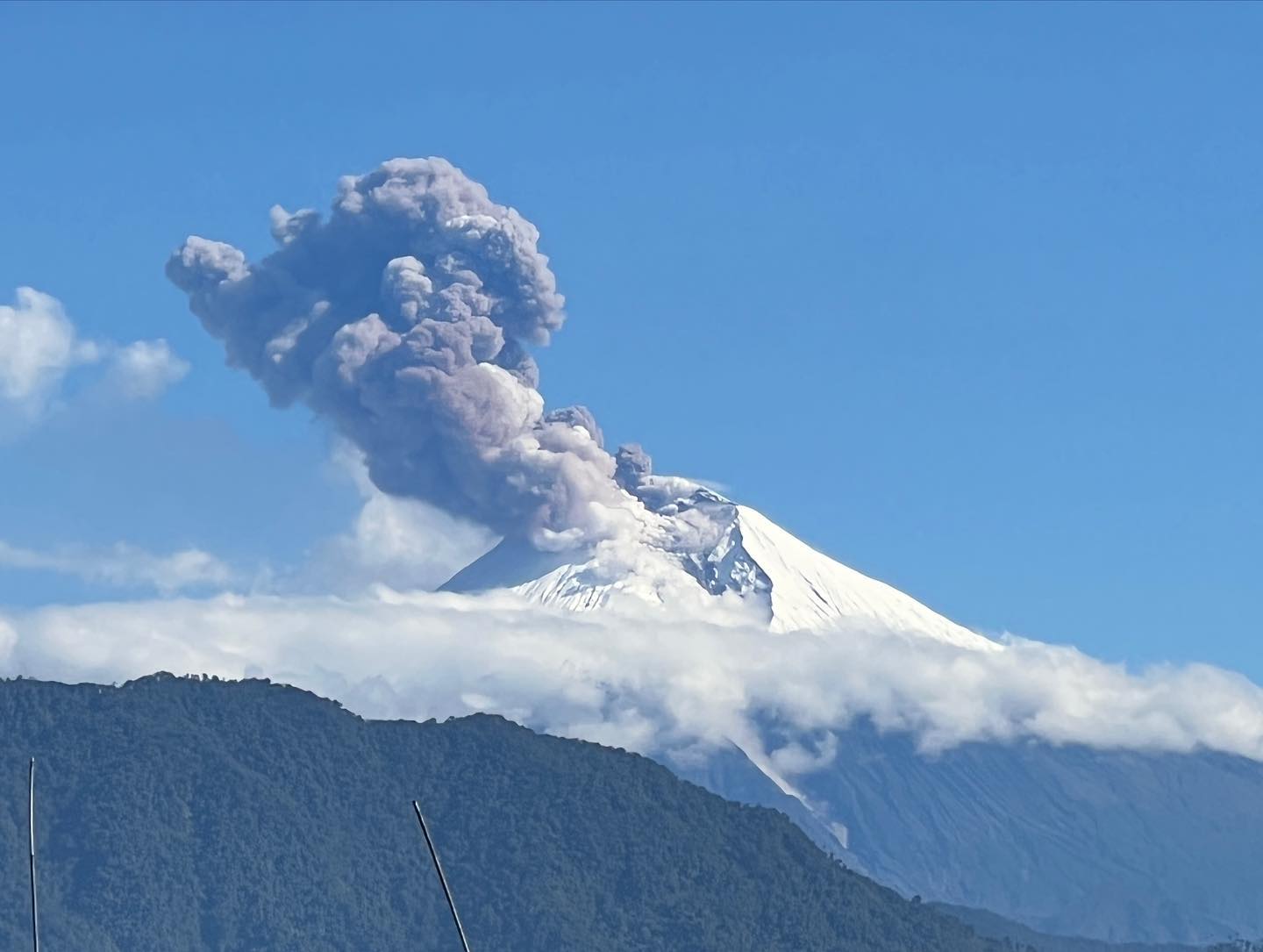
Guatemala , Santiaguito :
14°44′ 33˝ North latitude;
91°34’13˝ West longitude.
Altitude: 2,500 meters above sea level.
Weather conditions: partly cloudy
Wind: East
Precipitation: 27.8 mm.
Activity:
The Observatory reports activity in the Caliente Dome with moderate outgassing and moderate to strong explosions occurring at a rate of 2 to 7 explosions per hour. Moderate to strong explosions raise columns of water vapor and ash to heights of up to 4,700 meters above sea level (15,092 feet) and cause pyroclastic flows to descend over short distances mainly towards the South, South-West and West flanks. Detachment of boulders from the dome to the base and edges of the lava flow continues actively. Strong avalanches and noticeable sounds of volcanic activity are also recorded, as well as a constant incandescent pulse in the crater during the night. Activity remains at a high level, so there remains the possibility that with explosions or under the effect of gravity, part of the accumulated materials collapse and pyroclastic flows over long distances are generated towards the South. West, South, South-East and East.
Source : Insivumeh
Photo : Kyle Weinstein_photography .
Ecuador , Sangay :
DAILY REPORT ON THE STATE OF THE SANGAY VOLCANO, Friday March 15, 2024.
Information Geophysical Institute – EPN.
Surface activity level: High, Surface trend: No change
Internal activity level: High, Internal trend: No change
Seismicity: From March 14, 2024, 11:00 a.m. to March 15, 2024, 11:00 a.m.:
The number of seismic events recorded at the reference station over the past 24 hours is shown below. The level of seismic activity of the volcano remains high.
Explosion Event (EXP): 274
Precipitation/Lahars:
Over the past 24 hours, rains have been recorded in the volcano area, causing an increase in the flow of the Upano River. **Heavy rains could remobilize accumulated material and generate mud and debris flows that travel down the volcano’s flanks and flow into rivers downstream.
Emissions/ash column:
Due to weather conditions, gas and ash emissions were not observed via the monitoring camera network or the GOES-16 satellite system. The Washington VAAC has not released emissions reports for this volcano in the past 24 hours.
Observation:
Despite the cloud cover in the volcano area, yesterday evening, an episode of incandescence in the crater was observed thanks to the surveillance camera system. At the time of closing this report, the volcano remains completely cloudy
Alert level: yellow
Source : IGEPN.
Photo : AdriáLou Garay Véle