March 12 , 2023.
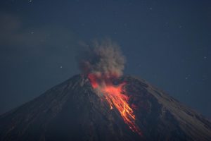
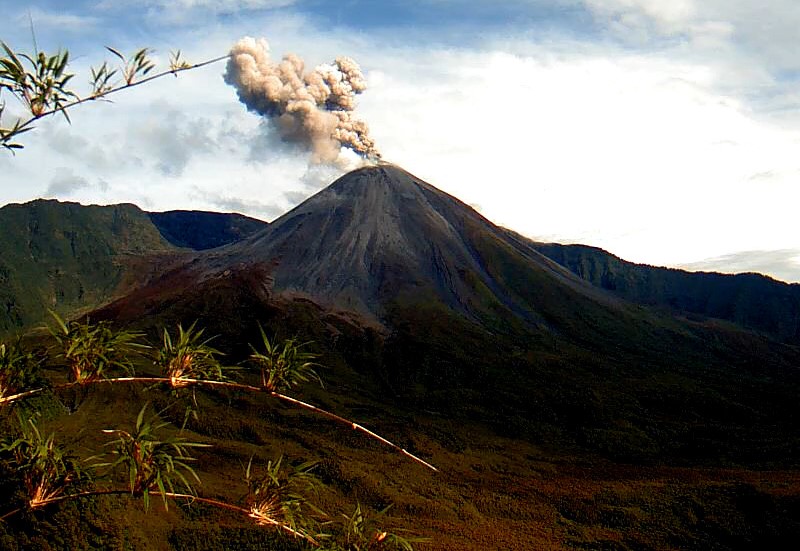
Chile , Lascar :
Seismology
The seismological activity of the period was characterized by the recording of:
62 seismic events of type VT, associated with the fracture of rocks (Volcano-Tectonics).
37 LP type seismic events, associated with fluid dynamics inside the volcanic system (Long Period). The size of the largest earthquake evaluated from the Reduced Displacement (RD) parameter was equal to 11 cm2.
3 TR type seismic events, associated with the sustained dynamics over time of fluids inside the volcanic system (TRemor). The size of the largest earthquake evaluated from the Reduced Displacement (RD) parameter was equal to 6 cm2.

Fluid geochemistry
The sulfur dioxide (SO2) emissions data obtained by the differential optical absorption spectroscopy (DOAS) equipment, corresponding to the Emú station, located 6 km in the East-South-East (ESE) direction from active crater, presented an average value of 200 ± 71 t/d, with a maximum daily value of 506 t/d on February 2.
No anomalies have been reported in emissions of sulfur dioxide (SO2) into the atmosphere in the area near the volcano, according to data published by the Tropopheric Monitoring Instrument (TROPOMI). No reports of atmospheric anomalies have been reported by the Ozone Monitoring Instrument (IMO) Sulfur Dioxide Panel.
Satellite thermal anomalies
During the period, no thermal alerts were recorded in the area associated with the volcano, according to the analytical processing of Sentinel 2-L2A satellite images, in combination of false color bands.
Geodesy
The two GNSS stations installed in the area of the Láscar volcano, which make it possible to monitor the deformation of the volcanic edifice, show small-scale displacements, both in the horizontal and vertical direction, not exceeding 0.16 cm/month. In conclusion, there is no evidence of deformation of the volcanic system for the period evaluated.
Surveillance cameras
The images provided by the fixed camera, installed near the volcano, recorded regular degassing, with a maximum column height of 720 m on February 4.
Activity remained at levels considered low, suggesting stability of the volcanic system. The technical volcanic alert is maintained in:
GREEN TECHNICAL ALERT: Active volcano with stable behavior – There is no immediate risk
Source : Sernageomin
Photo : RudiR/ commons.wikimedia.org .
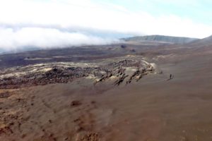
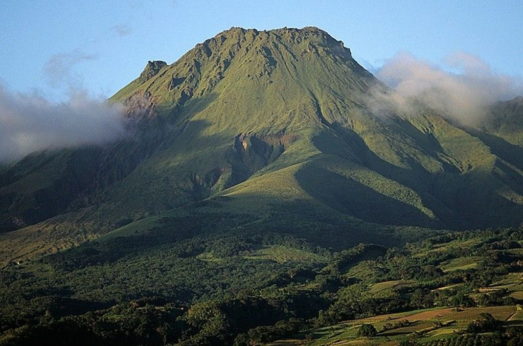
Colombia , Nevado del Huila :
Weekly bulletin on the activity of the Nevado del Huila volcano
From the monitoring of the activity of the NEVADO DEL HUILA VOLCANO, the MINISTRY OF MINES AND ENERGY, through the COLOMBIAN GEOLOGICAL SERVICE (SGC), reports that:
In the week from February 27 to March 4, 2024, seismic activity continued to present low levels, comparable to those recorded in previous months, both in number of events and in energy released. Images obtained from installed cameras showed low levels of degassing from the volcanic system.
Other parameters measured for the assessment of volcanic activity did not show significant changes.
During the period considered, the volcano continued to exhibit stable behavior.
The alert status for volcanic activity remains at: YELLOW ALERT: ACTIVE VOLCANO WITH CHANGES IN THE BEHAVIOR OF THE BASE LEVEL OF MONITORED PARAMETERS AND OTHER MANIFESTATIONS.
The COLOMBIAN GEOLOGICAL SERVICE will continue to monitor the evolution of the volcanic phenomenon and will inform in a timely manner of any changes that may occur.
Source : SGC
Photo : Parque Nacional
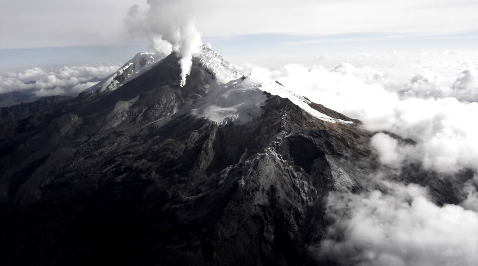
Ecuador , Reventador :
DAILY REPORT ON THE STATE OF THE REVENTADOR VOLCANO, Monday March 11, 2024.
Information Geophysical Institute – EPN.
Surface activity level: Moderate, Surface trend: No changes
Internal activity level: Moderate, Internal trend: No changes
Seismicity: From March 10, 2024, 11:00 a.m. to March 11, 2024, 11:00 a.m.:
The following table shows the number of seismic events from the reference station over the last 24 hours.
Explosion (EXP) 30
Long Period (LP) 14
Transmitting tremor (TREMI) 23
Tremor harmonic (TRARM): 3
Precipitation/Lahars:
No rain was recorded in the volcano area. In the event of heavy rains, these could remobilize the volcanic material accumulated nearby and generate flows of mud and debris which would slide down the sides of the volcano and flow into adjacent rivers.
Emissions/ash column:
Since yesterday, no gas or ash emissions have been observed thanks to the volcano’s surveillance camera system. On the other hand, W-VAAC issued a report during the night referring to clouds of gas and ash 800 m above the crater level in a West-Northwest direction.
Observation:
During last night, thanks to surveillance cameras, several episodes of incandescence were observed at the level of the crater accompanied by descents of pyroclastic materials up to 700 m below the level of the crater. On the other hand, the volcano remained completely cloudy yesterday morning and evening and partially clear during the afternoon.
Other monitoring parameters:
Over the last 24 hours, the MIROVA-MODIS satellite system recorded 1 weak thermal anomaly.
Alert level: Orange.
Source et photo : IGEPN.
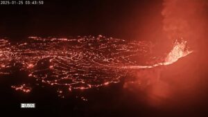
La Martinique , Montagne Pelée :
Weekly report, Paris Institute of Globe Physics / Martinique Volcanological and Seismological Observatory
Activity on Montagne Pelée. Saint-Pierre, March 8, 2024 at 2:00 p.m. local time (GMT-4)
Volcanic activity decreased this week with 9 earthquakes of volcanic origin observed.
Between March 1, 2024 at 4:00 p.m. (UT) and March 8, 2024 at 4:00 p.m. (UT), the OVSM recorded 9 very low energy volcano-tectonic earthquakes. These earthquakes were clearly identified as originating from one of the well-known seismically active zones at Montagne Pelée, located between 1.0 and 1.4 km depth below the summit of the volcano.
Surface seismicity of the volcano-tectonic type is associated with micro-fracturing in the volcanic edifice linked to the global reactivation of the volcano observed since the end of 2018.
No earthquake was felt by the population.
The previous week, the OVSM had recorded 14 earthquakes of volcanic origin. As of March 8, 2024 and during the last 4 weeks, the OVSM has therefore observed a total of 71 volcanic earthquakes, or an average of 17 to 18 earthquakes per week.
During phases of volcanic reactivation of volcanoes similar to Montagne Pelée, it is usual to observe seismic activity varying in intensity and frequency.
The alert level is currently YELLOW: vigilance.
Source : OVSM /IPGP
Photo : Photopoesie
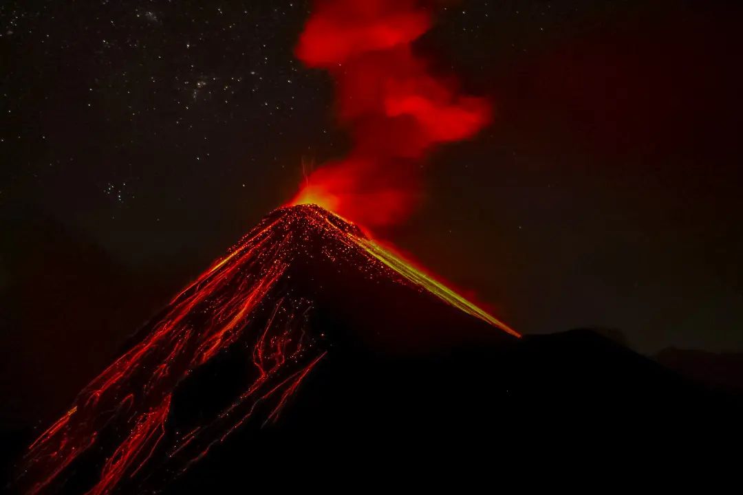
Guatemala , Fuego :
14°28’54˝ North latitude;
90°52’54˝ West longitude.
Altitude: 3,763 meters above sea level.
Weather conditions: Clear weather
Wind: North-East
Precipitation: 0.0 mm.
Activity:
The Fuego Volcano Observatory OVFGO reports weak, moderate, and a few strong explosions, which occur at a frequency of 3 to 7 per hour. These explosions generate columns of gray gas and ash at heights of 4,300 to 4,700 meters above sea level (14,108 to 15,420 feet), which travel 12 km westward and southward. South West. The explosions produce weak and moderate avalanches around the crater and towards the Seca, Ceniza, Taniluyá and Las Lajas ravines where part of the ejected material reached the vegetation. Low and moderate rumblings are reported with weak shock waves that vibrate the roofs and windows of houses near the volcano. Falling fine ash particles are also reported in the communities of Panimache I, Morelia, Santa Sofía and other neighboring communities.
Source : Insivumeh
Photo : Desnivel Tour