March 9 , 2024.
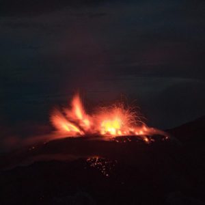
Indonesia , Merapi :
MOUNT MERAPI ACTIVITY REPORT. from March 1 to 7, 2024
OBSERVATION RESULT
Visual
The weather around Mount Merapi is generally clear in the morning and night, while it is foggy from noon to evening. White smoke, thin to thick in thickness, low to moderate pressure and with a height of 375 m was observed from the observation post of Mount Merapi Babadan on March 7, 2024 at 05:30 WIB. This week, on March 4, 2024, a series of warm clouds descended 8 times and headed southwest (upstream of Bebeng River) with a maximum sliding distance of 2,600 m. Volcanic ash rain due to hot cloud avalanches was observed at Pasarbubar station (north side at a distance of 800 m from the summit), light ash rain was also reported at Selo and Cepogo, in the regency of Boyolali. Lava avalanches were observed 123 times in the South and Southwest, including once upstream of the Boyong River up to 1,000 m and 122 times upstream of the Bebeng River with a maximum distance of 2,000 m. The sound of avalanches was heard twice from the Babadan post with low intensity. The morphology of the southwest dome was observed to have changed due to hot cloud activity and lava avalanches. The measured hot spot reached 251.1°C, which was 3.8°C lower than the previous measurement temperature. The morphology of the median dome is relatively constant. The measured hot spot reached 209.5°C, which was 17.4°C higher than the previous measurement temperature. Based on the analysis of aerial photos from January 10, 2024, the volume of the southwest dome was measured at 2,663,300 m3 and that of the central dome at 2,358,400 m3.
Seismicity
This week, Mount Merapi seismicity recorded:
8 Warm Cloud Avalanche (APG) earthquakes,
9 superficial volcanic earthquakes (VTB),
80 multi-phase (MP) earthquakes,
2 low frequency (LF) earthquakes,
590 avalanche earthquakes (RF),
9 tectonic earthquakes (TT).
The intensity of earthquakes this week is still quite high.
Deformation
The deformation of Mount Merapi monitored by EDM this week showed a shortening rate of 0.3 cm/day.
Rain and lahars
This week there was rain at Mount Merapi observation post with a rain intensity of 65 mm/hour for 90 minutes at Babadan observation post on March 6, 2024 and additional flows were reported in the Trising rivers and Boyong.
Conclusion
Based on the results of visual and instrumental observations, it was concluded that: The volcanic activity of Mount Merapi is still quite high in the form of effusive eruptive activity. The activity status is set to the “SIAGA” level .
Source : BPPTKG
Photo : Andi volcanist.
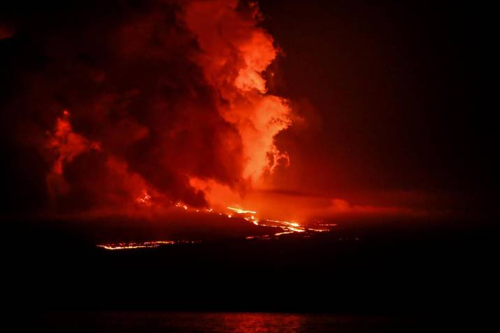
Ecuador / Galapagos Islands , Fernandina :
DAILY REPORT ON THE ACTIVITY OF THE FERNANDINA VOLCANO. Quito, Thursday March 7, 2024.
From March 06, 2024 11:00:00 to March 07, 2024 11:00:00
Activity level:
Surface: High; Surface trend: Descending
Internal: High; Internal trend: Descending
Emissions/ash column:
Yesterday afternoon, the emission of gas in a West-South-West direction from the emplaced lava flows was reported.
Gas:
The Mounts satellite system recorded 5170.8 tonnes of sulfur dioxide (SO2) measured on 03/06/2024 at 2:07 p.m. TL (Galapagos time).
Other monitoring parameters:
The FIRMS satellite system recorded hundreds of thermal anomalies. 24 hours.
Observation:
Through satellite images, it has been observed that the maximum range of lava flows is 8 km, measured from the elevated area. A fire is also observed to the west of the lava field. It is important to note that Fernandina Island has no human settlements, so there is no risk to the population. However, if lava flows enter the sea, it is recommended to keep your distance as contact can generate small explosions and, therefore, the release of toxic gases. Likewise, it is recommended not to approach the eruption area, due to the risk of being affected by the products of this event or by possible secondary phenomena such as fires.
Source : IGEPN
Photo : EFE / Vanguardia.
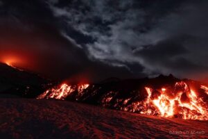
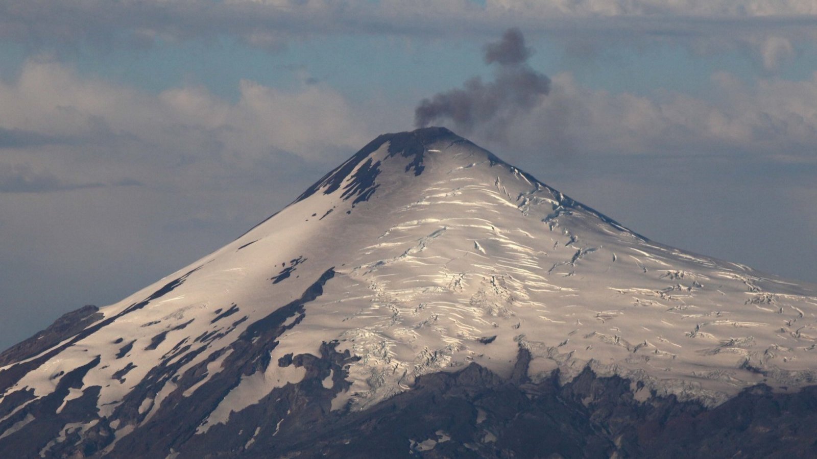
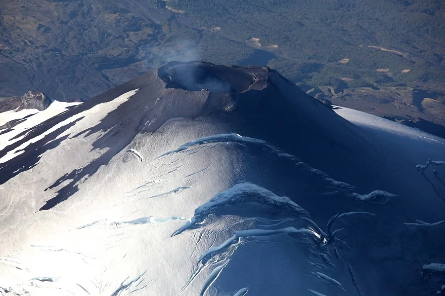
Chile , Villarica :
Seismology
The seismological activity of the period was characterized by the recording of:
A continuous tremor signal associated with the fluid dynamics inside the volcano, which during the period presented an energy variation, evaluated with the RSAM parameter, between 0.9 and 2.5 µm/s, values considered above their baseline level.
321 seismic events of type VT, associated with the fracturing of rocks (Volcano-Tectonics). The most energetic earthquake had a Local Magnitude (ML) value equal to 3.3, located 4.4 km east-southeast of the volcanic edifice, at a depth of 3.9 km relative to to the crater.
24697 LP type seismic events, associated with fluid dynamics inside the volcanic system (Long Period). The size of the largest earthquake evaluated from the Reduced Displacement (RD) parameter was equal to 85 cm2.
5719 seismic events of type TR, associated with the dynamics maintained over time of fluids inside the volcanic system (TRemor). The size of the largest earthquake evaluated from the Reduced Displacement (RD) parameter was equal to 59 cm2.
1 VLP type seismic event, associated with the dynamics of large volumes of fluids inside the volcanic system (Very Long Period). The size of the earthquake evaluated from the Reduced Displacement (RD) parameter was equal to 17 cm2.
Fluid geochemistry
The sulfur dioxide (SO2) emissions data obtained by the differential optical absorption spectroscopy (DOAS) equipment, corresponding to the Los Nevados and Tralco stations, installed respectively at 10 km in an East-North-East direction and 6 km East-South-East of the active crater, presented an average value of 827 ± 195 t/d, which represents moderate values for this volcanic system. The maximum daily value was 2,857 t/d on February 28, considered an abnormal value for this system.
5 satellite anomalies were reported in atmospheric SO2 emissions in the area near the volcano, on February 18, 19, 23, 24 and 29, according to data published by Tropopheric Monitoring Instrument (TROPOMI) and Mounts.
Satellite thermal anomalies
During the period, 23 thermal alerts were recorded in the area associated with the volcano, with a maximum volcanic radiative power (VRP) of 127 MW on February 16, a value considered high according to data processed by the Observation of the volcanic activity in the mid-infrared. (MIROVA).
Thanks to the analysis of Sentinel 2-L2A satellite images, 6 radiance anomalies were detected in the area associated with the crater during the evaluated period. The NHI tools platform detected a maximum area of anomalous radiance in the crater area of 47,200 m2 on February 17.
Geodesy
Geodetic activity was characterized by:
– Low amplitude of variation rates of horizontal and vertical components of GNSS monitoring stations.
– Displacement rate of medium magnitude and with slight changes compared to the previous period. The online elongation of the SE-NW monitoring reaches 0.8 cm/month due to the annual cyclical variation of the stations southeast of the volcanic edifice.
– Thanks to InSAR, no signs of deformation have been observed over the last 3 months.
In conclusion, a period of stability is evident in the monitoring of deformations, but with changes of small magnitude which do not exclude the appearance of superficial morphological changes.
Surveillance cameras
From the surveillance cameras installed on the volcano, whitish columns of degassing mainly associated with water vapor were observed, with a maximum height of 980 m on February 29. On the other hand, on February 17, 18, 25, 28 and 29, columns with low pyroclast content were observed, characterized by passive emissions, gray in color and low pyroclast load, with a maximum height of 120 m on February 18. There were incandescences every night and Strombolian explosions on February 16, 18, 19, 20, 23, 24, 26, 27 and 29, highlighting the activity of February 24 with the ejection of pyroclasts to maximum height 150 m above the level of the crater. .
Satellite geomorphological analysis
Thanks to the photo-interpretation of Planet Scope, Sentinel 2 L2A and SkySat collect images, the persistence of the accumulation of pyroclasts around the crater is observed. Inside the crater, an abundant accumulation of pyroclasts and the development of a ring of pyroclasts 67 m in diameter are observed around the lava lake. Concerning the exposed melting area, it was visible throughout the fortnight, with an approximate area of 400 m2 according to the Skysat image of February 25.
Volcanic activity is characterized by the recurrent recording of seismicity linked to fluid dynamics, with a tendency to stabilize the energy values of the seismic signal.
continues at values close to 1.3 µm/s. Occasionally, more energetic LP and VT earthquakes were recorded, warranting the publication of special reports. At the same time, there remains a record of moderate explosions that disperse materials generally in the area near the crater, a record of incandescent phenomena and thermal anomalies by satellites. All of the above suggests an active lava lake located near the surface, with variations in the geometry of the emission center and the level of the lava lake, implying a still unstable process and with the potential to generate explosive activity.
Thus, your technical alert is maintained at:
YELLOW TECHNICAL ALERT: Changes in the behavior of volcanic activity
Source : Sernageomin
Photos : TVN ( archive) , Aton.
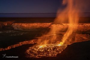
Hawaii , Kilauea :
HAWAIIAN VOLCANO OBSERVATORY WEEKLY UPDATE. U.S. Geological Survey
Tuesday, March 5, 2024, 7:45 AM HST (Tuesday, March 5, 2024, 17:45 UTC)
19°25’16 » N 155°17’13 » W,
Summit Elevation 4091 ft (1247 m)
Current Volcano Alert Level: ADVISORY
Current Aviation Color Code: YELLOW
Activity Summary:
Kīlauea volcano is not erupting. Due to continued low rates of seismicity, HVO will issue weekly Kīlauea updates on Tuesdays until further notice. Additional messages will be issued as needed.
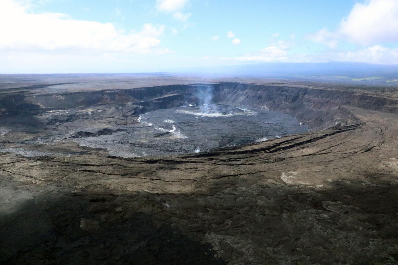
Summit Observations:
Low levels of seismicity beneath the summit continues. Earthquakes are dispersed widely from the summit to the southwest. There were 61 earthquakes recorded around the summit over the past week. Depths beneath the summit are 0.5-5 miles (1–8 km) below the surface, and magnitudes are typically below M2.0.
Ground deformation remains low with tiltmeters near Uēkahuna and Sand Hill showing modest changes over the past week.
Sulfur dioxide (SO2) gas emission rates have remained low since October 2023. An SO2 emission rate of approximately 85 tonnes per day was recorded on March 1.
Rift Zone Observations:
Seismicity in Kīlauea’s upper East Rift Zone and Southwest Rift Zone remain low. No unusual activity has been noted along the middle and lower sections of Kīlauea’s East Rift Zone. We continue to closely monitor both rift zones.
Source : HVO
Photo : USGS/ K. Mulliken.
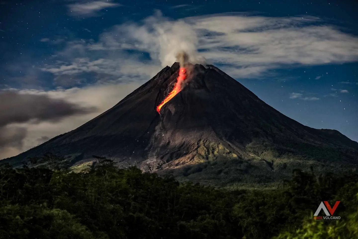
Guatemala , Santiaguito :
14°44′ 33˝ North latitude;
91°34’13˝ West longitude.
Altitude: 2,500 meters above sea level.
Weather conditions: Clear weather
Wind: North-East
Precipitation: 0.0 mm.
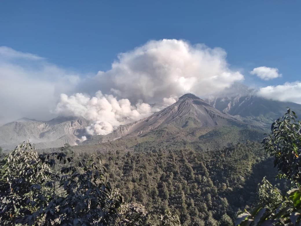
Activity:
The Santiaguito volcano observatory OVSAN reports moderate degassing above the crater. Weak and moderate explosions are recorded, expelling columns of gas and ash which disperse in the West and South-West direction. At night and early morning, constant incandescence was observed in the Caliente Dome crater and in the upper part of the lava flow in a West-Southwest direction. Weak to moderate boulder avalanches are recorded on the lava flow, on the southern flank and on the southeastern flank. The volcano maintains high activity due to the extrusion of blocky lava into the Caliente Dome in a West, Southwest direction. With the unstable nature of the material in the crater. There is a chance of moderate to strong pyroclastic flows, so do not stay near or in river beds near the slopes of the volcano.
Source : Insivumeh
Photo : Noticias la Red GT San José del Golfo