March 6 , 2024.
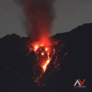
Iceland , Reykjanes Peninsula :
Increased likelihood of an eruption. Weather conditions over the next few days could affect IMO‘s monitoring system. Hazard assessment unchanged
Updated 5. March at 14:20 UTC
Likely scenarios over the next few days:
The volume of magma within the Svartsengi reservoir continues to increase, which could result in a new dike propagation and/or volcanic eruption in the coming days.
A volcanic eruption could start with a very short warning time, even less than 30 minutes.
It is most likely that an eruption will occur in the area between Mt. Stóra-Skógfell and Mt. Hagafell.
Seismicity over the dike has been low since the magma propagation ended on Saturday (2 March) evening. There is slightly more activity at Mt. Fagradalsfjall, where around 20 earthquakes have been detected in the last 24-hours.
Model calculations indicate a volume loss of about -1.3 million cubic metres from the Svartsengi magma reservoir on Saturday – which fed a 3-km long dike intrusion between Mt. Stóra-Skógfell and Mt. Hagafell. The volume loss from the Svartsengi reservoir was much lower than that which occurred during previous events, where a volume loss of about -10 million cubic metres was calculated.
Continuous land uplift is detected on GNSS observations since Saturday‘s magma propagation. Magma inflow beneath Svartsengi thus continues and model calculations suggest an inflow/accumulation rate of about half a million cubic metres per day. In total, about 9,5 million cubic metres of magma has been recharged to the reservoir beneath Svartsengi since the eruption on 8-9 February.
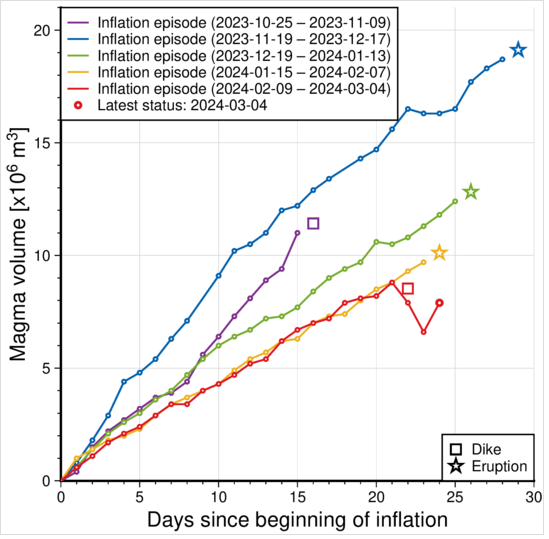
The graph shows a comparison of volume increase within the Svartsengi reservoir prior to dike propagations and/or eruptions. The status of the volume change as of 4 March is indicated by the red line. This line also shows what affect the magma propagation on the 2 March had on the accumulation process within the magma reservoir beneath Svartsengi. The quantities displayed on this graph are derived from model calculations based on GNSS data alone. Joint InSAR-GNSS modelling of the diking event on Saturday indicates a volume loss of about -1.3 million cubic metres from the Svartsengi reservoir which fed the dike propagation within the Sundhnúkur crater row, without resulting in an eruption. Values derived from both the GNSS only and the joint InSAR-GNSS inversions are subject to uncertainty.
Therefore, pressure in the magma reservoir continues to build up, and there is an increased likelihood of another dike propagation within the Sundhnúkur crater row and/or a volcanic eruption in the coming days.
Source : IMO.
Photos : Siggi Anton , IMO
Alaska , Gareloi :
AVO/USGS Volcanic Activity Notice
Current Volcano Alert Level: NORMAL
Previous Volcano Alert Level: ADVISORY
Current Aviation Color Code: GREEN
Previous Aviation Color Code: YELLOW
Issued: Tuesday, March 5, 2024, 11:50 AM AKST
Source: Alaska Volcano Observatory
Notice Number: 2024/A241
Location: N 51 deg 47 min W 178 deg 47 min
Elevation: 5161 ft (1573 m)
Area: Aleutians
Volcanic Activity Summary:
Volcanic activity at Mount Gareloi (Gareloi volcano) has decreased over the past few weeks. Occasional small earthquakes continue to be observed; however, the current activity is at background levels. Due to this decrease in activity, the Alaska Volcano Observatory is lowering the Aviation Color Code and Volcano Alert Level to GREEN/NORMAL.
Mount Gareloi is monitored by a local seismic and infrasound network, satellite data, and regional infrasound and lightning-detection networks.
Remarks:
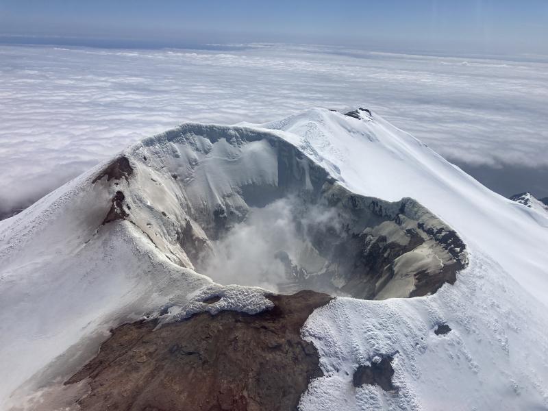
Mount Gareloi, which makes up all of Gareloi Island, is a stratovolcano located in the Delarof Islands group of the Aleutian Islands, about 2,000 km (1,242 mi) west-southwest of Anchorage and about 150 km (93 mi) west of Adak, the westernmost community in Alaska. This small volcano is 10 × 8 km (6.2 × 5.0 mi) in diameter at its base with two summits, separated by a narrow saddle. The northern, slightly higher peak contains crater about 300 m (1,000 ft) across. The southern summit has a crater open to the south and a persistent degassing vent (fumarole) on its western rim. Gareloi has been one of the most active in the Aleutians since the 1740s, with 16 reports of eruptive activity at Gareloi since 1760. In 1929, its largest historical eruption produced sixteen small south- to southeast-trending craters that extend from the southern summit to the coast, as well as lava flows and pyroclastic deposits on the southeastern flank of the volcano. Eruptions of Gareloi commonly produce ash clouds and lava flows, and the primary hazard is airborne clouds of ash that could affect aircraft. Since seismic instruments were installed in 2003, they have detected small but consistent seismic signals from beneath Mount Gareloi’s edifice.
Source : AVO
Photo : Mann, Doerte / AVO / EarthScope Consortium
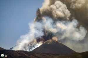
Ecuador / Galapagos Islands , Fernandina :
DAILY REPORT ON THE ACTIVITY OF THE FERNANDINA VOLCANO. Quito, Tuesday March 5, 2024.
From March 4, 2024 11:00:00 to March 5, 2024 11:00:00
Activity level:
Surface: High; Surface trend: Descending
Internal: High; Internal trend: Descending
Emissions/ash column:
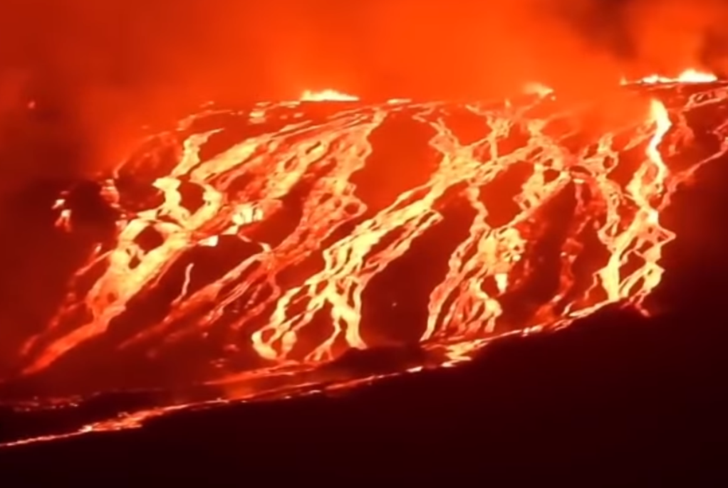
Thanks to the GOES16 satellite system, it was observed that the emission of gases which accompanied the establishment of lava flows ceased yesterday afternoon.
Gas:
The Mounts satellite system recorded approximately 24,000 tonnes of sulfur dioxide (SO2) measured at 1:27 p.m. TL on 04/03/2024 (Galapagos time).
Other monitoring parameters:
The WORLDVIEW satellite system and the FIRMS satellite system have recorded hundreds of thermal alerts. Additionally, MIROVA-VIIRS recorded 3 very high thermal alerts and 1 high thermal alert, MIROVA-MODIS recorded 1 very high thermal alert, 1 high thermal alert and 1 extreme thermal alert in the last 24 hours.
Observation:
Thanks to satellite images and maps made by the staff of the Geophysical Institute, it was observed that the extent of lava flows has only slightly increased over the past 24 hours. Additionally, according to the park rangers’ assessment, activity has decreased, indicating that the color is no longer as strong as in previous days. It is important to note that Fernandina Island has no human settlements, so there is no risk to the population. However, if lava flows enter the sea, it is recommended to keep your distance as contact can generate small explosions and, therefore, the release of toxic gases. Likewise, it is recommended not to approach the eruption area, due to the risk of being affected by the products of this event or by possible secondary phenomena such as fires.
Source : IGEPN
Photo : Byron Aguirre via Alejandro Miguel . ( capture d’écran FB )
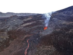
Italy , Stromboli :
WEEKLY BULLETIN, from February 26, 2024 to March 3, 2024. (issue date March 5, 2024)
SUMMARY STATEMENT OF ACTIVITY
In light of the monitoring data, it appears:
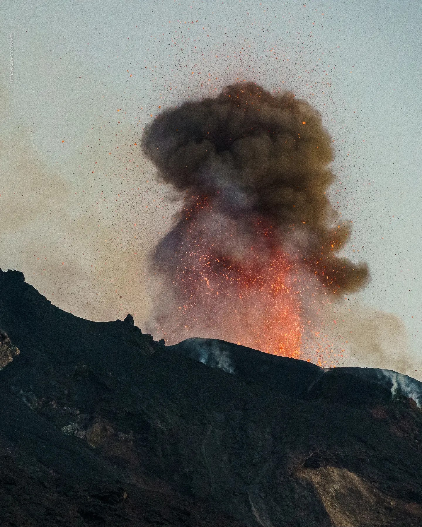
1) VOLCANOLOGICAL OBSERVATIONS: Normal Strombolian activity was observed during this period. The total hourly frequency fluctuated between average values (7-12 events/h). The intensity of the explosions was low and medium in the areas of the North and South-Central craters.
2) SISMOLOGY: The monitored seismological parameters do not show significant variations.
3) GROUND DEFORMATIONS: The island’s ground deformation monitoring networks showed no significant changes to report for the period under review.
4) GEOCHEMISTRY: Mid-level SO2 flux.
The CO2 flux in the summit area shows high values.
C/S ratio in the plume: there are no updates.
Helium Isotope Ratio in Thermal Aquifer: There are no updates.
CO2 flow in Scari: remains at average values.
5) SATELLITE OBSERVATIONS: Thermal activity observed by satellite was generally weak.
VOLCANOLOGICAL OBSERVATIONS
In the observed period, the eruptive activity of Stromboli was characterized through the analysis of images recorded by the INGV-OE surveillance cameras located at Pizzo (SPT), at altitude 190 m (SCT-SCV) and at Point dei Corvi (SPCT). . The explosive activity was mainly produced by 2 (two) eruptive vents located in the northern area of the crater and by 2 (two) vents located in the south central area.
Due to the video signal interruption reported in the previous bulletin, images of the explosive activity were observed beginning at 15:36 UTC on February 26.
Observations of explosive activity captured by surveillance cameras
In the area of the North crater (N), with a mouth located in sector N1 and a mouth located in sector N2, explosive activity was observed mainly of low intensity (less than 80 m height) in sector N2 and of medium intensity (less than 80 m high to more than 150 m high) up to sector N1. The products emitted in the eruption were mainly coarse materials (bombs and lapilli). The average frequency of explosions oscillated between 4 and 6 events/h.
In the South-Central (CS) zone, sectors C and S1 did not show significant activity. In sector S2 the explosions were of variable intensity ranging from low (less than 80 m in height) to medium (less than 150 m in height) emitting fine materials sometimes mixed with coarse materials. The average frequency of explosions varied between 3 and 6 events/h.
Source : INGV.
Photo : Stromboli stati d’animo / Sebastiano Cannavo.
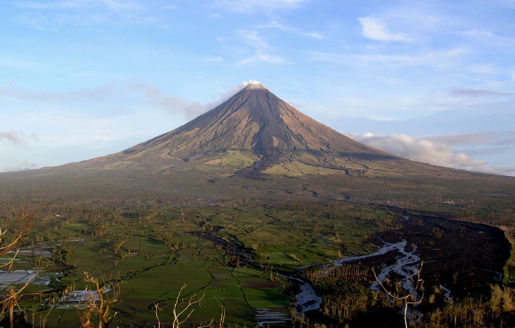
Philippines , Mayon :
MAYON VOLCANO BULLETIN , 05 March 2024 , 05:30 PM
This serves as notice for the lowering of the alert status of Mayon Volcano from Alert Level 2 (Moderate Level of Unrest) to Alert Level 1 (Low Level of Unrest).
Since the start of the year, Mayon Volcano has exhibited a steady decline in its monitored parameters. This is supported by the following observations:
1. Volcanic Earthquake Activity: Volcanic earthquakes recorded by the Mayon Volcano Network (MVN) have declined to a daily average of 2-3 earthquakes/day since the first week of January 2024. A considerable number of these earthquakes are related to rock fracturing processes within the volcano. In addition, rockfall from Mayon’s summit dome averaged 0-1 events/day indicating a significant slowing down of lava dome growth.
2. Ground Deformation: Long-term ground deformation data from Global Positioning Systems (GPS), Electronic Distance Measurements (EDM) and electronic tiltmeters show that the edifice is still inflated overall. Short-term data indicate deflation of the general northern middle slopes, whereas recent inflation of the general southern slopes and continued inflation of the upper slopes is occurring. Microgravity observations likewise show positive (density increase) and negative (density decrease) microgravity anomalies on the northern lower and middle slopes of the volcano, respectively. Ground deformation and microgravity anomalies are interpreted to be caused by crystallization of the resting magma beneath the volcano.
3. Volcanic Gas Emission: Sulfur Dioxide emission or SO2 flux from Mayon crater based on continuous gas spectrometry has varied between a high 2,394 tonnes/day on 22 January 2024 to a low of 420 tonnes/day on 5 March 2024. Since January 2024 to present, the SO2 flux has averaged 1148 tonnes/day. Overall, SO2 emissions are above the background level of 500 tonnes/day, consistent with continued degassing from the resting un-erupted magma.
4. Visual Observation of the Summit and Lava Flow: Mayon’s summit crater has generated only weak to moderate degassing plumes this year. Since 8 December 2023 when the status of Mayon was lowered to Alert Level 2, crater glow, or incandescence associated with superheated gas emitted from the summit crater, has remained weak and visible only with the aid of a telescope. No movement of the lava flows on the Mi-isi, Bonga and Basud Gullies could be observed as well. These observations of stable summit conditions, sparse rockfall events and lack of movement of the lava flows are consistent with the absence of magma re-supply to the shallow levels of the edifice.
In view of the above, PHIVOLCS-DOST is now lowering the alert status of Mayon from Alert Level 2 to Alert Level 1. This means that the volcano’s state of unrest has declined to low levels and that the likelihood of an eruption occurring within the immediate future has diminished. However, the lowering of the alert status should not be interpreted that unrest has completely ceased. In the event of a renewed increase in any one or combination of the above monitoring parameters, the alert status may step up once again to Alert Level 2. On the other hand, if there is a noticeable return to baseline levels of ground deformation and sustained low levels of other monitoring parameters, then the alert status may further step down. The public is still reminded to avoid entry into the 6-km Permanent Danger Zone or PDZ due to perennial hazards of rockfalls, avalanches, and sudden steam-driven or phreatic eruption at the summit area.
Source : Phivolcs.
Photo : Theworldnews