February 29 , 2024.
Japan , Sakurajima :
JMA reported ongoing eruptive activity at Minamidake Crater (Aira Caldera’s Sakurajima volcano) during 17-26 February with nighttime crater incandescence. Very small eruptive events were recorded during 17-23 February. An explosion at 17h34 on 24 February generated an ash plume that rose 400 m above the crater rim before entering weather clouds, and ejected blocks as far as 1.2 km away from the vent. The Alert Level remained at 3 (on a 5-level scale), and the public was warned to stay 2 km away from both craters.
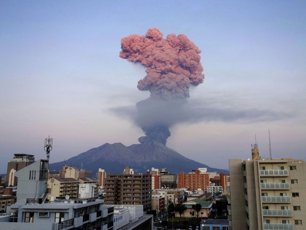
The Aira caldera in the northern half of Kagoshima Bay contains the post-caldera Sakurajima volcano, one of Japan’s most active. Eruption of the voluminous Ito pyroclastic flow accompanied formation of the 17 x 23 km caldera about 22,000 years ago. The smaller Wakamiko caldera was formed during the early Holocene in the NE corner of the caldera, along with several post-caldera cones. The construction of Sakurajima began about 13,000 years ago on the southern rim and built an island that was joined to the Osumi Peninsula during the major explosive and effusive eruption of 1914. Activity at the Kitadake summit cone ended about 4,850 years ago, after which eruptions took place at Minamidake. Frequent eruptions since the 8th century have deposited ash on the city of Kagoshima, located across Kagoshima Bay only 8 km from the summit. The largest recorded eruption took place during 1471-76.
Source : Agence météorologique japonaise (JMA), GVP
Photo : Deniss García Mendoza
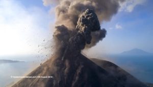
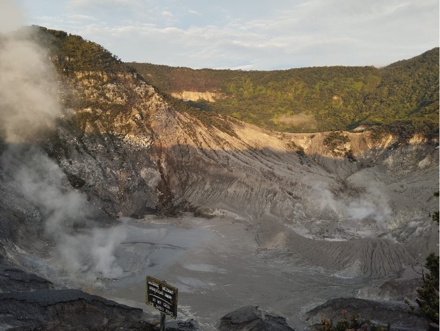
Indonesia , Tangkuban Parahu :
Press release on the volcanic activity of Mount Tangkuban Parahu, February 28, 2024.
Mount Tangkuban Parahu is an active volcano located in West Bandung Regency and Subang Regency, West Java Province. This volcano has 9 craters of which the two main craters are in the summit area, namely Kawah Ratu and Upas Crater. The eruption of Mount Tangkuban Parahu generally takes the form of a phreatic eruption of Kawah Ratu. The last increase in volcanic activity at Mount Tangkuban Parahu took place in 2019. The eruption phase had started on July 26, 2019 at 3:48 p.m. WIB, an eruption occurred in the Ratu crater with a column of mud mixed with some ash reaching a height of 200 meters from the bottom of the crater, of a thick blackish gray color. Continuous eruptive activity was observed until August 9, 2019. The distribution of sandy materials generally fell to the crater floor, while eruption ash was scattered around the crater depending on wind direction and speed.
On February 28, 2024 at 05:30 WIB and 06:01 WIB, an emission earthquake was recorded with an amplitude of 42 mm and 56 mm and an earthquake duration of 8 minutes. The results of checks around the Ratu, Ecoma and Domas craters on February 28, 2024 revealed no new deposits of volcanic material in these three craters.
The latest developments in the activities of Mount Tangkuban Parahu until February 28, 2024 at 12:00 WIB, based on the results of visual and instrumental monitoring, are as follows:
The results of checks around the Ratu, Ecoma and Domas craters on February 28, 2024 revealed no new deposits of volcanic material in these three craters. Smoke emissions in the three craters showed no increase in height, pressure or thickness.
Volcanic activity at Mount Tangkuban Parahu during the February 2024 period is dominated by low-frequency earthquakes which indicate shallow or near-surface fluid movement activity. In February, there was a relative increase in the number of low-frequency earthquakes, correlated with an increase in precipitation intensity. This increase could occur due to changes (build-up) in pressure at shallow depths due to an increase in the amount of rain that fell this month, while this is an indication of a build-up of pressure from deep magma which has not been observed.
Results of deformation monitoring with an inclinometer and electronic distance measuring (EDM) equipment this month showed no significant trend of additional subsurface pressure in response to swelling of the body of Mount Tangkuban Parahu.
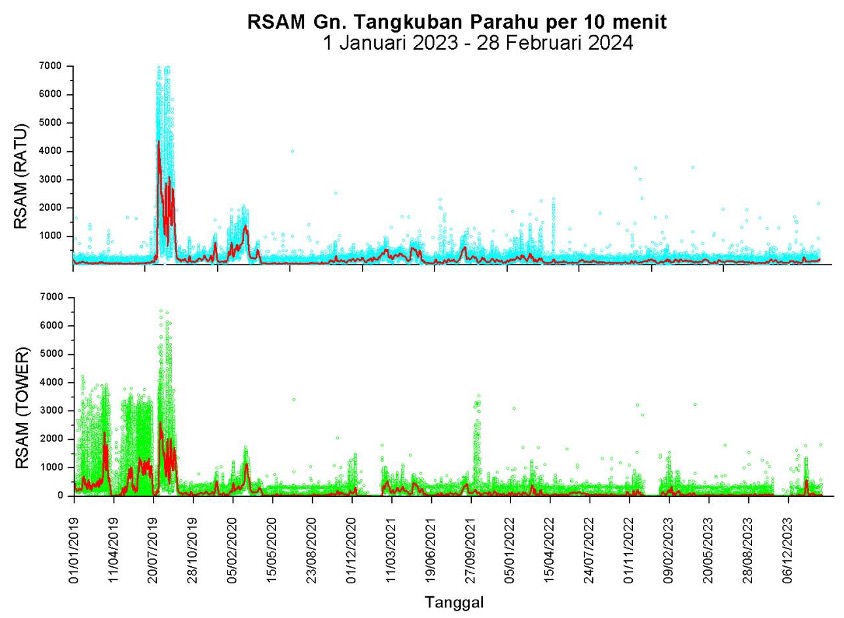
Seismic amplitude (RSAM) graph of Mount Tangkuban Parahu for the period January 1, 2019 to February 28, 2024 RATU station (top) and TOWER station (bottom).
One should be aware of the potential danger posed by a phreatic eruption, that is, one that occurs without a clear or significant increase in volcanic symptoms. If a phreatic eruption occurs, it may be accompanied by ash falls and ejections of material around the crater.
Based on the results of visual and instrumental assessments, the activity level of Mount Tangkuban Parahu on February 28, 2023 at 12:00 WIB is still at Level I (normal) with recommendations for the public and visitors/tourists:
Do not approach the bottom of the crater, do not linger too long and do not spend the night in the active craters area of Mount Tangkuban Parahu.
Move away/leave the area around the crater immediately if an increase in intensity/thickness of smoke from the crater is observed and/or you smell a strong odor of gas to avoid the potential danger of exposure to toxic gases or phreatic eruptions.
Source et photos : PVMBG
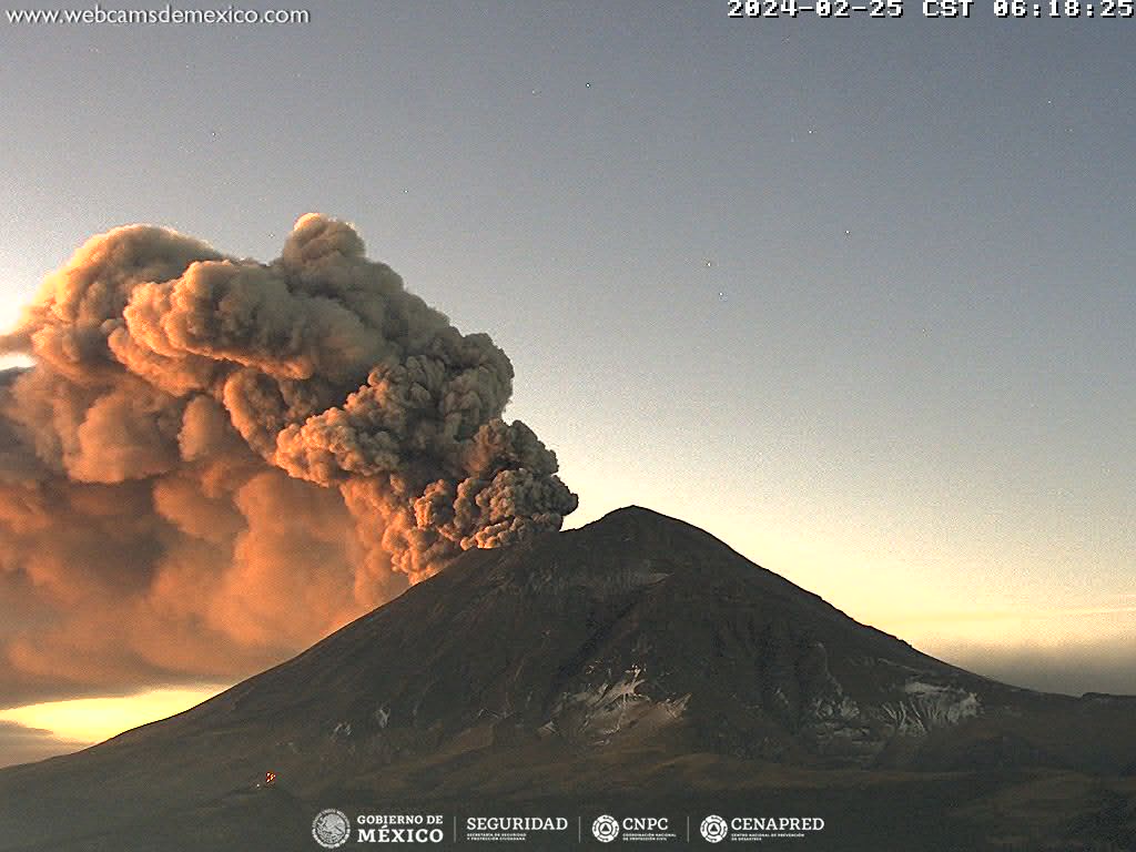
Mexico , Popocatepetl :
CENAPRED reported that eruptive activity continued at Popocatépetl during 21-27 February. The seismic network recorded daily periods of high-frequency, low-amplitude tremor that lasted from about 90 minutes to almost 22 hours. The Washington VAAC reported that daily ash plumes visible in webcam and satellite images generally rose to 5.2-6.7 km (17,000-22,000 ft) a.s.l. and drifted predominantly E, SE, S, and SW. The ash emissions were continuous for periods of time with remnant ash continuing to be visible in subsequent satellite images, drifting 75-140 km before dissipating. At 11h51 on 24 February a dense ash plume rose to 7.6 km (25,000 ft) a.s.l. and drifted ENE; the plume was visible in satellite images the next day drifting almost 225 km SE. Several ash emissions lasting 1-2 hours each were visible in webcam and satellite images during 26-27 February.
Based on information from El Centro Nacional de Comunicación y Operación de Protección Civil (CENACOM), CENAPRED noted that minor ashfall was reported in Hueyapan (17 km SSW), Tetela del Volcán (20 km SW), and Jiutepec (59 km SW) in the state of Morelos on 21 February and in the municipalities of Jiutepec (60 km WSW), Atlatlahucán (30 km WSW), Cuautla (43 km SW), Tlaltizapan (65 km SW), and Ciudad Ayala in Morelos, and in Huaquechula (30 km SE) and Tlapanalá (39 km SE), Puebla, on 22 February. The Alert Level remained at Yellow, Phase Two (the middle level on a three-color scale) and the public was warned to stay 12 km away from the crater.
Sources : Centro Nacional de Prevencion de Desastres (CENAPRED), Washington Volcanic Ash Advisory Center (VAAC) , GVP.
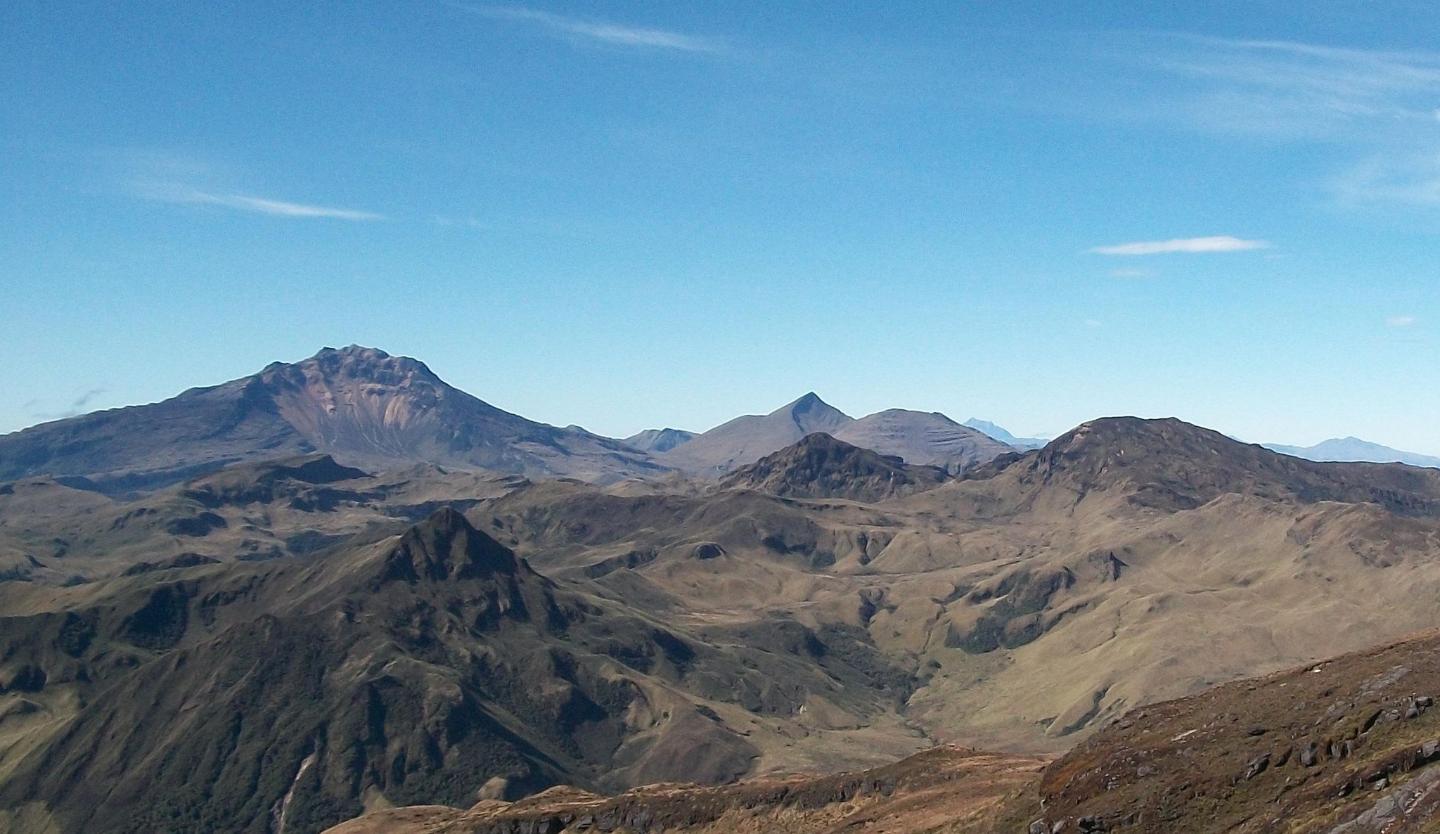
Colombia , Chiles / Cerro Negro :
Weekly activity bulletin of the Chiles and Cerro Negro Volcanic Complex (CVCCN)
Regarding the monitoring of the activity of the CHILES AND CERRO NEGRO VOLCANOES, the MINISTRY OF MINES AND ENERGY, through the COLOMBIAN GEOLOGICAL SERVICE (SGC), reports that:
For the period evaluated between February 20 and 26, in low and fluctuating levels, both the occurrence and the seismic energy released increased, maintaining the predominance of earthquakes linked to rock fracture. With low frequency, seismic events associated with the movement of fluids within the volcanic system continue to be recorded, some of them with very low frequency contents.
The fracture earthquakes were located very concentrated towards the southern sector of the Chiles volcano, at distances less than 3.5 km and at depths between 2.5 and 5 km compared to its summit (4,700 m altitude ) and a few other events were scatteredly located with a maximum magnitude of 2.6. None of the earthquakes were reported to be felt by residents in the area of volcanic influence.
In addition, volcanic deformation processes recorded by ground-mounted sensors and remote satellite sensors continued.
The evolution of activity in the CVCCN is the result of internal processes derived from the complex interaction between the magmatic system, the hydrothermal system and the geological faults of the area. Thus, the probability of the occurrence of energetic earthquakes that can be felt by residents of the CVCCN zone of influence continues.
Volcanic activity remains on YELLOW ALERT Status: Active volcano with changes in baseline behavior of monitored parameters and other manifestations
Source et photo : SGC
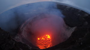
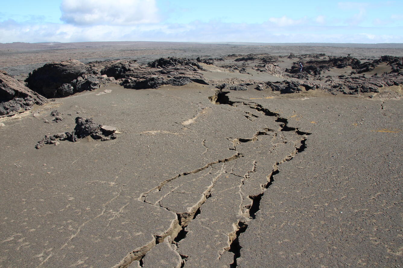
Hawaii , Kilauea :
Wednesday, February 28, 2024, 6:59 AM HST (Wednesday, February 28, 2024, 16:59 UTC)
19°25’16 » N 155°17’13 » W,
Summit Elevation 4091 ft (1247 m)
Current Volcano Alert Level: ADVISORY
Current Aviation Color Code: YELLOW
Activity Summary:
Kīlauea volcano is not erupting. Low to moderate rates of seismicity at the summit and along the Koaʻe fault system southwest of the summit continues following an intrusion of magma into the area at the end of January.
Summit Observations:
Seismicity beneath the summit and extending 5-7 miles (8-11 km) southwest of the caldera under the Koaʻe fault zone continues. Earthquakes are dispersed widely from the summit to the southwest. There were 8 earthquakes recorded around the summit over the past 24 hours. Depths beneath the summit are 0.5-5 miles (1–8 km) below the surface, and magnitudes are typically below M2.0.
Ground deformation remains low with tiltmeters near Sand Hill showing modest changes in the past day.
Sulfur dioxide (SO2) gas emission rates have remained low since October 2023. An SO2 emission rate of approximately 117 tonnes per day was recorded on February 22.
Rift Zone Observations:
Seismicity in Kīlauea’s upper East Rift Zone and Southwest Rift Zone remain low. No unusual activity has been noted along the middle and lower sections of Kīlauea’s East Rift Zone. We continue to closely monitor both rift zones.
Source : HVO
Photo : USGS / N. Deligne