February 26 , 2024.
Indonesia , Ili Lewotolok :
Press release on the extension of the safety distance for the G. ILI LEWOTOLOK, FEBRUARY 24, 2024 AT 5:00 PM WITA.
Based on the classification of Indonesian volcanoes, Mount Ili Lewotolok, located in the northern part of the mainland of the island of Lembata (Lomblen), is a type A stratovolcano whose activity has been recorded since 1660. The eruption which occurred in the central October 1852 crater was an eruption that damaged the surrounding area and produced a new crater (K2) and solfatara penetrations on the eastern slope of the cone.
The eruption period of Mount Ili Lewotolok began with the first eruption on November 27, 2020 which produced an ash column approximately 500 meters high. This was followed by the second (main) eruption on November 29, 2020, which produced a column of ash over 4,000 meters. The eruptions are still ongoing today, fluctuating. Likewise, the activity level of Mt. Ili Lewotolok increased or decreased several times. Until now, the activity level of G. Ili Lewotolok is still at level II (WASPADA) as of October 15, 2023.
The latest developments in the activities of G. Ili Lewotolok are as follows:
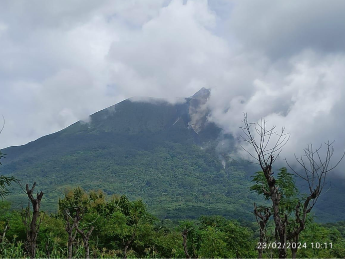
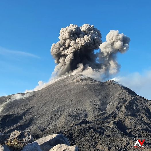
During the observation period from February 16 to 23, 2024, white and gray smoke is visually observed from the main crater, of moderate to thick intensity with a height of 25 to 700 meters from the summit. An eruption was observed at a height of 200 to 1,000 meters above the summit, the ash column from the eruption was white to gray in color. An avalanche was observed, but the distance and direction of the slide were not observed.
During the same period, 60 eruption/explosion earthquakes were recorded, 17 avalanche earthquakes, 2,562 emissions earthquakes, 65 non-harmonic tremors, 31 hybrid earthquakes, 2 tremors shallow volcanic earthquakes, 2 deep volcanic earthquakes, 3 local tectonic earthquakes, 3 distant tectonic earthquakes and 1 continuous tremor.
Seismic energy in general still fluctuates but has an upward trend. Recorded volcanic earthquakes have occurred beneath Mt. Ili Lewotolok, with depths ranging from 1.5 to 5.5 km.
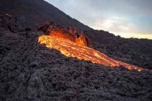
On February 15, 2023, new lava flows were observed towards the South and South-East up to 400 m from the center of the eruption. On February 23, 2024, the new lava flow had reached a distance of 1 km to the South-East and 600 meters to the South.
Until now, the explosive eruptions continue and become more pronounced. The dominant zone of lava ejections (incandescence) is always around the crater area and can reach a distance of about 500 meters outside the crater. We must remain alert to the potential threat of danger from ejected lava/incandescent material, which is currently estimated to be within a 2 km radius of the center of activity.
Based on the latest instrumental monitoring data from Mount Ili Lewotolok, volcanic activity is still quite high, so the recommended distance should be changed to the activity level, which is still at level II (WASPADA):
Communities around Mount Ili Lewotolok as well as visitors/climbers/tourists are advised not to enter and carry out activities within a 2 km radius around the activity center, and residents of the villages of Lamawolo, Lamatokan and Jontona to always be aware of potential threats of lava avalanches and hot clouds from the eastern summit/crater.
Communities around Mount Ili Lewotolok as well as visitors/climbers/tourists as well as residents of Jontona and Todonara villages are advised not to enter and carry out activities in the areas of the South and South-East sectors until ‘3 km from the activity center of Mount Ili Lewotolok, and always be aware of the potential threats of lava avalanches and hot clouds coming from the southern and southeastern parts of the crater.
Source : PVMBG.
Photos : PVMBG , Andi Volcanist
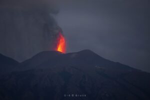
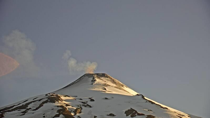
Chile , Villarica :
Special Report on Volcanic Activity (REAV), La Araucanía and Los Ríos regions, Villarrica volcano, February 25, 2024, 3:58 p.m. local time (mainland Chile)
The National Geology and Mining Service of Chile (Sernageomin) announces the following PRELIMINARY information, obtained through the monitoring equipment of the National Volcanic Monitoring Network (RNVV), processed and analyzed at the Southern Andean Volcano Observatory (Ovdas):
On Sunday February 25, 2024, at 3:40 p.m. local time (6:40 p.m. UTC), monitoring stations installed near the Villarrica volcano recorded an earthquake associated with the fracturing of rocks inside the volcanic system (volcano-tectonic type).
The characteristics of this earthquake after its analysis are as follows:
ORIGINAL TIME: 3:40 p.m. local time (6:40 p.m. UTC)
LATITUDE: 39.459° S
LONGITUDE: 71.896°W
DEPTH: 6.1 km
LOCAL MAGNITUDE: 3.0 (ML)
Observation :
Before this event, two volcano-tectonic earthquakes were recorded and subsequently, a VT type event was recorded, all of lower energy. No changes to monitoring settings have been recorded.
The technical volcanic alert is maintained at YELLOW level.
Source et photo : Sernageomin
Colombia , Galeras :
Galeras Volcano Weekly Activity Bulletin
From the monitoring of the activity of the GALERAS VOLCANO, the MINISTRY OF MINES AND ENERGY through the COLOMBIAN GEOLOGICAL SERVICE (SGC) reports that:
For the period from February 13 to 19, 2024, low and fluctuating levels of seismic occurrence and energy were maintained, with values similar to those recorded in previous weeks and with the predominance of earthquakes associated with the fracturing of the rocks.
The fracture earthquakes were located in different sectors of the volcanic edifice, at distances between 0.3 and 8 km, with depths between 1 and 9 km from its summit (4,200 m above sea level). and a maximum magnitude of 0.8.
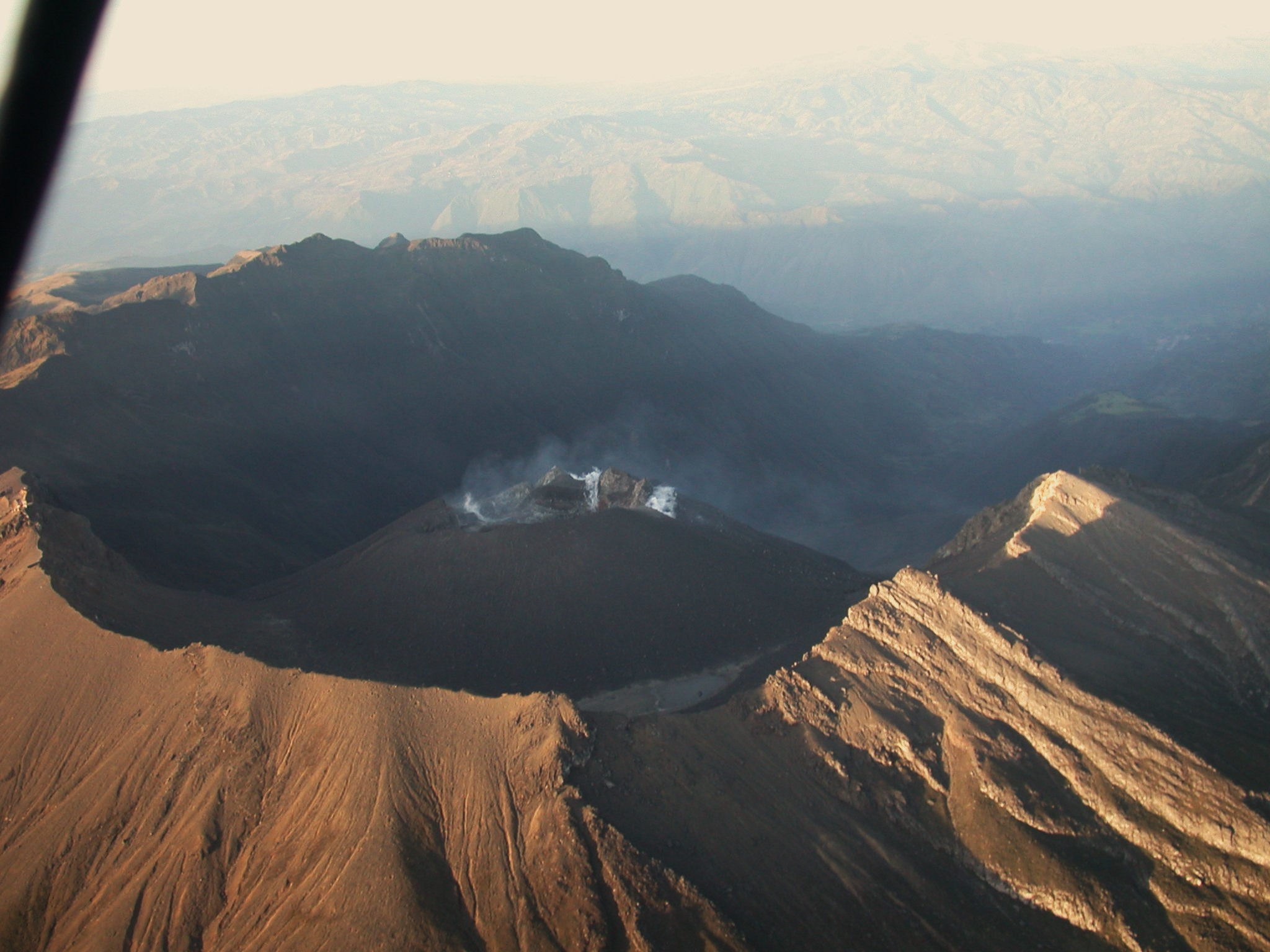
Gas emissions were recorded in the fumarole fields of Las Chavas, to the West, and El Paisita, to the North of the active cone, with white gas columns, of very low height and variable dispersion due to from the action of the winds.
Other volcanic monitoring areas showed stability in their recordings.
Volcanic activity remains on YELLOW ALERT Status: Active volcano with changes in baseline behavior of monitored parameters and other manifestations
Source et photo : Ingeominas .
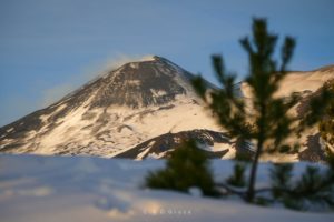
Hawaii , Kilauea :
Sunday, February 25, 2024, 8:39 AM HST (Sunday, February 25, 2024, 18:39 UTC)
19°25’16 » N 155°17’13 » W,
Summit Elevation 4091 ft (1247 m)
Current Volcano Alert Level: ADVISORY
Current Aviation Color Code: YELLOW
Activity Summary:
Kīlauea volcano is not erupting. Low to moderate rates of seismicity at the summit and along the Koaʻe fault system southwest of the summit continues following an intrusion of magma into the area at the end of January.
Summit Observations:
Seismicity beneath the summit and extending 5-7 miles (8-11 km) southwest of the caldera under the Koaʻe fault zone continues. Earthquakes are dispersed widely from the summit to the southwest. There were 2 earthquakes recorded near the summit over the past 24 hours. Depths beneath the summit are 0.5-6 miles (1–10 km) below the surface, and magnitudes are typically below M2.0.
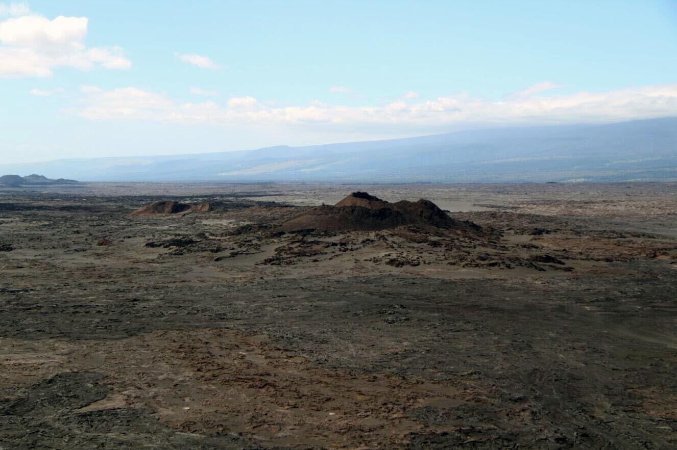
Pu‘ukoa‘e, on the Southwest Rift Zone of Kīlauea, is prominent in this aerial photo taken on February 6, 2024. The slopes of Mauna Loa and the Nīnole Hills are visible in the background.
Ground deformation remains low with tiltmeters near Sand Hill showing modest changes in the past day.
Sulfur dioxide (SO2) gas emission rates have remained low since October 2023. An SO2 emission rate of approximately 100 tonnes per day was recorded on February 16.
Rift Zone Observations:
Seismicity in Kīlauea’s upper East Rift Zone and Southwest Rift Zone remain low. No unusual activity has been noted along the middle and lower sections of Kīlauea’s East Rift Zone. We continue to closely monitor both rift zones.
Source : HVO
Photo : USGS / H. Winslow.
Costa Rica , Poas :
Latitude: 10.2
Longitude: -84,233
Altitude: 2,687 meters above sea level
Activity observed:
From approx. At 7 a.m., the low-frequency tremor returned with moderate amplitude. The high frequency tremor continues at low amplitude. The CO2/SO2 and H2S/SO2 ratios have returned to the range of values of recent weeks. They continue to show great variability, notably the CO2/SO2 ratio. The SO2 concentration at the lookout exceeded 3 ppm yesterday, but remains very low today (<0.5 ppm).
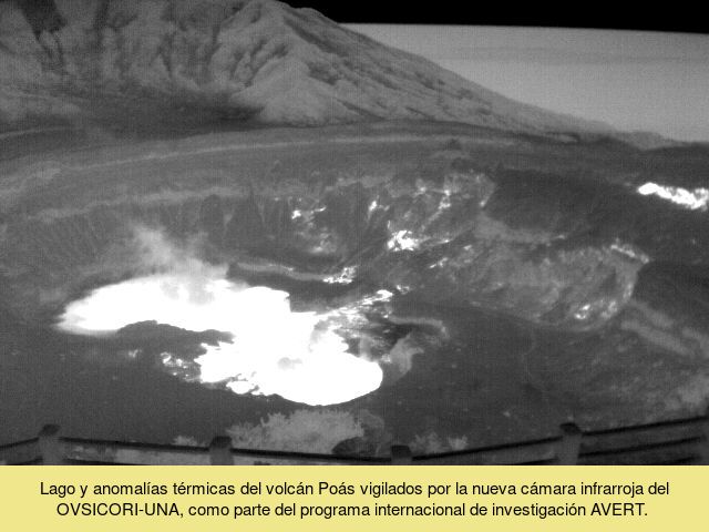
Yesterday, the OVSICORI-UNA research group took water and gas samples from the Río Cuarto lagoon at 5 m, 20 m, 40 m and 60 m. He reports that there was no evidence of an overturning of deep water with surface water, as observations on Friday, February 23, suggested.
Environmental conditions:
The wind blows from the South-West. There was no visibility part of the night and all morning.
Activity Level: Warning (2)
Source : Ovsicori