
July 18 , 2019.
Alaska , Semisopochnoi :
51°55’44 » N 179°35’52 » E,
Summit Elevation 2625 ft (800 m)
Current Volcano Alert Level: ADVISORY
Current Aviation Color Code: YELLOW
Local seismic sensors and regional infrasound sensors detected a signal yesterday likely generated by a small explosion from Semisopochnoi. No significant ash emissions are expected from events of this size, and no ash signals have been observed in cloudy satellite images. Seismic tremor, fluctuating between periods of continuous activity and discrete bursts, continued over the last 24 hours.
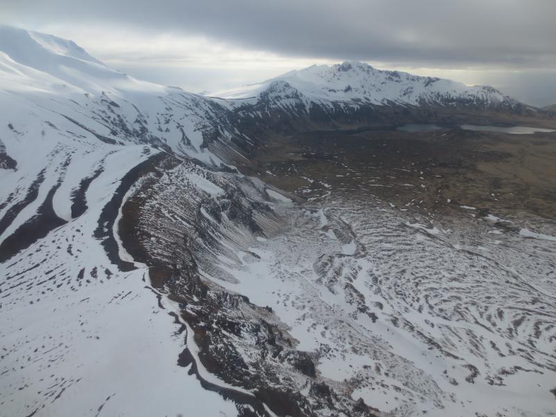
Semisopochnoi is monitored with an on-island seismic network and remotely by satellite and lightning sensors. Furthermore, an infrasound array on Adak Island may detect explosive emissions from Semisopochnoi with a 13 minute delay if atmospheric conditions permit.
Source : AVO.
Photo : Kaufman, Max.
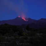
Italy / Sicily , Etna :
Getting up at 5:00 is a bit brutal. But this morning, it’s really worth it.
Here is the new Southeast crater of Etna, as we had not seen for a while: Strombolian activity, very small, but very clear.
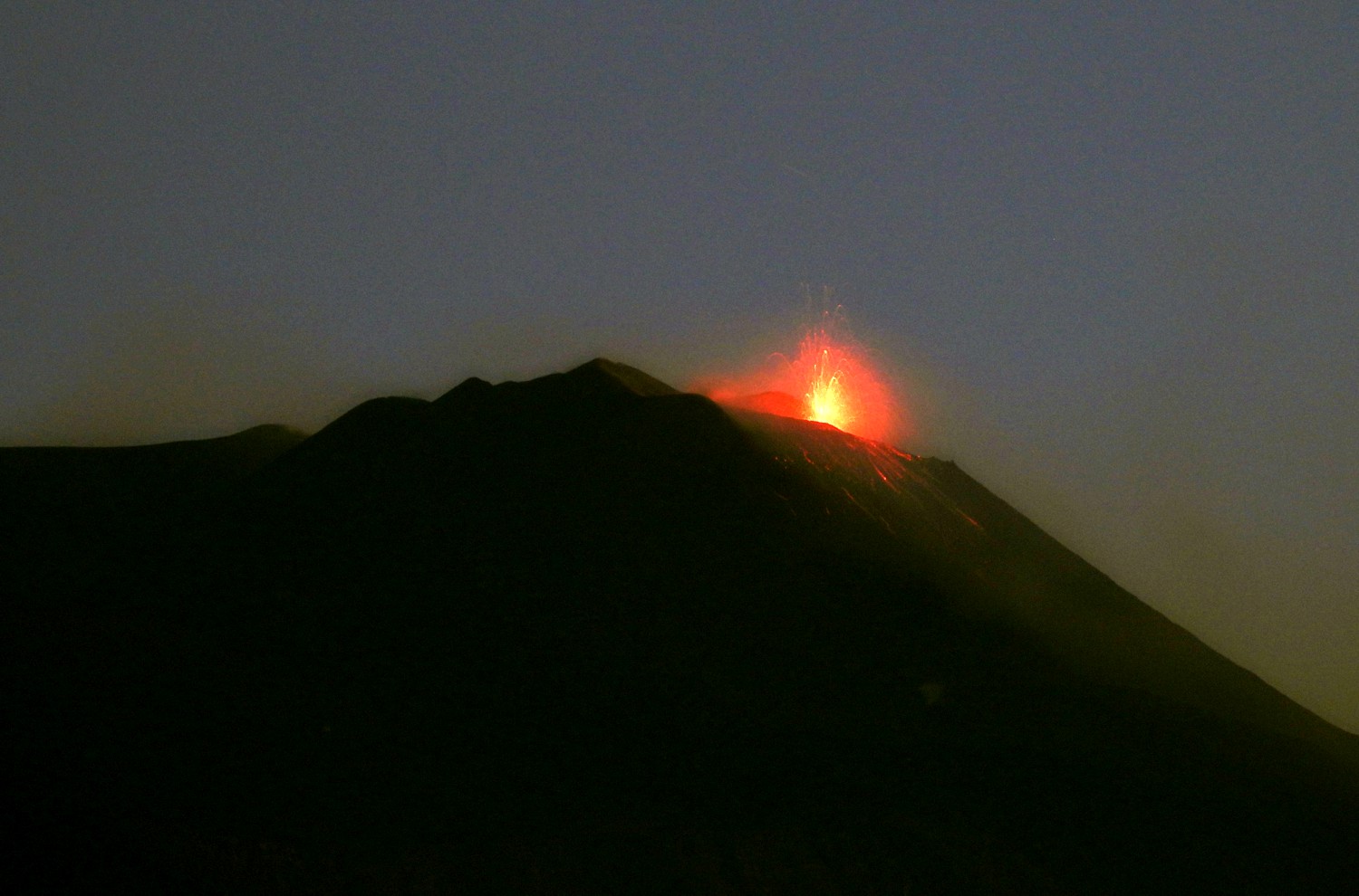
The active mouth is about the vent that I once called « u puttusiddu », which has now joined the new Southeast crater .
The view is taken from our house in Tremestieri Etneo, 20 km from the new Southeast crater, on the southern flank of the volcano.
Source : Dr Boris Behncke .
Peru , Ubinas :
Analysis period: July 1 to July 15, 2019 Arequipa, July 16, 2019
Alert level: YELLOW
The Geophysical Institute of Peru (IGP) reports that the Ubinas volcano continues an eruptive process. At present, the increase in signals associated with the movement and rise of magmatic fluids has been recorded. as a result, the authorities are advised to maintain the volcanic alert level in yellow.
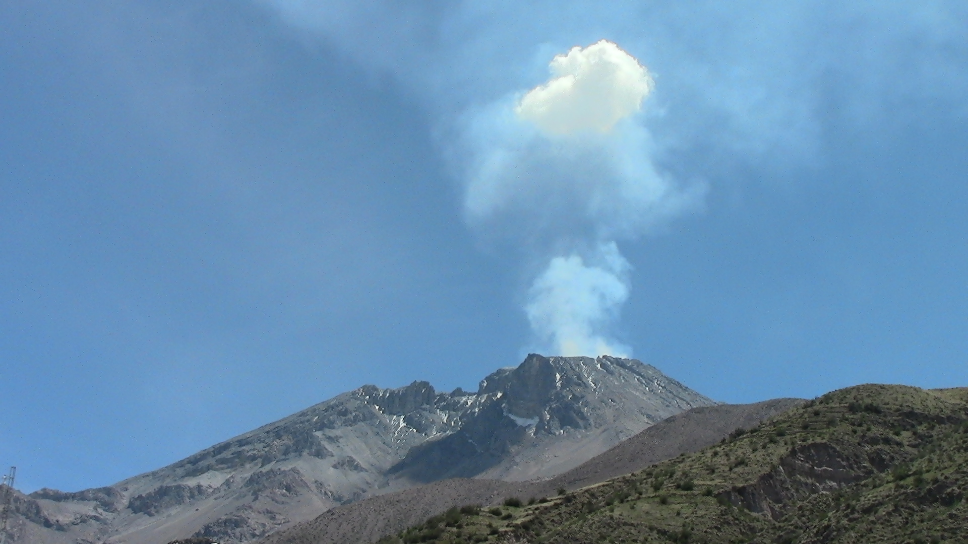
The IGP has analyzed seismic activity recorded during the period from July 1 to 15, 2019. Seismicity, which is linked to the movements of volcanic fluids (water vapor, gas and magma), is still recorded with an average of 116 events per day (type LP). Similarly, events related to volcanic rock breakage processes (VT type) continue to occur in large numbers, at a rate of 279 earthquakes per day. Since 2 July, surveillance cameras have recorded light bluish-colored emissions that correspond to the presence of SO2 (magmatic gas) in the crater of the Ubinas volcano. The monitoring of the deformation of the volcanic structure, using GNSS data (processed with fast orbits), presents no anomalies. Satellite monitoring, using information from the SENTINEL system, shows an accumulation of volcanic gases at the bottom of the volcano’s crater. Data obtained from TROPOMI (SO2) and MIROVA (thermal anomalies) do not show any significant changes during the analysis period.
RECOMMENDATIONS:
• It is recommended that authorities maintain the alert level in yellow.
• The use of lenses and masks is recommended to avoid any risk to health in case of resumption of ash emissions.
Source : IGP Pérou.
Photo : AZUL , 12/2016
Japan , Asosan :
32.884°N, 131.104°E
Elevation 1592 m
JMA reported that sulfur dioxide emissions at Asosan’s Nakadake Crater reached a high value of 2,300 tons per day on 12 July. Very small events ejected sediment during 13-16 July. The Alert Level remained at 2 (on a scale of 1-5).
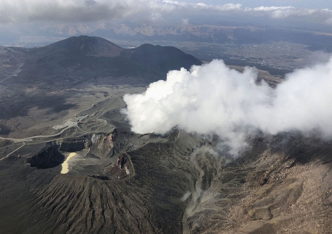
The 24-km-wide Asosan caldera was formed during four major explosive eruptions from 300,000 to 90,000 years ago. These produced voluminous pyroclastic flows that covered much of Kyushu. The last of these, the Aso-4 eruption, produced more than 600 km3 of airfall tephra and pyroclastic-flow deposits. A group of 17 central cones was constructed in the middle of the caldera, one of which, Nakadake, is one of Japan’s most active volcanoes. It was the location of Japan’s first documented historical eruption in 553 CE. The Nakadake complex has remained active throughout the Holocene. Several other cones have been active during the Holocene, including the Kometsuka scoria cone as recently as about 210 CE. Historical eruptions have largely consisted of basaltic to basaltic-andesite ash emission with periodic strombolian and phreatomagmatic activity. The summit crater of Nakadake is accessible by toll road and cable car, and is one of Kyushu’s most popular tourist destinations.
Source: Japan Meteorological Agency (JMA), GVP.
Photo : kyodo.
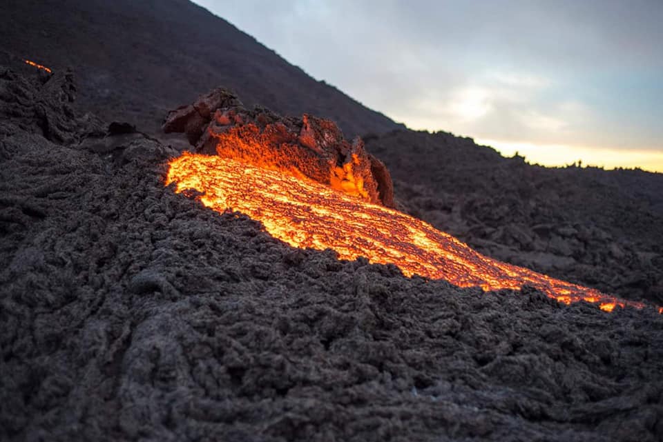
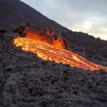
Guatemala , Pacaya :
Type of activity: Strombolian
Morphology: Composite Stratovolcano
Geographical location: 14 ° 22’50˝ Latitude N; 90 ° 36’00˝ Longitude O.
Altitude: 2,552msnm.
Weather conditions: partly cloudy
Wind: South
Precipitation: 0 mm.
Activity:
A moderate white outgassing rises to an approximate height of 300 meters above the crater and is dispersed westward on the slopes of the volcano. The seismic station records internal tremors associated with constant degassing and Strombolian explosions, which lift materials at a height of approximately 5 to 15 meters above the crater. There are low to moderate rumblings. An incandescent is observed in the Mackenney crater as well as lava flows in the northwest direction on the slopes of the volcano. Low to moderate avalanches can be seen ahead of the lava flows.
Source : Insivumeh .
Photo : Davis Rojas via Shérine France .


No comment yet, add your voice below!