February 20 , 2024.
Alaska , Gareloi :
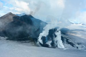
Unrest continues at Mount Gareloi. Seismicity has declined over the past several days but remains slightly elevated with periods of seismic tremor. No activity was observed in cloudy satellite and webcam images over the past day.
Mount Gareloi persistently emits magmatic gases from a fumarole field on the south crater and commonly exhibits low-level seismic activity. The current increase in seismicity likely reflects a change to the magmatic-hydrothermal system, but it is not clear that the likelihood of a volcanic eruption has increased.
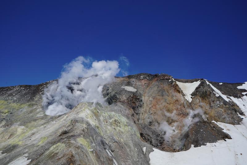
View of Gareloi’s actively degassing south crater wall.
AVO will continue to monitor activity to determine if the recent changes are related to influx of new magma or other changes to the magmatic system.
Mount Gareloi is monitored by a local seismic and infrasound network, satellite data, and regional infrasound and lightning-detection networks.
Source : AVO
Photo : Lopez Tarin , AVO / University of Alaska Fairbanks, Geophysical Institute.
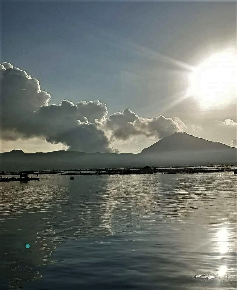
Philippines , Taal :
TAAL VOLCANO ADVISORY , 19 February 2024 , 14:30 PM
This is a notice of elevated sulfur dioxide degassing from Taal Volcano.
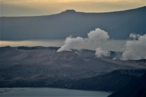
A total of 14,211 tonnes/day of volcanic sulfur dioxide or SO2 gas emission from the Taal Main Crater was measured today, 19 February 2024, the second highest flux recorded this year. Taal has averaged approximately 10,000 tonnes/day since January 2024 and has been continuously degassing voluminous concentrations of SO2 since 2021. Based on reports from the Batangas LGU, sulfur stench was reported by residents of Brgys. Bilibinwang and Banyaga in the Municipality of Agoncillo. Nonetheless, moderate winds have prevented the accumulation of SO2 and no volcanic smog or vog over Taal Caldera was thus observed by visual monitors throughout the day. Volcanic earthquake activity has remained weak with only 17 volcanic earthquakes, mostly tremor events associated with volcanic gas activity, being recorded this year.
DOST-PHIVOLCS reminds the public that Alert Level 1 prevails over Taal Volcano, which means that it is still in abnormal condition and should not be interpreted to have ceased unrest nor ceased the threat of eruptive activity. At Alert Level 1, sudden steam-driven or phreatic explosions, volcanic earthquakes, minor ashfall and lethal accumulations or expulsions of volcanic gas can occur and threaten areas within Taal Volcano Island or TVI. Furthermore, degassing of high concentrations of volcanic SO2 continues to pose the threat of potential long-term health impacts to communities around Taal Caldera that are frequently exposed to volcanic gas. DOST-PHIVOLCS strongly recommends that entry into TVI, Taal’s Permanent Danger Zone or PDZ, especially the vicinities of the Main Crater and the Daang Kastila fissure, must remain strictly prohibited. Local government units are advised to continuously monitor and assess volcanic SO2 exposure of, and potential impacts on, their communities and undertake appropriate response measures to mitigate these hazards.
DOST-PHIVOLCS is closely monitoring Taal Volcano’s activity and any new significant development will be immediately communicated to all stakeholders.
Source : Phivolcs
Photo : Onin casal /Agoncillo ERT
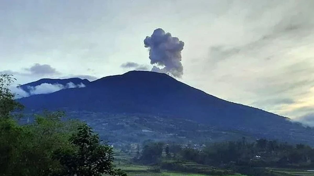
Indonesia , Marapi :
Mount Marapi erupted on Monday, February 19, 2024 at 09:57 WIB. The height of the eruptive column was not observed. The eruption was recorded on a seismograph with a maximum amplitude of 11.1 mm and a duration of 28 seconds.
VOLCANO OBSERVATORY NOTICE FOR AVIATION – VONA
Issued : February 19 , 2024
Volcano : Marapi (261140)
Current Aviation Colour Code : ORANGE
Previous Aviation Colour Code : orange
Source : Marapi Volcano Observatory
Notice Number : 2024MAR016
Volcano Location : S 0 deg 22 min 52 sec E 100 deg 28 min 23 sec
Area : West Sumatra, Indonesia
Summit Elevation : 9251 FT (2891 M)
Volcanic Activity Summary :
Eruption at 02h57 UTC (09h57 local).
Volcanic Cloud Height :
Ash-cloud is not observed.
Other Volcanic Cloud Information :
Ash-cloud is not observed.
Remarks :
Eruption recorded on seismogram with maximum amplitude 11.1 mm and maximum duration 28 second. Tremor recorded on seismogram with maximum amplitude 3 mm.
Source : Magma Indonésie.
Photo : Between
Peru , Sabancaya :
Analysis period: from February 12, 2024 to February 18, 2024, Arequipa, February 19, 2024
Alert level: ORANGE
The Geophysical Institute of Peru (IGP) reports that the eruptive activity of the Sabancaya volcano remains at moderate levels, that is, with the recording of an average of 35 daily explosions, with columns of ash and of gas up to 2600 m altitude above the summit of the volcano. Consequently, the volcanic alert level remains at the ORANGE level
The IGP recorded and analyzed the occurrence of 247 earthquakes of volcanic origin, associated with the circulation of magmatic fluids inside the Sabancaya volcano, as well as earthquakes linked to the fracturing of rocks. An average of 35 explosions were recorded daily.

Columns of ash and gas have been observed at an altitude of up to 2600 m above the summit of the volcano. The predominant direction of these emissions was towards the East, South East and West sectors of the volcano over a distance of less than 10 KM.
We continue to record a slight inflation process in the northern sector (around the Hualca Hualca volcano).
Satellite recordings identified the presence of 5 thermal anomalies, with a maximum value of 4 MW, associated with the presence of a lava body on the surface of the volcano crater.
Moderate emissions (1742 tonnes/day) of sulfur dioxide (SO2) were observed.
RECOMMENDATIONS
• Keep the volcano alert level in orange.
• Do not approach within a radius of less than 12 km from the crater.
Source : Cenvul
Photo : Ingemmet
Hawaii , Kilauea :
Monday, February 19, 2024, 8:51 AM HST (Monday, February 19, 2024, 18:51 UTC)
19°25’16 » N 155°17’13 » W,
Summit Elevation 4091 ft (1247 m)
Current Volcano Alert Level: ADVISORY
Current Aviation Color Code: YELLOW
Activity Summary:
Kīlauea volcano is not erupting. Low to moderate rates of seismicity at the summit and along the Koaʻe fault system southwest of the summit continues following an intrusion of magma into the area at the end of January.
Summit Observations:
Seismicity beneath the summit and extending 5-7 miles (8-11 km) southwest of the caldera under the Koaʻe fault zone continues. Earthquakes are dispersed widely from the summit to the southwest. There were approximately 7 earthquakes recorded across this region over the past 24 hours. Depths remain consistent at 1–5 km (0.6-3 mi) below the surface, and magnitudes are typically below M2.0.
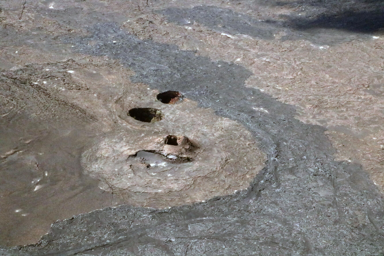
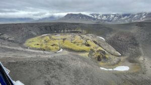
An aerial view of the Twin Pit Craters near Maunaiki trail in the Ka‘ū Desert of Hawaii Volcanoes National Park.
Ground deformation remains low with tiltmeters near Sand Hill and Uēkahuna bluff recording slight deflationary tilt over the past 24 hours, likely the start of a new DI event.
Sulfur dioxide (SO2) gas emission rates have remained low since October 2023. An SO2 emission rate of approximately 100 tonnes per day was recorded on February 16.
The overall decrease in seismicity and deformation suggests that this event is waning. However, renewed episodes of activity remain a possibility and an eruption could occur with little advanced warning.
Rift Zone Observations:
Seismicity in Kīlauea’s upper East Rift Zone and Southwest Rift Zone remain low. No unusual activity has been noted along the middle and lower sections of Kīlauea’s East Rift Zone. We continue to closely monitor both rift zones.
Source : HVO
Photo : USGS / K. Mulliken.