February 06 , 2024.
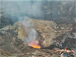
Iceland , Reykjanes Peninsula :
At 04:17 this morning a M3.4 was measured in the eastern caldera of Katla. Events of this magnitude are not uncommon in Mýrdalsjökull glacier and the last measured event of similar magnitude, M3,3 occurred on August 29th last year.
Models based on GPS data since Feb 1st indicate that approximately 6.5 million cubic meters of magma has accumulated beneath the Svartsengi region. According to this assessment, magma will soon reach the same volume as drained during the January 2024 eruption. Therefore, the timescale for the next eruption could be within two weeks or possibly days. This means that the likelihood of a magma intrusion, and a volcanic eruption, have increased.
Source : IMO
Photo : Siggi Anton
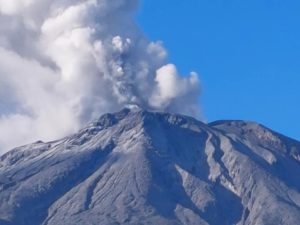
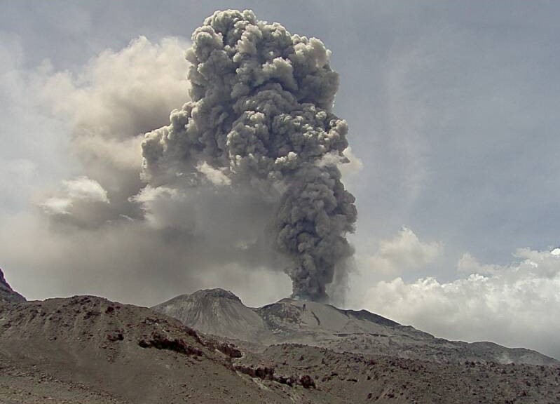
Indonesia , Marapi :
Mount Marapi erupted on Monday, February 5, 2024, at 3:16 p.m. WIB. The height of the eruptive column was not observed. The eruption was recorded on a seismograph with a maximum amplitude of 30.1 mm and a duration of 89 seconds.
SEISMICITY OBSERVATIONS
20 emission earthquakes with an amplitude of 2 to 14.3 mm and earthquake duration of 25 to 426 seconds.
2 low-frequency earthquakes with an amplitude of 6 to 7.6 mm and an earthquake duration of 17 to 28 seconds.
5 Shallow volcanic earthquakes with an amplitude of 1 to 4.3 mm and an earthquake duration of 9 to 25 seconds.
2 deep volcanic earthquakes with an amplitude of 9.3 to 12.8 mm, and an earthquake duration of 24 to 25 seconds.
1 Distant tectonic earthquake with an amplitude of 2.5 mm, and the earthquake lasted 100 seconds.
1 Continuous tremor with an amplitude of 0.5 to 3.5 mm, dominant of 2 mm.
RECOMMENDATION
1. Communities around Mount Marapi and climbers/visitors/tourists should not enter and conduct activities within a 4.5 km radius of the eruption center (Verbeek crater) of Mount Marapi.
2. Communities living around the valleys/streams/river banks that originate at the summit of Mount Marapi should always be aware of the potential threat of lahars that may occur, particularly during the rainy season.
Source : Magma Indonésie.
Photo : Auteur inconnu
Peru , Sabancaya :
Analysis period: from January 29, 2024 to February 5, 2024, Arequipa, February 5, 2024
Alert level: ORANGE
The Geophysical Institute of Peru (IGP) reports that the eruptive activity of the Sabancaya volcano remains at moderate levels, that is, with the recording of an average of 29 daily explosions, with columns of ashes and of gas up to 1600 m altitude above the summit of the volcano. Consequently, the volcanic alert level remains at the ORANGE level
The IGP recorded and analyzed the occurrence of 334 earthquakes of volcanic origin, associated with the circulation of magmatic fluids inside the Sabancaya volcano, as well as earthquakes linked to the fracturing of rocks. An average of 29 explosions were recorded daily.
Columns of ash and gas have been observed at an altitude of up to 1600 m above the summit of the volcano. The predominant direction of these emissions was towards the West and South West sectors of the volcano over a distance of less than 10 KM.
We continue to record a slight inflation process in the northern sector (around the Hualca Hualca volcano).
Satellite recordings identified the presence of 3 thermal anomalies, with a maximum value of 8 MW, associated with the presence of a lava body on the surface of the volcano crater.
Moderate emissions (2102 tonnes/day) of sulfur dioxide (SO2) were observed.
RECOMMENDATIONS
• Keep the volcano alert level in orange.
• Do not approach within a radius of less than 12 km from the crater.
Source : Cenvul
Photo : Ingemmet
Hawaii , Kilauea :
Monday, February 5, 2024, 9:43 AM HST (Monday, February 5, 2024, 19:43 UTC)
19°25’16 » N 155°17’13 » W,
Summit Elevation 4091 ft (1247 m)
Current Volcano Alert Level: ADVISORY
Current Aviation Color Code: YELLOW
Activity Summary:
Kīlauea volcano is not erupting. Seismicity in the summit and along the Koa‘e fault system southwest of the summit continues to decrease over the last 24 hours. The intrusion of magma into this area appears to have slowed, and the likelihood of an eruption has decreased.
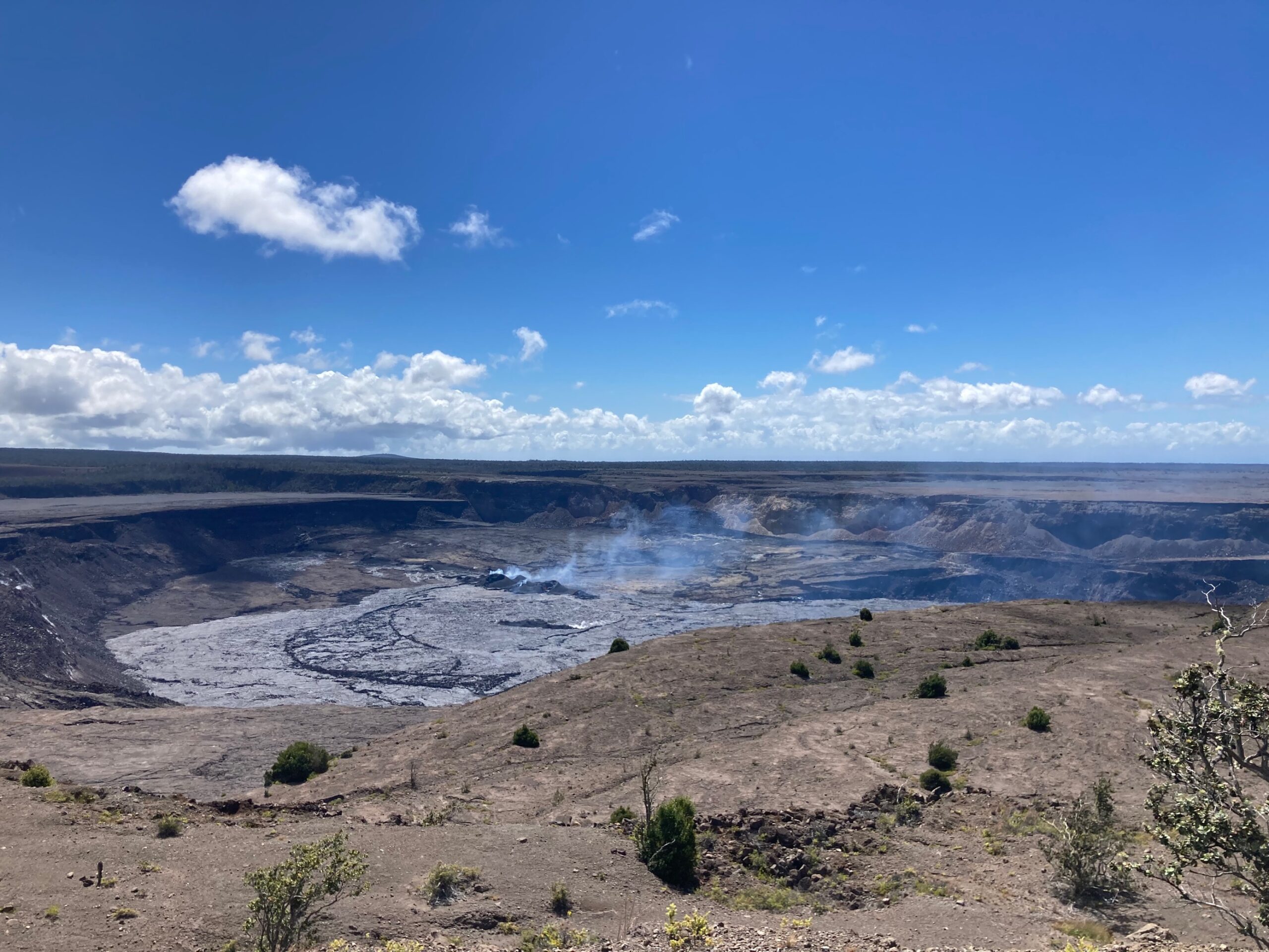
Summit Observations:
Seismicity and ground deformation beneath the summit and extending 5-7 miles (8-11 km) southwest of the caldera under the Koa‘e fault zone continues to decrease. Earthquake counts are holding steady at 1–7 earthquakes; dispersed widely from the summit to the southwest. Depths remain consistent, 1–4 km (less than a mile–2.5 mi) below the surface and magnitudes range a maximum of 2+ to less than 1. In total, approximately 100 earthquakes, down from ~150, have been recorded across this region over the past 24 hours, reflecting the continued decrease in seismicity.
Over the past day, tiltmeters near Sand Hill and Uēkahuna bluff have recorded very little change after the steep deflation of the past 2 days related to magma moving southwest. Sandhill is on a deflationary trend.
Global Positioning System (GPS) instruments have recorded up to 8 inches (20 cm) of horizontal motion at stations around the SWRZ and immediately to the south along the Koa‘e fault zone.
Sulfur dioxide (SO2) gas emission rates remain low. Field measurements indicated an SO2 emission rate of approximately 70 tonnes per day, on January 17, which was similar to measurements in October, November, and early December.
Source : HVO
Photo : USGS/ M. Patrick. ( archive).
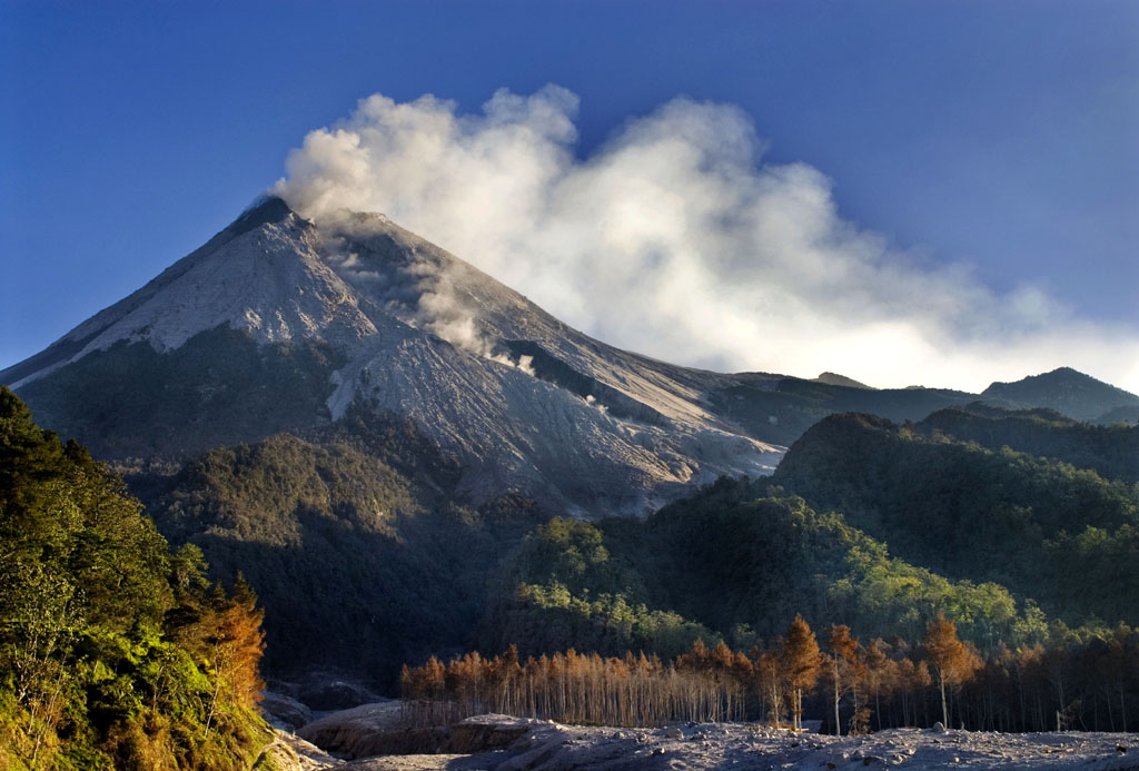
Guatemala , Santiaguito :
Weather conditions: Clear weather.
Wind: North.
Precipitation: 0.6 mm.
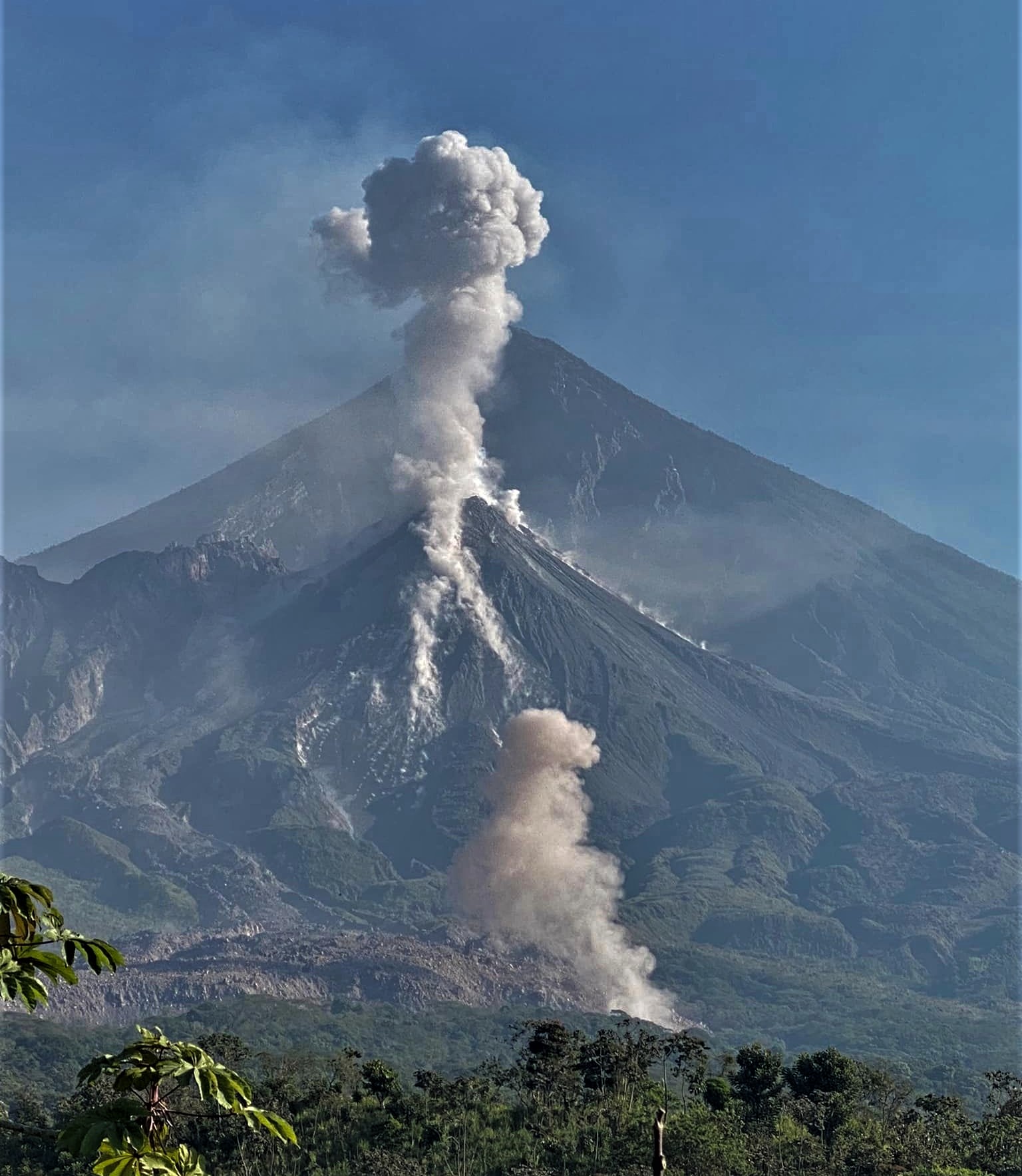
Activity:
The Santa María-Santiaguito Volcanic Complex Observatory reports activity in the Caliente dome, with continuous low to moderate degassing, raising columns of water vapor and other magmatic gases to heights of 300 meters above of the dome and moving towards the South-West. During the night and early morning, incandescence was observed in the dome. Low and moderate explosions occur at a rate of 1 to 2 per hour, accompanied by low rumbling sounds. They raise columns of water vapor and ash to heights of 600 to 900 meters above the dome and cause the descent of pyroclastic flows over short distances, mainly towards the west, south-west and south flanks of the dome. Caliente, leaving its well-marked descent channels, some of which almost reach the base of the dome. The descent of these flows produces faint noises perceptible in areas close to the domes. The wind is variable from the North and North-West, so the possibility of a weak fall of fine ash particles on the farms of the South-East flank, El Nuevo Palmar and its surroundings is not excluded. Activity remains at a high level, so there remains the possibility that with explosions or under the effect of gravity, part of the accumulated materials collapse and pyroclastic flows over long distances are generated towards the South. West, South and South-East.
Source : Insivumeh.
Photo : Armando Pineda.