January 23 , 2024.
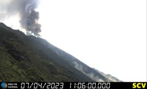
Philippines , Bulusan :
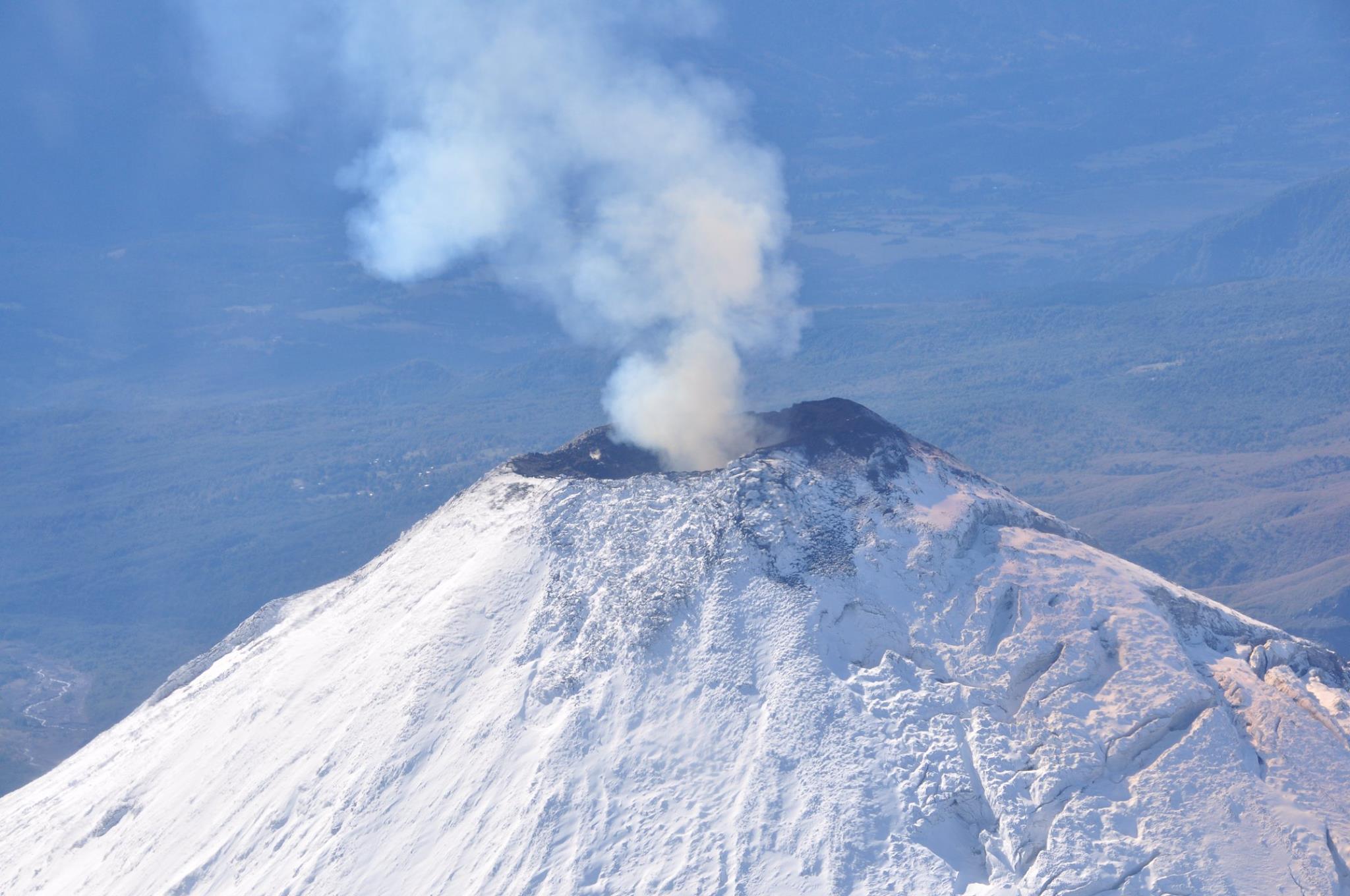
BULUSAN VOLCANO ADVISORY , 23 January 2024 , 01:30 AM
This is a notice of increased seismic activity at Bulusan Volcano.
A total of ninety-one (91) volcano-tectonic (VT) earthquakes associated with rock fracturing at 2 to 4 kilometers depth beneath the southwestern flanks have been recorded by the Bulusan Volcano Network (BVN) since 1:38 AM of 22 January 2024. The southwestern as well as southeastern flanks of Bulusan Volcano have been inflated since February 2023 based on ground deformation data from continuous GPS and electronic tilt monitoring. In contrast, degassing activity from the summit crater and active vents has been very weak to moderate when the volcano summit has been visible. Nonetheless, increased seismic activity and pressurization of the volcano edifice may indicate that hydrothermal processes may be occurring beneath the volcano and may lead to steam-driven eruptions at any of the summit vents.
The public is reminded that Alert Level 1 prevails over Bulusan Volcano, which means it is currently at low-level unrest with increased chances of steam-driven or phreatic eruptions. Local government units and the public are reminded that entry into the 4-kilometer radius Permanent Danger Zone (PDZ) should be prohibited and that vigilance in the 2-kilometer Extended Danger Zone (EDZ) on the southeast sector must be exercised due to the possibilities of sudden and hazardous phreatic eruptions. Civil aviation authorities must also advise pilots to avoid flying close to the volcano’s summit as ash from any sudden phreatic eruption can be hazardous to aircraft. Furthermore, people living within valleys and along river/stream channels should be vigilant against sediment-laden stream flows and lahars in the event of heavy and prolonged rainfall occurring simultaneous with phreatic eruption.
DOST-PHIVOLCS is closely monitoring Bulusan Volcano’s condition and any new development will be relayed to all concerned.
Source et photo : Phivolcs
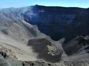
Peru , Sabancaya :
Analysis period: from January 15, 2024 to January 21, 2024, Arequipa, January 22, 2024
Alert level: ORANGE
The Geophysical Institute of Peru (IGP) reports that the eruptive activity of the Sabancaya volcano remains at moderate levels, that is, with the recording of an average of 52 daily explosions, with columns of ash and of gas up to 2500 m altitude above the summit of the volcano. Consequently, the volcanic alert level remains at the ORANGE level
The IGP recorded and analyzed the occurrence of 320 earthquakes of volcanic origin, associated with the circulation of magmatic fluids inside the Sabancaya volcano, as well as earthquakes linked to the fracturing of rocks. An average of 52 explosions were recorded daily.

Columns of ash and gas have been observed at an altitude of up to 2500 m above the summit of the volcano. The predominant direction of these emissions was towards the West and South West sectors of the volcano over a distance of less than 10 KM.
We continue to record a slight inflation process in the northern sector (around the Hualca Hualca volcano).
Satellite recordings identified the presence of 11 thermal anomalies, with a maximum value of 17 MW, associated with the presence of a lava body on the surface of the volcano crater.
RECOMMENDATIONS
• Keep the volcano alert level in orange.
• Do not approach within a radius of less than 12 km from the crater.
Source : Cenvul
Photo : Zintia Roxana Fernández Licla
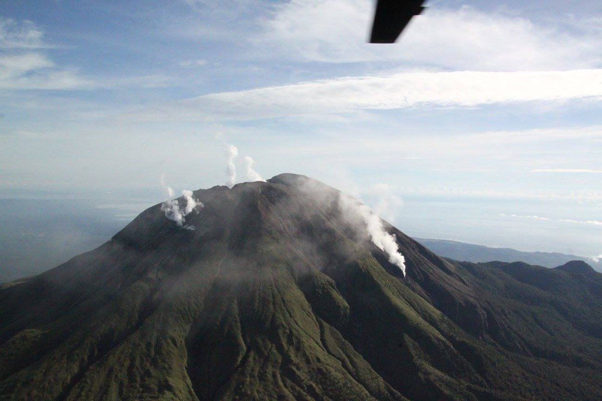
Vanuatu , Ambrym :
16°15’00”S 168°07’00”E
Summit Elevation 4377ft (1334m)
Current Volcano Alert Level: Level 2
Ambrym volcano activity has decreased from minor eruption to major unrest state. The Volcanic Alert Level degraded from Level 3 to Level 2.
Latest seismic analysis and observation has confirmed a decrease of the Ambrym volcano activity. The volcanic Alert now has degraded to Level 2. Ambrym volcano is now in the Major Unrest State. The current activity still consists of reduced emission of steam/gas and dimmer to no night glow compared to the past three (3) days.
Ground observation and our volcano monitoring system (webcam and seismic data) analysis from the 15th-17th January 2024 confirms the decrease of seismic activity and the emission of sulfur gas, ash and steam. This current volcanic activity shows that Ambrym volcano is currently in the major unrest state, consistent with the Alert Level 2.
With the ongoing activity and the associated hazards, the danger zone at the summit is maintained at Danger Zone B .These danger zones are about 2 km around Benbow and 4 km around Marum craters including Maben-Mbwelesu, Niri-Mbwelesu and Mbwelesu. Additional danger zone is at the South-East of Ambrym within 500 meters from major cracks (Opened during the 2018 Eruption). It is a useful reminder that eruptions can occur at any level of unrest with little or no warnings.
Source : Geohazard.
Photo : G Vitton
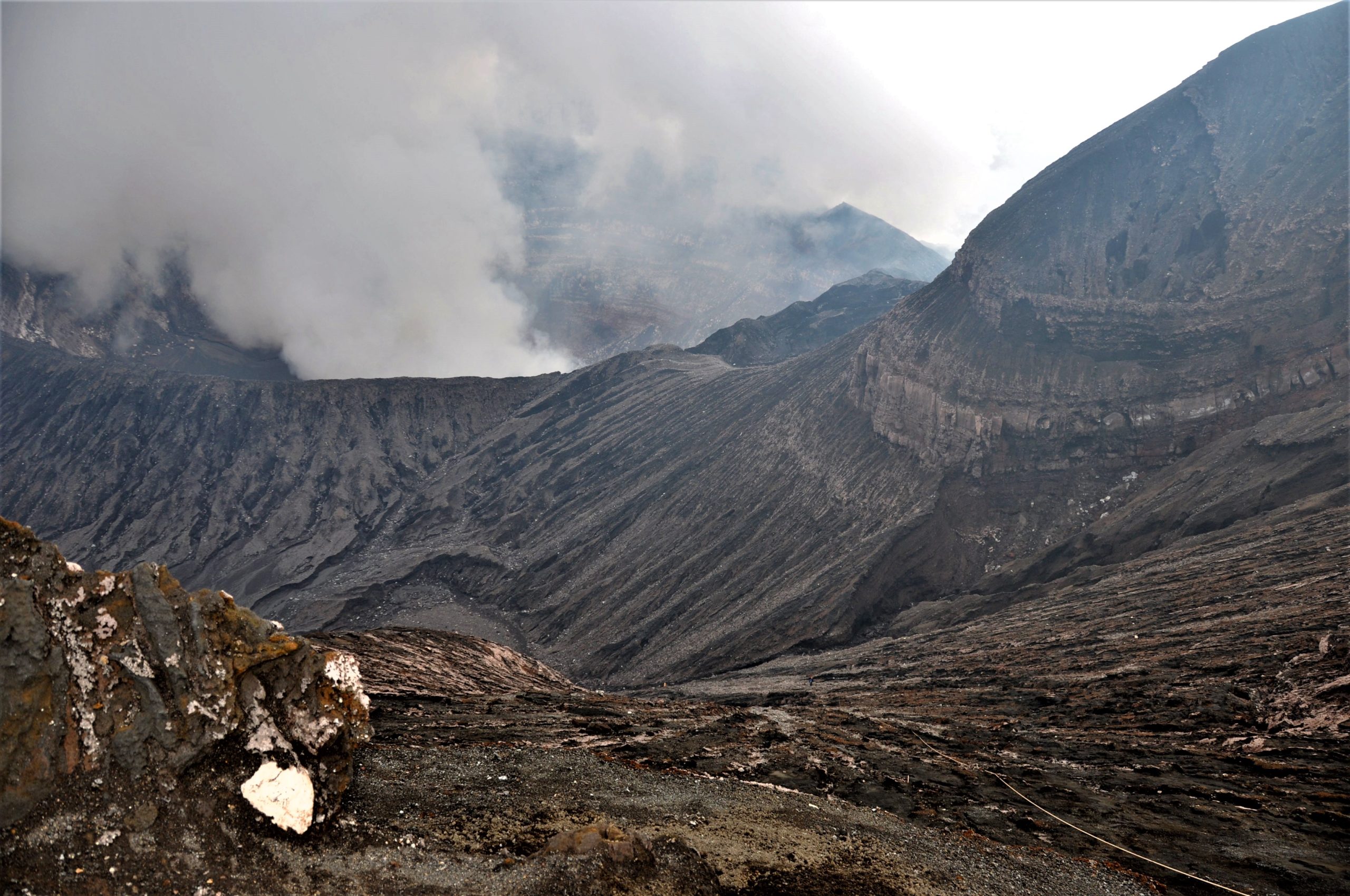
Chile , Villarica :
Special Report on Volcanic Activity (REAV), La Araucanía and Los Ríos regions, Villarrica volcano, January 22, 2024, 04:40 local time (mainland Chile)
The National Geology and Mining Service of Chile (Sernageomin) announces the following PRELIMINARY information, obtained through the monitoring equipment of the National Volcanic Monitoring Network (RNVV), processed and analyzed at the Southern Andean Volcano Observatory (Ovdas):
From Monday January 18, 2024, at 2:21 a.m. local time (5:21 a.m. UTC), monitoring stations installed near the Villarrica volcano recorded a swarm of earthquakes associated with the fracturing of rocks (Volcano-tectonics) inside the system volcanic. This increase in seismicity occurs after the 3.9 magnitude earthquake reported in the previous bulletin.
Observation :
At the time of issuing this report, approximately 160 seismic events of the Volcano-tectonic (VT) type have been recorded in the last 3 hours, which remain ongoing, with a decreasing occurrence.
The locations are mainly concentrated in an area located around 4 to 5 km east-southeast of the main crater, with depths between 4 and 5.5 km.
No changes in the behavior of the fluid-type seismic activity of the volcano have been recorded, nor any associated surface activity observed.
The technical volcanic alert is maintained at YELLOW level.
Source : Sernageomin.
Photo : Auteur inconnu ( archive).
Guatemala , Fuego :
Weather conditions: Clear weather.
Wind: South and South-West.
Precipitation: 0.0 mm.
Activity:
The Fuego Volcano Observatory reports volcanic activity, which consists of small to moderate explosions, which occur at a frequency of 1 to 6 per hour, raising columns of gas and gray ash to heights between 4,400 and 4,700 meters above sea level (14,763 to 15,748). feet), which move variably toward the West, Northwest, North, and Northeast, carrying ash over distances of up to 30 kilometers or more.

Due to wind direction, low ash particle fall may occur over Yepocapa, Acatenango, Parramos and La Antigua Guatemala. The accelerated winds move the ashes into the upper part of the ravines and form ash curtains on the southwest, south and southeast flanks. The explosions lift incandescent material up to 100 meters above the crater and produce weak avalanches around the crater towards the Seca, Taniluyá, Ceniza and La Lajas ravines. The activity is occasionally accompanied by low rumbles and shock waves, as well as faint aircraft turbine sounds lasting less than a minute.
Source : Insivumeh
Photo : Conred.