January 18 , 2024 .
Iceland , Reykjanes Peninsula :
Continued and Significant Fissure Evolution within Grindavík . A new graben has formed east of the graben that emerged within Grindavík on November 10
Updated 16 January 18:00 UTC
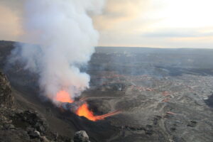
Magma continues to accumulate beneath Svartsengi at a rate similar to that observed before the last two eruptions. This was the consensus reached during a consultation meeting of scientists this morning. During the eruption this past Sunday, similar to the December 18 eruption, magma flowed eastward from the accumulation site beneath Svartsengi, creating a magma conduit extending from Stóra-Skógfell southward beneath Grindavík. Computational models support this observation and indicate that the origin of the magma was slightly further west compared to the previous eruption, leading to variations in recent GPS measurements compared to those recorded on December 18.
As a magma conduit forms close to the surface, the Earth’s crust is strained, causing the land above the central part of the conduit to subside and form a graben. Additionally, the ground is elevated on either side of it. Computational models reviewed at the consultation meeting show that the GNSS station in Svartsengi is located at the edge of the conduit, where the land rises as the conduit forms. Now, two days after the conduit’s formation, the Svartsengi GNSS station is expected to show subsidence if magma accumulation has ceased. However, this is not observed, indicating that magma accumulation continues as before.
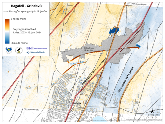
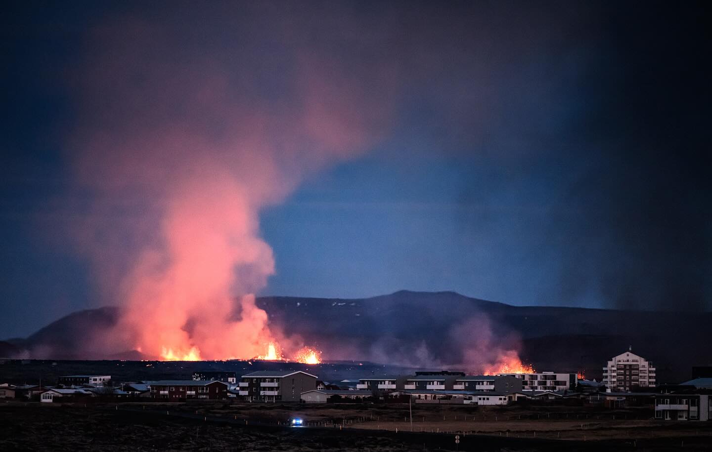
The magma conduit generated in the eruption that began on Sunday lies slightly further east than the conduit that extended under Grindavík on November 10. Data collected and processed by the Icelandic Institute of Natural History and the National Land Survey of Iceland reveal that a new graben has formed east of the one that appeared on November 10. The newly formed graben measures approximately 800-1000 meters in width, as shown on the map below. The greatest subsidence within it is approximately 30 cm, but it is worth noting that the region is still experiencing subsidence, and the valley is progressively widening. In comparison, the graben that developed in Grindavík on November 10 had a width of about 2 km, with the most significant subsidence measuring around 1.3 meters.
Inside this recently formed graben, previously mapped fissures that were visible on the surface have expanded, and additional fissures have emerged. Consequently, the risk associated with these fissures and the possibility of ground collapse into them have increased in the eastern section of Grindavík compared to before.
Land uplift continues at Svartsengi . Danger still assessed as very high within Grindavík
Updated 17 January 18:00 UTC
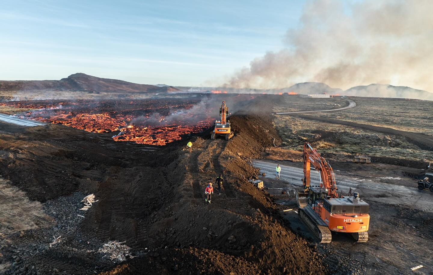
Magma accumulation continues under Svartsengi. It is too early to assert the rate of the land uplift shortly after the volcanic eruption. Experts will continue to assess data from GPS meters in the area to get an overall assessment of the situation. One of the meters, which was located north of Grindavík, went under lava, but over 20 GPS meters are in the area that are being used.
Seismic activity has been mild over the magma conduit in the last 24 hours. According to computational models, magma lies shallow at the southern end of the conduit, where the land appears to be heavily fractured, making it easier for the magma to reach the surface. Therefore, there is a continued likelihood that new eruption fissures may open without warning.
There is still danger within Grindavík related to fissures and the potential for ground collapse into them. Significant movements have occurred in connection with the subsidence valley in the eastern part of the town. These movements were mostly along the fissures that formed on November 10 and had already been mapped.
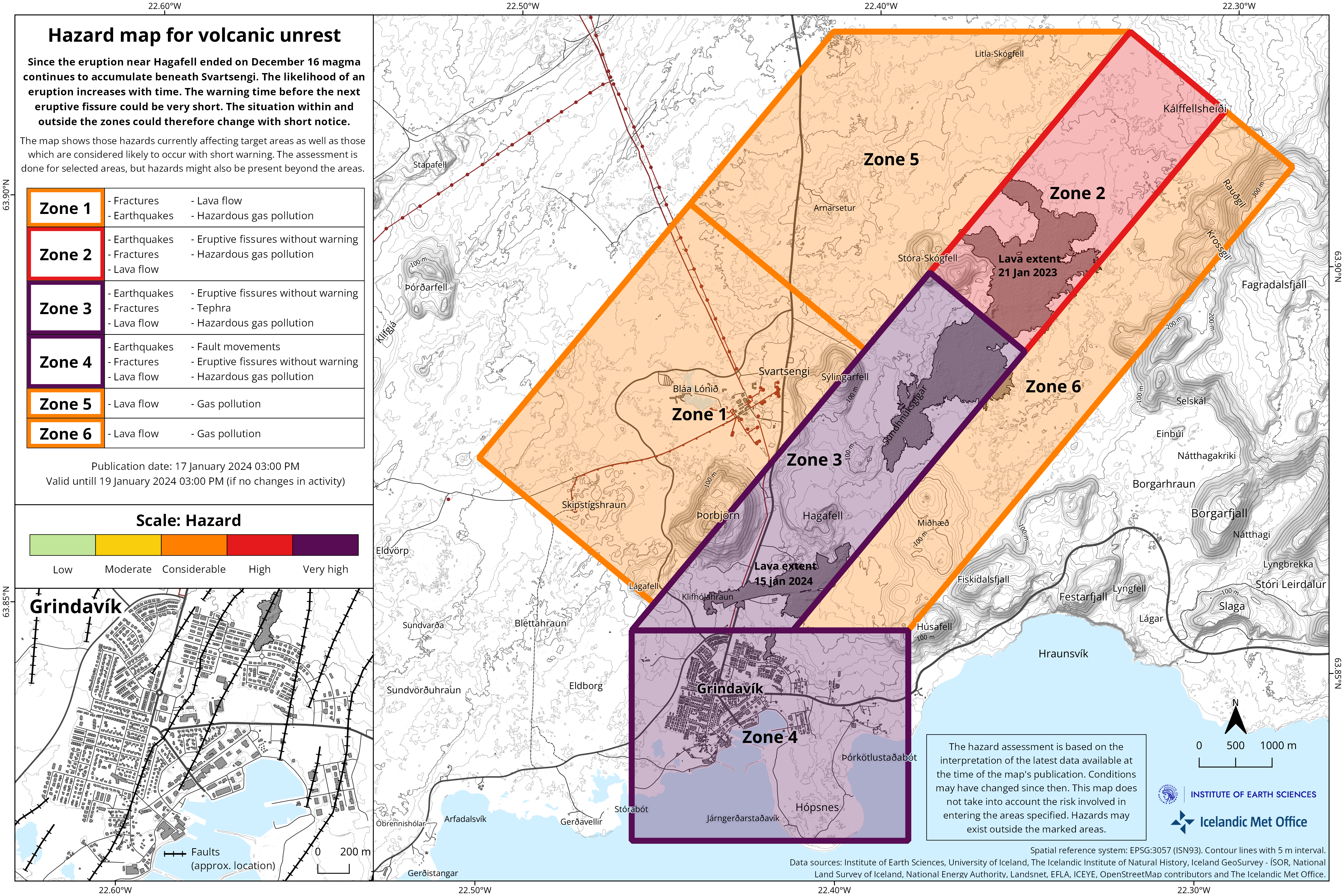
Gas pollution was measured yesterday during work on wells connected to the utility system within Grindavík. The Icelandic Meteorological Office does not monitor localized gas pollution within Grindavík. It needs to be further examined whether the gas pollution is related to the magma lying very shallow in the area. It should be noted that dangerous gas pollution is among the issues mentioned in the current hazard assessment for Grindavík.
The IMO has issued an updated hazard assessment map. There are no changes in the overall hazard assessment for the areas compared to what was previously. The map takes effect at 15:00 today and is valid until Friday, January 19, at 15:00, unless there are changes.
Source : IMO
Photos : Sigurður Ólafur Sigurðsson , IMO
Northern Kuril Islands / Russia , Ebeko :
VOLCANO OBSERVATORY NOTICE FOR AVIATION (VONA)
Issued: January 18 , 2024
Volcano: Ebeko (CAVW #290380)
Current aviation colour code: ORANGE
Previous aviation colour code: orange
Source: KVERT
Notice Number: 2024-04
Volcano Location: N 50 deg 41 min E 156 deg 0 min
Area: Northern Kuriles, Russia
Summit Elevation: 1156 m (3791.68 ft)
Volcanic Activity Summary:
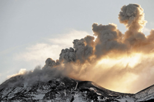
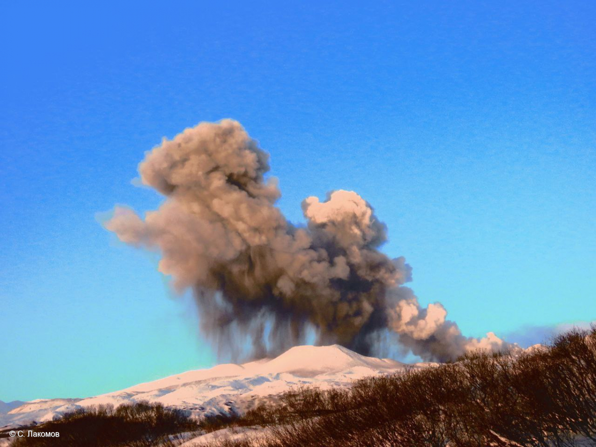
A moderate explosive eruption of the volcano continues. According to visual data from Severo-Kurilsk, explosions sent ash up to 2 km a.s.l., and ash cloud drifted to the east of the volcano.
A moderate explosive eruption of the volcano continues. Ash explosions up to 6 km (19,700 ft) a.s.l. could occur at any time. Ongoing activity could affect low-flying aircraft and airport of Severo-Kurilsk.
Volcanic cloud height:
1800-2000 m (5904-6560 ft) AMSL Time and method of ash plume/cloud height determination: 20240118/0058Z – Visual data
Other volcanic cloud information:
Distance of ash plume/cloud of the volcano: 5 km (3 mi)
Direction of drift of ash plume/cloud of the volcano: E
Time and method of ash plume/cloud determination: 20240118/0058Z – Visual data
Source : kvert .
Photo : S. Lakomov
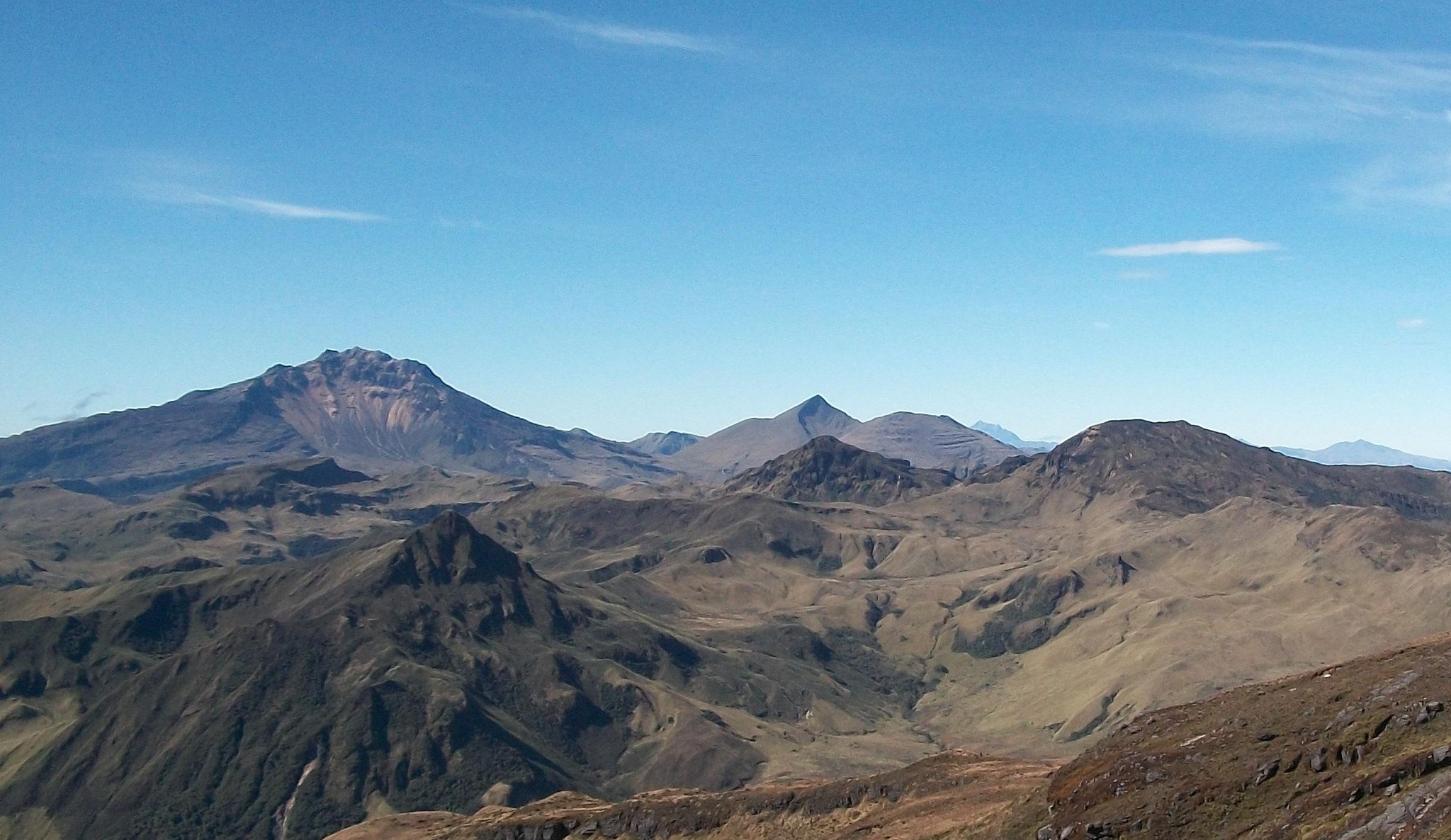
Colombia , Chiles / Cerro Negro :
Weekly activity bulletin of the Chiles and Cerro Negro Volcanic Complex (CVCCN)
Regarding the monitoring of the activity of the CHILES AND CERRO NEGRO VOLCANOES, the MINISTRY OF MINES AND ENERGY, through the COLOMBIAN GEOLOGICAL SERVICE (SGC), reports that:
In the week of January 9 to 15, 2024, a decrease in seismicity was recorded, both in occurrence and in energy released, compared to the previous week. The predominant seismicity continues to be linked to the fracture of the rocks of the volcanic edifice, although the presence of earthquakes associated with the movement of fluids within these volcanoes persists.
Fracture seismicity was located mainly towards the south of the Chiles volcano at distances between 0.5 and 3 km, depths up to 7 km from its summit (4,700 m above sea level) and a maximum magnitude of 1.7. None of these earthquakes were reported as felt.
Volcanic deformation processes are maintained according to the processing of recordings from ground-mounted sensors and remote satellite sensors.
The evolution of activity in the CVCCN continues, due to internal processes derived from the complex interaction between the magmatic, hydrothermal system and the geological faults of the area, such that the probability of occurrence of energetic earthquakes that may be felt by residents of the CVCCN area of influence persists.
Volcanic activity remains on YELLOW ALERT Status: Active volcano with changes in baseline behavior of monitored parameters and other manifestations
Source et photo : SGC
Japan , Suwanosejima :
JMA reported that the eruption at Suwanosejima’s Ontake Crater continued during 8-15 January. Eruptive events on 11 January produced ash plumes that rose as high as 1.1 km above the crater rim and drifted SE. An explosion at 05h48 on 13 January produced an ash plume that rose 800 m and drifted SE. At 00h22 on 14 January an explosion ejected large blocks 1.1 km to the N and 1 km to the S of the vent and produced an ash plume that rose 500 m above the crater rim. The Alert Level was raised to 3 (on a 5-level scale) and the public was warned to stay 2 km away from the crater. Another eruptive event at 23h13 on 15 January generated an ash plume that rose more than 1 km above the crater rim and drifted S.
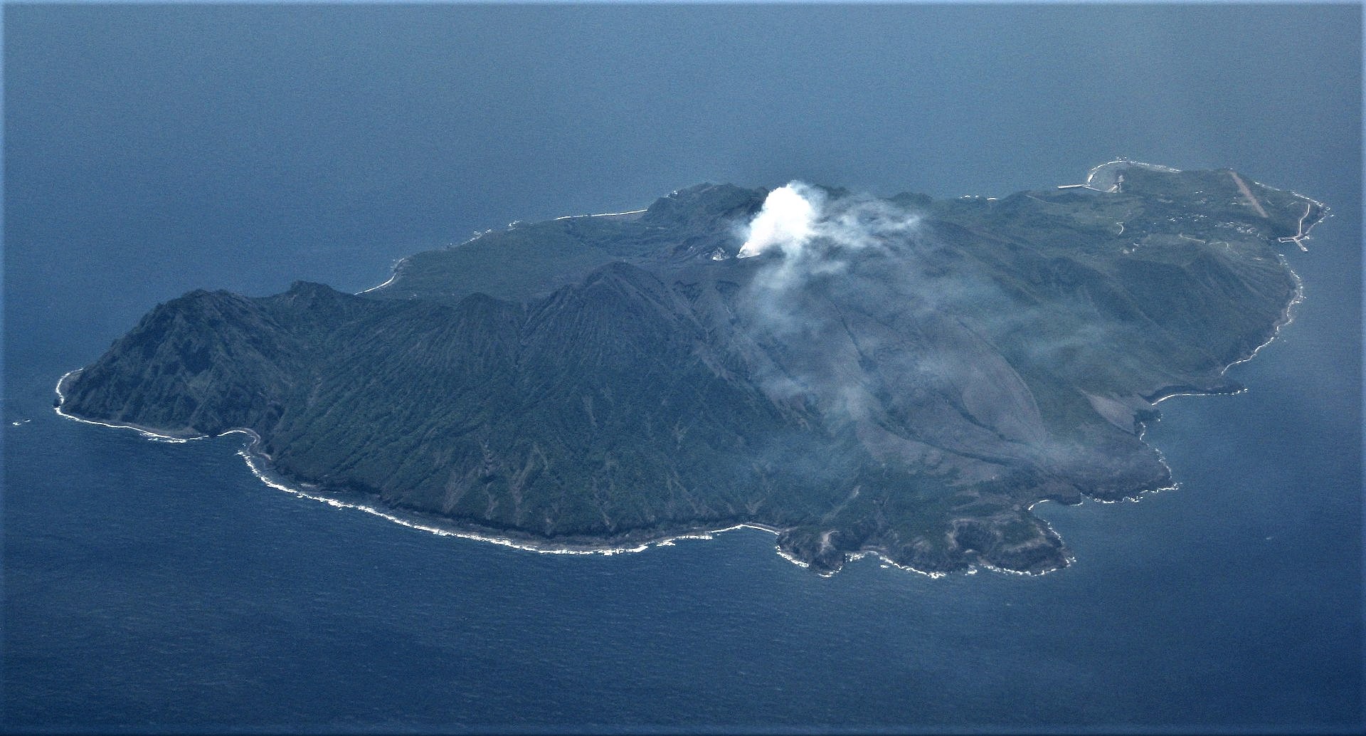
The 8-km-long island of Suwanosejima in the northern Ryukyu Islands consists of an andesitic stratovolcano with two historically active summit craters. The summit is truncated by a large breached crater extending to the sea on the east flank that was formed by edifice collapse. One of Japan’s most frequently active volcanoes, it was in a state of intermittent Strombolian activity from Otake, the NE summit crater, between 1949 and 1996, after which periods of inactivity lengthened. The largest recorded eruption took place in 1813-14, when thick scoria deposits blanketed residential areas, and the SW crater produced two lava flows that reached the western coast. At the end of the eruption the summit of Otake collapsed, forming a large debris avalanche and creating the open Sakuchi caldera, which extends to the eastern coast. The island remained uninhabited for about 70 years after the 1813-1814 eruption. Lava flows reached the eastern coast of the island in 1884. Only about 50 people live on the island.
Source : Agence météorologique japonaise (JMA) , GVP.
Photo : Ray Go.
Costa – Rica , Poas :
The Poás volcano maintains a stable tremor, with small variations in amplitude and frequency content, dominating the frequency band between 1.5 and 5 Hz. During this week, an increase in the number of hydrothermal eruptions and of their energy. To date, 12 eruptions have been recorded, the largest was recorded yesterday, January 11, at 8:51 p.m., which produced a plume of water vapor and gas exceeding 500 meters in height (for dark and dark conditions). foggy at night, an adequate height estimate could not be made). The SO2/CO2 ratio remains high, with a weekly average of 1.8 ± 0.7, and a maximum of 3.4 observed on January 10. The SO2 concentration at the viewpoint is less than 3.3 ppm this week. During the last week, the NOVAC station recorded an average flow of 330 ± 30 t/d of SO2. The lake level continues to fall due to hydrothermal activity and lack of rain. The Sentinel satellite measured 53.7 tonnes of SO2 during its passage over the volcano yesterday.
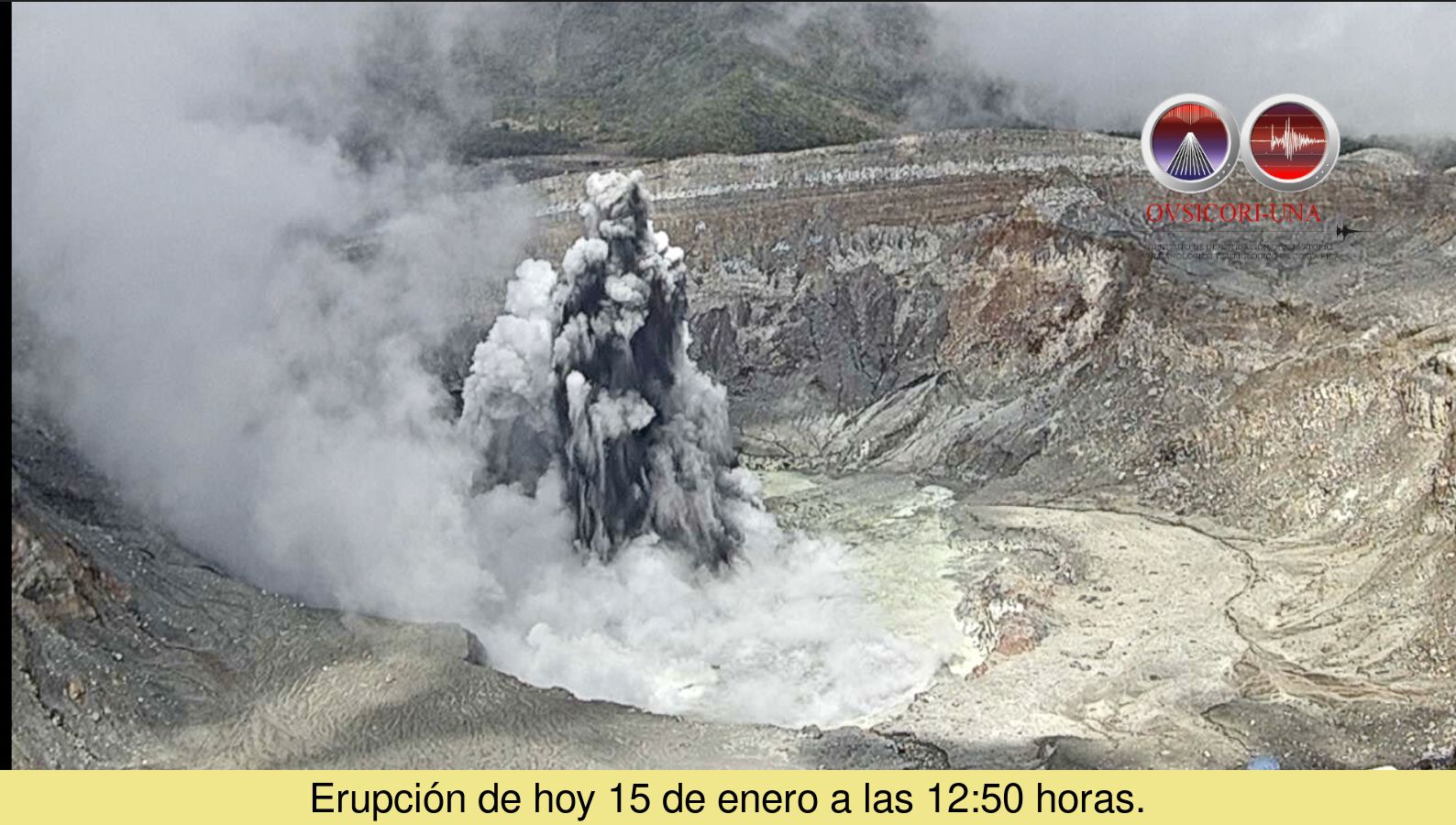
OVSICORI-UNA reported that small phreatic eruptions at Poás continued to be observed during 8-16 January. Phreatic eruptions were recorded daily, ejecting sediment no more than 200 m above the lake’s surface and producing steam-and-gas plumes that rose no higher than 500 m. In a special report OVSICORI-UNA noted that both gas-and-steam emissions and seismicity began to increase during the second half of 2023. The lake level had been decreasing since October 2023 and eruptive events became more frequent and energetic in December; a phreatic eruption at 2051 on 11 January was the largest event recorded during December 2023-January 2024.
Source: Observatorio Vulcanologico y Sismologico de Costa Rica-Universidad Nacional (OVSICORI-UNA) , GVP
Photo : Ovsicori.