October 28 , 2018.
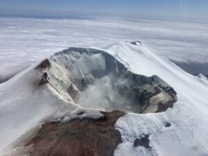
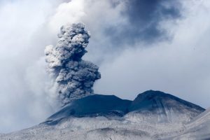
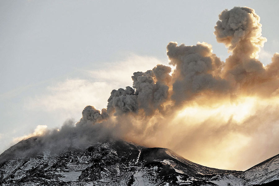
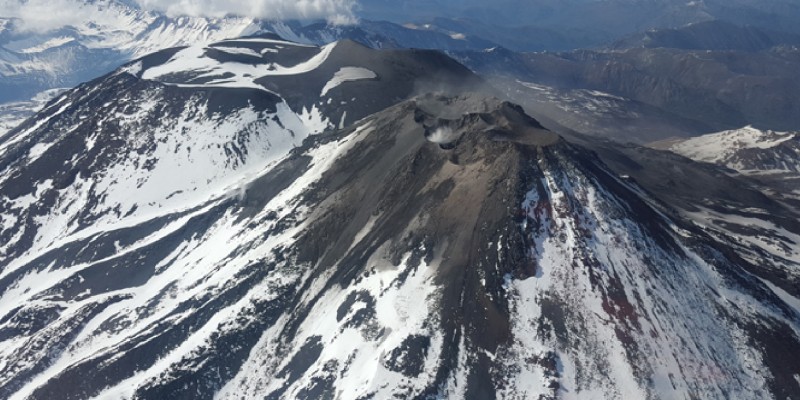
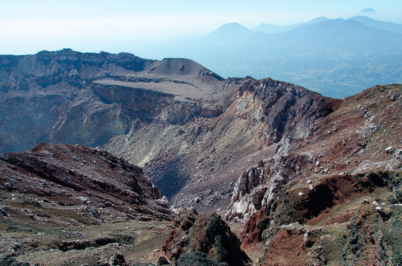
Chile , Nevados de Chillan :
Volcanic Activity Report (RAV), Volcanological Observatory of the South Andes – Ovdas, October 26, 2018 16:00 HL.
Current alert level: ORANGE
Volcanic monitoring
Seismic activity: During the last 24 hours, the monitoring network of the volcanic complex Nevados of Chillan continues to record a seismicity type volcano tectonic (VT) , type long period (LP) and episodes of tremor, with seismic energy who remains at a rank considered moderate. The seismicity LP and TR being related to the occurrence of explosions which impulses the surface activity and is associated with the variation between the growth and the partial destruction of the viscous lava dome in the crater Nicanor. The most energetic VT event was located 3.4 km east of the active crater at a depth of 5.2 km.
Observations:
The weather conditions made it possible to visualize a column of mainly white to light gray gas. During the night, incandescence is observed associated with high temperature degassing produced from the active crater.
Other observations
⦁ Infrasound sensors recorded acoustic signals associated with explosions (EX) with maximum values and less than 0.31 Pa (reduced to 1 km as a reference).
⦁ No thermal radiation was reported according to the information processed by the MIROVA group.
Danger
Exposure / Specific risks:
These facts establish that, given current conditions, the most likely scenario is the generation of sporadic minor eruptive impulses (columns with an elevation not exceeding 5 km) associated with explosions of gas, particles and pyroclastic projections. ballistic whose range fluctuates around 2 or 3 km around the active crater. Similarly, it is likely that the lava dome may extend beyond the active crater, forming a viscous lava flowing towards the north-northeast. It will eventually be sensitive to gravity collapses, generating high-speed heat flows known as pyroclastic flows, with blocks and ashes, which could affect Gato and Las Minas, who in turn could trigger lahares. in the tributaries of the Nubian River.
In addition, it was considered with a lower probability, a moderate explosive eruptive phase (IEV = 3 to 4) associated with partial or total destruction of the lava dome nestled in the active crater … / …
Conclusion
The behavior of the Nevados de Chillan volcanic complex continues to evolve as a result of a minor eruption related to the growth and partial destruction of a lava dome tucked into the active crater « Nicanor », whose internal dynamics lead to activity. explosive hot gases and pulsatile releases, ballistic particles around the crater, while maintaining the production of long – period type seismic events and tremors, in ranges of energy considered moderate for this process. This process could generate a major eruptive event without showing clear precursors.
…/…
Read the full report: http://sitiohistorico.sernageomin.cl/reportesVolcanes/20181026040308620RAV_Ñuble_octubre_2018_N°50.pdf
Source : Sernageomin.
El Salvador , San Miguel ( Chaparrastique ) :
Location: San Miguel Department
Altitude: 2,130 meters
Type of volcano: Stratovolcano
Attraction type: Strombolian – Vulcanian
Last major eruption: December 29, 2013
The seismic vibrations of the Chaparrastic volcano have fluctuated between 50 and 77 RSAM units during its average day, ie on average 65 units, the normal value is between 50 and 150 RSAM units. The presence of micro-earthquakes associated with the circulation of fluids (magma, gas) was reduced by 18.63% compared to the previous month, with an average value of 335 events per day; mainly low frequency signals (1.5 to 5 Hz). Two micro-earthquakes were located on the northern flank of the volcano. Due to their low magnitude, none was perceived by the population living in this area of the volcano.
For sulfur dioxide (SO2) emissions, they fluctuate from 423 to 541 and remain below the 620 t / d threshold. These values are considered normal in a volcanic system with an open conduit. According to the monitoring data analysis, the activity of the volcano has stabilized. However, changes can occur suddenly, with the possibility of emitting small plumes of gas and ash, with energy similar to that previously experienced, or, in a smaller probability, having lava presence in the area. crater. Therefore, the monitoring of the volcano continues with in perspective the changes that the volcano presents.
Source : Marn
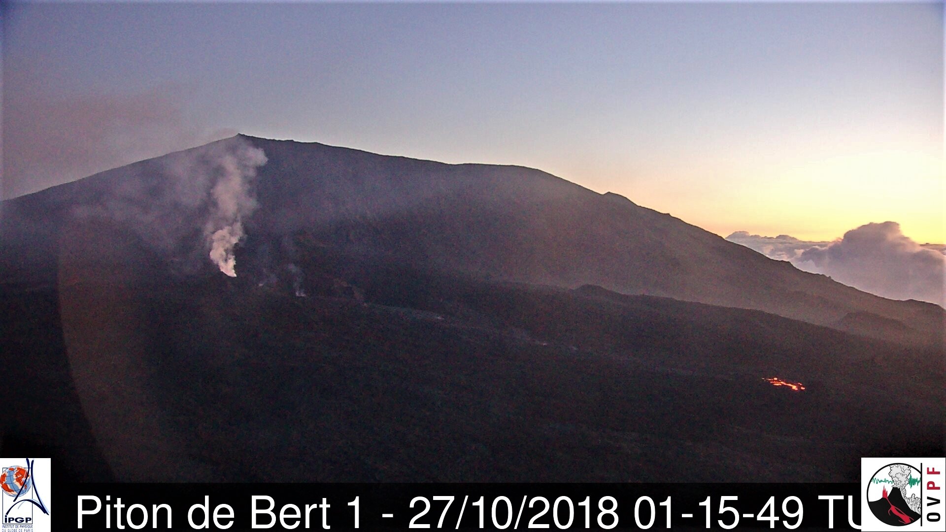
La Réunion , Piton de la Fournaise :
Activity Bulletin from Saturday, October 27, 2018 at 15:30 (local time).
The eruption started on September 15th at 4:25 am local time continues. The intensity of the volcanic tremor (indicator of eruptive intensity at the surface) remains very low and has stabilized since 72h (Figure 1).
– A volcano-tectonic earthquake was recorded during the day of October 26, while no earthquake was recorded during the current day.
– Inflation (swelling) of the building is always recorded. This inflation reflects the pressurization of a localized source beneath the summit craters (Bory-Dolomieu) at a depth of 1-1.5 km, related to the recharge of the superficial reservoir by deeper magma.
– SO2 emissions at the eruptive vent are low (near or below the detection limit).
– CO2 emissions from the soil at the volcano deposit remain low.
– The surface flows could not be estimated today because of lava flows that are too weak at the surface and / or cloud cover.
– The surface activity is always extremely weak. This night of very small resurgences were still visible on the downstream part of the main tunnel, about 1 km from the eruptive vent.
Alert level: Alert 2-2 – Eruption in the Enclos .
Source : OVPF. http://www.ipgp.fr/fr/ovpf/bulletin-dactivite-samedi-27-octobre-2018-a-15h30-heure-locale
Indonesia , Dukono :
VOLCANO OBSERVATORY NOTICE FOR AVIATION – VONA.
Issued: October 28 , 2018
Volcano: Dukono (268010)
Current Aviation Colour Code: ORANGE
Previous Aviation Colour Code: orange
Source: Dukono Volcano Observatory
Notice Number: 2018DUK197
Volcano Location: N 01 deg 41 min 35 sec E 127 deg 53 min 38 sec
Area: North Maluku, Indonesia
Summit Elevation: 3933 FT (1229 M)
Volcanic Activity Summary:
Eruption with volcanic ash cloud at 08h50 UTC (17h50 local).
Volcanic Cloud Height:
Best estimate of ash-cloud top is around 5533 FT (1729 M) above sea level, may be higher than what can be observed clearly. Source of height data: ground observer.
Other Volcanic Cloud Information:
Ash cloud moving to northeast.
Remarks:
Eruption and ash emission is continuing.
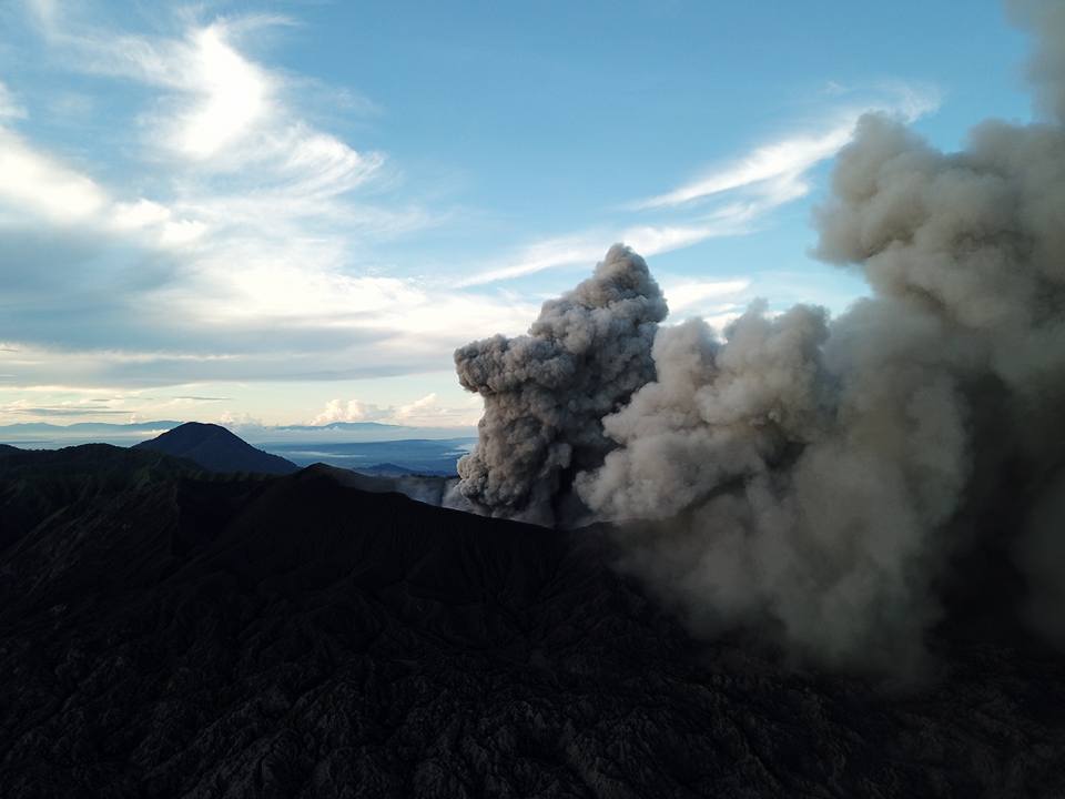
Level of Activity at Level (WASPADA). The Dukono (1229 m above sea level) is experiencing a continuous eruption.
Since yesterday and until this morning, the peak of the volcano has been observed visually until it is covered with mist. Crater smoke was observed to be white / gray with a thick intensity, about 500 meters above the summit. The wind is blowing weakly towards the East.
The seismograms of October 27, 2018 recorded:
5 earthquakes of eruption
1 distant tectonic earthquake.
The tremor is recorded continuously with an amplitude of 0.5 to 6 mm (dominant value 2 mm)
Recommendation: People around Mount Dukono and visitors / tourists should not climb and approach the crater of Malupang Warirang within a radius of 2 km.
Source : Magma Indonésie , PVMBG.