January 08 , 2024.
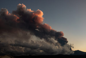
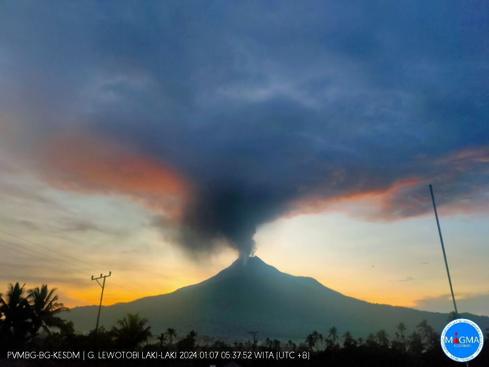
Indonesia , Lewotobi Laki-Laki :
VOLCANO OBSERVATORY NOTICE FOR AVIATION – VONA
Issued : January 07 , 2024
Volcano : Lewotobi Laki-laki (264180)
Current Aviation Colour Code : ORANGE
Previous Aviation Colour Code : orange
Source : Lewotobi Laki-laki Volcano Observatory
Notice Number : 2024LWK012
Volcano Location : S 08 deg 32 min 20 sec E 122 deg 46 min 06 sec
Area : East Nusa Tenggara, Indonesia
Summit Elevation : 5069 FT (1584 M)
Volcanic Activity Summary :
Eruption with volcanic ash cloud at 22h52 UTC (06h52 local).
Volcanic Cloud Height :
Best estimate of ash-cloud top is around 9869 FT (3084 M) above sea level or 4800 FT (1500 M) above summit. May be higher than what can be observed clearly. Source of height data: ground observer.
Other Volcanic Cloud Information :
Ash cloud moving to northwest. Volcanic ash is observed to be gray to brown. The intensity of volcanic ash is observed to be thick.
Remarks :
Tremor recorded on seismogram with maximum amplitude 7 mm.
Source : Magma Indonésie
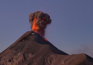
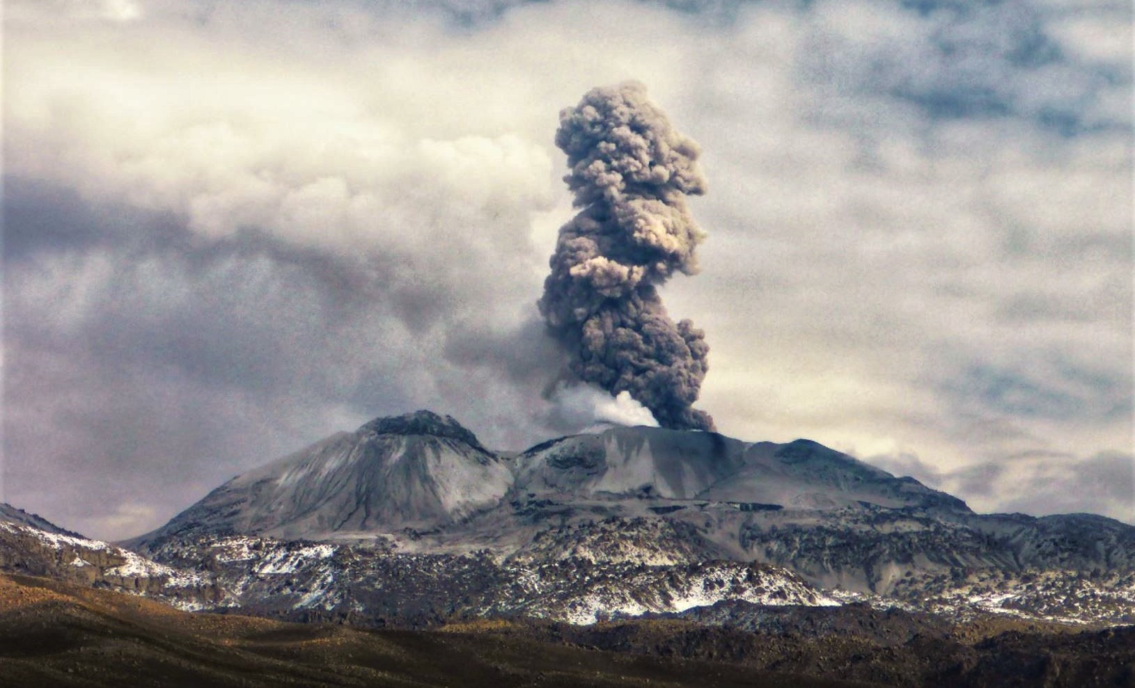
Peru , Sabancaya :
Analysis period: from December 26, 2023 to January 2, 2024, Arequipa, January 3, 2024
Alert level: ORANGE
The Geophysical Institute of Peru (IGP) reports that the eruptive activity of the Sabancaya volcano remains at moderate levels, that is, with the recording of an average of 62 daily explosions, with columns of ash and of gas up to 1600 m altitude above the summit of the volcano and their subsequent dispersion. Consequently, the volcanic alert level remains at the ORANGE level
The IGP recorded and analyzed the occurrence of 400 earthquakes of volcanic origin, associated with the circulation of magmatic fluids inside the Sabancaya volcano, as well as earthquakes linked to the fracturing of rocks. An average of 62 explosions were recorded daily.
Columns of ash and gas have been observed at an altitude of up to 1600 m above the summit of the volcano. The predominant direction of these emissions was towards the West and South West sectors of the volcano over a distance of less than 10 KM.
We continue to record a slight inflation process in the northern sector (around the Hualca Hualca volcano).
Satellite recordings identified the presence of 6 thermal anomalies, with a maximum value of 35 MW, associated with the presence of a lava body on the surface of the volcano crater.
RECOMMENDATIONS
• Keep the volcano alert level in orange.
• Do not approach within a radius of less than 12 km from the crater.
Source : Cenvul.
Photo : Andina.
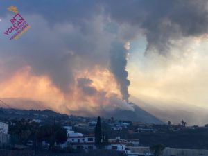
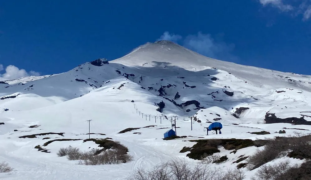
Chile , Villarica :
Special Report on Volcanic Activity (REAV), La Araucanía and Los Ríos regions, Villarrica volcano, January 7, 2024, 5:10 a.m. local time (mainland Chile)
The National Geology and Mining Service of Chile (Sernageomin) announces the following PRELIMINARY information, obtained through the monitoring equipment of the National Volcanic Monitoring Network (RNVV), processed and analyzed at the Southern Andean Volcano Observatory (Ovdas):
On Sunday January 7, 2024, at 04:46 local time (07:46 UTC), monitoring stations installed near the Villarrica volcano recorded an earthquake associated with the fracturing of rocks inside the volcanic system (volcano-tectonic type).
The characteristics of the earthquake after its analysis are as follows:
ORIGINAL TIME: 04:46 local time (07:46 UTC)
LATITUDE: 39.427°S
LONGITUDE: 71.871°E
DEPTH: 5.2 km
LOCAL MAGNITUDE: 3 (ML)
Observation :
Lower energy volcano-tectonic (VT) events were recorded before and after the event mentioned in this report. The weather conditions did not make it possible to observe the surface activity.
No changes in the seismic behavior of the fluids were recorded.
The technical volcanic alert is maintained at YELLOW level.
Source: Sernageomin.
Photo : Auracaniadiario
Colombia , Chiles / Cerro Negro :
Weekly activity bulletin from the Chiles Volcanic Complex / Cerro Negro (CVCCN)
Regarding the monitoring of the activity of the CHILES AND CERRO NEGRO VOLCANOES, the MINISTRY OF MINES AND ENERGY, through the COLOMBIAN GEOLOGICAL SERVICE (SGC), reports that:
For the period between December 26, 2023 and January 1, 2024, and compared to the previous week, volcanic seismicity decreased in its occurrence and slightly increased in the energy released, maintaining the predominance of earthquakes associated with the fracturing of rocks within the volcanic structure. In addition, events associated with the transit of fluids towards the interior of volcanic conduits have been recorded.
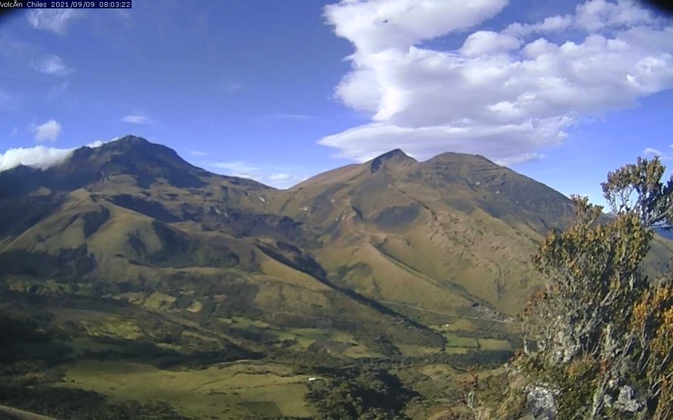
The earthquakes were located mainly to the south of the Chiles volcano, at distances of up to 5 km, with depths less than 6 km from its summit (4,700 m above sea level). The maximum magnitude recorded was 2.8. The earthquake recorded on December 27, 2023 at 1:33 a.m. stands out, which was located south of the Chiles volcano, with a depth of 5 km and a magnitude of 2.8, which was reported as felt by the inhabitants of the Chiles indigenous reserve .
Deformations continue to be recorded in several sectors of the CVCCN detected with sensors installed in these volcanoes and with satellite sensors.
The evolution of activity in the CVCCN continues, due to internal processes derived from a complex interaction between the magmatic, hydrothermal system and the geological faults of the area, such that the probability of occurrence of energetic earthquakes that may be felt by residents of the CVCCN area of influence.
Volcanic activity remains on YELLOW ALERT Status: Active volcano with changes in baseline behavior of monitored parameters and other manifestations.
Source et photo : SGC
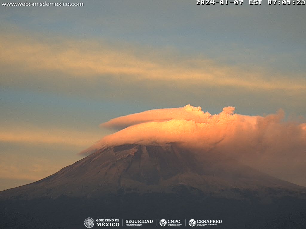
Mexico , Popocatépetl :
January 7, 11:00 a.m. (January 7, 5:00 p.m. GMT)
Activity from the last 24 hours
An expiration was detected, accompanied by water vapor, volcanic gases and ash, in addition to 1,348 minutes of tremor (10:46 p.m.) of low amplitude.
In the morning and at the time of this report, a constant emission of water vapor, volcanic gases and ash, which disperses towards the North-East (NE) is recorded.
The Popocatépetl volcano warning light is located in Yellow Phase 2.
The scenarios planned for this phase are:
A few smaller to moderate sized explosions
Appearance of tremors of variable amplitude
Light to moderate ash rain in surrounding towns and some more distant towns
Ejection of incandescent fragments within the exclusion radius of 12 kilometers
Source et photo : Cenapred.