November 14 , 2023.
Iceland , Reykjanes Peninsula :
Svartsengi continues to inflate . Ongoing possibility of additional dikes forming or an eruption. Updated 13. December at 11:15 UTC
The area around Svartsengi continues to inflate. The rate of inflation has decreased somewhat since Friday, but it is still greater than it was prior to the formation of the dike that traveled under Grindavík November 10 .
While magma continues to accumulate around Svartsengi, further dikes or an eruption remain possible.
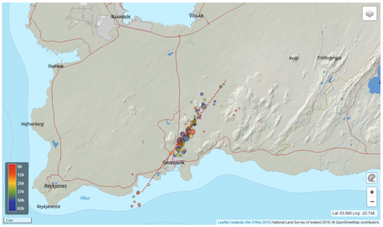
If another dike forms it is considered to be likeliest that it would follow the same path as the November 10 dike. The most likely location for a potential eruption under these conditions is assessed to be north of Grindavík in the direction of Hagafell and the area around Sundhnúkagígar.
Seismic activity continues at a similar level to the previous days. It is generally weak and mostly in the area around Hagafell.
Source et photo : IMO
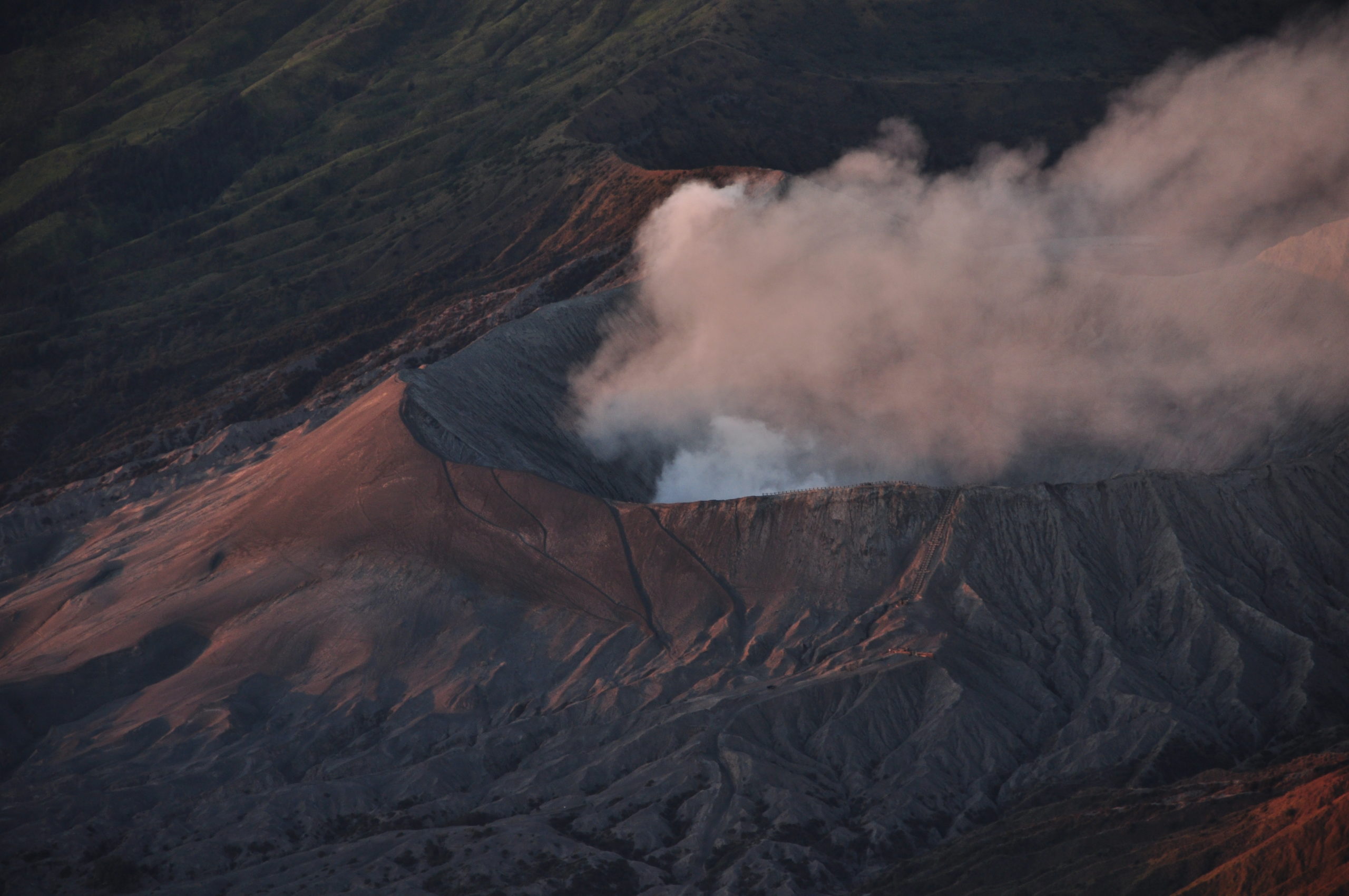
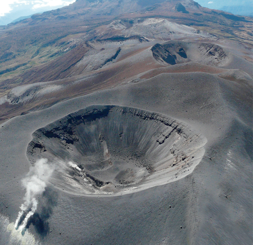
Indonesia , Bromo :
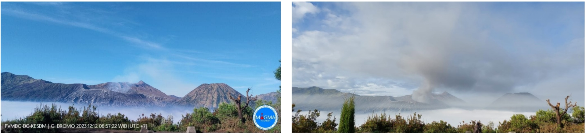
Press release on increased activity at Mount Bromo Crater on December 13, 2023
Mount Bromo is a cinder cone volcano located in the Tengger caldera, peaking at 2,329 meters above sea level. Administratively, this volcano is included in Probolinggo Regency, Malang Regency, Pasuruan Regency and Lumajang Regency, East Java Province. The eruptive character of Mount Bromo appears in the form of explosive and effusive eruptions coming from the central crater. The eruption produces ash, sand, lapilli and sometimes emits incandescent lava and volcanic bombs. The last eruption occurred in July 2019 as a phreatic eruption without being preceded by a significant increase in seismicity.
The activity of the Mount Bromo crater is monitored visually and instrumentally from the Bromo Volcano Observation Post (PGA) located in the hamlet of Cemoro Lawang, Ngadisari village.
The latest developments in Mount Bromo Crater activity until December 13, 2023 at 06:00 WIB are as follows:
There has been an increase in activity from the Mount Bromo crater in the form of observations of gray smoke emitting from the crater, of medium to thick intensity, with medium to high pressure from within the crater of Mount Bromo based on visual observations on December 13, 2023 at 06:00 WIB. . Meanwhile, during observations several months earlier, white crater smoke was observed emitted from the crater with light to thick intensity, low to moderate pressure with heights ranging from 50 to 900 meters above the summit . The gray smoke from the crater is usually accompanied by volcanic ash.
Earthquake observations show that continuous earthquake tremors are always recorded with an amplitude of 0.5 to 1 mm (dominant value 0.5 mm), accompanied by the recording of volcanic earthquakes during 3 incidents in December. This shows that there is a process of pressure fluctuation in the body of Mount Bromo which is accompanied by fluid flow towards the surface.
Deformation observations using the Borehole Tiltmetres and Tiltmeter equipment show a trend of inflation or increased pressure around the body of Mount Bromo in December.
The potential danger that could arise due to the increased activity of the Mount Bromo crater is the appearance of phreatic or magmatic eruptions with distribution of eruptive material in the form of ash and thrown stones (incandescence) which can reach a radius of 1 km around the center of the crater, as well as the release of gases dangerous for life.
Based on the results of a comprehensive assessment, the activity level of Mount Bromo on December 13, 2023 at 08:00 WIB is still at Level II (WASPADA) with recommendations tailored to the latest potential danger threats, as follows:
– People around Mount Bromo and visitors/tourists/climbers do not enter the crater area within a radius of 1 km around the active Mount Bromo crater.
– Communities around Mount Bromo, traders, tourists, mountaineers and Mount Bromo tourism managers should be aware of sudden phreatic eruptions without being preceded by significant volcanic symptoms.
– The regional government, BPBD in the regency always coordinates with Mount Bromo Observation Post in Cemoro Lawang, Ngadisari Village, Sukapura District, Probolinggo Regency or the Center for Volcanology and Disaster Mitigation (022) 7272606 in Bandung (West Java Province).
Source : PVMBG
Photos : PVMBG , G Vitton.
Colombia , Purace – Chaîne volcanique Los Coconucos :
Weekly bulletin of the activity of the Puracé volcano – Los Coconucos volcanic chain.
Monitoring the activity of the VOLCANIC CHAIN PURACE VOLCANO – LOS COCONUCOS, the MINISTRY OF MINES AND ENERGY through the COLOMBIAN GEOLOGICAL SERVICE (SGC)
reports:
During the week of December 5 to 11, 2023, a decrease in the frequency of seismic events and their energy levels was noted. However, variations above the historical average in seismic activity persisted. Likewise, localized deformations continued to be recorded between the Puracé and Curiquinga volcanoes. Regarding the measurement of gases, stable values were recorded in the flow of sulfur dioxide (SO2), while the concentration values of carbon dioxide (CO2) remain high compared to what was recorded last year .
The images obtained using the installed cameras show an increase in degassing from the volcanic system, both inside the crater and in the external lateral fumarole (northwest flank of the volcanic edifice).
The other parameters measured and used for the diagnosis of volcanic activity showed no notable changes during the period evaluated.
The alert status for volcanic activity remains at: YELLOW ALERT: ACTIVE VOLCANO WITH CHANGES IN THE BEHAVIOR OF THE BASE LEVEL OF MONITORED PARAMETERS AND OTHER MANIFESTATIONS.
Source et photo : SGC
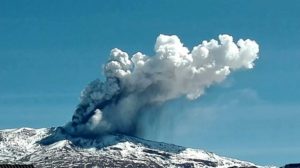
Japan , Kirishimayama :
JMA lowered the Alert Level for Kirishimayama to 1 (on a 5-level scale) on 6 December. The number of volcanic earthquakes had increased during July-August in an area around the NE side of Karakunidake and on 15 September and had remained low since then. Minor inflation detected in May slowed in October and was no longer detected in November. Fumarolic areas remained at normal levels.
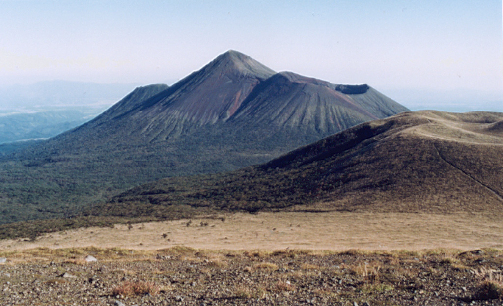
Takachihomine peak (center) in the Kirishima volcanic complex is flanked on the E (right) by Ohachi, with its broad summit crater. Madudake cone is to the far right. Kirishima is a large group of more than 20 Quaternary cones within Kirishima National Park, located N of Kagoshima Bay. The late-Pleistocene to Holocene group of cones, maars, and underlying shield volcanoes occupies an area of 20 x 30 km.
Kirishimayama is a large group of more than 20 Quaternary volcanoes located north of Kagoshima Bay. The late-Pleistocene to Holocene dominantly andesitic group consists of stratovolcanoes, pyroclastic cones, maars, and underlying shield volcanoes located over an area of 20 x 30 km. The larger stratovolcanoes are scattered throughout the field, with the centrally located Karakunidake being the highest. Onamiike and Miike, the two largest maars, are located SW of Karakunidake and at its far eastern end, respectively. Holocene eruptions have been concentrated along an E-W line of vents from Miike to Ohachi, and at Shinmoedake to the NE. Frequent small-to-moderate explosive eruptions have been recorded since the 8th century.
Source: Japan Meteorological Agency (JMA) , GVP.
Photo : Ichio Moriya (Kanazawa University).
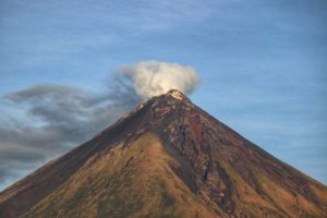
Vanuatu , Yasur :
On 4 December the Vanuatu Meteorology and Geohazards Department (VMGD) reported that activity at Yasur continued at a level of “major unrest,” as defined by the Alert Level 2 status (the middle level on a scale of 0-4) during November. Recent satellite observations indicated an increase in steam, gas, and ash emissions from the summit crater. Explosions continued, with some ejecting bombs that landed back in and around the crater. The public was reminded to not enter the restricted area within 600 m around the boundaries of the Permanent Exclusion Zone, defined by Danger Zone A on the hazard map.
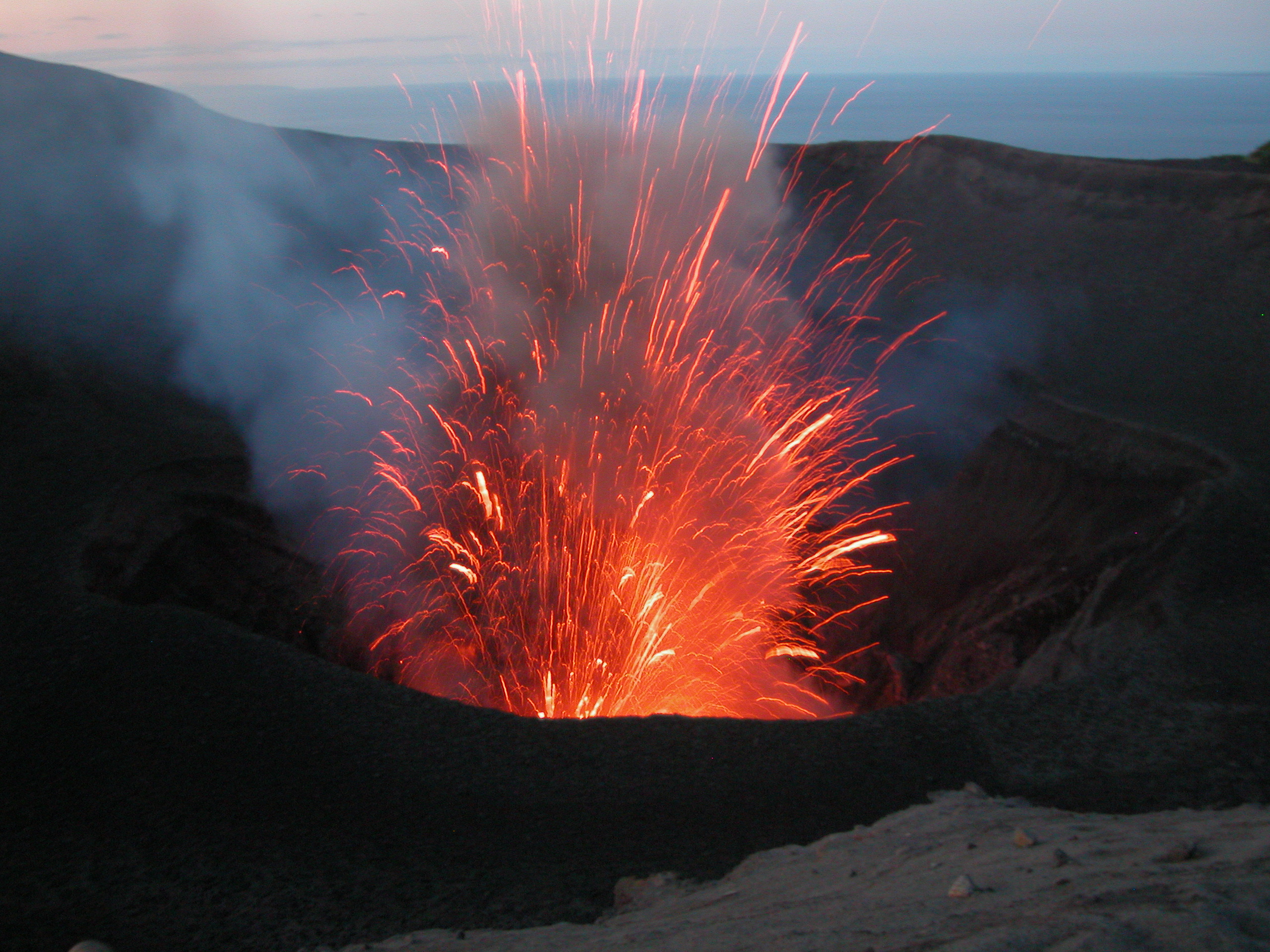
Yasur has exhibited essentially continuous Strombolian and Vulcanian activity at least since Captain Cook observed ash eruptions in 1774. This style of activity may have continued for the past 800 years. Located at the SE tip of Tanna Island in Vanuatu, this pyroclastic cone has a nearly circular, 400-m-wide summit crater. The active cone is largely contained within the small Yenkahe caldera, and is the youngest of a group of Holocene volcanic centers constructed over the down-dropped NE flank of the Pleistocene Tukosmeru volcano. The Yenkahe horst is located within the Siwi ring fracture, a 4-km-wide open feature associated with eruption of the andesitic Siwi pyroclastic sequence. Active tectonism along the Yenkahe horst accompanying eruptions has raised Port Resolution harbor more than 20 m during the past century.
Source: Vanuatu Meteorology and Geohazards Department (VMGD) , GVP.
Photo : Michel Massat