October 29 , 2023.
Iceland , Reykjanes Peninsula:
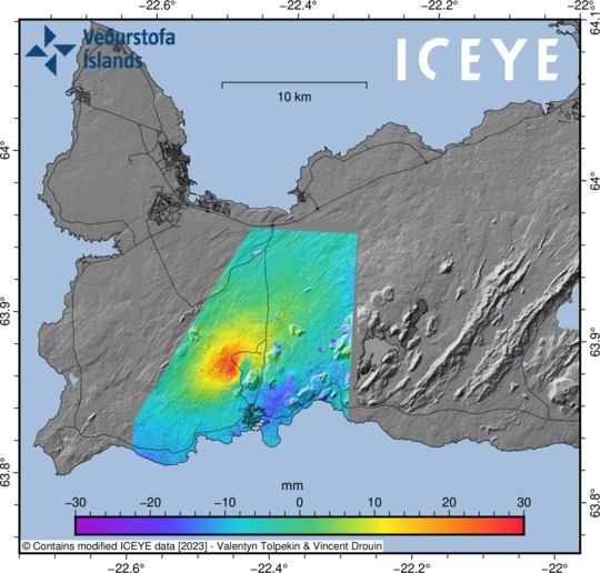
Ground uplift detected northwest of Þorbjörn . New data reveals a complex process of magma movements on the Reykjanes Peninsula. Updated 28th of October at 1:30pm
The latest cGPS measurements, along with a newly acquired InSAR image over Reykjanes Peninsula, reveals a clear sign of ground uplift, centred around Svartsengi. This uplift signal began at some point on 27 October, and it reflects a pressure increase that is probably caused by a magmatic intrusion at depth. The centre of the uplift signal is around 1.5 km northwest of Þorbjörn, close to the Blue Lagoon. In 2020 and 2022, similar uplift signals were detected in the same area and with similar geometry. This is now the fifth inflation event in the area. From an initial assessment, the ongoing uplift signal is occurring more rapidly than before. Presently, there are no indications of magma moving at shallower depth. However, the situation may evolve rapidly. For instance, significant fracturing has occurred in the Svartsengi area due to triggered seismicity in recent days. Such fracturing could allow magma to find pathways to shallower depth.
Overall, the latest deformation results from the Reykjanes Peninsula show a complex, ongoing process of magma movements in the earth’s crust. These processes are affecting a wide area, including Fagradalsfjall (where long-term inflation continues), east of Festarfjall (where the deformation seems to have stopped), and – in the last 24 hours – an area close to Svartsengi shows inflation.
The seismic swarm that began on 25 October north of Grindavík has resulted in over 7.000 earthquakes. The level of earthquake has reduced considerably, although the swarm is still ongoing, meaning that felt earthquakes are still likely.
Geophysical modelling is underway today to determine the depth and size of the uplift source close to Svartsengi. An additional satellite radar image will be available from Reykjanes Peninsula on 29 October. This image should provide an even closer insight into the recent magma movements and deformation pattens on the peninsula.
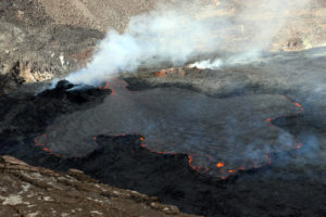
Source and photo : IMO
Alaska , Bogoslof :
53°55’38 » N 168°2’4″ W,
Summit Elevation 492 ft (150 m)
Current Volcano Alert Level: ADVISORY
Current Aviation Color Code: YELLOW
Over the past week, nearly 120 earthquakes have been detected in the vicinity of Bogoslof volcano. This increase in earthquake activity prompted AVO to raise the Aviation Color Code and Volcano Alert Level to YELLOW/ADVISORY on Tuesday, October 24. Seismicity remains elevated through Friday with earthquakes ranging from magnitude 2 to 3.0. Many smaller events are also recorded, but formal locations and magnitudes for these events are difficult to obtain with the limited seismic network. Increases in seismic activity typically precede eruptions, but many volcanoes have exhibited similar behavior that did not result in eruptions. There have been no other signs of unrest observed in satellite data over the past week.
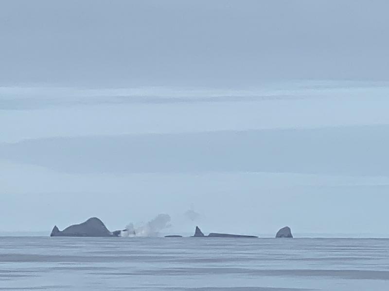
Bogoslof Island as seen by a fishing vessel passing by the island.
Bogoslof volcano is monitored using a single local seismic station, distant seismic and infrasound instruments, satellite data and lightning networks.
Bogoslof Island is the largest of a cluster of small, low-lying islands making up the emergent summit of a large submarine stratovolcano. The highest point above sea level prior to this eruption was about 100 m (300 ft); however, the volcano is frequently altered by both eruptions and wave erosion and has undergone dramatic changes in historical time. The two main islands currently above sea level are Fire Island and Bogoslof Island, both located about 98 km (61 mi) northwest of Unalaska/Dutch Harbor, 123 km (76 mi) northeast of Nikolski, and 149 km (93 mi) northeast of Akutan. The volcano is situated slightly north (behind) the main Aleutian volcanic front. Bogoslof volcano is within the USFWS Aleutian Maritime Wildlife Refuge and is habitat for marine mammals and seabirds.
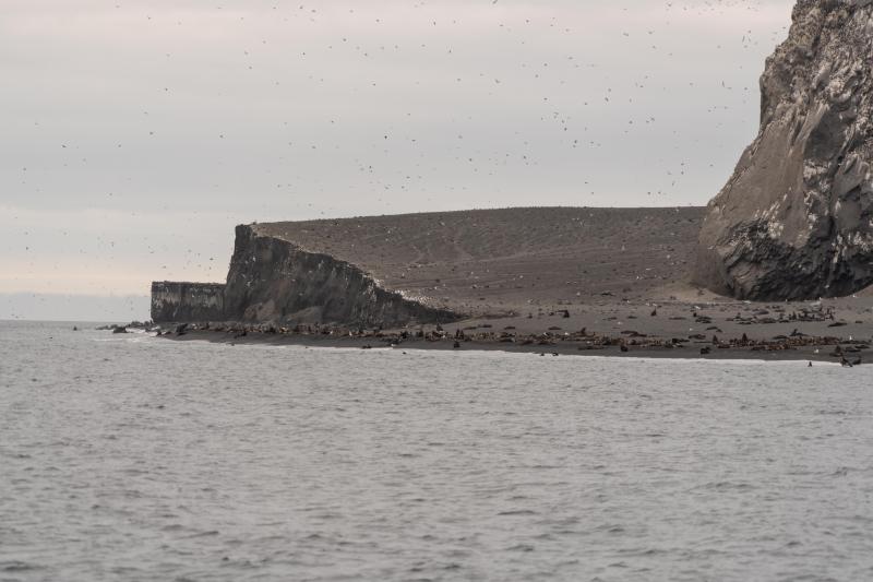
Northwest side of Bogoslof Island, July 14, 2019. The sea cliff exposure contains several sequences of tuff ring deposits associated with the 2016-2017 eruptive period. This area was heavily guarded by Callorhinus ursinus (Northern Fur Seal) so it was not possible to examine these outcrops. Castle Rock is on the far right of the photograph.
At least nine historical eruptions have been documented at Bogoslof volcano. Previous eruptions of the volcano have lasted weeks to months, and have on occasion produced ash fall on Unalaska. These eruptions are often characterized by multiple explosive, ash-producing events as well as the growth of lava domes. The most recent occurred from December 2016 to August 2017 and produced seventy main explosive events that generated volcanic ash clouds that rose as high as 13 km (42,500 ft) above sea level, and that greatly modified the topography of Bogoslof Island.
Source : AVO
Photos : Shaishnikoff, Trever ( 2020) , Waythomas, Chris / Alaska Volcano Observatory / U.S. Geological Survey ( 2019)
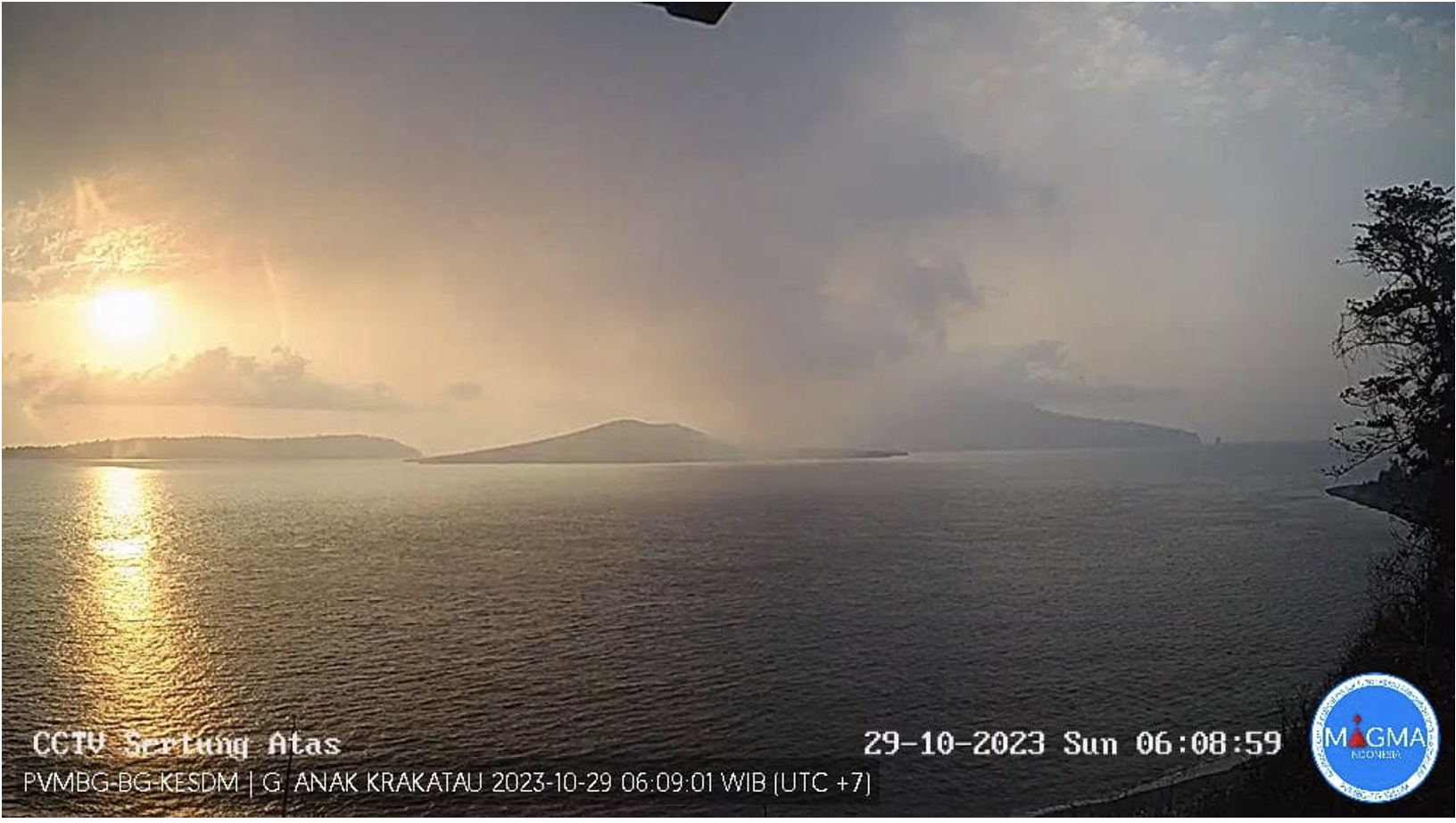
Indonesia , Anak Krakatau :
Press release on the development of volcanic activity on ANAK KRAKATAU.
Anak Krakatau Volcano (G. Anak Krakatau) is a volcano located in the Sunda Strait and South Lampung Regency, Lampung Province. Geographically, this volcano is located at coordinates 6o 06′ 05.8 South latitude and 105o 25′ 22.3″ East longitude, with a height of 195 m above sea level. This volcano is monitored visually and instrumentally from the Pasauran Pandeglang Volcano Observation Post, Banten and the Hargo Pancuran Kalianda Volcano Observation Post, Lampung.
The volcanic activity of Mount Anak Krakatau is still very present since the 2018 eruption which modified its morphology and was accompanied by the December 2018 tsunami. Until now, eruptive activity still occurs every year and in 2023 , 415 seismic eruptions were recorded with eruption column heights varying between 50 and 3,500 meters above the summit.
The latest developments regarding the activity of Mount Anak Krakatau until October 29, 2023 are as follows:
There was a significant increase in seismicity on October 28, 2023, where 50 deep volcanic earthquakes were recorded, 43 shallow volcanic earthquakes, 37 hybrid/multi phase earthquakes and an increase in the amplitude of continuous tremors up to 76 mm. This shows that there is a supply of magma to the surface accompanied by an increase in pressure at shallow depth. This condition can cause explosive or effusive breakouts.
Deformation observations using an inclinometer showed that inflation has occurred on the tangential and radial axes at Tanjung station of 50 microradians and 15 microradians respectively since April 2023. Meanwhile, at the station LAVA93, an inflation has occurred on the radial axis of 30 microradians since September 2023. This confirms with its appearance, an increased pressure at shallow depth.
Visual observations showed that the smoke from the crater was weak to medium, white, at a height of 25 to 300 meters above the crater summit.
The potential danger from the current activity of Mount Anak Krakatau is the ejection of incandescent material within a radius of 2 km from the center of the eruption, but it is possible that the ejection reaches a greater distance. At the same time, the distribution of volcanic ash depends on wind direction and speed and can reach larger areas. The potential danger of avalanches from the body of Mount Anak Krakatau has always been an ongoing threat that must always be monitored and anticipated.
Based on visual and instrumental observation data and potential eruption risks, as of October 29, 2023 at 08:00 WIB, the activity level of Mount Anak Krakatau is still at Level III (SIAGA) with the following recommendations:
The public is not allowed to approach Anak Krakatau within a 5 km radius of the active crater.
Areas outside a 5 km radius are safe from the threat of eruption, except for the distribution of volcanic ash which depends on wind direction and speed.
Source : PVMBG.
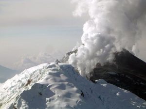
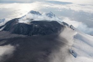
Photo : Magma Indonésie.
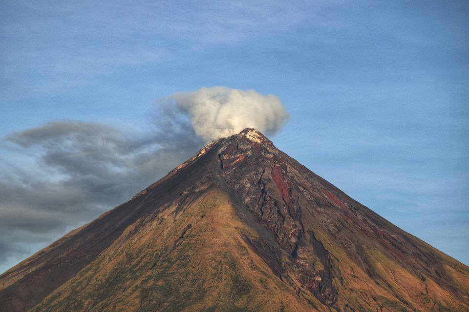
Philippines , Mayon :
MAYON VOLCANO BULLETIN 29 October 2023 8:00 AM
In the past 24-hour period, the Mayon Volcano Network recorded one hundred thirteen (113) volcanic earthquakes including one hundred eight (108) volcanic tremors having a duration of one (1) to sixteen (16) minutes, two (2) pyroclastic density current events, and ninety-seven (97) rockfall events. The lava flows have maintained their advances to approximately 3.4 kilometers in Bonga (southeastern), 2.8 kilometers in Mi-isi (south), and 1.1 kilometers in Basud (eastern) Gullies. Rockfalls and PDCs generated by the collapse of the summit dome deposited debris still within four (4) kilometers of the crater .
Volcanic sulfur dioxide (SO2) emission averaged 750 tonnes/day on 28 October 2023. Short-term observations from electronic tilt and GPS monitoring indicate inflation of the northwestern upper and middle slopes since late July 2023 and October 2023, respectively. Longer-term ground deformation parameters from EDM, precise leveling, continuous GPS, and electronic tilt monitoring indicate that Mayon is still generally inflated relative to baseline levels.
Alert Level 3 is maintained over Mayon Volcano, which means that it is currently in a relatively high level of unrest, and hazardous eruption within weeks or even days could still be possible.
Source : Phivolcs
Photo : Erickson Banzuela Balderama
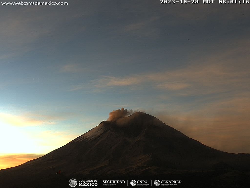
Mexico , Popocatepetl :
October 28, 11:00 a.m. (October 28, 5:00 p.m. GMT)
Activity from the last 24 hours
60 exhalations were detected accompanied by the emission of volcanic gases and, on some occasions, ash. Additionally, 16 minutes of very low to low amplitude tremors were recorded.
At the time of this report, the volcano is observed with a slight emission of water vapor and gas heading towards the West-Northwest.
The Popocatépetl volcanic warning fire is in yellow phase 2.
The scenarios planned for this phase are:
A few small to moderate explosions
Appearance of tremors of variable amplitude
Light to moderate ash rain in surrounding towns and some more distant towns
Ejection of incandescent fragments within the exclusion radius of 12 kilometers
The occurrence of lahars can be expected to descend into the ravines, due to the accumulation of ash on the slopes and their interaction with the rains expected in the coming weeks.
Possibility of pyroclastic flows not reaching populations
Source et photo : Cenapred.