October 28 , 2023.
Iceland , Reykjanes Peninsula :
Ground deformation East of Festarfjall observed at another station . Triggered seismicity north of Grindavík continues . Updated 27th of October at 2pm
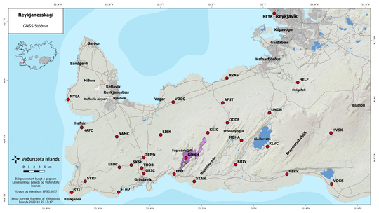
The ground-deformation signal detected since yesterday in the area East of Festarfjall is confirmed by the latest cGPS data. The horizontal displacement over the past few days is ~ 2 cm as seen at FEFC station and movement has now also been measured at another cGPS station located in Selatangar. A 1-day interferogram spanning 26 to 27 of October, does not reveal any significant changes in the area, but the signal at FEFC measured during this 24-hr period was smaller than 1 cm, likely too small to be detected by this interferogram. cGPS stations in Grindavík and north of here show no significant changes.
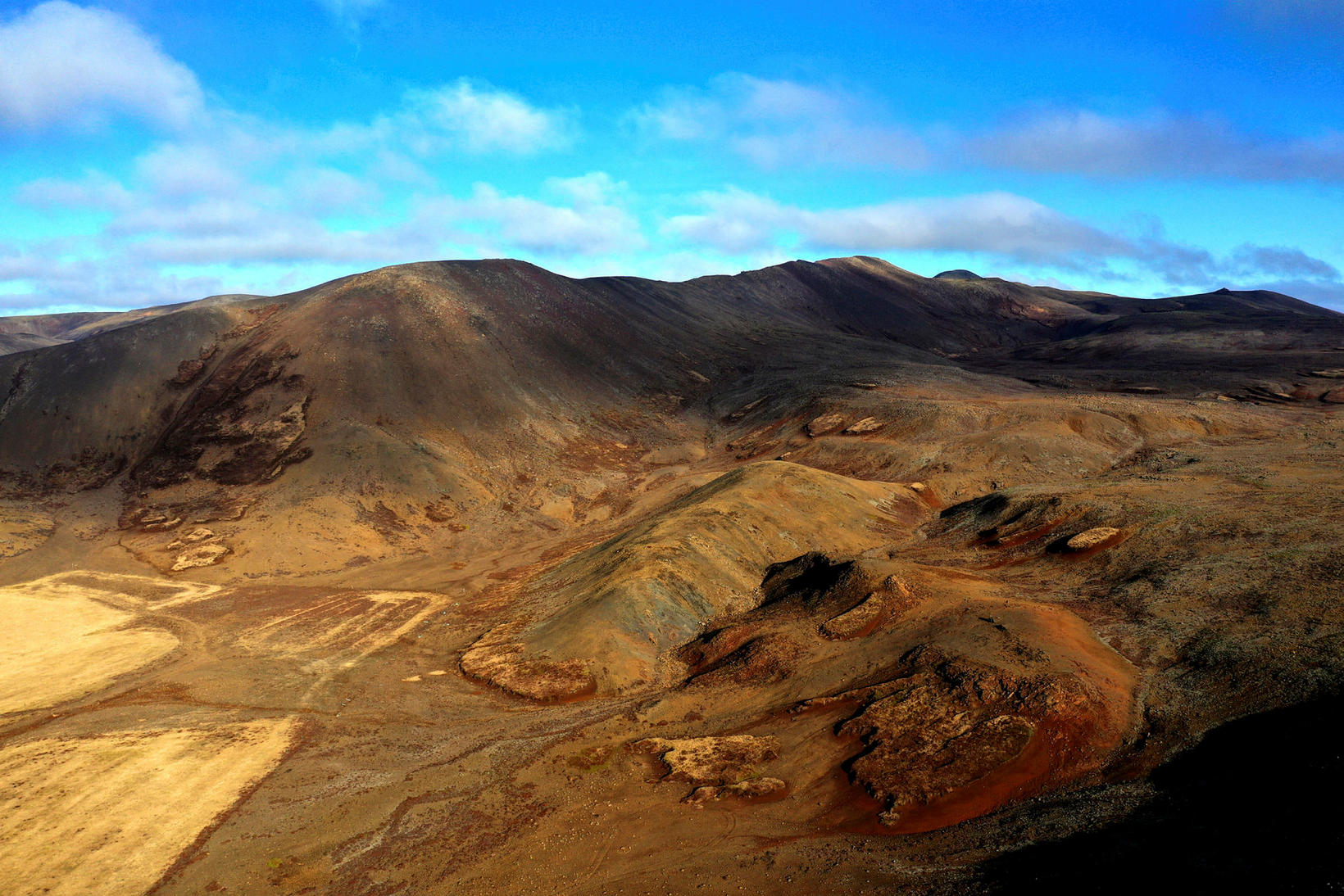
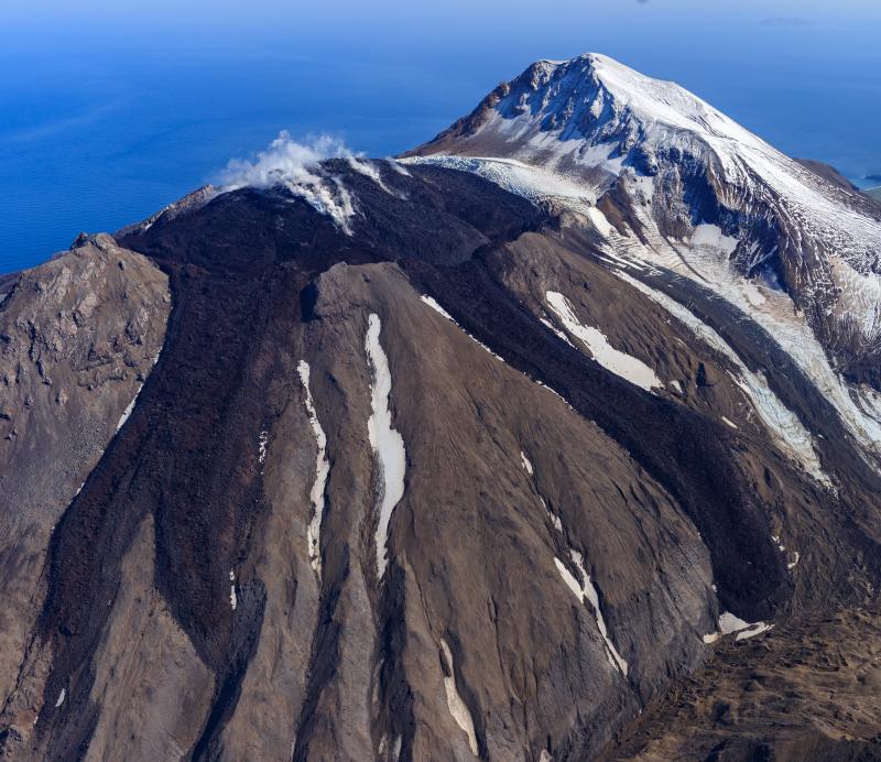
Fagradalsfjall mountain, where the volcanic eruption began on March 24, 2021.
The seismic swarm north of Grindavík continues with around 1000 earthquakes since midnight. A total of 5800 eqs have been recorded since the beginning of the activity. An earthquakes M4.0 was measured at 04:02 UTC on 27 October around 2 km north of Grindavík. The seismic activity is interpreted as the response of the crust to the stress changes induced by continued magmatic inflow at depth beneath the Fagradalsfjall volcanic system.
Source : IMO
Photos : IMO , mbl.is/Eggert Jóhannesson
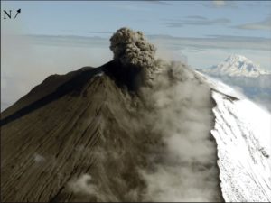
Alaska , Great Sitkin :
52°4’35 » N 176°6’39 » W,
Summit Elevation 5709 ft (1740 m)
Current Volcano Alert Level: WATCH
Current Aviation Color Code: ORANGE
Slow eruption of lava is likely continuing at Great Sitkin Volcano. Weakly elevated surface temperatures were observed from the eruptive vent region in satellite images and there were a few small earthquakes each day. There have been no new observations of the lava flow in the past week, but satellite radar observations through October 17 showed continued growth of the eastern branch of the summit lava flow.
The current lava flow at Great Sitkin Volcano began erupting in July 2021. No explosive events have occurred since a single event in May 2021.
The volcano is monitored by local seismic, geodetic, and infrasound sensors, web cameras, regional infrasound and lightning networks, and satellite data.
Great Sitkin Volcano is a basaltic andesite volcano that occupies most of the northern half of Great Sitkin Island, a member of the Andreanof Islands group in the central Aleutian Islands. It is located 26 miles (43 km) east of the community of Adak. The volcano is a composite structure consisting of an older dissected volcano and a younger parasitic cone with a ~1 mile (1.5 km)-diameter summit crater. A steep-sided lava dome, emplaced during the 1974 eruption, occupies the center of the crater. That eruption produced at least one ash cloud that likely exceeded an altitude of 25,000 ft (7.6 km) above sea level. A poorly documented eruption occurred in 1945, also producing a lava dome that was partially destroyed in the 1974 eruption. Within the past 280 years a large explosive eruption produced pyroclastic flows that partially filled the Glacier Creek valley on the southwest flank.
Source : AVO
Photo : Loewen, Matt
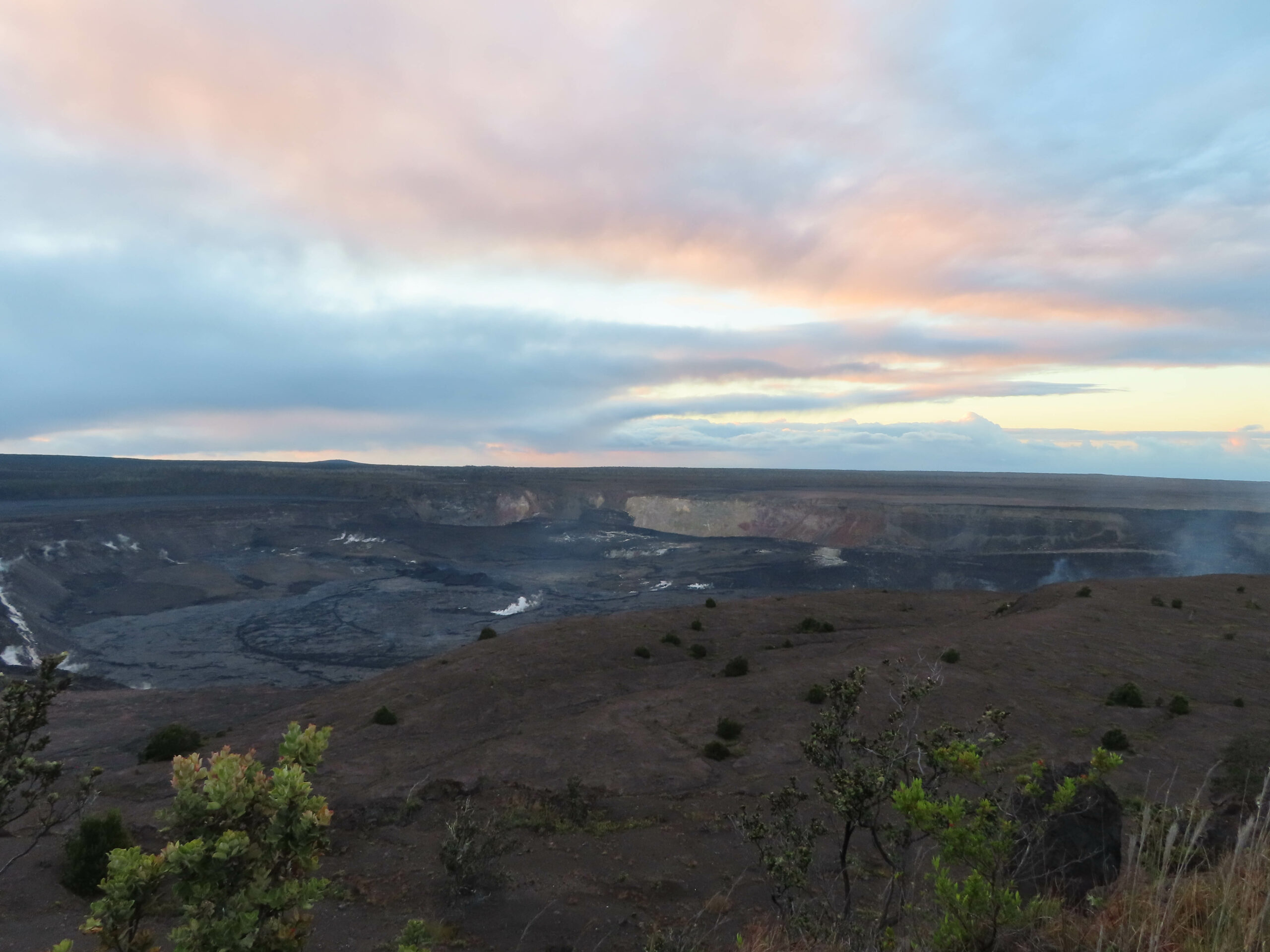
Hawaii , Kilauea :
Friday, October 27, 2023, 8:17 AM HST (Friday, October 27, 2023, 18:17 UTC)
19°25’16 » N 155°17’13 » W,
Summit Elevation 4091 ft (1247 m)
Current Volcano Alert Level: ADVISORY
Current Aviation Color Code: YELLOW
Activity Summary:
Kīlauea volcano is not erupting. The unrest to the south-southwest of Kīlauea’s summit has continued over the past 24 hours, with a slight increase in seismicity, in association with an intrusive event that began in early October. Unrest may continue to wax and wane with changes to the input of magma into the area. The summit of Kīlauea remains at a high level of inflation and eruptive activity is possible in the coming weeks or months. No unusual activity has been noted along Kīlauea’s East Rift Zone or the Southwest Rift Zone.
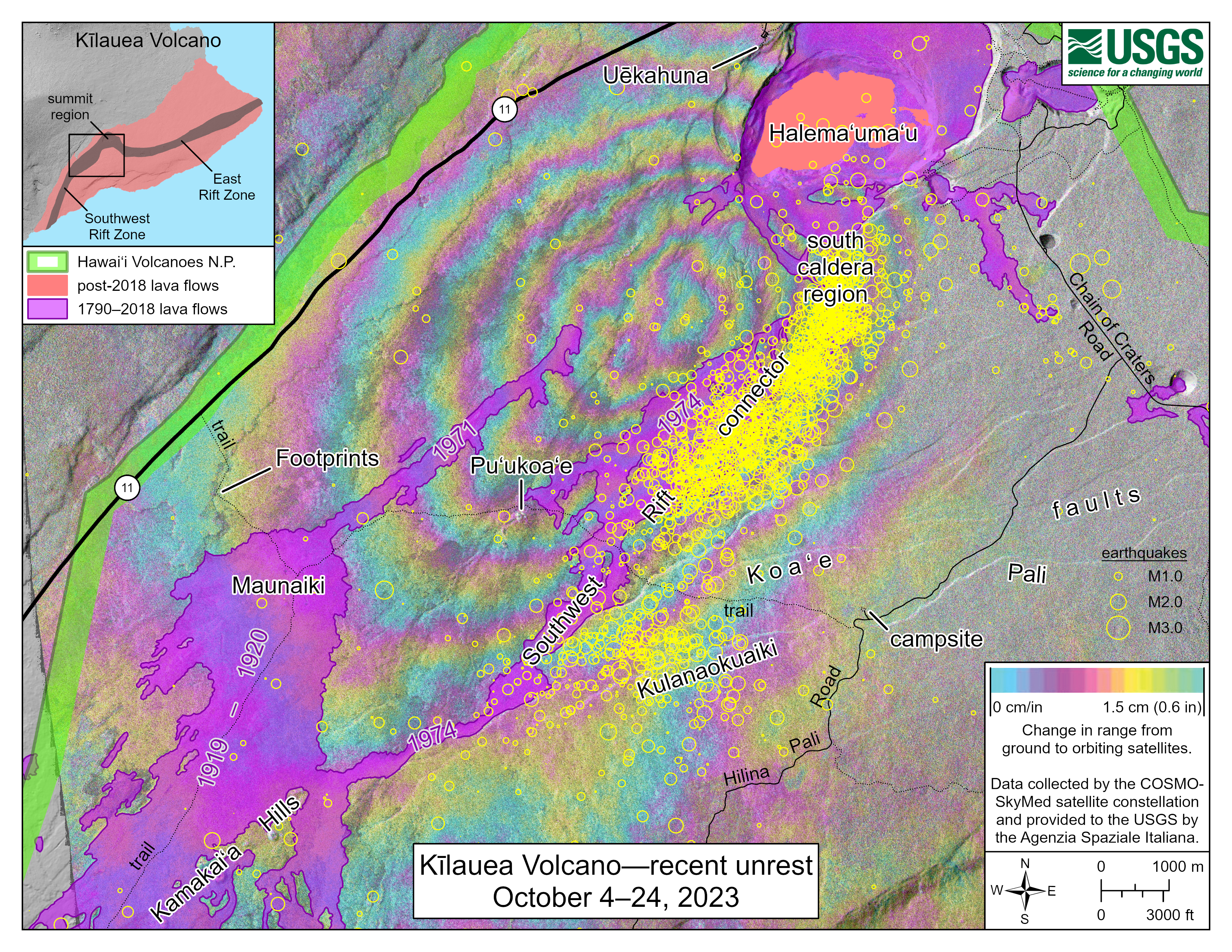
This map shows recent unrest at Kīlauea summit. Yellow circles denote earthquake locations from October 4–24, 2023, as recorded by HVO seismometers. Nearly 2,000 earthquakes were detected during this time period. Colored fringes denote areas of ground deformation from September 24–October 10 as measured by satellite radar. Approximately 10 cm (4 inches) of uplift was detected during this time period. Each color cycle represents 1.5 cm (0.6 in) of ground motion toward the satellite, indicating uplift associated with a magmatic intrusion.
Summit Observations:
Unrest to the south and southwest of the summit area of Kīlauea continued over the past day with a slight increase in seismicity. Waxing and waning of unrest may continue.
Elevated seismicity (a seismic swarm) associated with an intrusion beneath the south-southwest region of Kīlauea’s summit began in early October. Since then, swarm activity has varied, with the greatest number of earthquakes occurring on October 4-6, 16-18, 21-23, and 26. Over the past 24 hours, swarm activity continued to slightly increase, with approximately 169 earthquakes recorded in Kīlauea’s summit region, an increase from 98 over the previous 24 hours. Most of the earthquakes related to this unrest have been smaller than magnitude-2 and have occurred at depths of around 1–3 km (0.6–2 mi) below the surface.
The Uēkahuna summit tiltmeter, located northwest of the caldera, has been mostly stable over the past 24 hours, recording minor inflation that transitioned to minor deflation early this morning. The Sand Hill tiltmeter, located southwest of the caldera, has been mostly stable over the past 24 hours. Overall, inflation at the summit of Kīlauea remains high and has surpassed the level seen just before the most recent eruption on September 10. However, the current rate of inflation in the region has diminished significantly since October 4-6.
Sulfur dioxide (SO2) emission rates remain low and were measured at a rate of about 100 tonnes per day on October 19.
It is unclear if unrest in Kīlauea summit region will continue and it is not possible to say with certainty if activity will lead to an eruption; activity may remain below the ground surface. However, an eruption remains possible, most likely in Kīlauea’s summit region inside of Hawai‘i Volcanoes National Park and away from infrastructure. Similar patterns of earthquake activity and ground deformation occurred to the south of the caldera prior to the September and June 2023 eruptions in Kīlauea summit caldera (in Halemaʻumaʻu crater and on the downdropped block). Volcanic gas emissions pose the greatest hazard to areas downwind of Kīlauea’s summit.
There is currently no sign of an imminent eruption and increasing inflation and earthquake activity (heightened unrest) are expected to precede an eruption. During periods of heightened unrest prior to recent eruptions at Kīlauea summit, signs of imminent eruption did not appear until 1-2 hours before lava reached the surface. The summit of Kīlauea remains at a high level of inflation and eruptive activity is possible in the coming weeks or months. HVO scientists will continue to monitor Kīlauea volcano closely and will issue additional messages as warranted by changing activity.
Source : HVO
Photos : USGS / J.M. Chang.
Colombia , Cumbal :
Weekly activity bulletin from the Cumbal Volcanic Complex
Regarding the monitoring of the activity of the CUMBAL VOLCANIC COMPLEX (CVC), the MINISTRY OF MINES AND ENERGY, through the COLOMBIAN GEOLOGICAL SERVICE (SGC), reports that:
In the period from October 17 to 23, 2023, compared to the previous week and in low levels, the seismicity in the CVC showed a slight increase in the values of the number of earthquakes and the seismic energy released, with the predominance of events associated with fracturing of rocks within the volcanic complex. The earthquakes were located near the two active cones of the CVC, La Plazuela in the Northeast and Mundo Nuevo in the Southwest, at distances less than 4 km and at depths less than 6 km relative to height. reference (4,700 m altitude) and with a maximum magnitude of 1.1.
When atmospheric conditions permitted, gas emission columns were observed from the El Verde fumarole field to the northeast of the CVC and from the Los Rastrojos, Boca Vieja and Las Bandas fumarole fields to the southeast. West of the CVC, with white columns, which had varying heights. and dispersion depending on the wind regime.
No significant variation was observed in the other geophysical and geochemical parameters of volcanic monitoring.
Volcanic activity remains on YELLOW ALERT: Active volcano with changes in the behavior of the base level of monitored parameters and other manifestations.
Source et photo : SGC.
Costa Rica , Rincon de la Vieja :
Latitude: 10.83°N;
Longitude: 85.34°W;
Altitude: 1916 m.
Current activity level: Caution
Possible manifestations: Small eruptions, bubbles or geysers, significant gas emission, increase in temperature (incandescence), seismic swarms or volcanic tremor,
slight inflation-extension of the volcanic edifice, hot springs.
The predominantly exhalatory phreatic activity continues during this week. 23 exhalations and three small eruptions were recorded. None of these were associated with lahar or ash emission. We note the appearance of continuous long period (LP) type signals, some of them being intense in seismic energy, in addition to the background tremor, which is observed for the most part continuous and variable in amplitude, with a wide range of frequencies (0.5 – 8 Hz). Signals associated with fractures (VT) near the summit and base of the volcano are also recorded.

Regarding the deformation detected by GNSS equipment, the elevation of the volcano’s summit continues to be observed, accumulating 2.5 cm since August, which is relatively high. Overall, higher inflation has been observed in recent months, higher than in the first months of the year. Based on data from December 2022 to date, a source can be located, approximately 5 km ± 2.5 km below sea level, with an accumulation of magmatic fluids of several million cubic meters. It should be noted, however, that these models carry significant uncertainty. The CO2/SO2 ratio measured in the plume remains low with a weekly average of 1.9 ± 0.19 and the H2S/SO2 ratio is 0.31 ± 0.30. These values suggest a shallow magma source and open conduits. Since the previous week, a significant increase in SO2 flow was observed up to 257 ± 45 t/d as the average SO2 flow.
Source : Ovsicori
Photo : Federico Chavarría-Kopper – Ovsicori