July 21 , 2023.
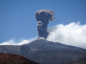
Alaska , Shishaldin :
54°45’19 » N 163°58’16 » W,
Summit Elevation 9373 ft (2857 m)
Current Volcano Alert Level: WATCH
Current Aviation Color Code: ORANGE
Lava has continued to erupt from the summit crater of Shishaldin over the last day. This activity was reflected in satellite observations of strongly elevated surface temperatures at the summit. Seismicity is currently low. Low-level as emissions near the summit crater maybe occuring with current activity, and larger explosions from Shishaldin can occur with little warning.

High resolution satellite images from mid-day yesterday document deposits from the period of increased activity earlier that morning. Ash deposits tracked southwest from the vent and from pyroclastic deposits on the north, east, and south flanks. Pyroclastic deposits from the eruption to date have extended as far as 1.9 miles (3 km) from the vent. Mudflows triggered by the eruption have extended further down the flanks.
Shishaldin is monitored by local seismic and infrasound sensors, web cameras, and a telemetered geodetic network. The local monitoring network is partially impaired, therefore AVO is also using nearby geophysical networks, satellite data and regional infrasound and lighting data.
Source : AVO.
Photo : Nick Enloe via Sherine France.
Iceland , Litli Hrútur :
Latest news on the volcanic eruption on the Reykjanes Peninula
Updated 20 July, 2023
An updated hazard map has been prepared for the eruption site at Litli-Hrútur. The new map shows the revised location of the dike intrusion between the 4-10 July 2023, based on both new deformation modelling and seismic relocations. The dike intrusion which was emplaced prior to the eruption onset extends from Keilir in the north to Meradalahnúkar in the south.

The Icelandic Met Office meets SST each day at 9 in the morning for an update and overview of the ongoing activity. Indications and information on hazards and forecasts are provided regularly during such meetings in support of the operations in the field.
We would like to remind anyone visiting or accessing the eruption site, that this eruption continues to present significant hazards which may evolve and/or occur with very little or no warning time.
Lave flow rate comparable to those measured during previous eruptions
The activity is now focussed on one crater. Early morning on the 19th there was a partial collapse of the main crater caused a large and sudden release of lava on the western side. The event was preceded by an increase in eruption tremor which lasted about 5 hours followed by a sudden drop. A few hours after the event lava started to flow south again, following the incline in the landscape.

The average lava flow rate between the 17th and 18th of July is estimated to about 8,7m3/ according to the latest data published at the University of Iceland. This rate is well comparable to those measured during previous eruptions in Fagradalsfjall. As of 18 July, the area of the new lava field was determined to be 0.92 km2 and the volume of erupted lava at about 9 million cubic meters.
A volcanic gas plume rises from the main crater and calibrated cameras estimate its height to be between 1-2 km above sea level. The SO2 flux has been similar to previous eruptions showing fluctuations within a range of 30-130 kg/s according to DOAS measurements. Grass and moss fires continue in the area, but firefighters have managed to put most of them out.
Source : IMO
Photos : 80 Jours voyages / S Chermette.
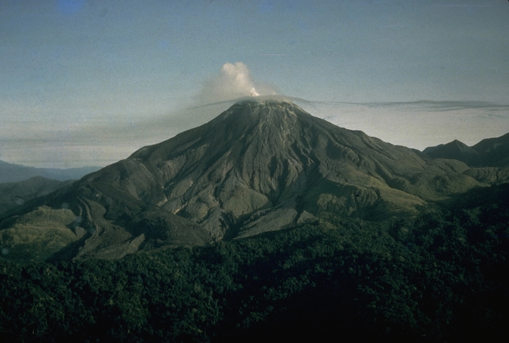
Papua New Guinea , Bagana :
An explosive eruption at Bagana on 15 July was similar to one that occurred on 7 July. According to the Darwin VAAC an eruption at around 08h30 on 15 July produced an ash plume that rose to 16.5 km (54,000 ft) and drifted N based on satellite images. The plume was visible continuing to drift N in an image from 19h00 but had dissipated by 21h50. Ground-based reports indicated that pyroclastic flows had occurred in the vicinity of the volcano; small deposits confined to one drainage were inspected by RVO during an overflight on 17 July, and were confirmed to be from the 7 July event. The Autonomous Bougainville Government (ABG) issued a statement on 17 July noting significant impacts of ashfall in local communities. According to the National Disaster Centre, ashfall from the first event lasted until 10 July; an eruption was also reported by RVO on 14 July.
Ashfall (presumably from events on 7 and 15 July) impacted about 8,111 people in Torokina, South Bougainville, including Tsito/Vuakovi, Gotana (9 km SW), Koromaketo, Kenaia, Longkogari, Kenbaki, Piva (13 km SW), and Atsinima (27km WNW) and in the Tsitovi district according to ABG. Significant ashfall was also reported in Ruruvu (22 km N) in the Wakunai District of Central Bougainville. The Alert Level was at Stage 3 (the third level on a four-level scale), confirmed by RVO the evening before. An evacuation was called for the villages in Wakunai, where heavy ashfall had contaminated water sources; the communities of Ruruvu, Togarau, Kakarapaia, Karauturi, Atao, and Kuritaturi were asked to evacuate to a disaster center at the Wakunai District Station within 24 hours. Communities in Torokina, nearest to Bagana, were to immediately evacuate to the Piva District station.
Sources: Autonomous Bougainville Government, Rabaul Volcano Observatory (RVO), Darwin Volcanic Ash Advisory Centre (VAAC), Papua New Guinea National Disaster Centre , GVP.
Photo : CD. Branch, 1964 (avec l’aimable autorisation de Ben Talai, Observatoire du volcan Rabaul).
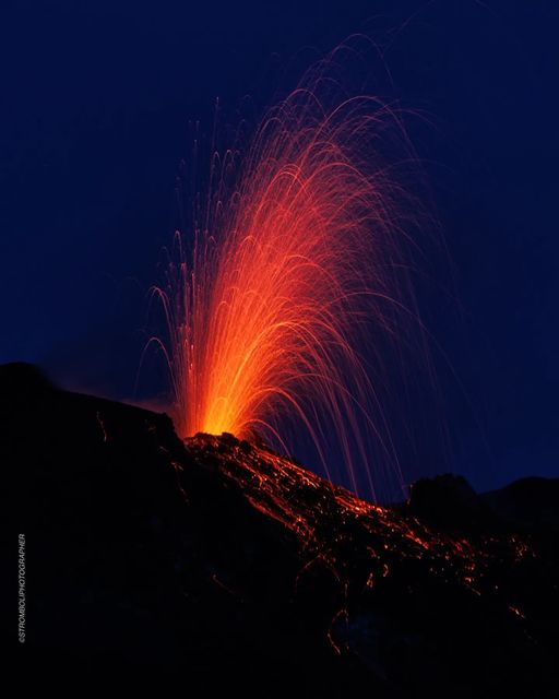
Italy , Stromboli :
WEEKLY BULLETIN, from July 10, 2023 to July 16, 2023. (issue date 18 July 2023)
ACTIVITY STATUS SUMMARY
In the light of the monitoring data, it is highlighted:
1) VOLCANOLOGICAL OBSERVATIONS: Explosive volcanic activity of the Strombolian type with a total frequency at a moderately low level and with an intensity of the explosions at a level between high and low in the areas of the North and Center-South craters.
2) SEISMOLOGY: The seismological parameters monitored do not show any significant variations.
3) GROUND DEFORMATIONS: The ground deformation monitoring networks did not show any significant variations.
4) GEOCHEMISTRY: The flow of SO2 is at a medium-low level.
The CO2 flux in the Pizzo area displays medium to high values.
The C/S data in the plume are average values.
There are no updates on the isotope ratio of dissolved helium in groundwater.
5) SATELLITE OBSERVATIONS: Thermal activity observed from the satellite was generally low level with rare and isolated moderate level anomalies.
VOLCANOLOGICAL OBSERVATIONS
During the observation period, the eruptive activity of Stromboli was characterized through the analysis of images recorded by the network of INGV-OE surveillance cameras on the visible and on the thermal (190 m altitude, Punta Corvi, 400 m altitude and Pizzo).
The explosive activity was produced by two eruptive vents located in the northern zone of the crater (N1 and N2) and by one located in the center-south zone of the crater (S2); all the mouths are placed inside the depression occupying the terrace of the crater. With regard to S1 and the power plant, their activity consisted of variable-rate degassing without eruptive activity.
Overall, the average/daily frequency of explosive activity produced by both crater areas is pegged at a moderately low, borderline average. The average partial frequency per crater area does not show a specific prevalence of activity between the two crater areas because it is at a low level. The explosions were mainly produced by N1 and N2 (N zone) and by S2 (CS zone) with a predominantly fine component (ash) mixed with a coarse component for N1 and predominantly coarse for S2. In the latter, the projection activity observed in the previous weeks continues. In the two areas of the crater, the intensity of the explosions varied between a low level and a high level.
Source : INGV
Photo : Stromboli stati d’animo.
La Réunion , Piton de la Fournaise :
Press release from the Paris Institute of Earth Physics, Piton de la Fournaise Volcanological Observatory, July 20, 2023 – 10:00 a.m. – 06:00 a.m. UTC
Ongoing eruption
The eruption started on 02/07/2023, around 08:30 local time continues. The amplitude of the volcanic tremor (indicator of an emission of lava and gas on the surface) is always fluctuating over time on the scale of a few tens of minutes, with phases of continuous tremor and phases of intermittent tremor. The amplitude of the tremor nevertheless remains low compared to the start of the eruption and is again down over the last 24 hours.
The fluctuations observed in the tremor are reflected at the level of the eruptive site by variations in intensity in the activity, with projections of lava fountains at the level of the more or less intense eruptive cone.
Thanks to milder weather conditions on the volcano yesterday, lava flow estimates were calculated by satellite method on the HOTVOLC platform (OPGC – Clermont Auvergne University) and MIROVA (University of Turin). During the last 24 hours the flow rates were between <1 and 4 m3/sec. Given the cloud mass present regularly on the eruptive site as well as the presence of lava tunnels, these flows may be underestimated.
Since the start of the eruption, the total volume of lava emitted on the surface is around 7.9 (± 2.7) Mm3.
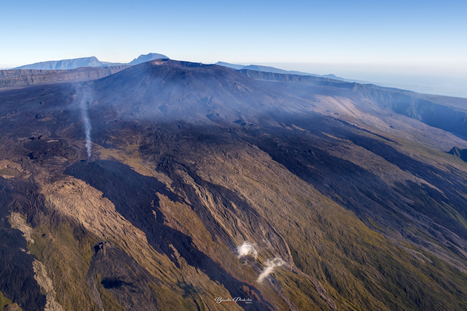
With the low surface activity, the morphology of the active volcanic cone – located southeast of the Enclos Fouqué at 1720 m altitude – hardly changes and the flow of the lava takes place mainly in lava tunnels, even if flows are still visible at resurgence points located at altitudes above 1500 m. This morning the level of the lava lake inside the volcanic cone was relatively low and very few projections were visible.
The flow front has not changed since July 5 and is still 1.8 km from the road.
Low inflation of the summit area is still recorded, indicating a re-pressurization of the volcano’s feeder system with possible transfer of deep magma to the latter.
The seismic activity recorded under the summit zone remains weak. Thus over the last 24 hours, no superficial volcano-tectonic earthquake has been recorded. This low seismic activity leads to a reduction in the risk of the appearance of a new crack and/or collapse in the crater, but does not mean that it can be excluded.
Alert level: Alert 2-1 (eruption in the Enclos without any particular threat to the safety of people, property or the environment).
Source : OVPF
Photo : Imaz press / Brandon production.