February 11 , 2023.
Indonesia , Merapi :
Report on the activity of Mount Merapi from February 03, 2023 to February 09, 2023, Published on February 10, 2023
RESULTS OF OBSERVATIONS
Visual
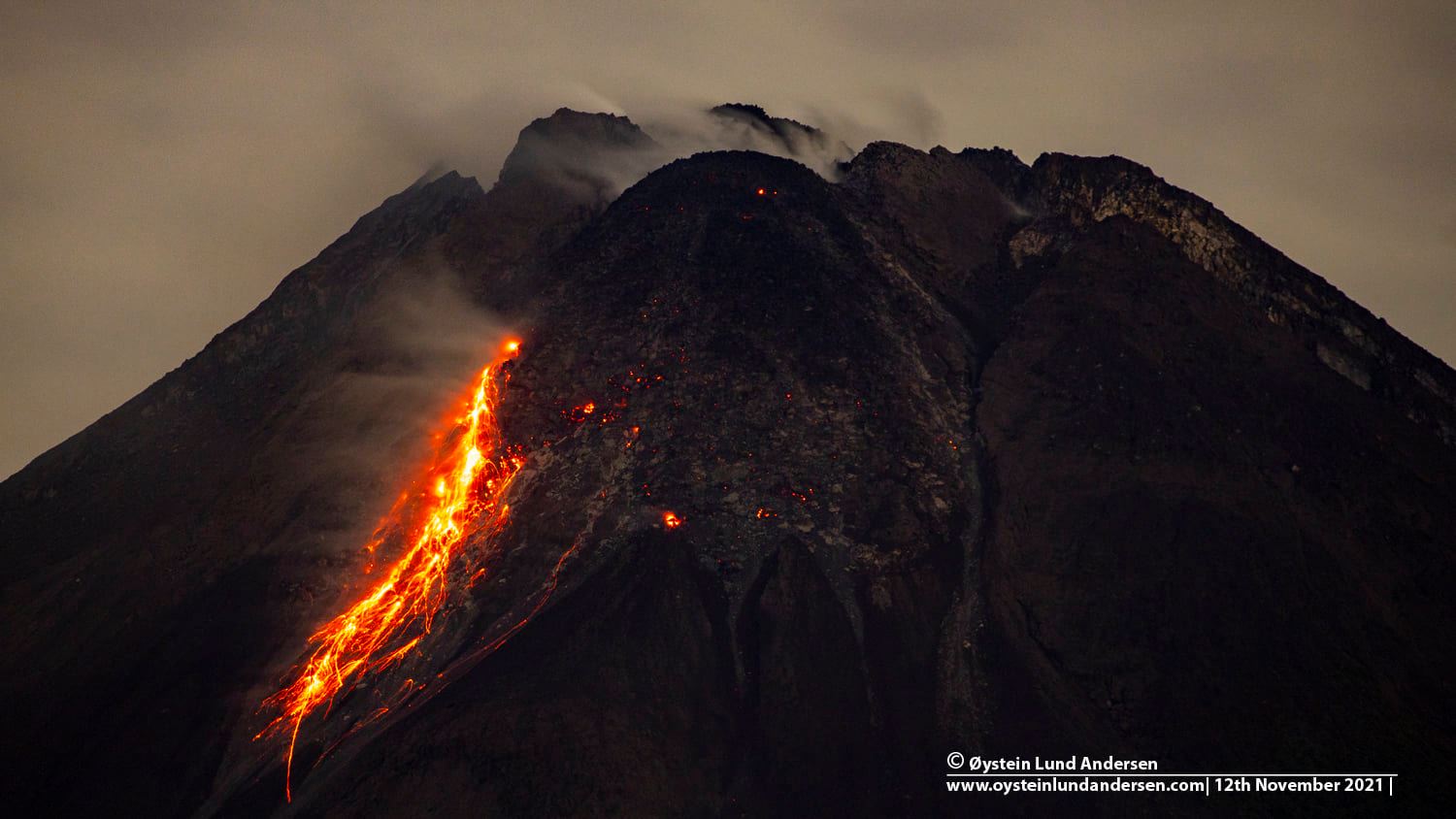
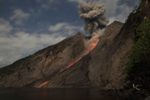
The weather around Mount Merapi is usually sunny in the morning and afternoon, while the evening is foggy. White smoke, thin to medium thickness, low pressure and 50 m high was observed from the Mount Merapi observation post in Badaban on February 03, 2023 at 08:40 WIB.
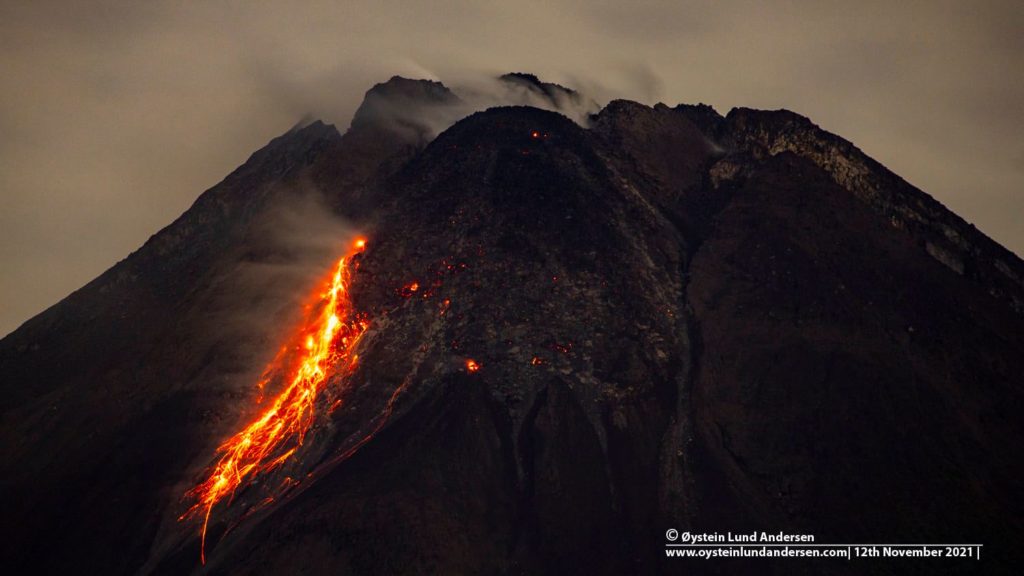
This week there was 1 southwestward hot cloud avalanche (toward Kali Boyong) with a maximum slip distance of 1500m. 5 lava avalanches were observed towards the South-West (Kali Bebeng then Kali Sat/Putih) with a maximum slip distance of 1800 m. The sound of avalanches was heard from Pos Babadan 1 time with low intensity.
On the Central dome and the South-West dome no significant change was observed. Based on aerial photos from January 13, 2023, the volume of the Southwest dome was measured at 1,598,700 m3 and the central dome at 2,267,400 m3.
Seismicity
This week, the seismicity of Mount Merapi showed:
1 hot cloud avalanche earthquake (APG)
9 deep volcanic earthquakes (VTB)
607 deep volcanic earthquakes (VTA),
168 avalanche earthquakes (RF),
4 emission earthquakes (DG),
4 tectonic earthquakes (TT).
14 multi-phase (MP) earthquakes
The intensity of this week’s seismicity is still quite high.
Deformation
Deformation monitoring by EDM and GPS methods this week showed no significant changes.
Rain and lahars:
This week, there was rain at the Post Kaliurang observation post with a rain intensity of 65 mm/h for 225 minutes on February 7, 2023. No increase in the flow of rivers descending from Mount Merapi was observed. reported.
Conclusion
Based on the results of visual and instrumental observations, it is concluded that:
-The volcanic activity of Mount Merapi is still quite high in the form of effusive eruption activity. The state of the activity is defined at the « SIAGA » level.
Source : BPPTKG
Photo : Oystein Lund Andersen
Chile , Hudson :
Seismology
The seismological activity of the period was characterized by the recording of:
162 VT-type seismic events, associated with rock fracturing (Volcano-Tectonics). The most energetic earthquake presented a local magnitude value (ML) equal to 2.0, located 5.4 km south-southwest of the center of the caldera, with a depth of 1.5 km per relation to the caldera.
385 LP-type seismic events, associated with fluid dynamics within the volcanic system (Long Period). The most energetic earthquake had a reduced displacement (DR) value of 71 cm2 and a local magnitude (ML) value of 1.8, located 4.0 km west-southwest of the center of the caldera, with a depth of 2.9 km in reference to the caldera.
7 TR-type seismic events, associated with the dynamics maintained over time of the fluids within the volcanic system (TRemor). The size of the largest earthquake assessed from the Reduced Displacement (DR) parameter was equal to 5 cm2.
9 HB-type seismic events, associated with both rock fracturing and fluid dynamics within the (hybrid) volcanic system. The most energetic earthquake presented a reduced displacement value (DR) of 84 cm2 and a local magnitude value (ML) equal to 2.3, located 2.7 km west-southwest of the center of the caldera, with a depth of 1.5 km in reference to the caldera.
Fluid Geochemistry
No anomalies in sulfur dioxide (SO2) emissions into the atmosphere have been reported in the area near the volcano, according to data published by the Tropospheric Monitoring Instrument (TROPOMI) and the Ozone Monitoring Instrument (OMI) Sulfur Dioxide Group.
Satellite thermal anomalies
During the period, no thermal alert was recorded in the area associated with the volcanic edifice, according to the analytical processing of Sentinel 2-L2A satellite images, in combination with false color bands.
Geodesy
Geodetic network data does not suggest areas with surface deformations.
Surveillance cameras
The images provided by the fixed camera, installed near the volcanic edifice, did not record any degassing columns or variations linked to surface activity.
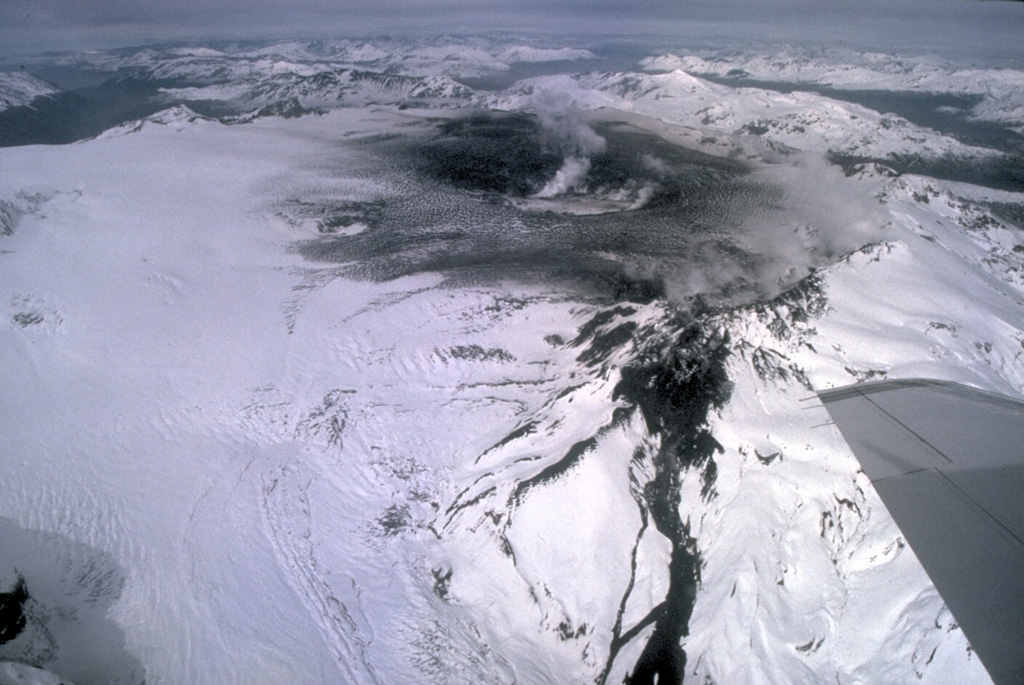
Activity remained at levels considered low, suggesting stability of the volcanic system. The volcanic technical alert is maintained at:
GREEN TECHNICAL ALERT: Active volcano with stable behavior – There is no immediate risk.
Source : Sernageomin.
Photo : Norm Banks, U.S. Geological Survey .
Iceland , Reykjanes Péninsula :
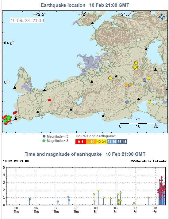
Just before 19:00 this evening a swarm of earthquakes started on Reykjanes Peninsula. Most of the earthquakes are about 4 to 5 km West of Reykjanestá at approximately 4 to 7 km depth. Eight earthquakes are of M3.0 or more and the largest of M3.8 at 19:45. It is common for earthquakes to occur in this area.
Week overview 30 January – 5 February
Over the last week 260 earthquakes were detected by IMOs SIL seismic network which is a more than in the previous week where 230 earthquakes were detected. Two earthquakes above M3 were detected in the past week, both of which were located out on Reykjaneshrygg. About 10 earthquakes were detected in Mýrdalsjökull and in Bárðarbunga, which is also where the largest earthquake on land was detected. It was a M2.8 in Bárðarbunga on 5th of February.
Source : IMO.
Ecuador , Cotopaxi :
DAILY REPORT OF THE STATE OF COTOPAXI VOLCANO, Friday February 10, 2023.
Information Geophysical Institute – EPN.
Surface Activity Level: Moderate, Surface Trend: Unchanged.
Internal activity level: Moderate, Internal trend: No change.
Seismicity: From February 09, 2023, 11:00 a.m. to February 10, 2023, 11:00 a.m.:
For seismicity statistics, there are 24 hours of transmission from the reference station.
Emission Tremor (TREMI) 21
Long Period (LP): 33
Volcano-tectonics ( VT): 1
Rains / Lahars:
Light rains were recorded in the area without causing lahars.
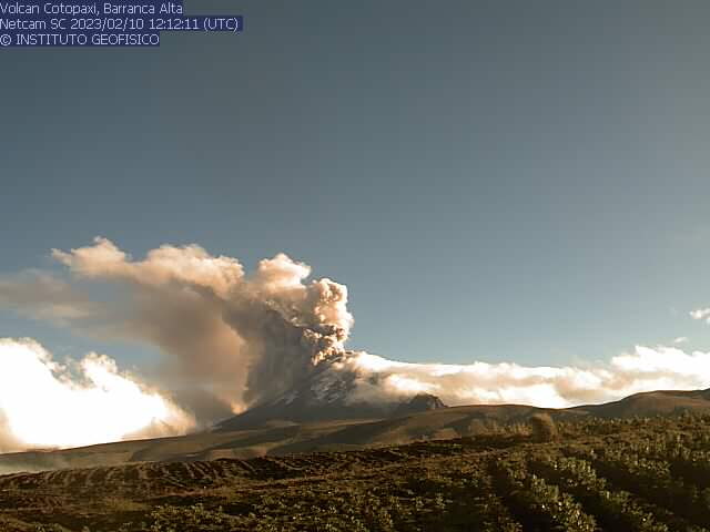
Emission / Ash Column:
Gas and ash emissions were observed at heights of up to 2000 meters above crater level in the west and northwest directions. The Washington VAAC issued 4 Emissions Statements, with elevations between 809 meters and 1,418 meters above crater level in the West, Northwest, and South directions. Slight ash falls were reported in the commune of Tambillo, belonging to the canton of Mejia, in the province of Pichincha.
Gas:
The MOUNTS system detected 431.8 tons of sulfur dioxide (SO2), measured on 02/09/2023 at 14:03 TL.
Other Monitoring Parameters:
During the last 24 hours, no thermal anomaly has been observed.
Observation:
The broadcasts were seen through the network of surveillance cameras in the late afternoon yesterday and this morning. At the close of this bulletin, the sector appears completely cloudy.
Alert level: Yellow.
Source et photo : IGEPN
Indonesia , Semeru :
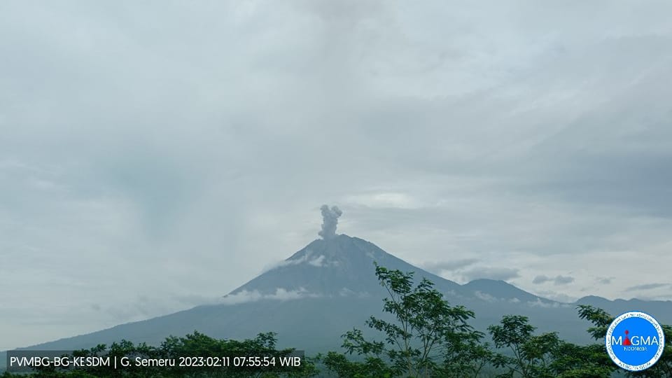
Mount Semeru exhibited an eruption on Saturday February 11, 2023 at 07:54 WIB. The height of the eruptive column was observed at ± 600 m above the summit (± 4276 m above sea level). The ash column was observed to be white to gray with thick intensity, oriented to the east. The eruption was recorded on a seismograph with a maximum amplitude of 22 mm and a duration of 89 seconds.
VOLCANO OBSERVATION NOTICE FOR AVIATION – VONA
Published: February 11, 2023 .
Volcano: Semeru (263300)
Current Aviation Color Code: ORANGE
Previous Aviation Color Code: orange
Source: Semeru Volcano Observatory
Notification number: 2023SMR029
Volcano location: S 08 deg 06 min 29 sec E 112 deg 55 min 12 sec
Region: East Java, Indonesia
Summit elevation: 11763 FT (3676 M)
Volcanic Activity Summary:
Eruption with cloud of volcanic ash at 07:54 UTC (14:54 local).
Height of volcanic clouds:
The best estimate of the ash cloud top is approximately 13363 FT (4276 M) above sea level or 1600 FT (600 M) above the summit. May be higher than what can be observed clearly. Source of height data: ground observer.
Other Volcanic Cloud Information:
Ash cloud moving east. The volcanic ash is observed to be white to gray. It is observed that the intensity of volcanic ash is thick.
Remarks :
Eruption recorded on seismogram with a maximum amplitude of 22 mm and a maximum duration of 89 seconds.
Source et photo : Magma Indonésia.

