December 21 , 2022.
Italy , Etna :
WEEKLY BULLETIN from December 12, 2022 to December 18, 2022, (issue date December 20, 2022)
ACTIVITY STATUS SUMMARY
In the light of the monitoring data, it is highlighted:
VOLCANOLOGICAL OBSERVATIONS: Effusive activity continues from open vents in the Valle del Leone. Variable outgassing, sometimes of an impulsive nature at Bocca Nuova (BN). Weak fumarolic degassing at Voragine (VOR), Southeast Crater (SEC) and Northeast Crater (NEC).
2) SEISMOLOGY: Low seismic activity due to fracturing; average amplitude of tremors at average levels; location of sources between Bocca Nuova and Southeast craters.
Map of the lava field updated on December 18, 2022, made by analyzing Sentinel satellite images.
The background image is the shaded model of the relief of the summit area of Etna, obtained by processing drone images acquired during several overflights (September 15 and 21, 2022, October 6, 21 and 23), superimposed on the shaded model derived from Pléiades images of August 22, 2020 (AO Remote Sensing). CSE = Southeast Crater.
3) INFRASOUND: poor detection of infrasound events for most of the week; the localized springs were located in the Bocca Nuova crater area
4) DEFORMATIONS OF THE GROUND: The general trend of inflation of the volcanic edifice continues, even if it presents lower rates than those recorded in the previous weeks.
5) GEOCHEMISTRY: SO2 flux at a medium-high level.
Soil CO2 flux shows average values.
The partial pressure of dissolved CO2 in groundwater shows values in seasonal variability.
Helium data from the latest sampling shows no significant changes from the previous ones, settling on the high level.
6) SATELLITE OBSERVATIONS: The thermal activity observed by satellite in the summit zone was of a high level in correspondence with the effusive eruption in the summit zone.
7) OTHER OBSERVATIONS: Under current conditions, the lava flow emitted by the effusive vent at the northeast base of the southeast crater remains confined to the Valle del Bove.
VOLCANOLOGICAL OBSERVATIONS
The monitoring of the volcanic activity of Etna, in the period from December 7 to 18, was carried out through the observations of the images of the surveillance cameras, and through direct observations on the ground. The period in question was characterized by unfavorable climatic conditions which strongly penalized visibility.
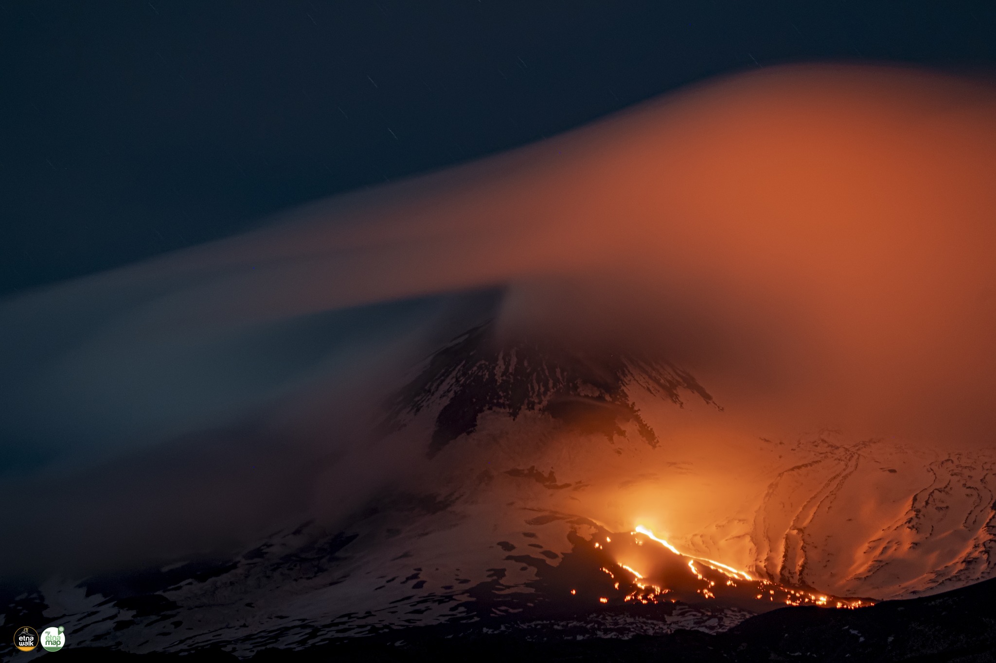
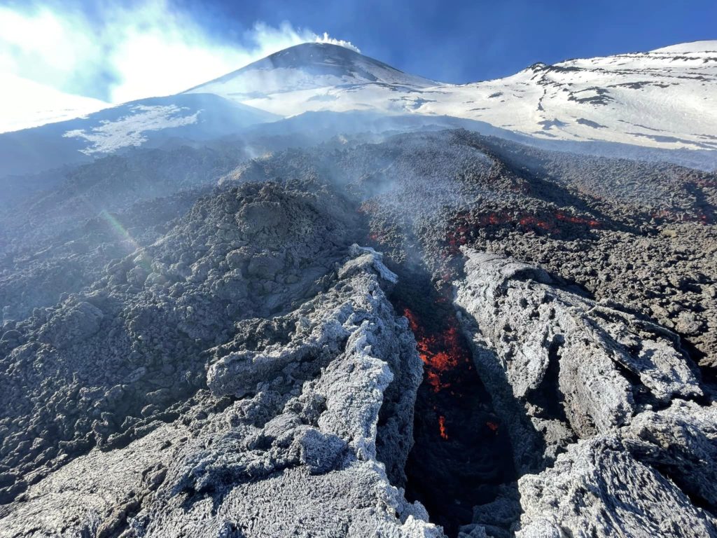
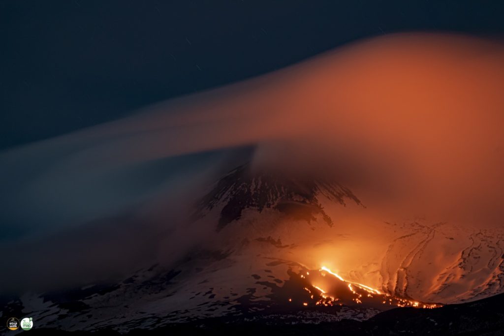
Effusive activity, described in the December 6 monthly bulletin, is still ongoing and open vents in the Valle del Leone continue to be fed.
The active lava field consists of the main lava flow, and several ephemeral vents feeding smaller lava flows.
In addition, from direct field information, the presence of hornito and modest explosive activity at the vents with emission of lava shreds were observed.
With regard to the summit craters, the activity was characterized by a variable rate degassing.
The Bocca Nuova (BN) crater was affected by degassing of variable intensity, sometimes of a pulsatile nature, while for the other craters the degassing was of the fumarolic type.
SEISMOLOGY:
The average amplitude of the volcanic tremor, after the phase of moderate increase observed between November 29 and December 1, remained within the range of average values for the whole week. The locations of the center of gravity of the sources were located on average in an area between the Southeast crater and the Bocca Nuova crater, at a depth between 2000 and 2800 meters above sea level. It should be noted that the location of the source of the tremor is not always considered reliable, due to the low number of stations available during days of adverse weather conditions.
Source : INGV.
Photos : INGV , Elìa Finocchiaro , Etna Walk / Giuseppe Distefano / Marco Restivo.
Italy , Stromboli :
WEEKLY BULLETIN from December 12, 2022 to December 18, 2022, (issue date December 20, 2022)
ACTIVITY STATUS SUMMARY
In the light of the monitoring data, it is highlighted:
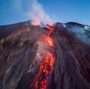
1) VOLCANOLOGICAL OBSERVATIONS: During this period, normal Strombolian activity was observed with intense spattering activity accompanied by an overflow of lava at the level of the North crater.
The total hourly frequency fluctuated between low (4 events/h) and low-medium (9 events/h) values.
The intensity of the explosions was mostly medium and low.
2) SEISMOLOGY: The seismological parameters do not show significant variations.
3) GROUND DEFORMATIONS: The ground deformation monitoring networks did not measure any significant variations.
4) GEOCHEMISTRY: The flux of SO2 at a medium to medium-high level.
There are no updates for the CO2 flux in the crater area. The latest measurements from 10.12.2022 show a downward trend while remaining on medium-high values.
CO2/SO2 ratio: CO2/SO2 ratio displays average values; the latest data (12/18/222) indicates the value of 11.7.
Isotope ratio of helium in groundwater: There are no updates. The latest data available (28.11.2022) indicates medium to high values (4.31).
5) SATELLITE OBSERVATIONS: Satellite-observed thermal activity was moderate to high at the lava overflow in the summit area on December 16, while on subsequent days only isolated low-value heat flux anomalies were observed .
VOLCANOLOGICAL OBSERVATIONS
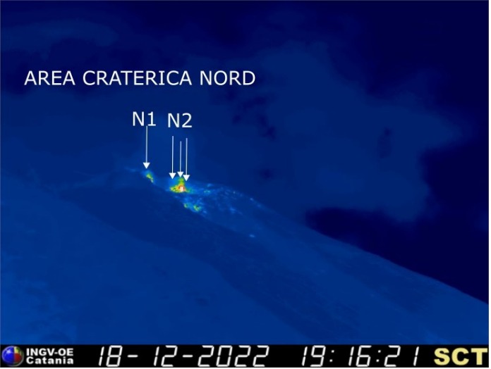
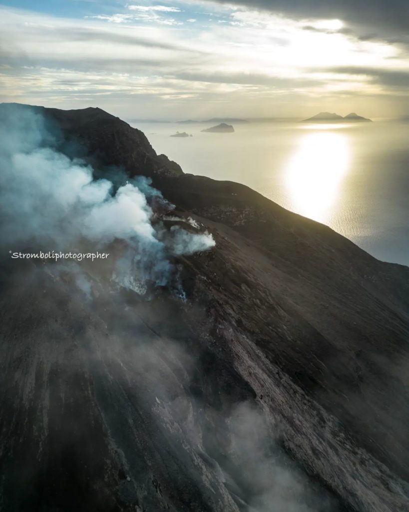
During the observation period, the eruptive activity of Stromboli was characterized by the analysis of the images recorded by the INGV-OE surveillance cameras at 190 m (SCT-SCV), Punta dei Corvi and Pizzo, while the camera at 400 m following problems in the acquisition of video signals caused by damage to the fiber optic connection between Punta Labronzo and AOC due to the bad weather that hit the island on August 12, 2022, is currently not not available. The explosive activity was mainly produced by 4 (four) eruptive vents located in the northern zone of the crater, one of them is located in the direction of N1 and three are located in the direction of N2. Due to unfavorable weather conditions, on December 12-13 and 17, 2022, the visibility of the crater area was insufficient for a correct description of the eruptive activity. In addition, on December 16, 2022, an overflow lava flow was emitted from the North Zone and extended along the upper central part of the Sciara del fuoco.
Overflight with drone: As part of the activities of the UN Departmental project and the DPC-INGV All.A convention, overflights with drones were carried out on December 15, which allowed the creation of the shaded model of the terrain of the crater area. and Sciara del Fuoco (with a resolution of 30 and 3 cm respectively. Figure 3.1 shows the deep slope formed by the collapse of the northern part of the crater rim following the eruptive activity of December 4.
Observations of explosive activity captured by surveillance cameras
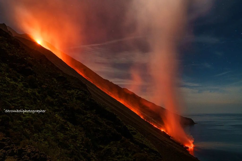
In the northern area of the crater, explosive and effusive activity was observed only from the vents that opened inside the Sciara del Fuoco following the eruptive activity of December 4. The four vents showed explosive activity (low intensity explosions (less than 80 m in height) and medium intensity (less than 150 m in height) emitting coarse materials (bombs and lapilli)) and effusive activity (lava flow who reached the coast). In addition, intense spattering activity was observed throughout the period both from the vent located near sector N1 and from those located near sector N2. The average frequency of explosions varied from 4 to 9 events/h.
No explosive activity was observed in the Center-South zone.
Overflow of December 16, 2022.
Beginning at 12:08 UTC, after intense spattering activity from the northern vents of the crater terrace near N2, an overflow of lava was emitted, which began to flow into the middle-upper part of the Sciara del Fuoco , channeled into the canyon produced on October 9, 2022. The lava flow showed a high initial flow, which after a few hours appeared to decrease and then gradually ceased.
Source : INGV.
Photos : INGV , Stromboli stati d’animo.
Chile , Villarica :
Special Report on Volcanic Activity (REAV), La Araucanía and Los Ríos regions, Villarrica volcano, December 21, 2022, 04:40 a.m. local time (mainland Chile)
The National Geology and Mining Service of Chile (Sernageomin) announces the following PRELIMINARY information, obtained through the monitoring equipment of the National Volcanic Monitoring Network (RNVV), processed and analyzed at the Observatory of Volcanoes of the Southern Andes (Ovdas):
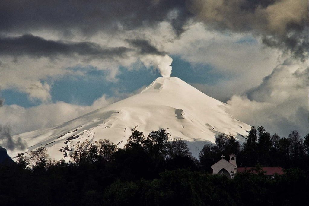
On Wednesday, December 21, from 04:23 local time (07:23 UTC), monitoring stations installed near the Villarrica volcano recorded an earthquake associated with fluid dynamics inside the volcanic system (Long period).
The characteristics of the earthquake, after its analysis, are as follows:
ORIGINAL TIME: 04:23 local time (07:23 UTC)
REDUCED DISPLACEMENT: 51.2 (cm*cm)
ACOUSTIC SIGNAL: 0.5 Pascals (Pa) reduced to 1 km
The characteristics of the activity associated with the event are as follows:
MAXIMUM COLUMN HEIGHT: Cloudy
SPRAY DIRECTION: Cloudy
COMMENTS:
No superficial activity associated with earthquakes was observed following the weather conditions in the area.
Therefore, the volcanic technical alert is maintained at the Yellow level.
Source : Sernageomin
Photos : minutoneuquen.com.
Colombia , Puracé / Los Coconucos Volcanic Chain :
Weekly bulletin of activity of the Puracé volcano – Volcanic chain of Los Coconucos.
The activity level of the volcano continues at the yellow Activity Level or (III): changes in the behavior of volcanic activity.
From the analysis and evaluation of the information obtained through the monitoring network of the Puracé volcano – Los Coconucos volcanic chain, during the week of December 13 to 19, 2022, the COLOMBIAN GEOLOGICAL SERVICE – Volcanological and Seismological Observatory of Popayán reports that:
During the week, 490 seismic events were recorded, of which 79 were associated with rock fracturing processes (VT type) and 411 with fluid dynamics in volcanic conduits, showing stability compared to the previous week.
The geodetic network of GNSS (Global Navigation Satellite System) stations for monitoring ground deformation continues to record a process associated with inflation.
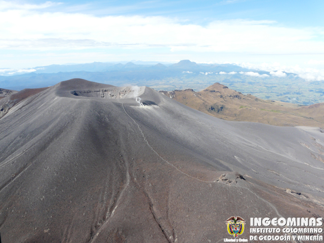
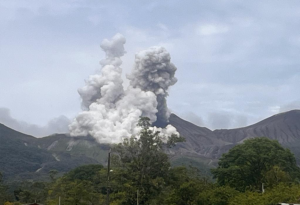
By monitoring the surface activity with the images obtained during the week through the web cameras Mina, Lavas Rojas, Cerro Sombrero and Curiquinga and Anambio, a degassing of the volcanic system was highlighted, with a white column preferentially oriented to the northwest.
Regarding the monitoring of volcanic gases, sulfur dioxide (SO2) measurements continue to show changes with a maximum flow of 4123 t / day for the week evaluated. Other instruments measuring the concentration of carbon dioxide (CO2) and radon gas (222Rn) continue to record high values in the known setting for this active volcanic system.
Electromagnetic field and infrasound wave monitoring sensors did not record variations associated with changes in volcanic activity.
It is then concluded that variations in volcanic activity continue to be recorded, in line with the behavior expected in a level of activity III (yellow level), which could evolve towards states of greater activity. The Colombian Geological Service continues to monitor the evolution of the volcanic phenomenon and will report any changes that may occur in due course.
Source : SGC.
Photo : Ingeominas.
Hawaii , Kilauea :
Tuesday, December 20, 2022, 9:52 AM HST (Tuesday, December 20, 2022, 19:52 UTC)
19°25’16 » N 155°17’13 » W,
Summit Elevation 4091 ft (1247 m)
Current Volcano Alert Level: ADVISORY
Current Aviation Color Code: YELLOW
Activity Summary:
Kīlauea Volcano is not erupting. All recent eruptive activity in the Halemaʻumaʻu crater has ceased. No other significant changes have been observed at the summit or in either rift zone.
Summit Observations:
Volcanic tremor is weak to nonexistent. Tilt records show deflation-inflation events (DI-events) over the past week and have been stable within long term inflationary trends. GPS data continue along inflationary trends. A sulfur dioxide (SO2) emission rate of approximately 200 tonnes per day (t/d) were measured on December 14, 2022.
View looking to the west on the crater floor of Halemaʻumaʻu, at the summit of Kīlauea. The foreground is covered by pāhoehoe, and the brown-colored feature in the background is the island that has persisted since the December 2020 eruption within Halema‘uma‘u.
Halemaʻumaʻu Lava Lake Observations:
Lava is no longer erupting from the western vent into the lava lake on Halemaʻumaʻu crater floor. The lava lake surface has cooled to form a dark crust. This week saw a few passive events of crustal overturn on December 14-15, which brought fresh incandescent lava to the lake surface from the hot lava lake below. A smaller overturn event occurred on December 17 and another small event started around midnight and continues this morning on Dec 20. Measured last on October 28, 2022, the total cumulative rise of the crater floor has been about 143 meters (469 feet), and 111 million cubic meters (29.2 billion gallons) of lava had been effused since the beginning of the latest eruption on September 29, 2021.
East Rift Zone Observations:
No unusual activity has been noted along the East Rift Zone or Southwest Rift Zone; steady rates of ground deformation and seismicity continue along both. Measurements from continuous gas monitoring stations downwind of Puʻuʻōʻō in the middle East Rift Zone remain below detection limits for SO2, indicating that SO2 emissions from Puʻuʻōʻō are negligible.
Source : HVO.
Photo : USGS / D. Downs.

