September 14 , 2022 .
Italy , Stromboli :
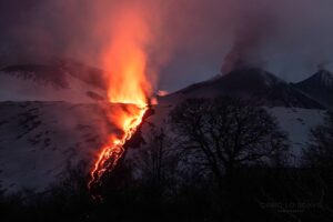
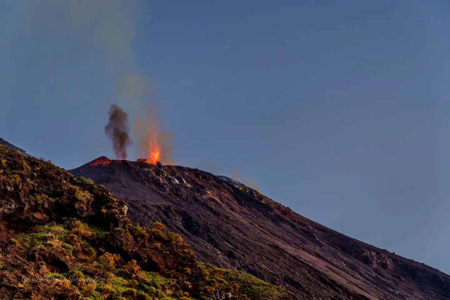
Stromboli volcano activity update for December 13, 2022 – Strong splashing and new effusion phase.
As of 04:00 UTC today (05:00 Local), the monitoring network of the Laboratory of Experimental Geophysics – Department of Earth Sciences of the University of Florence recorded an increase at 04:00 UTC in splash activity and an increase in seismic tremor followed by an additional phase of lava overflow. This activity is associated with a ground deformation of about 0.2 mrad recorded at the OHO station.
WEEKLY BULLETIN, from December 05, 2022 to December 11, 2022, (issue date December 13, 2022)
ACTIVITY STATUS SUMMARY
In the light of the monitoring data, it is highlighted:
1) VOLCANOLOGICAL OBSERVATIONS: During this period, effusive activity with spattering activity was observed only in the northern area of the crater interrupted by explosive activity. The total hourly frequency fluctuated between low (less than 1 event/h) and medium-low (7 events/h) values. The intensity of the explosions was generally low.
2) SEISMOLOGY: The seismological parameters do not show significant variations.
3) GROUND DEFORMATIONS: The ground deformation monitoring networks did not measure any significant variations.
4) GEOCHEMISTRY: The flux of SO2 at a medium-high level
CO2 fluxes in the crater area confirm the downward trend while remaining on medium-high values.
CO2/SO2 ratio: there are no updates; the latest data indicated mean values equal to 12.7.
Isotope ratio of helium in groundwater: decreasing but still on medium to high values (4.31).
5) SATELLITE OBSERVATIONS: Satellite observed thermal activity was moderate to high during the effusive eruption in the summit area.
VOLCANOLOGICAL OBSERVATIONS:
The effusive activity that began on December 4 continued during this period and was observed until the interruption of the video signal from the SPT and SCT cameras on December 8 at 15:03 UTC and by the SPCT camera on December 6 December at 7:52 p.m. UTC.
Observations of explosive activity captured by surveillance cameras:
In the northern area of the crater, explosive and effusive activity was observed only from the vents that opened inside the Sciara del Fuoco after the eruptive activity of December 4. The three vents showed explosive activity characterized by low intensity explosions (less than 80 m high) emitting coarse materials (bombs and lapilli)) and effusive activity that reached the coastline. In addition, intense spattering activity accompanied the flow of magma. The average frequency of explosions fluctuated between less than 1 and 7 events/h.
No explosive activity was observed in the south-central area.
Source : SGS , INGV.
Photo : Stromboli stati d’animo.
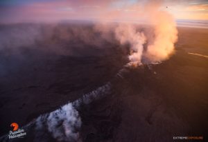
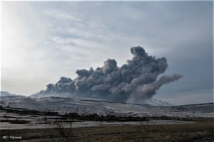
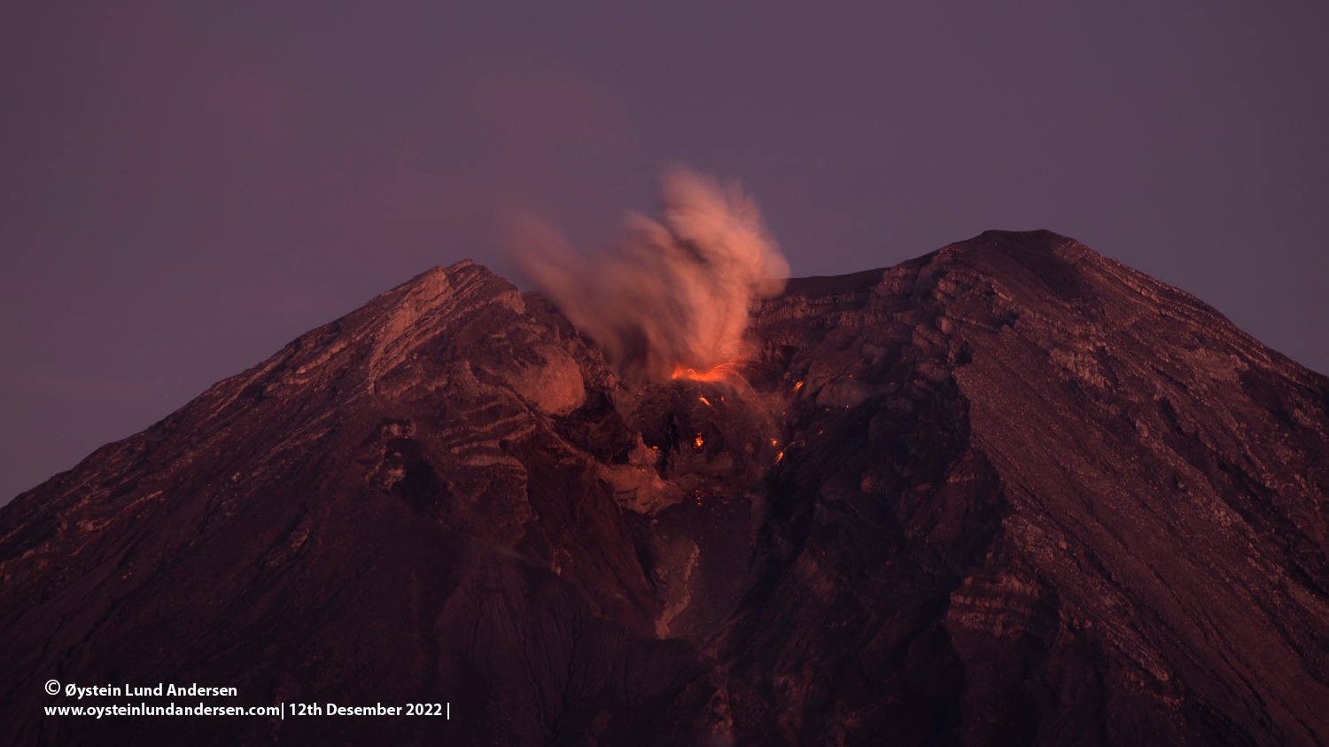
Indonesia , Semeru :
An eruption of G. Semeru occurred on Monday, December 12, 2022, at 07:27 WIB. The height of the eruptive column was observed at ± 500 m above the summit (± 4176 m above sea level). The ash column was white / gray with a moderate to thick intensity, oriented towards the South-West. The eruption was recorded on a seismograph with a maximum amplitude of 22 mm and a duration of 119 seconds.
VOLCANO OBSERVATORY NOTICE FOR AVIATION – VONA
Issued : Décember 12 , 2022.
Volcano : Semeru (263300)
Current Aviation Colour Code : ORANGE
Previous Aviation Colour Code : orange
Source : Semeru Volcano Observatory
Notice Number : 2022SMR721
Volcano Location : S 08 deg 06 min 29 sec E 112 deg 55 min 12 sec
Area : East java, Indonesia
Summit Elevation : 11763 FT (3676 M)
Volcanic Activity Summary :
Eruption with volcanic ash cloud at 00h00 UTC (07h00 local).
Volcanic Cloud Height :
Best estimate of ash-cloud top is around 13363 FT (4176 M) above sea level or 1600 FT (500 M) above summit. May be higher than what can be observed clearly. Source of height data: ground observer.
Other Volcanic Cloud Information :
Ash cloud moving to southwest. Volcanic ash is observed to be white to gray. The intensity of volcanic ash is observed to be medium.
Remarks :
Eruption recorded on seismogram with maximum amplitude 20 mm and maximum duration 67 second.
Source : Magma Indonésie .
Photo : Oystein Lund Andersen.
Hawaii , Kilauea :
HVO/USGS Volcanic Activity Notice
Current Volcano Alert Level: ADVISORY
Previous Volcano Alert Level: WATCH
Current Aviation Color Code: YELLOW
Previous Aviation Color Code: ORANGE
Issued: Tuesday, December 13, 2022, 7:12 AM HST
Source: Hawaiian Volcano Observatory
Notice Number: 2022/H656
Location: N 19 deg 25 min W 155 deg 17 min
Elevation: 4091 ft (1247 m)
Area: Hawaii
Volcanic Activity Summary:
Kīlauea is no longer erupting. Lava supply to the Halemaʻumaʻu lava lake ceased on December 9 based upon lava lake levels and behavior of the crater floor. Sulfur dioxide emissions have decreased to near pre-eruption background levels.
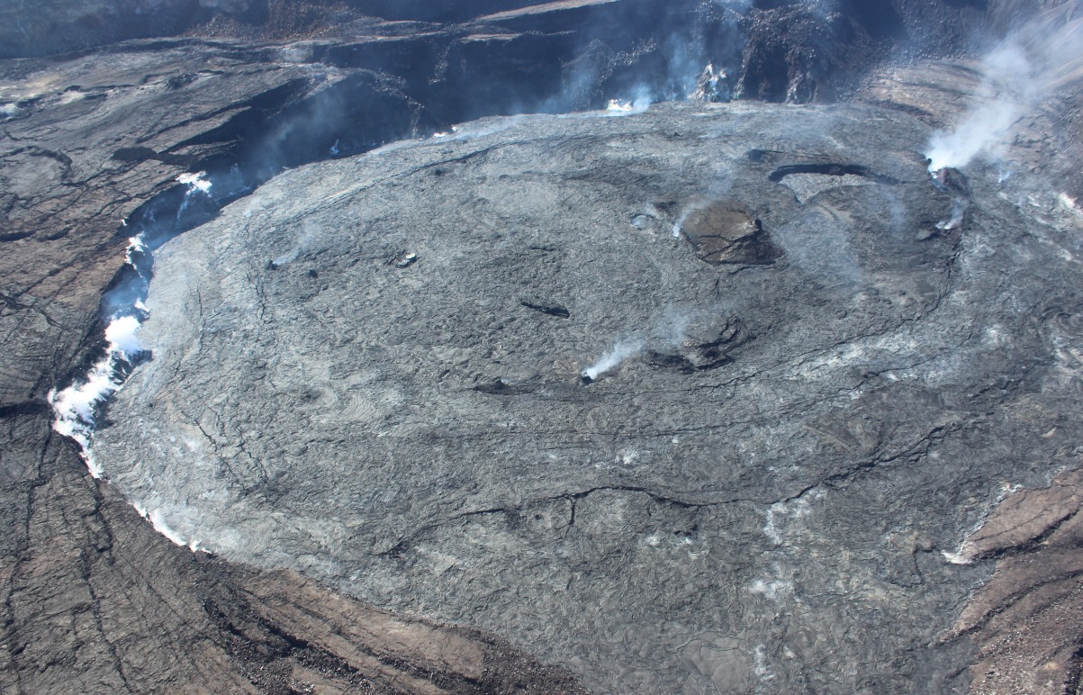
Accordingly, the USGS Hawaiian Volcano Observatory (HVO) is lowering the Volcano Alert Level for ground-based hazards from WATCH to ADVISORY and the Aviation Color Code from ORANGE to YELLOW.
Seismicity and deformation patterns remain unsettled. Potential remains for resumption of this eruption or initiation of a new eruption at or near the summit of Kīlauea.
HVO continues to closely monitor Kīlauea for signs of renewed activity. Should volcanic activity change significantly a new Volcanic Activity Notice will be issued.
Remarks:
Continuing hazards
Levels of volcanic gas (sulfur dioxide and carbon dioxide) can remain locally hazardous even though Kīlauea is no longer erupting. Sulfur dioxide (SO2) gas emissions have greatly decreased; however, local concentrations of sulfur dioxide (SO2) or hydrogen sulfide (H2S) may persist in downwind areas, and residents may notice odors of these gases occasionally. Significant hazards also remain around Halemaʻumaʻu from crater wall instability, ground cracking, and rockfalls that can be enhanced by earthquakes within the area closed to the public.
Source : HVO
Photo : USGS / J. Bard.
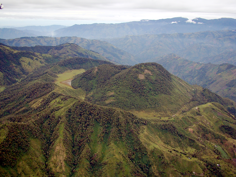
Colombia , Cerro Machin :
Cerro Machín volcano activity level bulletin.
The activity level continues at the yellow activity level or (III): changes in the behavior of volcanic activity.
Regarding the monitoring of the activity of the Cerro Machín volcano, the COLOMBIAN GEOLOGICAL SERVICE reports that:
Over the past week, the record of seismic activity related to rock fracturing around the volcano has decreased significantly. This seismic activity decreased both in the number of earthquakes recorded and in the seismic energy released, compared to the previous week. The earthquakes were located in the South, South-South-West and South-South-East sectors of the volcanic edifice, at depths between 2.2 and 3.2 km.
The highest magnitude recorded during the week was 0.9 ML (Local Magnitude) corresponding to the earthquake recorded on December 9 at 06:02 (local time), located 0.5 km south-south-east of the volcano, at a depth of 3.27 km. .
The other parameters used for the complete diagnosis of volcanic activity did not show significant changes during the period evaluated.
The COLOMBIAN GEOLOGICAL SERVICE remains attentive to the evolution of the volcanic phenomenon and will continue to report in a timely manner any changes that may occur.
Source : SGC.
Photo : La Cronica.
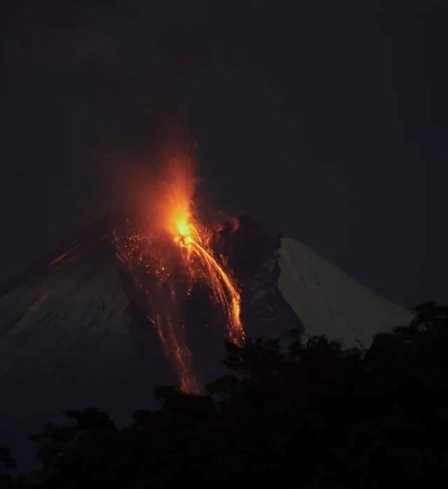
Ecuador , Sangay :
DAILY REPORT OF THE STATE OF SANGAY VOLCANO, Tuesday December 13, 2022.
Information Geophysical Institute – EPN.
Surface Activity Level: High, Surface Trend: No changes.
Internal activity level: High, Internal trend: No changes.
Seismicity: From December 12, 2022, 11:00 a.m. to December 13, 2022, 11:00 a.m.:
The data corresponds to 20 hours of transmission from the SAGA reference station.
Explosion (EXP) 1050
Emission Tremors (TREMI ) 35
Rains / Lahars:
No rain was recorded in the area. **In the event of heavy rains, these could remobilize the accumulated materials, generating mudslides and debris that would descend the flanks of the volcano and flow into adjacent rivers. **
Emission / Ash Column:
This morning, steam and ash emissions were observed with heights of up to 1000 meters above crater level in a southwesterly direction. In the past 24 hours, the VAAC agency in Washington has issued 4 ash emission readings at 1,100 meters above crater level in a southwesterly direction.
Other Monitoring Parameters:
The FIRMS system reported 32 thermal alerts while the MIROVA system reported 1 high thermal alert (341 MW) and 1 moderate thermal alert in the last 24 hours.
Observation:
At night, incandescence was observed at the summit and a lava flow descended on the southeast flank. At the moment, the area is cloudy.
Alert level: Orange.
Source : IGEPN
Photo : Diego Cardenas.
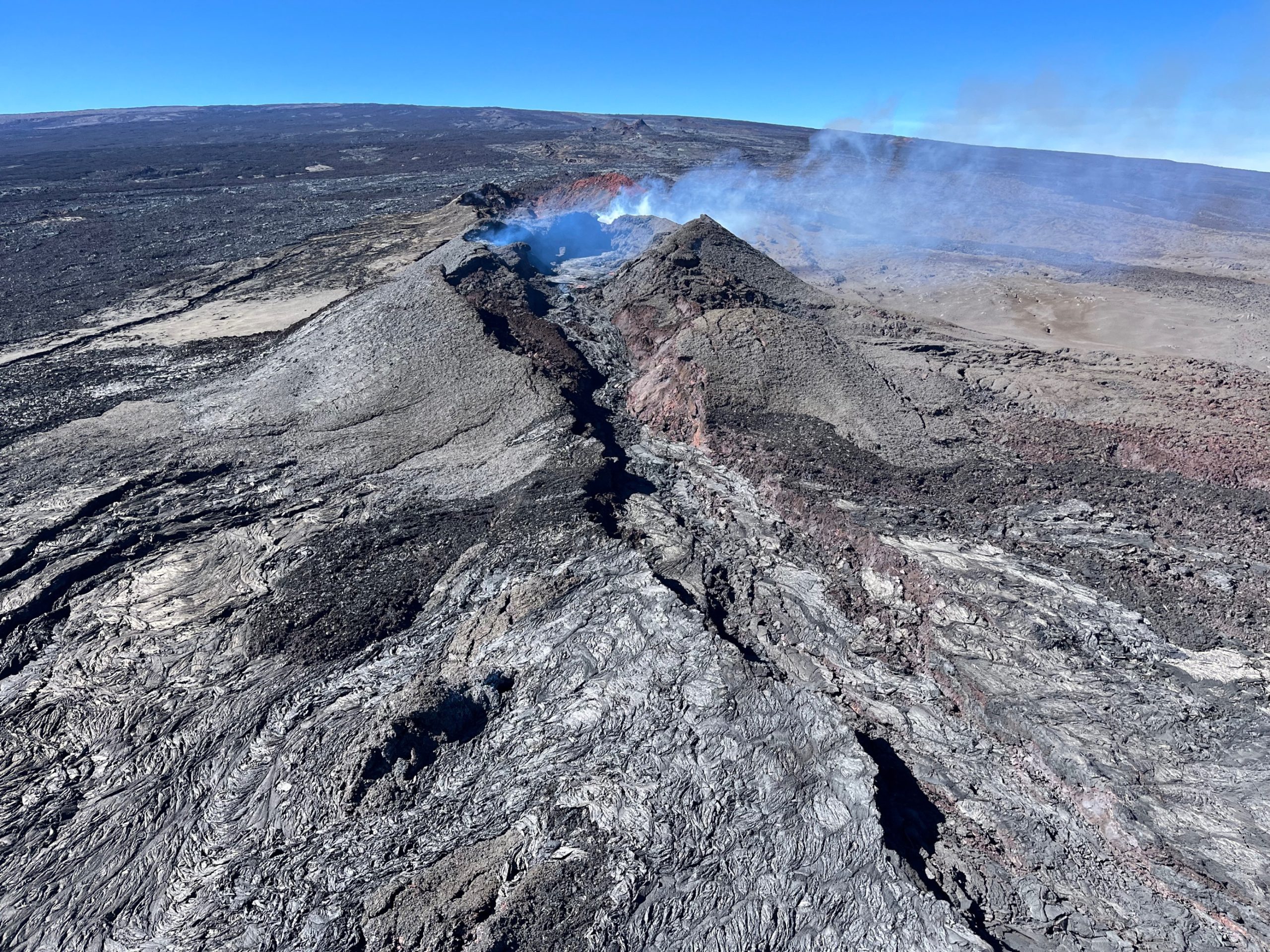
Hawaii , Mauna Loa :
HVO/USGS Volcanic Activity Notice
Current Volcano Alert Level: ADVISORY
Previous Volcano Alert Level: WATCH
Current Aviation Color Code: YELLOW
Previous Aviation Color Code: ORANGE
Issued: Tuesday, December 13, 2022, 7:17 AM HST
Source: Hawaiian Volcano Observatory
Notice Number: 2022/H657
Location: N 19 deg 28 min W 155 deg 36 min
Elevation: 13681 ft (4170 m)
Area: Hawaii
Volcanic Activity Summary:
Mauna Loa is no longer erupting. Lava supply to the fissure 3 vent on the Northeast Rift Zone ceased on December 10 and sulfur dioxide emissions have decreased to near pre-eruption background levels. Volcanic tremor and earthquakes associated with the eruption are greatly diminished.
Accordingly, the USGS Hawaiian Volcano Observatory (HVO) is lowering the Volcano Alert Level for ground-based hazards from WATCH to ADVISORY and the Aviation Color Code from ORANGE to YELLOW.
Spots of incandescence may remain near the vent, along channels, and at the flow front for days or weeks as the lava flows cool. However, eruptive activity is not expected to return based on past eruptive behavior. Summit and Northeast Rift Zone inflation continues.
HVO continues to closely monitor Mauna Loa for signs of renewed activity. Should volcanic activity change significantly a new Volcanic Activity Notice will be issued immediately.
Remarks:
Continuing hazards
A vent on the west side of the fissure 3 cone remains incandescent and occasionally produces small explosions as trapped gases are released. The lava flows around the vent remain hot and unstable. The vent area is also cut by numerous ground cracks.
Source : HVO.
Photo : USGS / K. Mulliken.