October 18 , 2022.
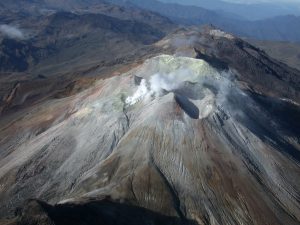
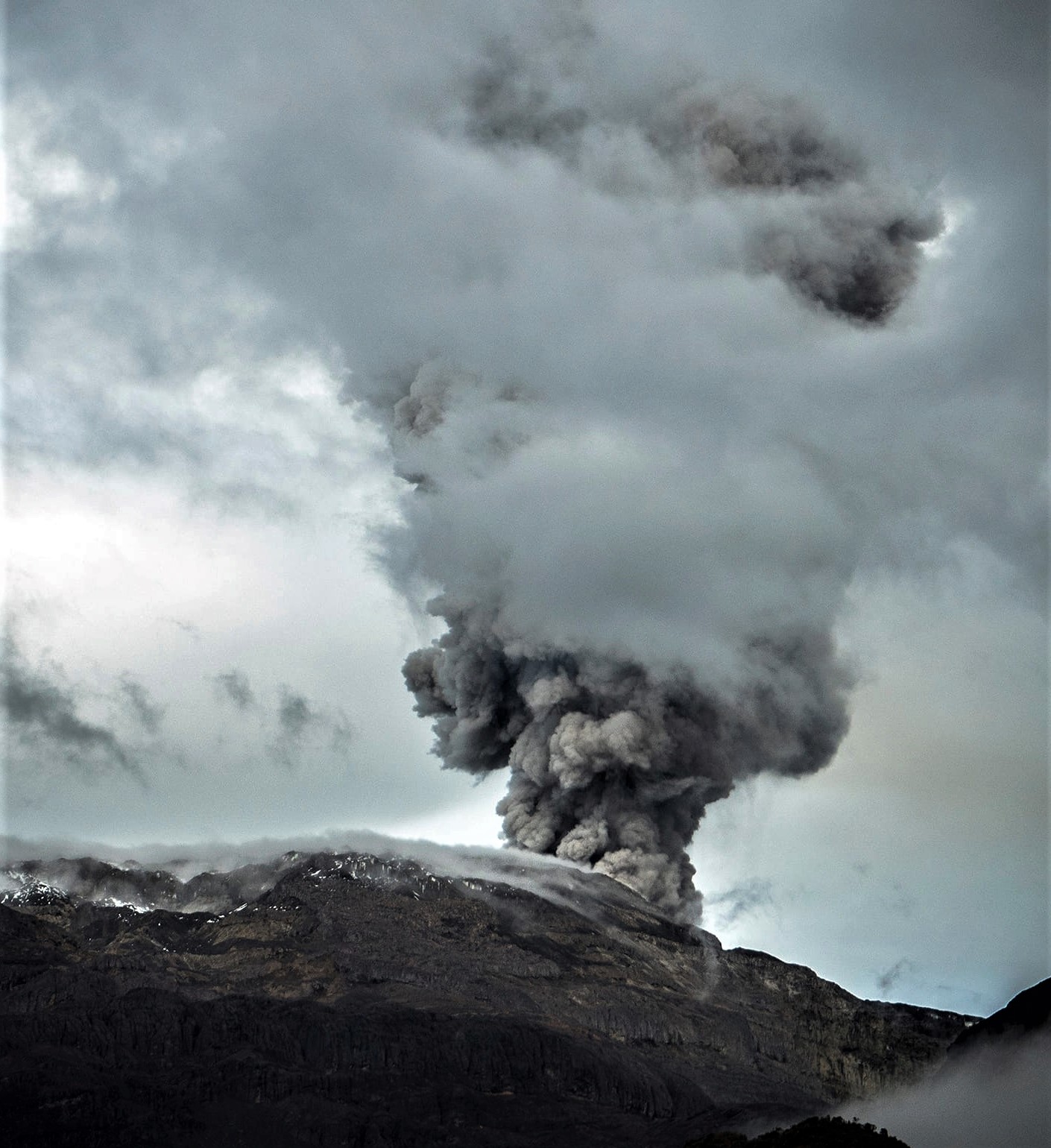
Chile , Tupungatito :
Seismology
The seismological activity of the period was characterized by the recording of:
292 VT-type seismic events, associated with rock fracturing (Volcano-Tectonics). The most energetic earthquake presented a value of local magnitude (ML) equal to 3.2, located 14.7 km north-northeast of the volcanic edifice, at a depth of 2.0 km by relative to the crater.
92 LP-type seismic events, associated with fluid dynamics within the volcanic system (Long Period type). The size of the largest earthquake estimated from the reduced displacement (RD) parameter was equal to 6 cm2.
1 HB-type seismic event, associated with both rock fracturing and fluid dynamics within the volcanic system (HyBrid). The size of the earthquake estimated from the reduced displacement parameter (RD) was equal to 2 cm2.
Fluid Geochemistry
No anomalies were reported in the emissions of sulfur dioxide (SO2) into the atmosphere in the area near the volcanic system, according to data published by the Tropospheric Monitoring Instrument (TROPOMI) and the Ozone Monitoring Instrument (OMI) Sulfur Dioxide Group (http://so2.gsfc.nasa.gov/).
Satellite thermal anomalies
During the period, no thermal alerts were recorded in the area associated with the volcanic edifice, according to analytical processing of Sentinel 2-L2A satellite images, in a combination of false color bands.
Activity remained at levels considered low, suggesting stability of the volcanic system.
The volcanic technical alert is maintained at:
GREEN TECHNICAL ALERT: Active volcano with stable behavior – There is no immediate risk
Source et photo : Sernageomin.
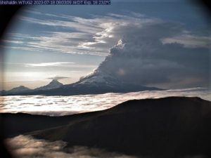
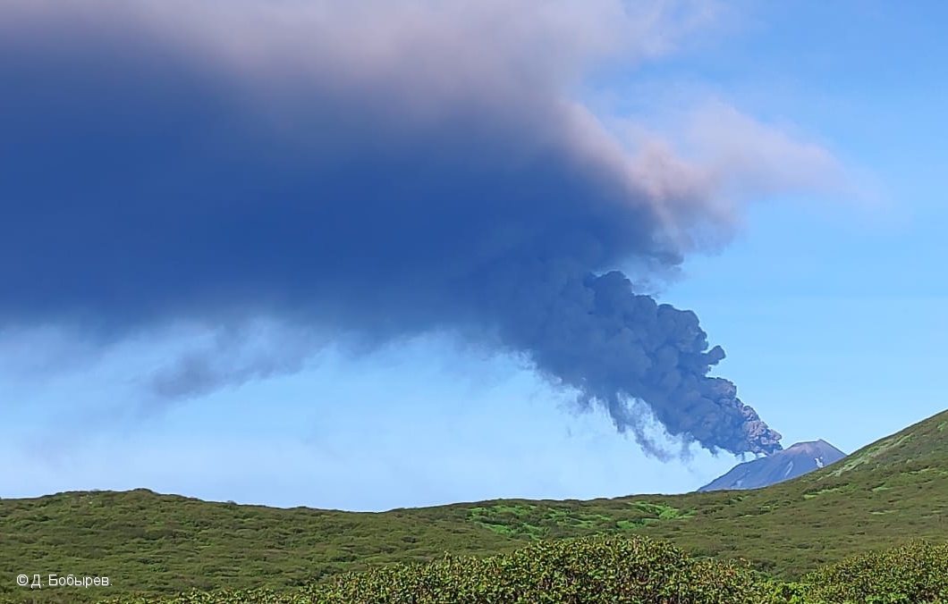
Russia / Kuril Islands , Chikurachki :
VOLCANO OBSERVATORY NOTICE FOR AVIATION (VONA)
Issued: October 18 , 2022
Volcano: Chikurachki (CAVW #290360)
Current aviation colour code: YELLOW
Previous aviation colour code: orange
Source: KVERT
Notice Number: 2022-140
Volcano Location: N 50 deg 19 min E 155 deg 27 min
Area: Northern Kuriles, Russia
Summit Elevation: 1816 m (5956.48 ft)
Volcanic Activity Summary:
A gas-steam activity of Chikurachki volcano continues. Satellite data by KVERT shows the last ash plume on 13:30 UTC and a thermal anomaly on 16:32 UTC on October 16. KVERT continues to monitor Chikurachki volcano.
A gas-steam activity of the volcano continues. The hazard of ash explosion up to 6 km (19,700 ft) a.s.l. remains. Ongoing activity could affect low-flying aircraft.
Volcanic cloud height: NO ASH CLOUD PRODUSED
Other volcanic cloud information: NO ASH CLOUD PRODUSED
Source : Kvert.
Photo : D. Bobyrev.
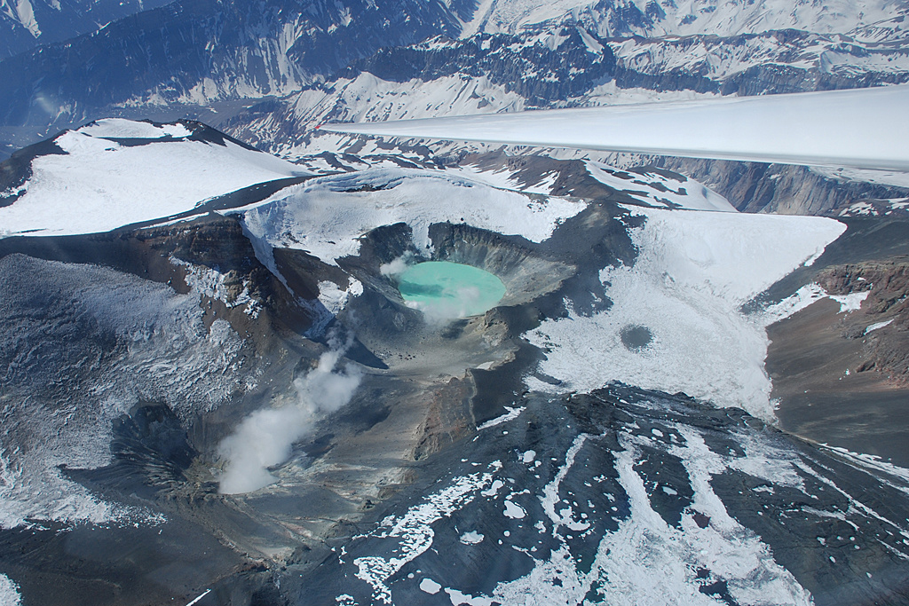
Colombia , Nevado del Ruiz :
Bulletin of activity level of the Nevado del Ruiz volcano.
The activity level continues at the Yellow Activity Level or (III): changes in the behavior of volcanic activity.
Regarding the monitoring of the activity of the Nevado del Ruiz volcano, the COLOMBIAN GEOLOGICAL SERVICE reports that:
Seismic activity related to fluid dynamics inside volcanic conduits showed an increase in the number of recorded earthquakes and a similar level of seismic energy released, compared to the previous week. According to the images captured by the cameras installed in the volcano area and to the report of the officials of the National Natural Park of Los Nevados in the region, the gas and ash emissions associated with some of these seismic signals have been confirmed. Similarly, the relative temperature changes of the material observed in the gas and ash columns were observed through the thermographic cameras.
Seismic activity associated with rock fracturing showed a decrease in both the number of earthquakes recorded and the seismic energy released, compared to the previous week. The earthquakes were located mainly in the northeast and southeast sectors of the volcano and in the Arenas crater and, to a lesser extent, in the north and southwest sectors. The depth of the earthquakes varied between approximately 0.4 and 7.0 km. The maximum magnitude observed during the week was 1.2 ML (Local Magnitude), and corresponded to two events recorded on October 6 at 8:45 p.m. (local time) and October 7 at 5:28 a.m. (local time), located at 7, 6 km east – southeast of the crater at a depth of 5.28 km and 2.1 km east of the crater at a depth of 4.0 km.
During the week, there was an increase in seismicity related to the process of ascent, emplacement-growth and evolution of a lava dome at the bottom of the Arenas crater, however, this seismicity is considered as low energy. Deformation of the volcanic surface continues to show minor changes. The volcano continues to emit water vapor and gases, mainly sulfur dioxide (SO2). Monitoring the volcano’s thermal activity, web portals have reported 2 thermal anomalies in Arenas Crater for this week.
Source : SGC.
Photo : Álex Palacio
Peru , Sabancaya :
Analysis period: from October 10, 2022 to October 16, 2022, Arequipa, October 17, 2022.
Alert level: ORANGE
The Geophysical Institute of Peru (IGP) reports that the eruptive activity of the Sabancaya volcano remains at moderate levels, that is to say with the recording of an average of 56 daily explosions, with columns of ash and of gas up to 2.6 km altitude above the summit of the volcano and their subsequent dispersion. Therefore, for the following days, no significant change is expected in eruptive activity.
The IGP recorded and analyzed the occurrence of 395 earthquakes of volcanic origin, associated with the circulation of magmatic fluids inside the Sabancaya volcano. An average of 56 explosions was recorded daily, in addition to recording Volcano-Tectonic (VT) type events associated with rock fracturing inside the Sabancaya volcano.

Monitoring the deformation of the volcanic structure using GNSS techniques (processed with fast orbits) does not show any significant anomalies. However, in general, an inflation process was observed in the northern sector (surroundings of the Hualca Hualca volcano). Visual surveillance identified columns of gas and ash up to 2.6 km above the summit of the volcano, which were dispersed towards the eastern, southeastern and northeastern sectors of Sabancaya . Satellite recordings have identified the presence of 9 thermal anomalies, with a maximum value of 13 MW, associated with the presence of a lava body on the surface of the volcano’s crater.
RECOMMENDATIONS
• Keep the volcanic alert level orange.
• Do not approach within a radius of less than 12 km from the crater.
Source : Cenvul
Photo : Zintia Roxana Fernández Licla
Ecuador , Reventador :
DAILY REPORT OF THE STATE OF THE REVENTADOR VOLCANO, Monday October 17, 2022.
Information Geophysical Institute – EPN.
Surface Activity Level: Moderate, Surface Trend: No change
Internal activity level: Moderate, Internal trend: No change.
Seismicity: From October 16, 2022, 11:00 a.m. to October 17, 2022, 11:00 a.m.:
The data corresponds to 24 hours of transmission from the REVS station
Explosion (EXP): 27
Long Periods (LP): 52
Emission Tremors (TREMI): 8
Harmonic Tremor (TRARM): 3
Rains / Lahars:
Light rain was recorded in the area. No lahar reports were received.
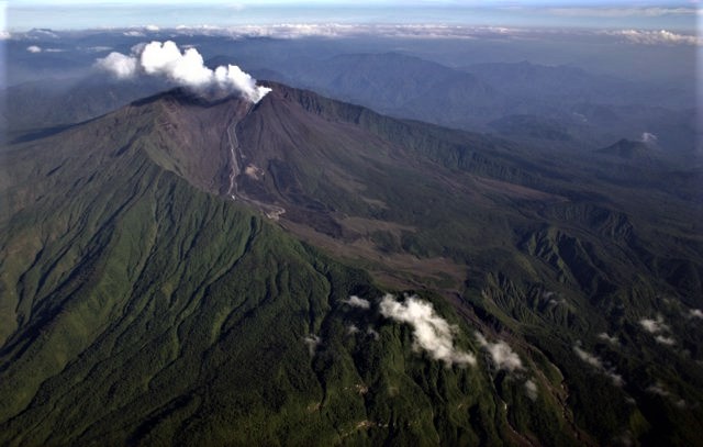
Emission / ash column:
Gas and ash emissions were observed at heights of up to 1000 meters above crater level in a west and northwest direction. The Washington VAAC reported ash emissions with heights of 988 meters above the summit in a northwesterly direction.
Other Monitoring Parameters:
In the past 24 hours, no thermal anomalies have been reported.
Gas:
The Mounts satellite system reported 31 tons of sulfur dioxide (SO2) for yesterday at 6:34 p.m. TL.
Observation:
At night and early in the morning, incandescence was observed in the crater as well as the rolling of blocks up to 700 meters below the summit on all sides of the volcano. The lava flow remains active on the northeast flank.
Alert level: Orange.
Source : IGEPN.
Photo : Patricio Ramon, (Instituto Geofisca, Escuela Politecnica Nacional).