October 15 , 2022.
Italy , Stromboli :
Press release on the activity of STROMBOLI, October 14, 2022 18:05, (16:05 UTC).
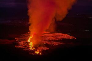
The National Institute of Geophysics and Volcanology, Osservatorio Etneo, announces that the eruptive scenario seems to be in sharp decline compared to what was observed in the previous days. The projection activity at the level of the N 2 crater (North zone) persists but is much more contained, as well as the thermal anomaly associated with the apical portions of the flow of
lava that seems to be diminishing. Field observations report that the lava flows seem to be no longer fed, however this consideration could be affected by the uncertainty due to the progression of the lava flow inside the erosion channel. The evaluation of the state of the lava flow and the altitude of the lava fronts will be carried out when the marine conditions have calmed down, from the boat and observing the Sciara del Fuoco from the front. The frequency and magnitude of collapses mainly from the lava front decreased, ordinary explosive activity fell to the lowest level.
From the seismic point of view, since the last update, no significant change has been recorded: the average amplitude of the volcanic tremor continues to show small fluctuations in its values and always remains confined to the medium-low level.
The GPS signal from Timpone del Fuoco (STDF) records at 17:20 UTC on October 13, 2022 an impulsive variation of the eastern component of about 1.5 cm. This variation is not visible on the inclinometer signals. Other analyzes are in progress for the interpretation of this signal.
The inclinometer network shows no significant changes.
Further updates will be communicated soon.
Source : INGV.
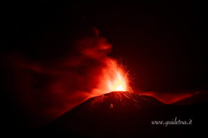
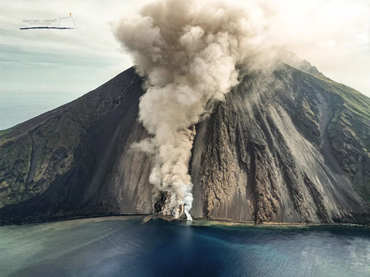
Photo : Sebastiano Cannavo / Stromboli Stati d’animo .
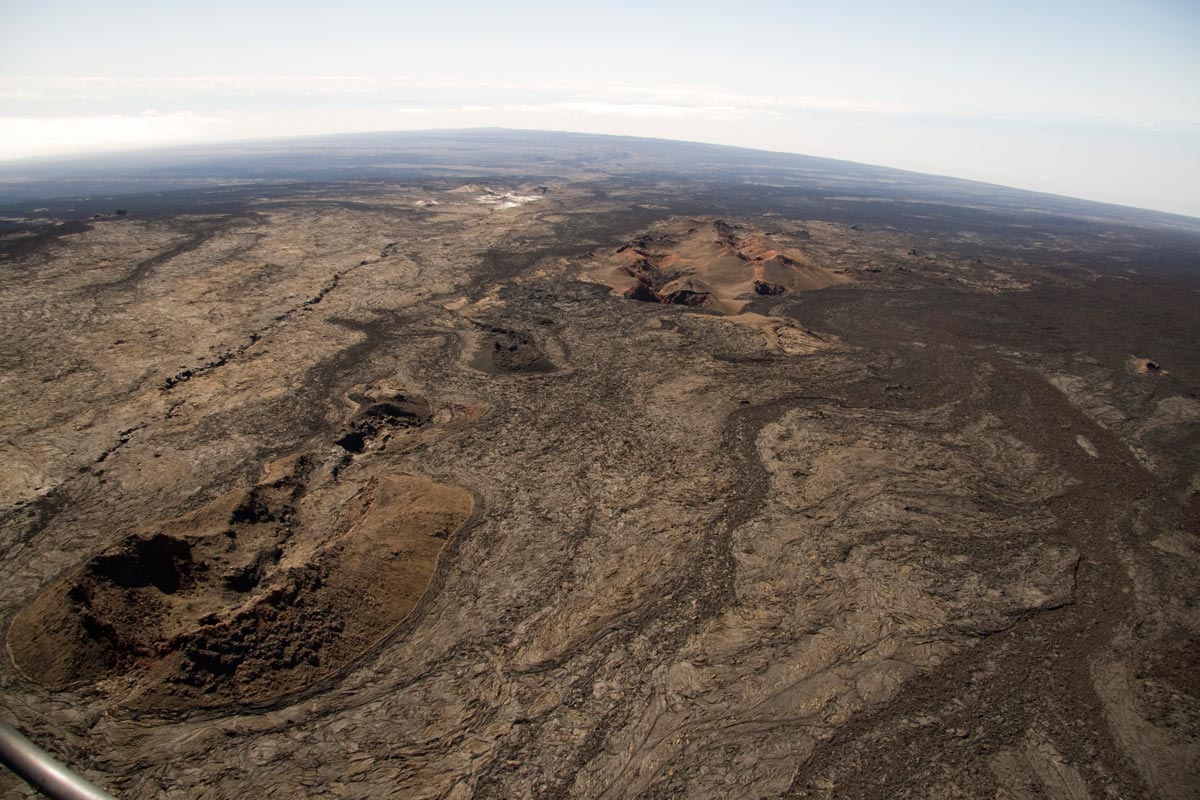
Hawaii , Mauna Loa :
19°28’30 » N 155°36’29 » W,
Summit Elevation 13681 ft (4170 m)
Current Volcano Alert Level: ADVISORY
Current Aviation Color Code: YELLOW
HAWAIIAN VOLCANO OBSERVATORY INFORMATION STATEMENT
Two moderate earthquakes occurred beneath the southern end of the Island of Hawai‘i at 9:07 a.m. this morning. The first earthquake (magnitude-4.6) was slightly offshore and south of Pāhala, at about 13 km (8 mi) depth. It was followed 24 seconds later by a larger magnitude-5.0 earthquake just south of Pāhala, 7.4 km (4.6 mi) beneath Highway 11. These two larger earthquakes were followed by a string of aftershocks, mostly less than magnitude-3.0, but including some larger ones up to magnitude-4.0. The aftershock sequence is continuing, between 0–12 km (0–7 mi) depth, south of Pāhala. The aftershocks could continue for several days to possibly weeks and may be large enough to be felt.
The two larger earthquakes were reported by hundreds of people from the Island of Hawaiʻi and felt to a lesser extent across the entire State of Hawai’i. Shaking from the larger earthquakes may have been strong enough to do minor local damage, especially to older buildings. The two earthquakes occurred within 24 seconds of each other creating shaking of longer duration and possibly greater intensity than either of the earthquakes would have created on their own.
This sequence of earthquakes appears to be related to readjustments along the southeast flank of Mauna Loa volcano. There has been no immediate effect on the continuing unrest beneath Mauna Loa summit, which remains elevated at levels similar to the past week. On several occassions large earthquakes have preceded past eruptions of Mauna Loa, though these have typically been larger than today’s earthquakes. It is not known at this time if this sequence of earthquakes is directly related to the ongoing unrest on Mauna Loa.
The Hawaiian Volcano Observatory will continue to closely monitor Mauna Loa for any changes.
Source : HVO
Photos : USGS.
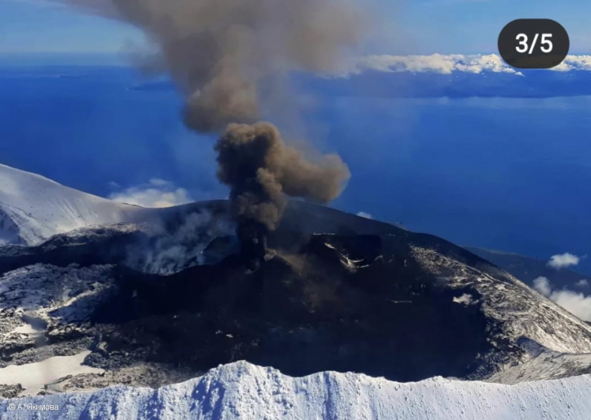
Russia / Kurils Islands , Alaid :
VOLCANO OBSERVATORY NOTICE FOR AVIATION (VONA)
Issued: October 15 , 2022
Volcano: Alaid (CAVW #290390)
Current aviation colour code: ORANGE
Previous aviation colour code: orange
Source: KVERT
Notice Number: 2022-134
Volcano Location: N 50 deg 51 min E 155 deg 33 min
Area: Northern Kuriles, Russia
Summit Elevation: 2339 m (7671.92 ft)
Volcanic Activity Summary:
The explosive activity of the volcano increased: explosions sent ash up to 5-5.2 km a.s.l., an ash plume is extending for 152 km to the east of the volcano.
A moderate eruptive activity of the volcano continues. Ash explosions up to 8 km (26,200 ft) a.s.l. could occur at any time. Ongoing activity could affect international and low-flying aircraft.
Volcanic cloud height:
5000-5200 m (16400-17056 ft) AMSL Time and method of ash plume/cloud height determination: 20221015/0500Z – Himawari-8 14m15
Other volcanic cloud information:
Distance of ash plume/cloud of the volcano: 152 km (94 mi)
Direction of drift of ash plume/cloud of the volcano: E / azimuth 94 deg
Time and method of ash plume/cloud determination: 20221015/0500Z – Himawari-8 14m15
Source : Kvert.
Photo : A. Yakimova
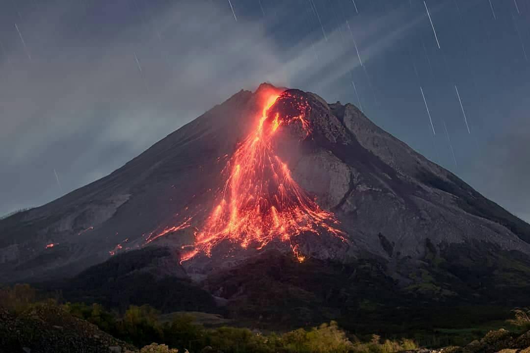
Indonesia , Merapi :
Report on the activity of Mount Merapi from October 07, 2022 to October 13, 2022, Published on October 14, 2022
RESULTS OF OBSERVATIONS
Visual
The weather around Mount Merapi is usually sunny in the morning and afternoon, while the evening is foggy. White, thin to medium thickness, low pressure, 175m high smoke was observed from Babadan’s Mount Merapi observation post on October 13, 2022 at 06:00 WIB.
This week, 7 lava avalanches were observed in the Southwest, descending the Bebeng River with a maximum sliding distance of 1500 m.
On the southwest and central dome still growing, but no significant morphological changes are observed. Based on photo analysis, the volume of the dome is calculated at 1,626,000 m3, and for the central dome it is 2,772,000 m3.
Seismicity
This week, the seismicity of Mount Merapi showed:
354 deep volcanic earthquakes (VTA),
1 shallow volcanic earthquakes (VTB),
243 multi-phase earthquakes (MP),
378 avalanche earthquakes (RF),
39 emission earthquakes (DG),
8 tectonic earthquakes (TT).
1 Tremor (TR)
1 low frequency earthquake ( LF)
The intensity of this week’s seismicity is still quite high.
Deformation
The deformation of Mount Merapi that was monitored using EDM and GPS this week shows no significant changes.
Rain and lahars:
This week, there was rain at the Kaliurang observation post with a rain intensity of 47 mm/h for 140 minutes on October 10, 2022.
Conclusion
Based on the results of visual and instrumental observations, it is concluded that:
The volcanic activity of Mount Merapi is still quite high in the form of effusive eruption activity. The state of the activity is defined at the « SIAGA » level.
Source : BPPTKG.
Photo : @ilhamm_ska
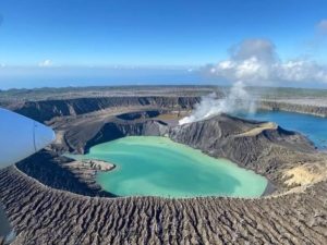
Chile , Laguna del Maule :
Seismology
The seismological activity of the period was characterized by the recording of:
1033 VT type seismic events, associated with rock fracturing (Volcano-Tectonics). The most energetic earthquake presented a value of Local Magnitude (ML) equal to 2.4, located 9.5 km west-south-west of the center of the lagoon, at a depth of 6.5 km in reference to the average height of the lagoon.
21 LP-type seismic events, associated with fluid dynamics within the volcanic system (Long Period). The size of the largest earthquake assessed from the reduced displacement parameter (RD) was equal to 61 cm2.
6 TR-type seismic events, associated with sustained dynamics over time of fluids within the volcanic system (TRemor). The size of the largest earthquake assessed from the reduced displacement parameter (RD) was equal to 14.7 cm2.
Fluid Geochemistry
No anomalies were reported in the emissions of sulfur dioxide (SO2) into the atmosphere in the area near the volcanic complex, according to data published by the Tropospheric Monitoring Instrument (TROPOMI) and the Ozone Monitoring Instrument (OMI) Sulfur Dioxide Group (http://so2.gsfc.nasa.gov/).

Satellite thermal anomalies
During the period, no thermal alert was recorded in the area associated with the volcanic complex, according to the analytical processing of Sentinel 2-L2A satellite images, in combination with false color bands.
Geodesy
According to the data provided by 4 GNSS stations and 2 inclinometer stations, which make it possible to measure the deformation in the complex, it is observed that the historically recorded inflationary process is continuing. The maximum uplift rate continues to be recorded at the GNSS MAU2 station, at the center of the geodetic network and to the southwest of the lagoon, estimating displacements of a maximum magnitude of 1.98 cm/month in the vertical component.
Surveillance cameras
The images provided by the fixed camera, installed near the complex, did not record any degassing columns or variations linked to surface activity.
Activity remained at levels considered low, suggesting stability of the volcanic system.
The volcanic technical alert is maintained at:
GREEN TECHNICAL ALERT: Active volcano with stable behavior – There is no immediate risk.
Source : Sernageomin
Photo : Dr Katie Keranen.