October 07 , 2022.
La Réunion , Piton de la Fournaise :
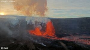
Piton de la Fournaise Eruption stopped but Enclos still closed.
The volcanic eruption that started on Monday September 19, 2022 ended today, Wednesday October 5, 2022, following a sudden stoppage of the eruptive tremor (elements of the OVPF).
No hypothesis is ruled out as to the evolution of the future situation (pause of the eruption, definitive cessation, resumption of activity on the same site, resumption of activity on another site), taking into account the strong seismicity that has been recorded in recent days.
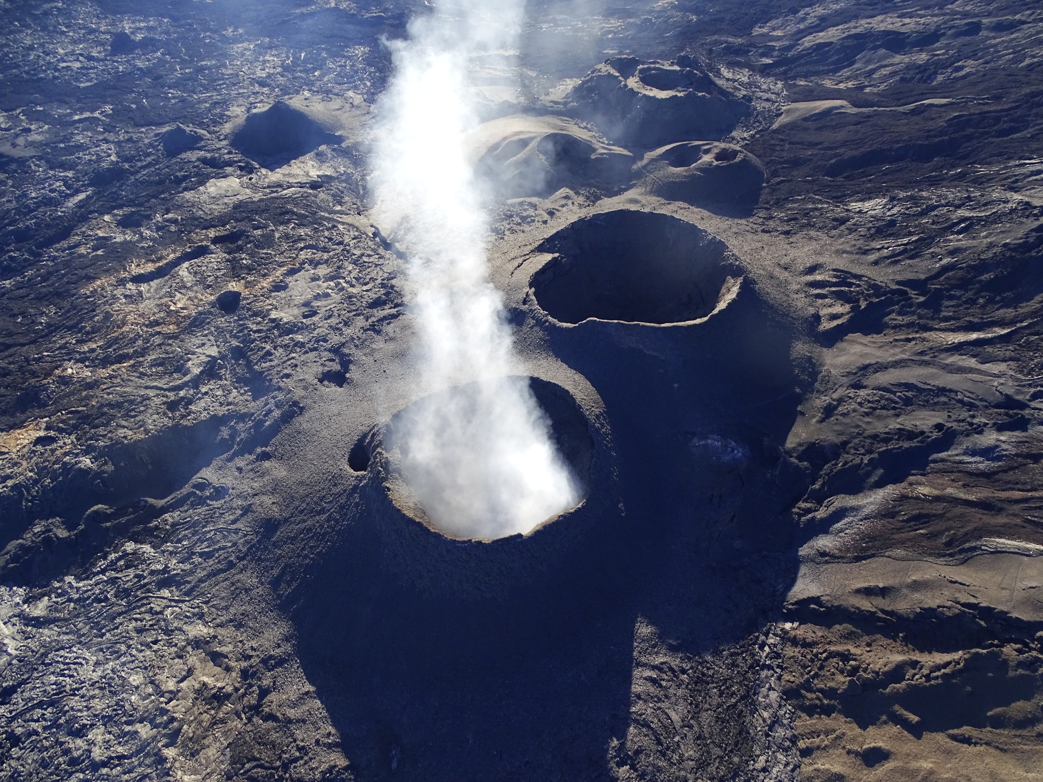
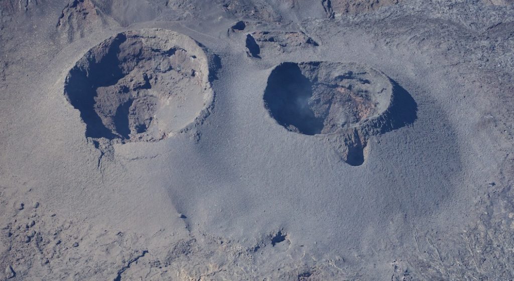
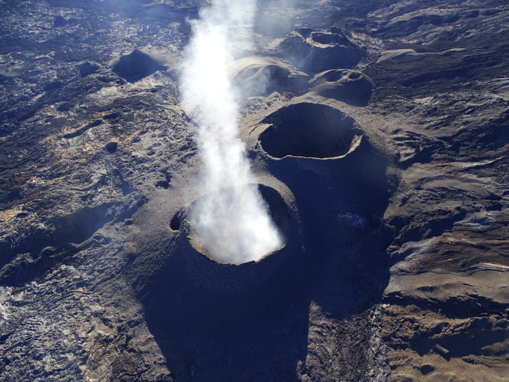
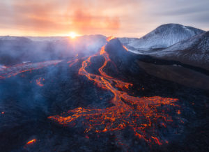
Overview of the site of the eruption of 19/09 – 5/10 at Piton de la Fournaise by a team from the OVPF-IPGP.
The new cone on the right of the image shows a very intense end to activity with lava projections that have reached the bottom of Piton Kalla Pélé (left). OVPF-IPGP
As a result, public access to the entire Piton de la Fournaise Enclos , whether from the Pas de Bellecombe trail or from any other trail, remains prohibited until further notice.
Since 11:40 this morning (6/10), a weak tremor has again been recorded on the OVPF-IPGP monitoring networks. This tremor corresponds to a degassing at the cone of the eruption from 09/19 to 10/05. No surface lava emission is observed.
Press release, Paris Institute of Earth Physics, Piton de la Fournaise Volcanological Observatory, October 06, 2022 – 7:45 p.m. (local time) – 3:45 p.m. (UTC time)
Tremor activity
Following the press release at 12:10 p.m. (local time) indicating a resumption of the eruptive tremor at Piton de la Fournaise, weak lava projections were observed on the OVPF-IPGP webcams between 6:32 p.m. and 7:05 p.m. (local time) which confirms that magma is near the surface.
Since then no activity apart from degassing has been observed. But an eruption remains likely in the short term.
It should be noted that the overflight of the site by a team from the OVPF-IPGP with the assistance of the SAG and the PGHM between 4:10 p.m. and 5:30 p.m. (local time) did not show any projection or lava effusion activity.
Source : Direction OVPF / IPGP.
Colombia , Puracé – Los Coconucos Volcanic Chain:
Weekly bulletin of the activity of the Puracé volcano – Los Coconucos volcanic chain
The activity level of the volcano continues at the Yellow Activity Level or (III): changes in the behavior of volcanic activity.
From the analysis and evaluation of the information obtained through the monitoring network of the Puracé volcano – Los Coconucos volcanic chain, during the week of September 27 to October 3, 2022, the COLOMBIAN GEOLOGICAL SERVICE – Volcanological and Seismological Observatory de Popayán informs that:
• With regard to the seismic activity recorded, there were no notable variations in terms of the number of events and the energy released. Of a total of 792 seismic events recorded, 115 were associated with rock fracturing processes (type VT) and 677 with fluid dynamics in volcanic conduits.
• The geodetic network of GNSS (Global Navigation Satellite System) stations monitoring ground deformation continues to record a process associated with inflation.
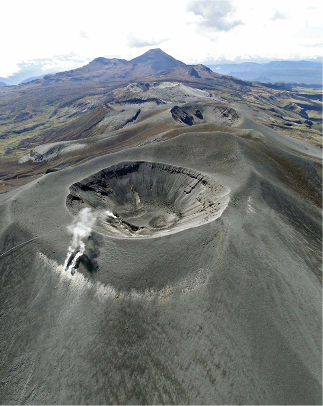
• By monitoring the surface activity, the images obtained during the week thanks to the web cameras Anambío, Mina, Lavas Rojas, Cerro Sombrero and Curiquinga, highlighted a degassing of the volcanic system, with a white column oriented preferentially towards the North-west.
• With respect to volcanic gas monitoring, sulfur dioxide (SO2) flux emissions recorded by telemetric stations continue to show changes in flux, with a maximum emitted of 2401 t/day for the assessed week. The other instruments for measuring carbon dioxide (CO2) and radon gas (222Rn) in the volcanic influence zone record considerable variations in their concentrations for the period evaluated, which is normal in active volcanic systems.
• On September 30, 2022, a mobile SO2 flow measurement was carried out on the Puracé – Termales de San Juan axis (Cauca), on which a measurement of 1782 t/day was detected, considered normal in relation to the behavior of the last few weeks.
• Magnetic field and infrasonic wave monitoring sensors did not record variations associated with changes in volcanic activity.
It is concluded from the above that variations in volcanic activity continue to be recorded, consistent with the behavior expected at activity level III (yellow level), which could evolve towards states of greater activity. The Colombian Geological Service continues to monitor the evolution of the volcanic phenomenon and will report any changes that may occur in due course.
Source et photo : SGC
Italy / Sicily , Etna :
MONTHLY BULLETIN, SEPTEMBER 2022, (issue date 04/10/2022)
ACTIVITY STATUS SUMMARY
In the light of the surveillance data, it is highlighted:
1) VOLCANOLOGICAL OBSERVATIONS: Degassing activity at variable level at the summit craters, frequent rumblings from the Bocca Nuova crater.
2) SEISMOLOGY: Low seismic activity of fracturing; the amplitude of the volcanic tremor remained mainly at medium-high levels.
3) INFRASOUND: moderate infrasound activity.
4) DEFORMATIONS OF THE SOIL: The data of the deformations of the permanent networks confirm the persistence of a state of inflation of the volcanic edifice.
5) GEOCHEMISTRY: SO2 flux at an average level and moderately increasing The soil CO2 flux shows average values.
The partial pressure of dissolved CO2 in groundwater shows values in seasonal variability.
Helium data from the latest sampling show no significant changes from previous ones, settling on the high level.
6) SATELLITE OBSERVATIONS: The thermal activity observed by satellite in the summit area was weak.
7) OTHER NOTES: Updated summit crater topography by drones.
VOLCANOLOGICAL OBSERVATIONS
The follow-up of the volcanic activity of Etna, during the observation period in question, was carried out by analyzing the images of the network of surveillance cameras of the INGV, Osservatorio Etneo (INGV-OE) and at through various inspections in the summit area carried out by INGV-OE staff.
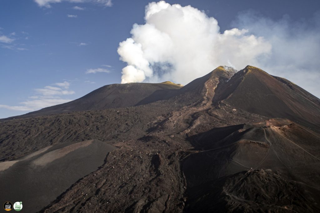
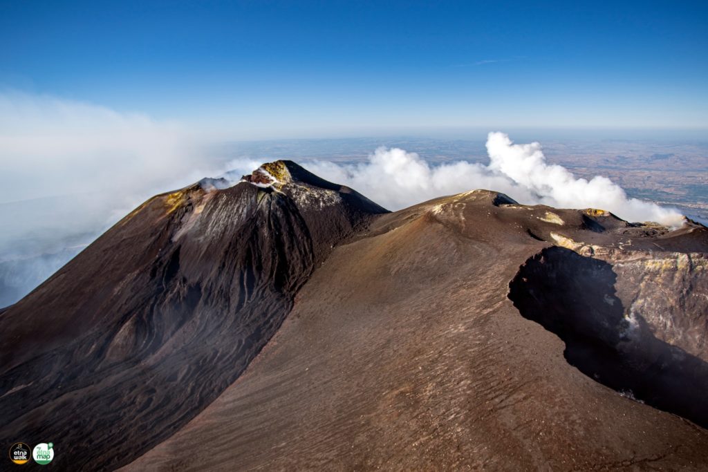
During the period under review, the activity of Etna did not show significant changes compared to that observed the previous month. It was characterized by a variable rate degassing of the summit craters. The major degassing is supported by the Bocca Nuova (BN) crater, and to a lesser extent by the fumarolic activity of the Southeast Crater (SEC).
Southeast Crater (SEC) shows fumarolic activity at points along the edges of the crater and within the breccia created when the cone flank collapsed on the evening of February 10, 2022.
SEISMOLOGY
During the month in question, six earthquakes were recorded that exceeded the magnitude 2.0 threshold. Seismicity only affected the middle-lower western sector of the volcanic edifice. The greatest release of energy is attributable to an earthquake, with a local magnitude of 3.6, located about 3.5 km east of the town of Paternò in the lower western slope of the volcano, at a hypocentral depth of about 2 km.
The temporal trend of the average amplitude of the volcanic tremor remained mainly at a medium-high level throughout the month; it can be seen that from mid-September, the average amplitude settled exclusively on an average value. The location of the source of the tremor is located in the area between the Southeast Crater and the Bocca Nuova crater, in a depth range between 2400 and 2900 meters above mean sea level.
GROUND DEFORMATIONS
The state of inflation of the volcanic building continues. As of 2:00 GMT on September 25 due to the switch to GPS satellites, 13 of the permanent GNSS stations have ceased to operate. Work is underway to restore their operation by changing the receiver.
Source : INGV.
Photos : Giuseppe Distefano / Etna Walk.
Russia / Kuril Islands , Ebeko :
VOLCANO OBSERVATORY NOTICE FOR AVIATION (VONA)
Issued: October 10 , 2022.
Volcano: Ebeko (CAVW #290380)
Current aviation colour code: ORANGE
Previous aviation colour code: orange
Source: KVERT
Notice Number: 2022-127
Volcano Location: N 50 deg 41 min E 156 deg 0 min
Area: Northern Kuriles, Russia
Summit Elevation: 1156 m (3791.68 ft)
Volcanic Activity Summary:
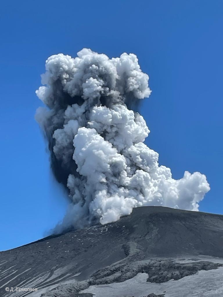
A moderate eruptive activity of the volcano continues. According to visual data by volcanologists from Severo-Kurilsk, explosions sent ash up to 3 km a.s.l., an ash cloud is drifting to the east of the volcano; an ashfall is observing at Severo-Kurilsk.
A moderate eruptive activity of the volcano continues. Ash explosions up to 6 km (19,700 ft) a.s.l. could occur at any time. Ongoing activity could affect low-flying aircraft and airport of Severo-Kurilsk.
Volcanic cloud height:
2800-3000 m (9184-9840 ft) AMSL Time and method of ash plume/cloud height determination: 20221007/0108Z – Visual data
Other volcanic cloud information:
Distance of ash plume/cloud of the volcano: 5 km (3 mi)
Direction of drift of ash plume/cloud of the volcano: E
Time and method of ash plume/cloud determination: 20221007/0108Z – Visual data
Source : Kvert
Photo: D. Ermolaev.
Japan , Nishinoshima :
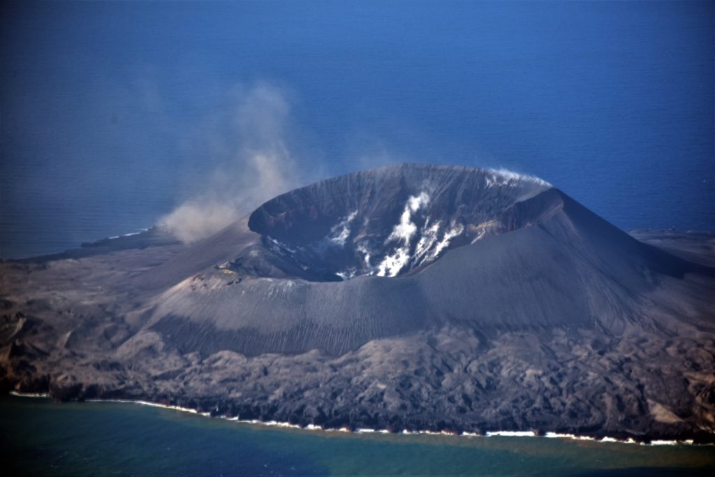
According to JMA and the Tokyo VAAC an eruption at Nishinoshima produced ash plumes that rose to 1.8-2.6 km (6,000-8,500 ft) a.s.l. and drifted E and W during 1-4 October.
The small island of Nishinoshima was enlarged when several new islands coalesced during an eruption in 1973-74. Another eruption that began offshore in 2013 completely covered the previous exposed surface and enlarged the island again. Water discoloration has been observed on several occasions since. The island is the summit of a massive submarine volcano that has prominent satellitic peaks to the S, W, and NE. The summit of the southern cone rises to within 214 m of the sea surface 9 km SSE.
Source : GVP , JMA.
Photo : Gardes cotes Japonais

