September 08 , 2022 .
La Réunion , Piton de la Fournaise :
Communicated ; September 07, 2022 – 5 p.m. (local time) – 12 p.m. (UTC time).
Seismic crisis:
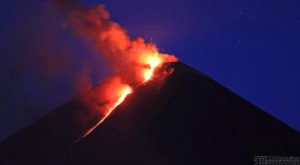
Since 4:54 p.m. local time, a seismic crisis has been recorded on the instruments of the Volcanological Observatory of Piton de la Fournaise. This seismic crisis is accompanied by rapid deformation. This indicates that magma is leaving the magma reservoir and spreading to the surface.
An eruption is likely at short notice in the next few minutes or hours.
Additional information will follow concerning the sector impacted by this magmatic propagation towards the surface.
Recommended alert level: Alert 1.

Communicated ; September 08, 2022 – 8:00 a.m. (local time) – 4:00 a.m. (UTC time)
End of seismic crisis
The seismic crisis that began on September 7 at 4:54 p.m. local time ended in the evening (around 7 p.m. local time). This seismic crisis was accompanied by weak deformation at the top (< 1 cm). The earthquakes were located on the northern rim of the Dolomieu crater.
The cessation of the seismic crisis means that the progression of magma has ceased at depth (intrusion) below the summit and has not reached the surface.
Since then, seismicity has remained sustained with 2 or 3 earthquakes recorded per hour.
No hypothesis is ruled out (permanent cessation of seismicity, resumption of intrusion, new intrusion) as to the evolution of the future situation given this persistent seismicity.
In the past such intrusions have sometimes preceded the final injection of magma leading to the eruption by a few days, as was recently observed in October 2019 and December 2020.
Alert level: Alert 1
Source : La direction de l’OVPF-IPGP
Photo : Imaz Press
Indonesia , Marapi :
Press release Volcanic activity of Mount Marapi, September 2, 2022.
The volcanic activity of Mount Marapi has fluctuated since January 2022, and the current level of activity is at level II (WASPADA) since August 3, 2011.
The latest developments on Mount Marapi activities until September 1, 2022 at 24:00 WIB are as follows:
There was an inflationary trend from the deformation data (Tiltmeter) for the stations around the summit and a deflationary trend (deflation) on the slopes.
Seismic data through September 1, 2022 at 12:00 a.m. WIB tends to fluctuate and is dominated by seismicity associated with hydrothermal activity.
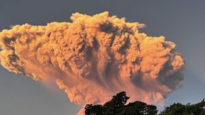
Visually, the eruptive activity has not been observed for 8 months and is only dominated by emissions from a height of about 50 to 100 m above the summit.
Under the above conditions, the potential hazard most likely to occur is a phreatic eruption with the threat of hazard presently in the form of ejection of crater material and ash which has the potential to strike an area a radius of 3 km from the eruptive center of the Verbeek crater.
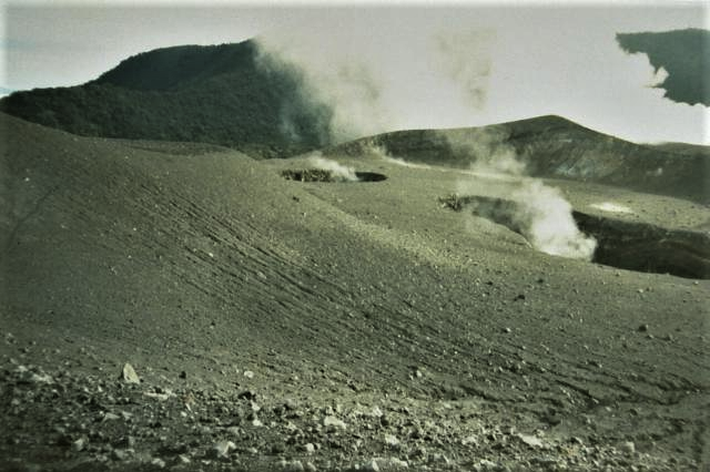
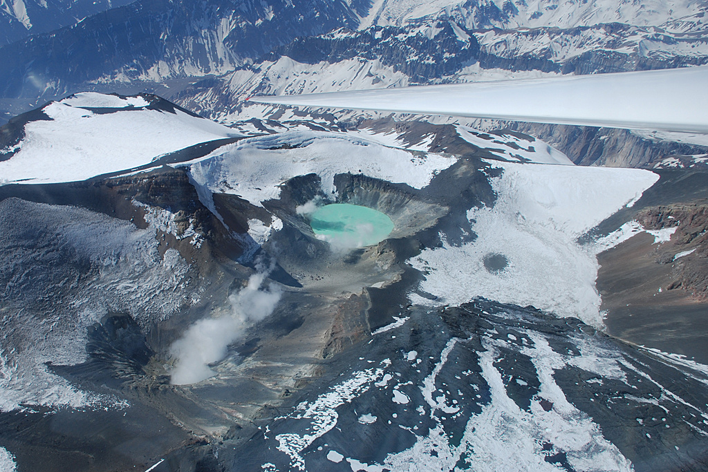
The small Kepundan B and C craters in the foreground, seen here in the north, are two of many historically active craters at Marapi. A plume of steam rises above the western summit crater, Kawah Bongsu. Verbeek Crater is also known as Kapundan Tenga or Kepundan Tenga.
Based on observations, analysis of visual and instrumental data up to September 2 at 12:00 WIB, the activity level of Mount Marapi is still at level II (alert).
Recommendations at this Level II (alert) level of activity are as follows: Communities around Mount Marapi and visitors/tourists are not permitted to do any activities/approach Mount Marapi within 3 km around the crater.
In a special notice posted on 2 September PVMBG reported that tiltmeter deformation data for Marapi showed a trend of inflation at the summit and deflation along the flanks. Seismicity continued to fluctuate with the dominating signal indicating hydrothermal activity. A phreatic eruption was the most likely kind of volcanic activity that could occur at the volcano, based on the recent data, and it could occur without warning; PVMBG reminded the public to stay at least 3 km away from the summit. The Alert Level remained at 2 (on a scale of 1-4).
Source : PVMBG , GVP.
Photo : Gede Suantika, 1993 (Observatoire volcanologique d’Indonésie).
Russia / Kuril Islands , Chikurachki :
VOLCANO OBSERVATORY NOTICE FOR AVIATION (VONA)
Issued: September 08 , 2022
Volcano: Chikurachki (CAVW #290360)
Current aviation colour code: YELLOW
Previous aviation colour code: orange
Source: KVERT
Notice Number: 2022-108
Volcano Location: N 50 deg 19 min E 155 deg 27 min
Area: Northern Kuriles, Russia
Summit Elevation: 1816 m (5956.48 ft)
Volcanic Activity Summary:
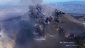
A gas-steam activity of the volcano continues. Probably, the explosive eruption that began on 23 August was ending on 02 September. According to the satellite data by KVERT, last time the ash plume from the volcano was observing on 02 September, and a weak thermal anomaly over the volcano on 04 September. KVERT continues to monitor Chikurachki volcano.
A gas-steam activity of the volcano continues. Ongoing activity could affect low-flying aircraft.
Volcanic cloud height: NO ASH CLOUD PRODUSED
Other volcanic cloud information: NO ASH CLOUD PRODUSED
Source : Kvert.
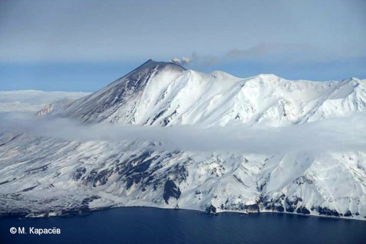
Photo : M. Karasev.
Chile , Tupungatito :
Special report on volcanic activity (REAV), Santiago Metropolitana region, Tupungatito volcano, September 07, 2022, 7:06 p.m. local time (mainland Chile).
The National Service of Geology and Mines of Chile (Sernageomin) publishes the following PRELIMINARY information, obtained through the monitoring equipment of the National Volcanic Monitoring Network (RNVV), processed and analyzed at the Volcanological Observatory of the Southern Andes ( Ovdas):
On Wednesday September 07, 2022, at 6:44 p.m. local time (22:44 UTC), the monitoring stations installed near the Tupungatito volcano recorded an earthquake associated with the fracturing of rocks (volcano-tectonic type) in the volcanic system.
The characteristics of earthquakes after their analysis are as follows:
ORIGINAL TIME: 6:44 p.m. local time (22:44 UTC)
LATITUDE: 33.293°S
LONGITUDE: 69.727°W
DEPTH: 2.0 km
LOCAL MAGNITUDE: 3.2ml
COMMENTS:
Before the occurrence of the volcano-tectonic event, a lower energy swarm was recorded.
The volcanic technical alert remains at the Green level.
Sources : Sernageomin.
Photo et photo : Sernageomin.
Comoros , Karthala :
According to the Direction Générale de la Sécurité Civile – Comores, the Observatoire Volcanologique du Karthala (OVK) reported that a significant increase in the number of small earthquakes beneath Karthala’s W flank began to be detected on 15 July. The abnormal activity persisted, so on 16 August the Alert Level was raised to Yellow (the lowest level on a three-level scale) and residents were asked to limit activities on and around the volcano. On 5 September OVK recommended that the Alert Level remain at Yellow.
The southernmost and largest of the two shield volcanoes forming Grand Comore Island (also known as Ngazidja Island), Karthala contains a 3 x 4 km summit caldera generated by repeated collapse. Elongated rift zones extend to the NNW and SE from the summit of the Hawaiian-style basaltic shield, which has an asymmetrical profile that is steeper to the S. The lower SE rift zone forms the Massif du Badjini, a peninsula at the SE tip of the island. Historical eruptions have modified the morphology of the compound, irregular summit caldera. More than twenty eruptions have been recorded since the 19th century from the summit caldera and vents on the N and S flanks. Many lava flows have reached the sea on both sides of the island. An 1860 lava flow from the summit caldera traveled ~13 km to the NW, reaching the W coast to the N of the capital city of Moroni.
Source : Direction Générale de la Sécurité Civile – Comores
Photo : Nicolas-Villenueve-Universite-de-La-Reunion-
Japan , Kuchinoerabujima :
The number of volcanic earthquakes with hypocenters near Kuchinoerabujima’s crater increased during 30-31 July prompting JMA to raise the Alert Level to 2 (on a scale of 1-5). The number of earthquakes then decreased to low levels by 1 August and remained low. Sulfur dioxide emissions were also at low levels and on some days were below the detection limit. On 1 September the Alert Level was lowered to 1.

A group of young stratovolcanoes forms the eastern end of the irregularly shaped island of Kuchinoerabujima in the northern Ryukyu Islands, 15 km W of Yakushima. The Furudake, Shindake, and Noikeyama cones were erupted from south to north, respectively, forming a composite cone with multiple craters. All historical eruptions have occurred from Shindake, although a lava flow from the S flank of Furudake that reached the coast has a very fresh morphology. Frequent explosive eruptions have taken place from Shindake since 1840; the largest of these was in December 1933. Several villages on the 4 x 12 km island are located within a few kilometers of the active crater and have suffered damage from eruptions.
Source : GVP , JMA.
Photo : 日本語: 海上保安庁