August 17 , 2022 .
Iceland , Reykjanes Peninsula :
August 15, 2022
The first data from the Pleiades satellite has arrived with images of Meradalur, but cloud cover has hampered viewing so far. The data was processed and a new map of the eruption site was created. It shows that the lava covers 1.25 square kilometers, its volume is 10.6 million cubic meters and the average lava flow over the past 10 days (August 4-14) is 10.4 m3/s . The lava flow has therefore decreased since what was the first eruptive cycle. This is common in volcanic eruptions. Aerial photographs were also taken on Saturday morning and Sunday evening. This data will be processed today with a better estimate of the current situation, but the figure above is average for a period of 10 days.
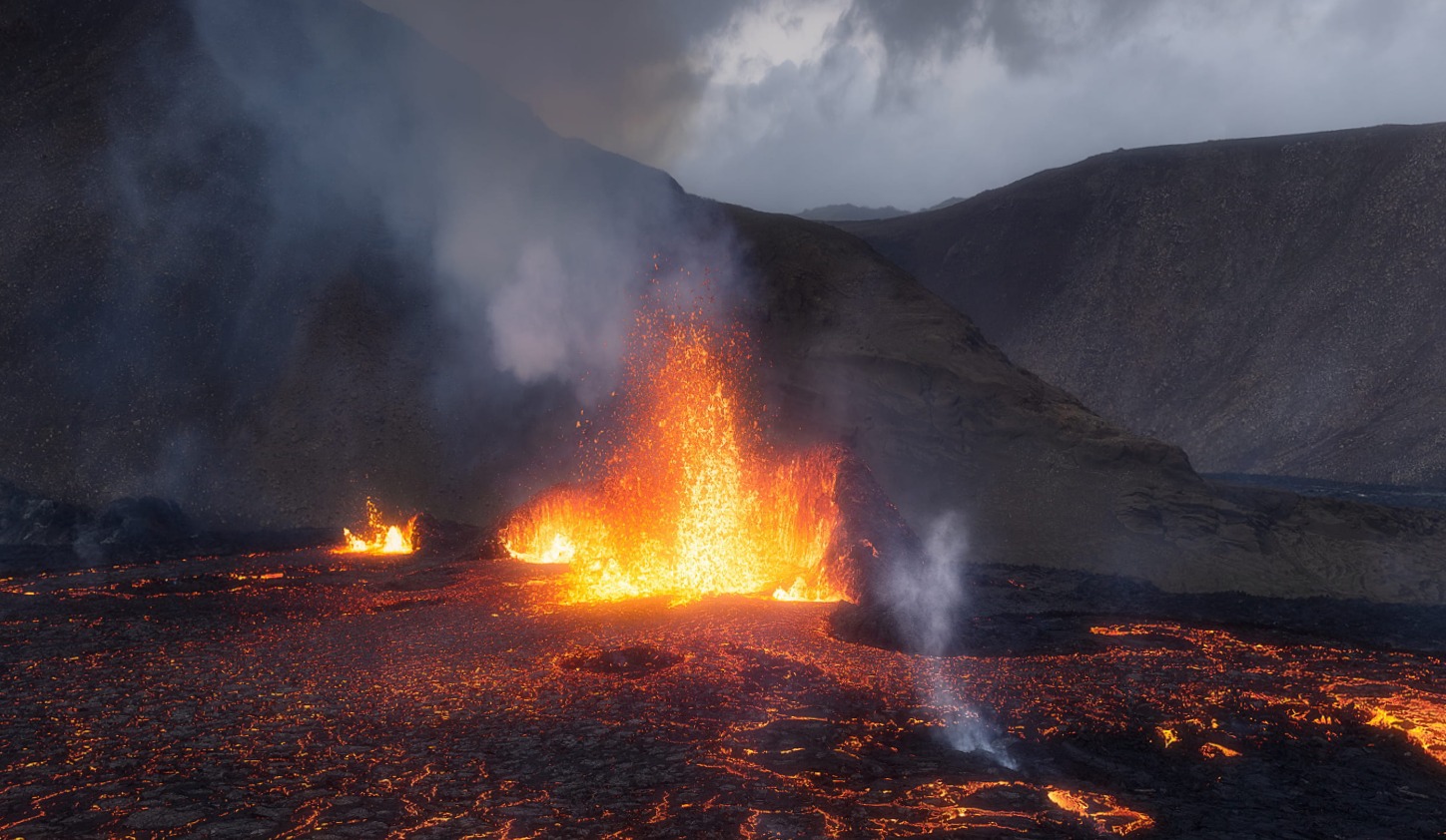
The first measurements of the August 13 and 15 overflights are now complete. The results show that the lava flow has decreased considerably. It was 11 m3/s on average from August 4 to 13, but the average flow from Saturday to Monday was much lower, 3-4 m3/s. The uncertainty is great on the measurements when the periods are so short, but overall the measurements obtained since Saturday morning (including that of the Pléiades satellite) show that the eruption has decreased. Is this consistent with the fact that in recent days the number of lava fountains has decreased and lava flows have flowed less in Meradalur than before. It is impossible to say at this stage if the end of the eruption is near, or if it is only a temporary trough of the eruption.
The Meradalur eruption site on Iceland’s Reykjanes peninsula will be closed tomorrow due to weather conditions. The closure was announced by Suðurnes Police in a press release.
Source : http://jardvis.hi.is/, icelandreview.com .
Photo : Joffrey Briaud
Ecuador , Sangay :
Special volcanic report on the Sangay volcano.
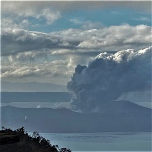
A new pulse of activity on the Sangay volcano is producing clouds of lava and ash. Quito, August 16, 2022.
At 10:00 a.m. TL on Friday August 12, 2022, a notable increase in seismic energy released by the Sangay volcano was recorded. This increase was followed by the emission of a lava flow on the southeast flank and the continuous emission of ash directed mainly towards the west and southwest of the volcano. Due to the climatic conditions, the lava flow and the ash emission were visible from the morning through the GOES-16 satellite. The low altitude ash cloud (< 2 km) reached up to 500 km to the west and southwest, exceeding the coast and causing ash fall in the provinces of Chimborazo and Guayas. On August 13, Guayaquil International Airport canceled several commercial flights due to the presence of ash in the atmosphere.
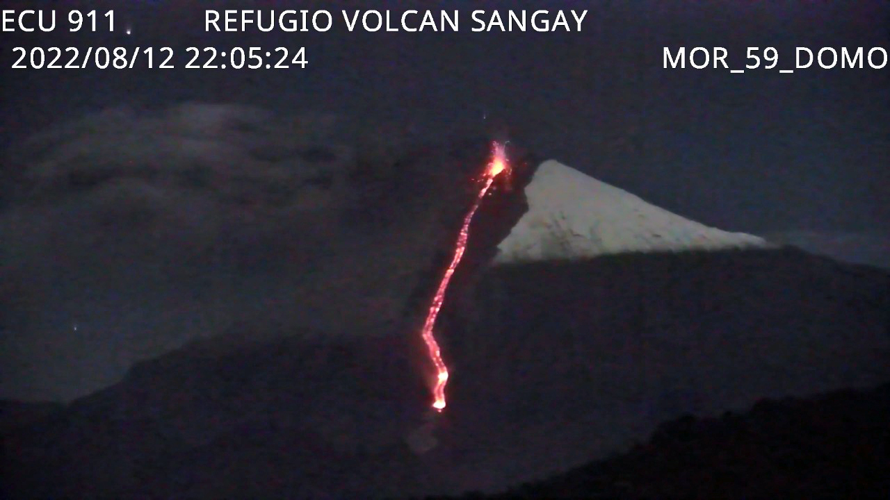
Emission of lava flow in the ravine of the southeast flank of Sangay. The lava flow has a range of 3 km and covers an approximate area of 0.25 km2 (25 hectares). Photo courtesy: ECU-911 Macas.
As of today, August 16, internal and surface activity has returned to previous levels, indicating the end of this eruptive pulse. However, light ash falls are still reported in the municipalities closest to the volcano, in the province of Chimborazo. The volcano began the current eruptive period in May 2019 and since that date several pulses of activity have occurred, like the one reported in this report, with some variation in their behavior.
Source : IGEPN.
Indonesia , Ibu :
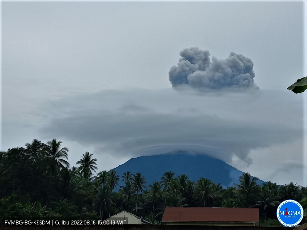
Mount Ibu erupted on Tuesday, August 16, 2022 at 2:54 p.m. WIT with an ash column height observed at ± 1500 m above the peak (± 2825 m above sea level). It is observed that the ash column is gray in color with a thick intensity, oriented towards the South. This eruption was recorded on a seismograph with a maximum amplitude of 26 mm and a duration of 100 seconds.
VOLCANO OBSERVATORY NOTICE FOR AVIATION – VONA
Issued : August 16 , 2022
Volcano : Ibu (268030)
Current Aviation Colour Code : ORANGE
Previous Aviation Colour Code : orange
Source : Ibu Volcano Observatory
Notice Number : 2022IBU50
Volcano Location : N 01 deg 29 min 17 sec E 127 deg 37 min 48 sec
Area : North Maluku, Indonesia
Summit Elevation : 4240 FT (1325 M)
Volcanic Activity Summary :
Eruption with volcanic ash cloud at 05h54 UTC (14h54 local).
Volcanic Cloud Height :
Best estimate of ash-cloud top is around 9040 FT (2825 M) above sea level, may be higher than what can be observed clearly. Source of height data: ground observer.
Other Volcanic Cloud Information :
Ash-cloud moving to south.
Source et photo : Magma Indonésie .
Italy , Stromboli :
WEEKLY BULLETIN, from August 08, 2022 to August 14, 2022. (issue date August 16, 2022)
ACTIVITY STATUS SUMMARY
In the light of the surveillance data, it is highlighted:
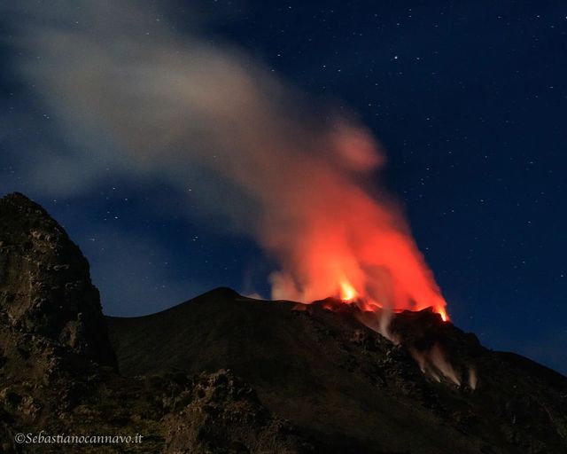
1) VOLCANOLOGICAL OBSERVATIONS: During this period a normal explosive activity of Strombolian type was observed. The total hourly frequency of explosions was variable on medium-low values (7-9 events/h). The intensity of the explosions was low and medium in both the North Crater area and the Center-South Crater area.
2) SEISMOLOGY: The seismological parameters monitored do not show any significant variations.
3) SOIL DEFORMATIONS: The island’s soil deformation monitoring networks did not show any significant changes to report for the period under review.
4) GEOCHEMISTRY: SO2 flux at a medium-low level
The soil CO2 flux in the summit area is on average values (updated until 07/10/2022).
The average weekly C/S value in the plume is not updated due to technical issues.
Isotope ratio of helium in groundwater on medium-high values (sampling of 07/27/2022).
5) SATELLITE OBSERVATIONS: The thermal activity observed by satellite in the summit area was weak.
VOLCANOLOGICAL OBSERVATIONS
During the observation period, the eruptive activity of Stromboli was characterized thanks to the analysis of the images recorded by the surveillance cameras of the INGV-OE (altitude 190m, Punta dei Corvi, altitude 400m and Pizzo) . From August 12, 2022 from 03:52 UTC due to the interruption of the video signal from the cameras at altitude 190m, at altitude 400m and on the Pizzo sopra la fossa, the observation of eruptive activity n was possible only from the camera of Punta dei Corvi. The explosive activity was mainly produced by 2 (two) eruptive vents located in the North crater area and 2 (two) eruptive vents located in the Center-South crater area. All the mouths are located inside the depression which occupies the terrace of the crater.
Sector N1 located in the area of the North crater produced explosions of low intensity (less than 80 m high) to medium (less than 150 m high) emitting fine materials (ash) mixed with coarse materials (bombs and lapilli). Sector N2 showed sporadic explosions of low intensity coarse material and discontinuous low spatter activity. The average frequency of explosions varied from 3 to 6 events/h.
In the Center-South zone, sectors C and S1 did not show significant explosive activity. Sector S2, with two emission points, showed explosions mainly of low intensity (less than 80 m in height) and sometimes medium (less than 150 m) emitting coarse materials. The frequency of the explosions varied between 3 and 4 events/h.
TO NOT FORGET :

FORZA STROMBOLI.
Source : INGV
Photos : Sebastiano Cannavo / Stromboli Stati d’animo.
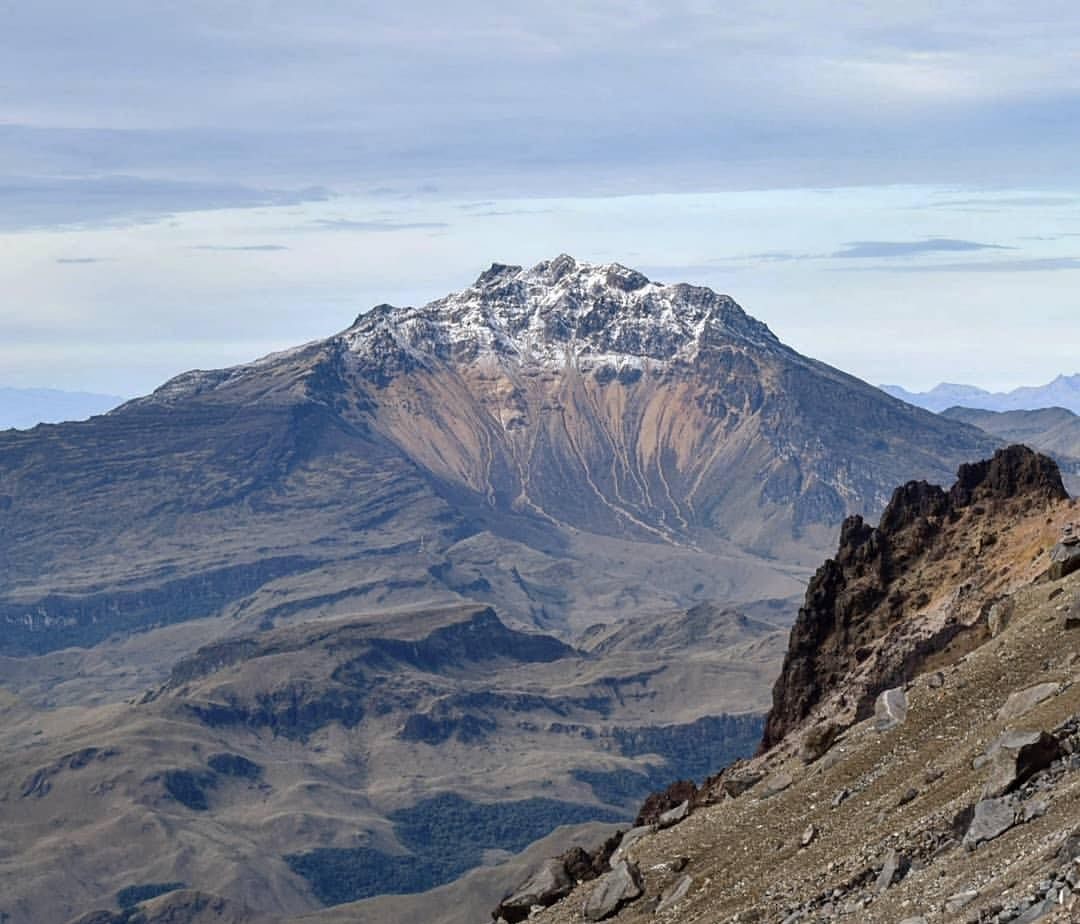
Colombia , Chiles / Cerro Negro :
Chiles and Cerro Negro volcanoes weekly activity bulletin
Volcano activity continues at YELLOW LEVEL ■ (III): CHANGES IN THE BEHAVIOR OF VOLCANIC ACTIVITY.
From monitoring the activity of the CHILES AND CERRO NEGRO VOLCANOES, the COLOMBIAN GEOLOGICAL SERVICE (SGC) reports that:
During the period between August 9 and August 15, 2022, there was a notable increase in the seismic activity of the volcano, both for seismicity related to the fracture of rock materials and the movement of fluids. This increase was most notable on August 13 and 14, when 2,081 and 2,579 fracture-related earthquakes were totaled, respectively. Of the total number of earthquakes this week, it was possible to locate 1660, the vast majority of which were located towards the southern flank of the Chiles Volcano, with epicentral distances of up to 5 km and depths of up to 6 km from the volcanic summit (4700 m altitude).
Some earthquakes were located scattered towards the southeast sector of the same volcano at distances of up to 14 km and depths of up to 11 km. The earthquakes recorded on August 14 at 03:56 and 04:10 with respective magnitudes of 3.0 and 3.2 are highlighted, as well as three other earthquakes with a magnitude of up to 2.8. The strongest earthquakes on August 14 were reported as felt by residents of the Mayasquer and Chiles indigenous reservations.
All these seismic manifestations are part of a process of ground deformation (observed instrumentally) which began at the end of March 2022 and continues to this day.
Based on the current behavior of this seismicity and what has been historically recorded in this active volcanic region, the possibility of the occurrence of more high energy level earthquakes that can be felt by the inhabitants of the area of Volcanic influence is not excluded.
Source : SGC.
Photo : Travelgrafía
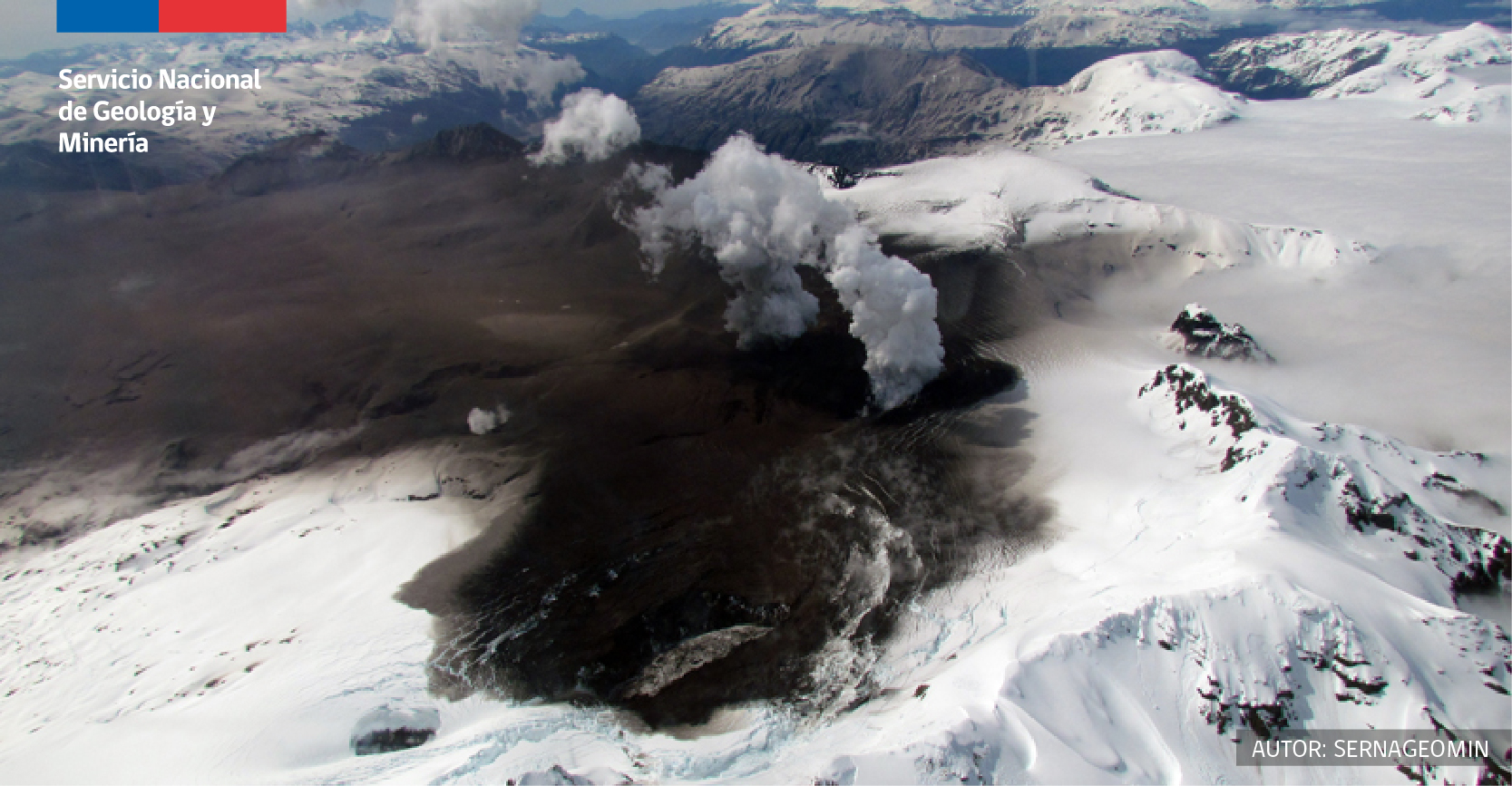
Chile , Hudson :
Special Report on Volcanic Activity (REAV), Aysen Del General Carlos Ibanez Del Campo area, Hudson volcano, August 14, 2022, 05:30 a.m. local time (mainland Chile).
The National Service of Geology and Mines of Chile (Sernageomin) publishes the following PRELIMINARY information, obtained through the monitoring equipment of the National Volcanic Monitoring Network (RNVV), processed and analyzed at the Volcanological Observatory of the Southern Andes ( Ovdas):
On Sunday August 14, 2022, at 04:31 local time (08:31 UTC), the monitoring stations installed near the Hudson volcano recorded an earthquake associated with both rock fracturing (volcano-tectonic type) and fluid dynamics in the volcanic system (hybrid type).
The characteristics of earthquakes after their analysis are as follows:
ORIGINAL TIME: 04:31 local time (08:31 UTC)
LATITUDE: 45.909°S
LONGITUDE: 72.950°W
DEPTH: 0.8 km
LOCAL MAGNITUDE: 2.8ml
REDUCED DISPLACEMENT: 1664.6 cm2
COMMENTS:
At the time of the issuance of this report, no other seismic events related to the internal dynamics of the volcano have been observed. Surveillance cameras showed no change in surface activity.
The volcanic technical alert remains at the Green level.
Sources : Sernageomin.
Photo : Sernageomin