June 22 , 2022.
Italy : Stromboli :
WEEKLY BULLETIN, from June 13, 2022 to June 19, 2022, (issue date June 21, 2022)
ACTIVITY STATUS SUMMARY
In the light of the surveillance data, it is highlighted:
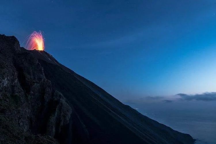
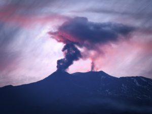
1) VOLCANOLOGICAL OBSERVATIONS: In this period a normal explosive activity of Strombolian type was observed. The total hourly frequency of explosions fluctuated between low values (2 events/h) and medium-low values (9 events/h). The intensity of the explosions was low and medium in the area of the North crater and low in the area of the Center-South crater.
2) SEISMOLOGY: The seismological parameters monitored do not show any significant variations.
3) GROUND DEFORMATIONS: There is a variation of the TDF tilt signal. After the extraordinary maintenance intervention of the SVIN station (high frequency GNSS network reference station) signal noise problems remain.
4) GEOCHEMISTRY: C/S ratio in the plume on average values (C/S = 5.09).
Flux of CO2 on the floor of the crater (Pizzo) on average values (about 7000 g/m2*g).
Isotope ratio of Helium dissolved in the thermal water table at high values (last sample taken on 05/30/2022, R/Ra 4.37).
SO2 flux at an average level
5) SATELLITE OBSERVATIONS: The thermal activity observed by satellite in the summit area was at a low level.
VOLCANOLOGICAL OBSERVATIONS
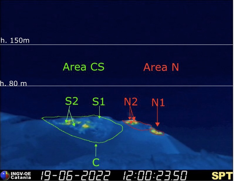
During the observation period, the eruptive activity of Stromboli was characterized through the analysis of images recorded by the INGV-OE surveillance cameras (altitude 190 m, Punta Corvi, altitude 400 m and Pizzo ). The explosive activity was mainly produced by 4 (four) eruptive vents located in the North crater area and 2 (two) eruptive vents located in the Center-South crater area. All the mouths are located inside the depression which occupies the terrace of the crater.
Observations of explosive activity captured by surveillance cameras:
Sector N1 located in the North crater area produced low intensity explosions (less than 80 m high) emitting fine materials (ash). Sector N2, with three emission points, showed continuous impulsive degassing accompanied occasionally by weak spattering activity. The average frequency of explosions varied between none and 4 events/h.
In the Center-South zone, sectors C and S1 did not show significant explosive activity. Sector S2, with two emission points, showed explosions of mainly low intensity (less than 80 m high) and sometimes medium (less than 150 m) emitting coarse material from the southernmost vent (Ginostra side) and fine materials from the northernmost mouth. The frequency of the explosions varied between 2 and 7 events/h.
Source : INGV.
Photos : INGV , Stromboli Stati D’animo .
Italy / Sicily , Etna :
WEEKLY BULLETIN, from June 13, 2022 to June 19, 2022, (issue date June 21, 2022)
ACTIVITY STATUS SUMMARY
In the light of the surveillance data, it is highlighted:
1) VOLCANOLOGICAL OBSERVATIONS: Effusive activity with development of lava flows inside the Valle del Bove, fumarolic degassing of the Southeast Crater, pulsed degassing of the Bocca Nuova crater, ordinary degassing of the Northeast Crater.
2) SEISMOLOGY: Low seismic activity of fracturing; average amplitude of the volcanic tremor in the average level.
3) INFRASONO: moderate infrasonic activity.
4) GROUND DEFORMATIONS: No significant variation in time series of ground deformation monitoring stations. Volcanic edifice-scale deflation continues with a modest trend.
5) GEOCHEMISTRY: SO2 flux at an average level
The flux of CO2 from the ground is at low average values.
The partial pressure of dissolved CO2 in groundwater shows values in seasonal variability. The latest data refers to the date of June 01, 2022 with high values.
6) SATELLITE OBSERVATIONS: Thermal activity in the summit area was at a high level consistent with effusive activity which ended on June 16th. The following days, the level was low.
VOLCANOLOGICAL OBSERVATIONS
During the week, the monitoring of the volcanic activity of Etna was carried out by analyzing the images of the surveillance cameras of the INGV, Osservatorio Etneo (INGV-OE) and
through field visits by INGV-OE agents on 13, 14 and 16 June.
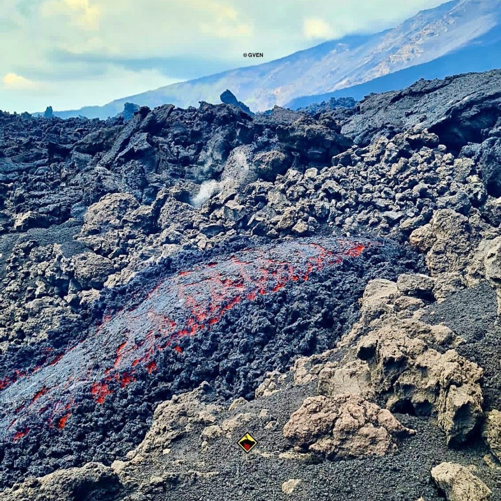
In general, during the week, the eruptive activity was characterized by an effusion of lava in the Valle del Bove and by a variable rate degassing of the summit craters.
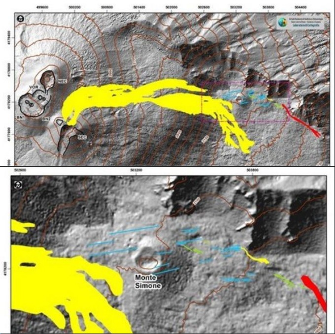
Figure 3.1 shows the summit area of Etna with the map of flows and fractures, obtained through the joint analysis of satellite images (Sentinel of June 11, 13 and 16 and Planescope of June 11) and the analysis of visible and thermal images acquired during the drone survey carried out on June 14. The map shows that the fracture field located in the Serracozzo area extends approximately from an altitude of 2150 m to an altitude of 1900 m and is composed of two fracture systems with a main direction NW-SE and ENE-WSW .
In particular, on June 13, the gradual exhaustion of the effusive activity produced by the mouth at about 2700 m altitude was observed, belonging to the eruptive fissure that opened on May 29, between 2900 and 2700 m. altitude. According to direct observations made on the morning of June 13 and according to images from the INGV-OE surveillance cameras, the lava flows were weakly fed with the fronts in the regression phase and on the evening of the same day, the lava in the field was cooling.
Regarding the crack system, which developed from June 7 at the base of the northern wall of the Valle del Bove in the Serracozzo area at an altitude between 2150 and 1900 m, on June 13 and 14 , a well-fed lava flow was observed produced by a single vent located at an elevation of about 1950 m, whose more advanced front on June 14 had reached an elevation of 1760 m above sea level. Moreover, from the inspection carried out on June 14 using a drone, it was possible to observe the development of small lava tunnels and two small ephemeral vents located at an altitude of 1870 and 1850 m. The effusive activity at the mouth located at 1950 m altitude was exhausted during the night of June 15 to 16, with the lava field which, during the inspection of the 16 in the morning, appeared already in the process of cool down .
During the observation period, the summit craters were characterized by degassing mainly by the Bocca Nuova crater, which fed an intense volcanic plume on June 13 which dispersed towards the SSW. During the week, no ash emission from the Southeast Crater was observed, only intense fumarolic degassing.
Source : INGV.
Photos : Guide Vulcanologiche Etna Nord , INGV.
United – States , Yellowstone :
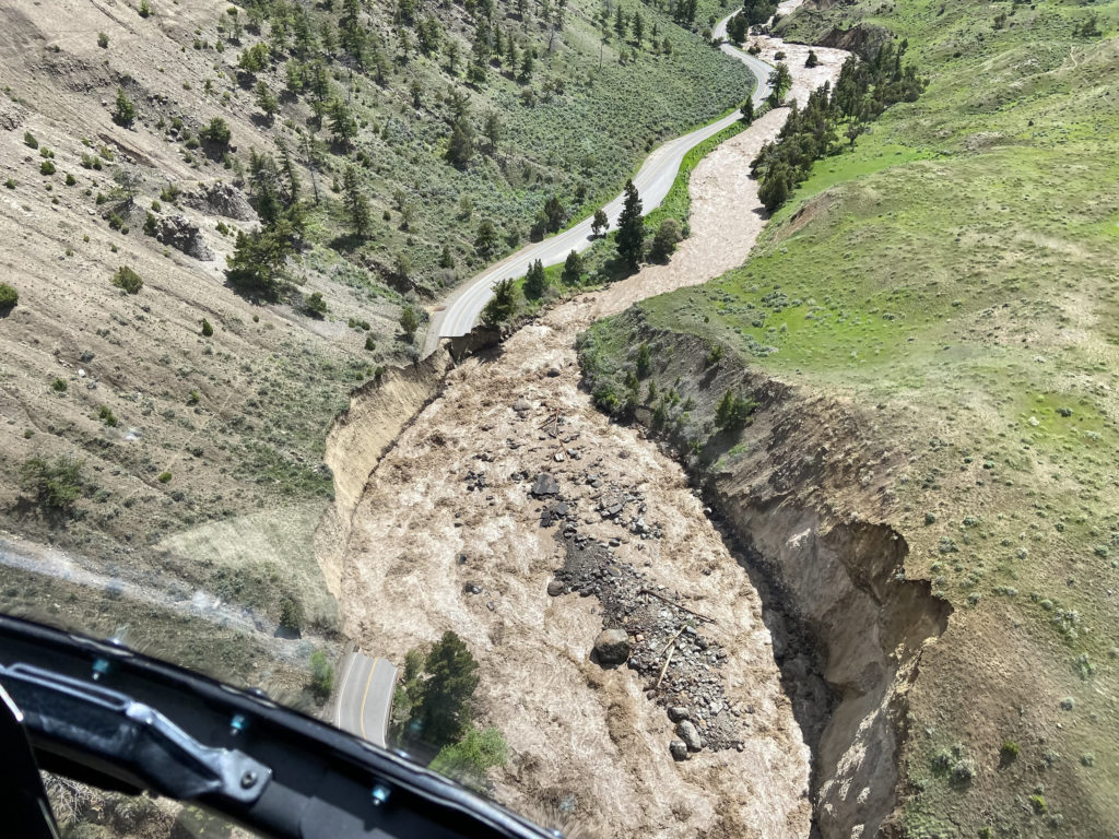
Last week, flooding in Yellowstone caused catastrophic damage to the area, destroying homes, roads and bridges, and isolating entire communities. Despite the magnitude of this event, the impacts on seismic and hydrothermal activity are likely to be minor.
From June 10-13, 2022, an « atmospheric river » event – a system of warm, extremely humid air that typically originates in the tropics – struck the Yellowstone National Park region. More than 2 to 3 inches of rain, combined with warm temperatures overnight, melted a large amount of snow that had not melted before due to a cool, snowy spring. This resulted in historic flooding.
Electricity was lost in many places, as was access to drinking water. Yellowstone’s north and northeast entrance roads are closed indefinitely, and Yellowstone National Park has been completely closed while the threat to visitor safety has been assessed (current plans call for the southern half of the park to reopen). park on June 22). Recovery will likely take years, with new roads and bridges needed in several places. Parts of the hardest hit northern part of Yellowstone National Park could be closed for months.
The flood level in the northern part of Yellowstone National Park and in southern Montana was literally unprecedented. On Monday, June 13, 2022, the water height of the Yellowstone River at the Corwin Springs gauge reached nearly 14 feet, about 2.5 feet higher than the previous record flood event in June 1918. These data indicates that the amount of water that flowed through the gauge during the four days between June 11 and 15 (over 70 billion gallons) would fill over one hundred thousand Olympic swimming pools! If a football field had walls on all sides, those walls would have to be three miles high to hold all that water.
Will historic flooding cause changes in seismic, hydrothermal, or volcanic activity in Yellowstone National Park? Probably not immediately, and maybe not at all. Most of the precipitation and snowmelt from the recent floods ended up in the rivers that drain the area, but some of the water has percolated into the ground.
Source : YVO.
Read the full article : https://www.usgs.gov/observatories/yvo/news/how-might-devastating-june-2022-floods-and-around-yellowstone-national-park
Photo : National Park Service / Doug Kraus, 13 juin 2022.
Colombia , Puracé – Los Coconucos Volcanic Range :
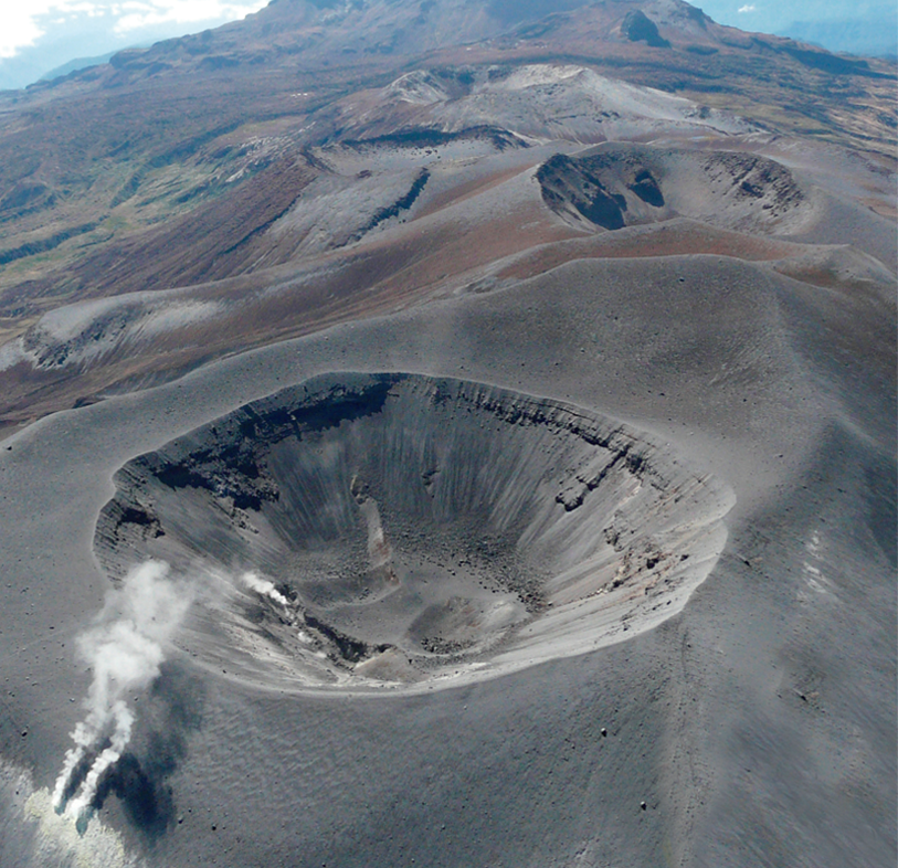
Weekly bulletin of the activity of the Puracé volcano – Los Coconucos volcanic chain
The activity level of the volcano continues at the Yellow Activity Level or (III): changes in the behavior of volcanic activity.
From the analysis and evaluation of the information obtained through the monitoring network of the Puracé volcano – Los Coconucos volcanic chain, during the week of June 14 to 20, 2022, the COLOMBIAN GEOLOGICAL SERVICE – Volcanological and Seismological Observatory of Popayan reports that:
During this week, the strong occurrence of earthquakes associated with the movement of fluids inside the volcano continues. A total of 1092 seismic events were presented, of which 83 were associated with rock fracturing processes (type VT) and 1009 with fluid dynamics in volcanic conduits; of these, 682 were classified as long period events (LP type), one (1) event as hybrid (HB type), 257 low frequency events (BF type), five (5) « tornillos » (TO type ) and 64 as low energy tremor pulses (TR type).
The geodetic network of GNSS (Global Navigation Satellite System) stations for monitoring ground deformation continues to record a process associated with inflation.
With regard to the monitoring of volcanic gases, the sulfur dioxide (SO2) flux emissions recorded by the telemetry stations showed a stable behavior, reaching
discharge values at permanent stations with a maximum issued of 1305 t/day for June 16. The other gas analysis instruments in the volcanic influence zone do not show any relevant changes for the evaluated period.
In the follow-up of surface activity, the images obtained during the week thanks to the Mina, Lavas Rojas and Cerro Sombrero web cameras showed degassing of the volcanic system, with a white column oriented preferentially towards the North-West.
Sensors monitoring magnetic and electric fields and infrasonic waves did not record variations associated with changes in volcanic activity.
Therefore, it is concluded that significant variations in volcanic activity continue to be recorded, in accordance with the behavior expected at activity level III (yellow level), which could evolve towards states of greater activity.
The Colombian Geological Service continues to monitor the evolution of the volcanic phenomenon and will report any changes that may occur in due course.
Source et photo : SGC.
Chile , Hudson :
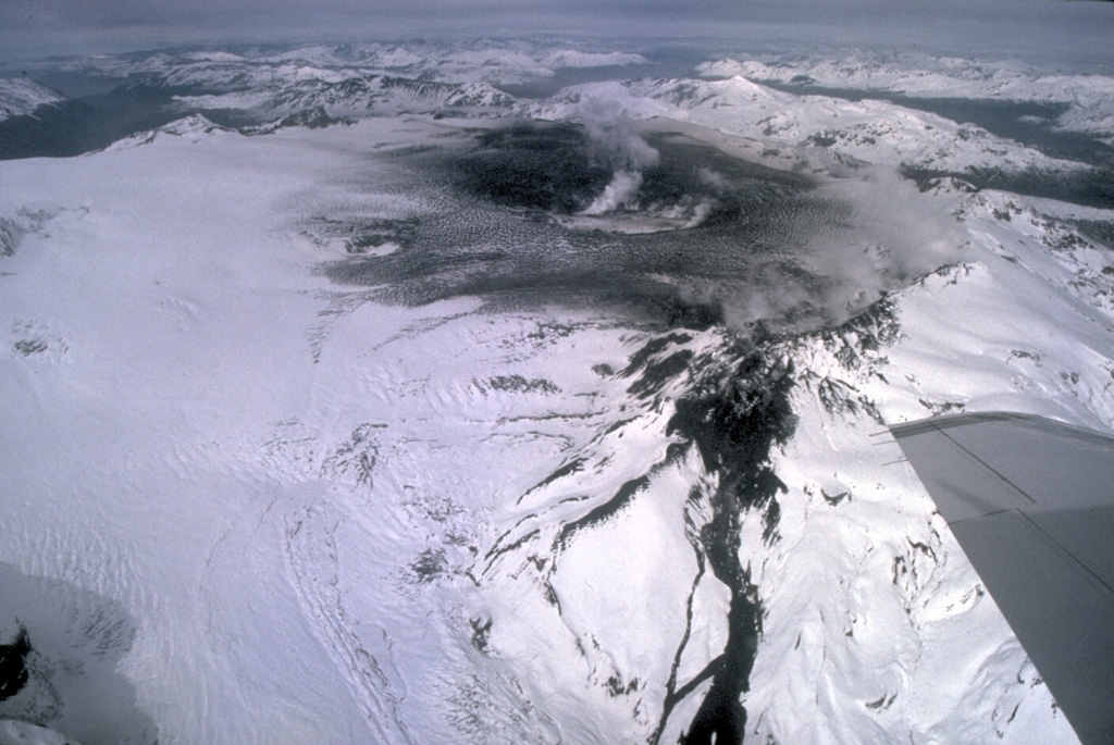
Special Report on Volcanic Activity (REAV), Aysen Del General Carlos Ibanez Del Campo area, Hudson volcano, June 21, 2022, 05:40 a.m. local time (mainland Chile).
The National Service of Geology and Mines of Chile (Sernageomin) publishes the following PRELIMINARY information, obtained through the monitoring equipment of the National Volcanic Monitoring Network (RNVV), processed and analyzed at the Volcanological Observatory of the Southern Andes ( Ovdas):
On Tuesday June 21, 2022, at 04:05 local time (08:05 UTC), the monitoring stations installed near the Hudson volcano recorded an earthquake associated with the fracturing of rocks (volcano-tectonic type) in the volcanic system.
The characteristics of earthquakes after their analysis are as follows:
ORIGINAL TIME: 04:05 local time (08:05 UTC)
LATITUDE: 45.939°S
LONGITUDE: 72.940°W
DEPTH: 5.5km
LOCAL MAGNITUDE: 3.4ml
COMMENTS:
No surface activity was observed associated with this event.
The volcanic technical alert remains at the Green level.
Sources : Sernageomin.
Photo : Norm Banks, 1991 (U.S. Geological Survey).

