May 03 , 2022.
New Zealand , Ruapehu :
Steam plume visible at Mt Ruapehu, volcanic unrest continues: Volcanic Alert Level remains at Level 2. Published: Tue May 3 2022 3:30 PM
Aviation Colour Code remains at Yellow
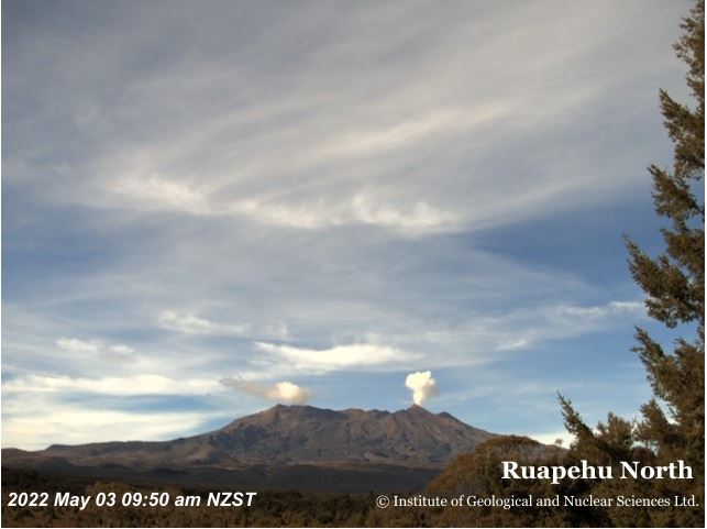
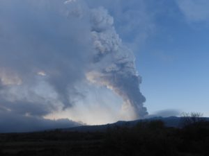
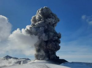
Earlier this morning, a steam plume was visible above Mt Ruapehu’s Crater Lake (Te Wai ā-moe). The first sign of the plume occurred at ~09:45 am and it ascended slowly to ~1 to 1.5 km above the summit area. The plume remained visible until around 10.30 am. Images of the plume indicate that atmospheric conditions favoured cloud formation, as cloud was also forming elsewhere around the volcano. The plume was seen widely around the volcano.
GeoNet image of Ruapehu from earlier this morning
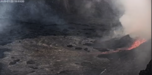
No seismic or acoustic activity accompanied the plume appearance, indicating the steam plume was not generated by strong activity in the lake. We cannot rule out that very minor activity has occurred, which is why our scientists conducted an observation flight early this afternoon. Observations from that visit indicate that central vent continues to be actively upwelling, and the lake level is marginally higher. These observations are like those reported yesterday.
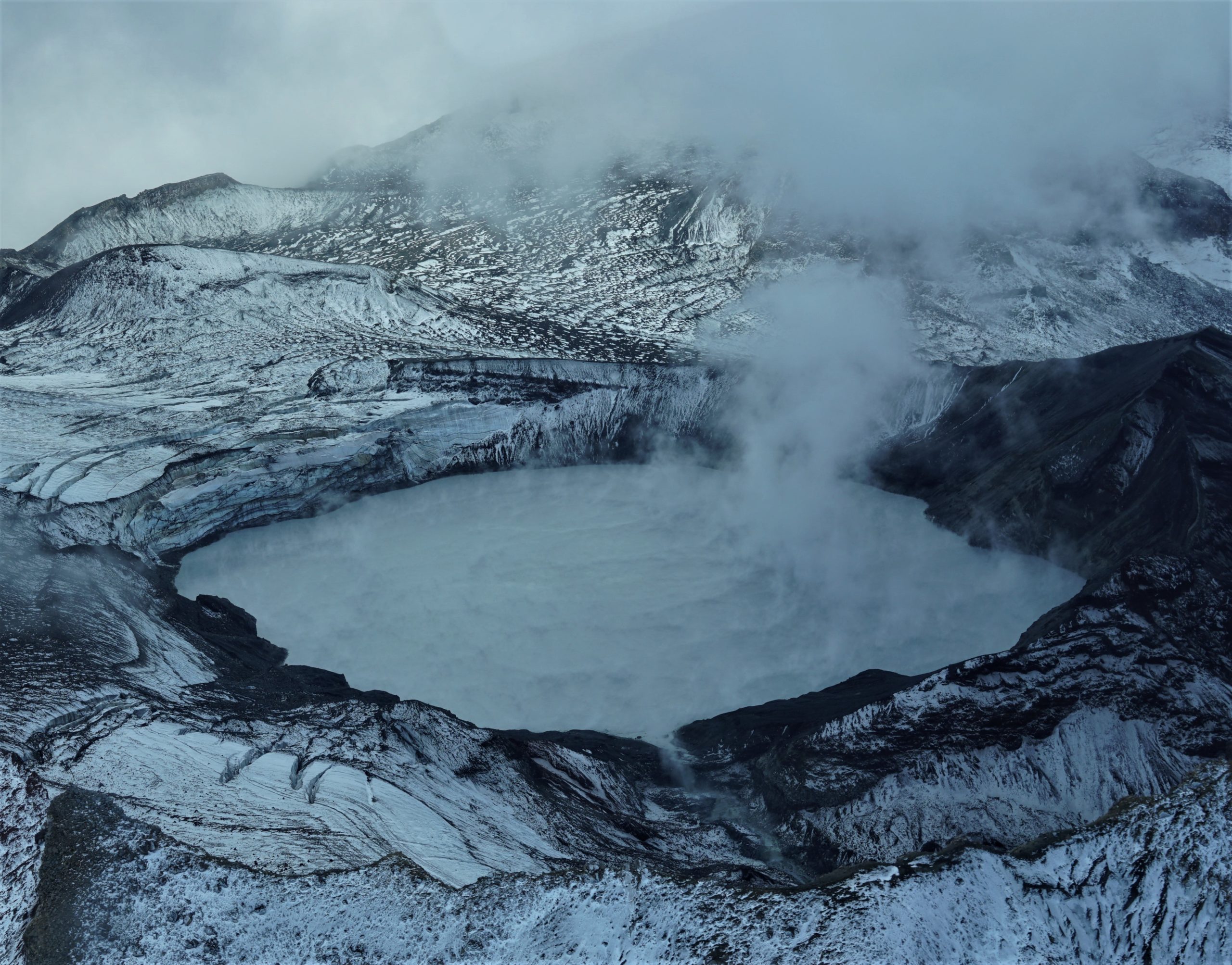
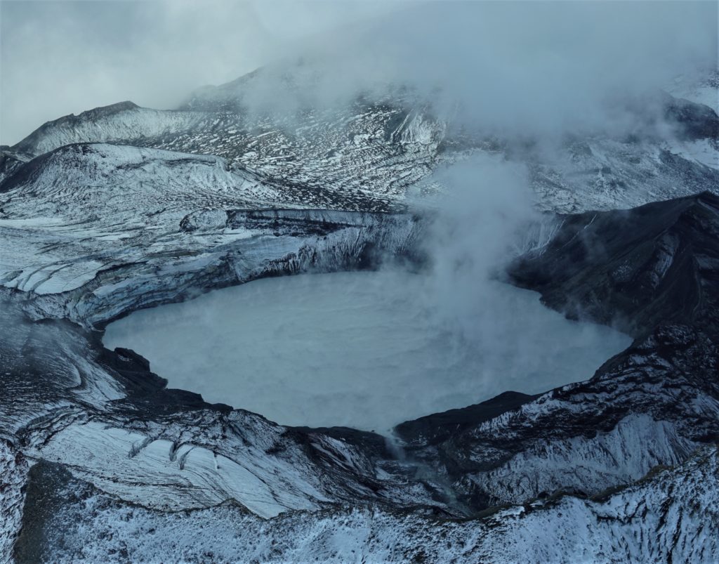
Image taken of Crater Lake (Te Wai ā-moe) from the observation flight this afternoon.
The current lake temperature is now ~39 ºC. In the past, lake temperatures this high, combined with cool and calm atmospheric conditions, have generated visible steam plumes above the lake. We may expect more plumes to be seen over the coming weeks/months under suitable weather conditions.
Laboratory analysis of the latest Crater Lake fluid samples are now processed. Results are very similar to past analyses and show no clear indication that magma is interacting with the hydrothermal system beneath the lake.
The interpretation of this activity is consistent with elevated volcanic unrest at the heightened level and therefore the Volcanic Alert Level remains at Level 2. The Aviation Colour Code remains at Yellow.
We will conduct further gas measurement and observation flights as weather conditions allow.
Mt Ruapehu is an active volcano and has the potential to erupt with little or no warning when in a state of elevated volcanic unrest.
Volcanic Alert Level 2 indicates the primary hazards are those expected during volcanic unrest; steam discharge, volcanic gas, earthquakes, landslides and hydrothermal activity. While Volcano Alert Level 2 is mostly associated with volcanic unrest hazards, eruptions can still occur with little or no warning.
Source : Geonet / Geoff Kilgour / Duty volcanologist .
La Réunion , Piton de la Fournaise :
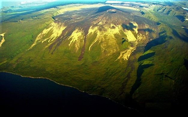
Piton de la Fournaise activity:
Seismicity:
In April 2022, the OVPF-IPGP recorded at the level of the Piton de la Fournaise massif in total:
• 42 superficial volcano-tectonic earthquakes (0 to 2.5 km above sea level) under the summit craters;
• No deep earthquakes (below sea level);
• 1222 landslides (in the Cratère Dolomieu, the ramparts of the Enclos Fouqué and the Piton de Crac, and the Rivière de l’Est).
Seismicity at Piton de la Fournaise was down slightly in April 2022 compared to the previous month with an average of 1.4 superficial volcano-tectonic earthquakes per day against around 2.5 earthquakes per day in March.
Most of these events were located below the southeast rim of the Dolomieu crater.
The month of April was also marked by numerous landslides (in the Cratère Dolomieu, the ramparts of the Enclos Fouqué and mostly at the broken of the Rivière de l’Est).
The large number of landslides at the level of the broken River of the East was reported to the General Staff of the Zone and Civil Protection of the Indian Ocean so that an aerial reconnaissance by the Air Gendarmerie Section can be made.
Deformation
After the end of the last eruption, on January 17, 2022, a slight recovery in peak inflation was recorded. This, after a slowdown in February, continued throughout March 2022 and accelerated in mid-April 2022.
This inflation is linked to a pressurization of the superficial magmatic reservoir located at about 1.5-2 km depth.
Balance sheet
The inflation which continued throughout the month of April, as well as the increase in CO2 fluxes in the ground, witnessed a replenishment and a pressurization of the superficial magmatic reservoir by upwellings of deep fluids.
This process of recharge from the depths to the superficial reservoir can take several days to several weeks before the reservoir roof weakens and ruptures, thus giving rise to an injection of magma towards the surface and an eruption, but can also stop without giving rise to an eruption in the short term.
Source : OVPF
Read the article : https://www.ipgp.fr/sites/default/files/ovpf_20220502_bullmensu.pdf
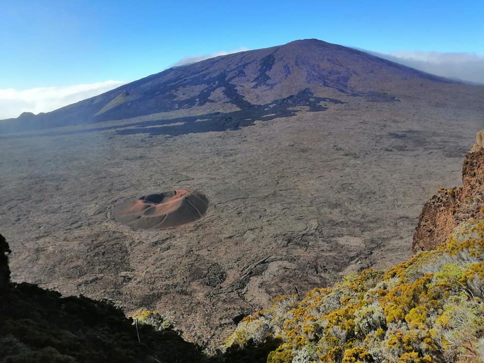
Photos : Nath Duverlie , OVPF.
United – States , Yellowstone :
44°25’48 » N 110°40’12 » W,
Summit Elevation 9203 ft (2805 m)
Current Volcano Alert Level: NORMAL
Current Aviation Color Code: GREEN
Recent Work and News
May means the start of geological and geophysical field work in Yellowstone! Field teams will conduct maintenance on monitoring stations following the end of Yellowstone’s harsh winter and will also perform the seasonal installation of semipermanent GPS stations. Each year, YVO scientists deploy 17 GPS stations in May/June and recover them in September/October. These temporary deployments densify the network of deformation-monitoring equipment, helping to fill gaps in the network of continuous (year-round) GPS stations.
Also in May, Yellowstone Volcano Observatory scientists will meet for their first face-to-face meeting in 4 years! The 2022 YVO Coordination Meeting, which will take place during May 11–13 in Mammoth Hot Springs, will include opportunities to share research results from the past few years and plans for the coming years, and also to discuss and evaluate the Yellowstone Volcano Observatory response plan, which will be updated during 2022.
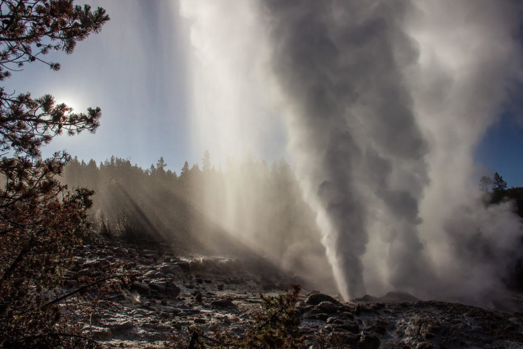
Steamboat Geyser did not erupt during the month of April, but it is experiencing frequent minor eruptive activity, which suggests that the current cycle of major eruptions is probably not yet over. Thus far in 2022, the geyser has had 4 major water eruptions.
Seismicity
During April 2022, the University of Utah Seismograph Stations, responsible for the operation and analysis of the Yellowstone Seismic Network, located 141 earthquakes in the Yellowstone National Park region. The largest event of the month was a minor earthquake of magnitude 2.5 located ~9 miles north-northeast of West Yellowstone, Montana, on April 30 at 2:41 AM MDT.
April seismicity in Yellowstone was marked by three small swarms:
1) A swarm of 24 earthquakes, ~5 miles north of West Yellowstone, MT, occurred April 9–14. The largest earthquake of the swarm (magnitude 1.9) occurred April 12 at 9:10 PM MDT.
2) A swarm of 20 earthquakes, ~9 miles northeast of West Yellowstone, MT, occurred April 9 – 11, with the largest earthquake (magnitude 2.1) occurring on April 9 at 12:59 PM MDT.
3) A swarm of 14 earthquakes, ~14 miles south-southwest of West Thumb, Yellowstone National Park, occurred April 6, with the largest earthquake (magnitude 1.4) occurring on April 6 at 4:21 PM MDT.
Yellowstone earthquake activity remains at background levels.
Ground deformation
No significant changes in ground deformation patterns were observed in data from continuous GPS stations over the past several months. No deformation is apparent in a station near Norris Geyser Basin, and stations within Yellowstone Caldera continue to subside at an overall rate of 2–3 cm (1 in) per year. This subsidence has been ongoing since 2015.
Source : YVO.
Photo : Steamboat / Mara Reed
Alaska , Semisopochnoi :
51°55’44 » N 179°35’52 » E,
Summit Elevation 2625 ft (800 m)
Current Volcano Alert Level: WATCH
Current Aviation Color Code: ORANGE
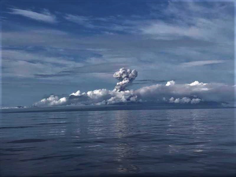
Low-level eruptive activity continues. Tremor was observed in seismic data but there have been no explosions in last day. The volcano was obscured by clouds in satellite and webcam images.
Small eruptions producing minor ash deposits within the vicinity of the active north crater of Mount Cerberus and ash clouds usually under 10,000 ft (3 km) above sea level have characterized the recent activity. Small explosions and associated ash emissions may continue and could be difficult to detect, especially when thick cloud cover obscures the volcano.
Semisopochnoi is monitored by local seismic and infrasound sensors, satellite data, web cameras, and remote infrasound and lightning networks.
Source : AVO.
Photo : Rojek, Nora / R/V Tiglax .
Ecuador , Sangay :
DAILY REPORT ON THE STATE OF SANGAY VOLCANO. Monday 02 May 2022.
Surface activity level: high, surface trend: no change.
Internal Activity Level: High, Internal Trend: Ascending.
Seismicity: There were no cuts in the transmission of data from the reference station for seismic statistics
Long Periods (LP): 277
Explosions ( EXP): 28
Transmit Tremor (TREMI): 34
Rains / Lahars:
No heavy rain was recorded in the area. **In the event of heavy rains, these could remobilize the accumulated materials, generating mudslides and debris that would descend on the flanks of the volcano and flow into the adjacent rivers.**
Emission / ash column:
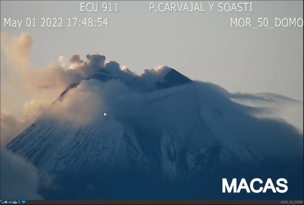
In the images shared by ECU911, several gas emissions were observed at the level of the crater, the direction of these emissions was constant towards the West. The Washington VAAC recorded 1 ash emission alert observed in satellites that reached 900 meters above crater level in a westerly direction.
Other Monitoring Parameters:
FIRMS satellite system reported 37 thermal alerts while MIROVA reported 1 high thermal alert and 1 moderate thermal alert in Sangay in the last 24 hours.
Observation:
Yesterday afternoon, in the images shared from ECU911, it was observed that during the afternoon the volcano cleared for a short period, allowing the emission described above to be observed, the rest of the time the cloudiness was permanent in the sector.
Alert level: Orange.
Source : IGEPN.
Photos : IGEPN

